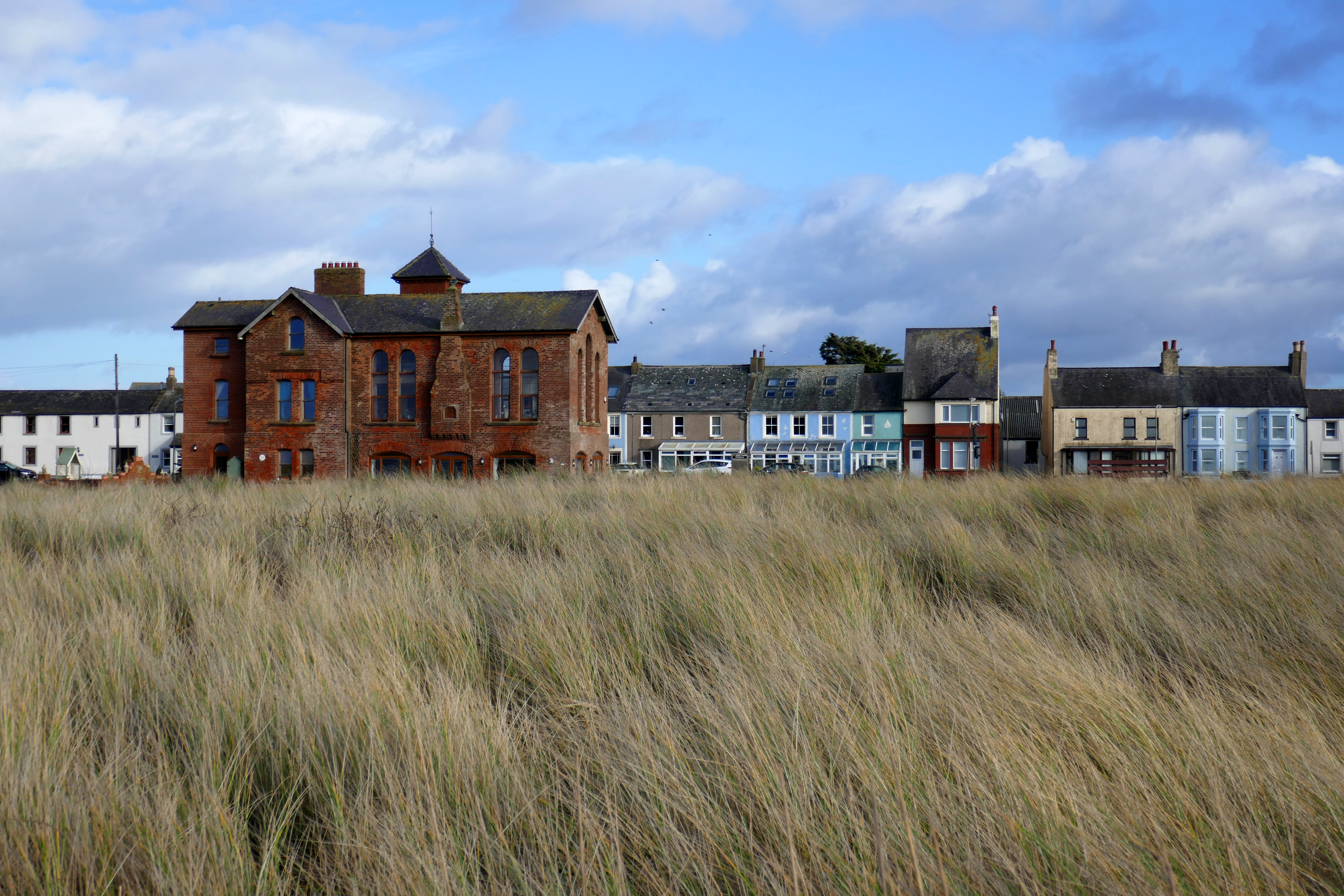
After exploring the southern shores of the Solway, driving into Scotland our first stop was the Old Blacksmith’s Shop in Gretna Green. Having traditionally been a haven for young people keen to marry, today it has handed itself completely over to romance and retail. The courtship maze, the wall of love padlocks and a sculpture called The Big Dance with two hands clasped together to form an arch all thawed my heart on a wintery morning!
We had been blessed with fine weather on the English part of this trip but now rain hammered on the roof of our campervan as we pulled into the nearby Devil’s Porridge Museum. This bizarrely-named museum tells the story of the huge Gretna Green site that produced cordite during World War One. Thousands worked here in hazardous conditions and we heard their stories while the rain pounded noisily on the museum roof. In the local history areas I was fascinated to read about the State Management Scheme for brewing and pubs which began in wartime but continued into the 1970s. This massive experiment aimed to change the drinking culture and reduce drunkenness. State-owned pubs sold weak beer along with food, forbade the buying of rounds and encouraged games such as dominoes and darts.
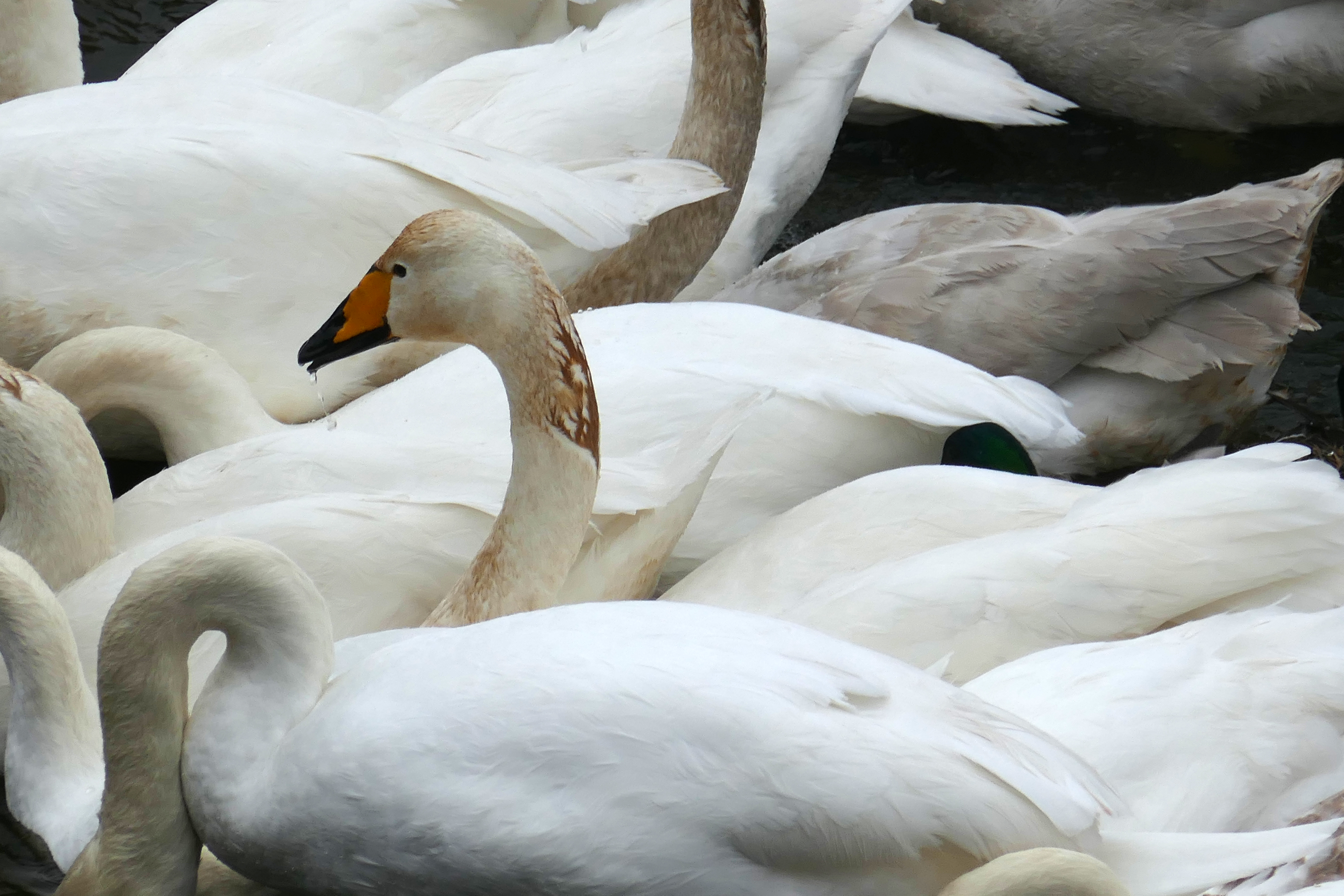
The wet and windy weather followed us along the northern Solway coast to The Wildfowl and Wetland Trust’s Caerlaverock reserve. One of the many things I like about having a ‘van is that you can see over hedges and walls and I pointed out groups of geese feeding in the fields as Anthony drove. We were just in time for Caerlaverock’s daily swan feeding and from the hide watched the multitude of swans boisterously squabbling over shovelfuls of food.
For the next couple of nights we had an enviable pitch at Queensberry Bay Leisure Park, with an unobstructed view over the Solway Firth and acres of sky. Watching the birds feeding on the mud, fishing boats leaving Annan harbour and the changing light of sunrises and sunsets could all be done from our snug campervan while the rain pattered on our tin roof. When we needed to stretch our legs, the campsite bar had the same spectacular view that was perfect for a lazy morning coffee with yesterday’s papers and evening beers.
When the rain eased we walked along quiet lanes finding small moments of joy when we disturbed hares in a field, picked out lapwing calls and found more cheerful clumps of flowering snowdrops. On Powfoot Beach the remains of wooden piers were draped in shimmering seaweed and an old circular bathing pool that was part of an early 20th century plan to develop this quiet stretch of coast into a holiday resort intrigued us.
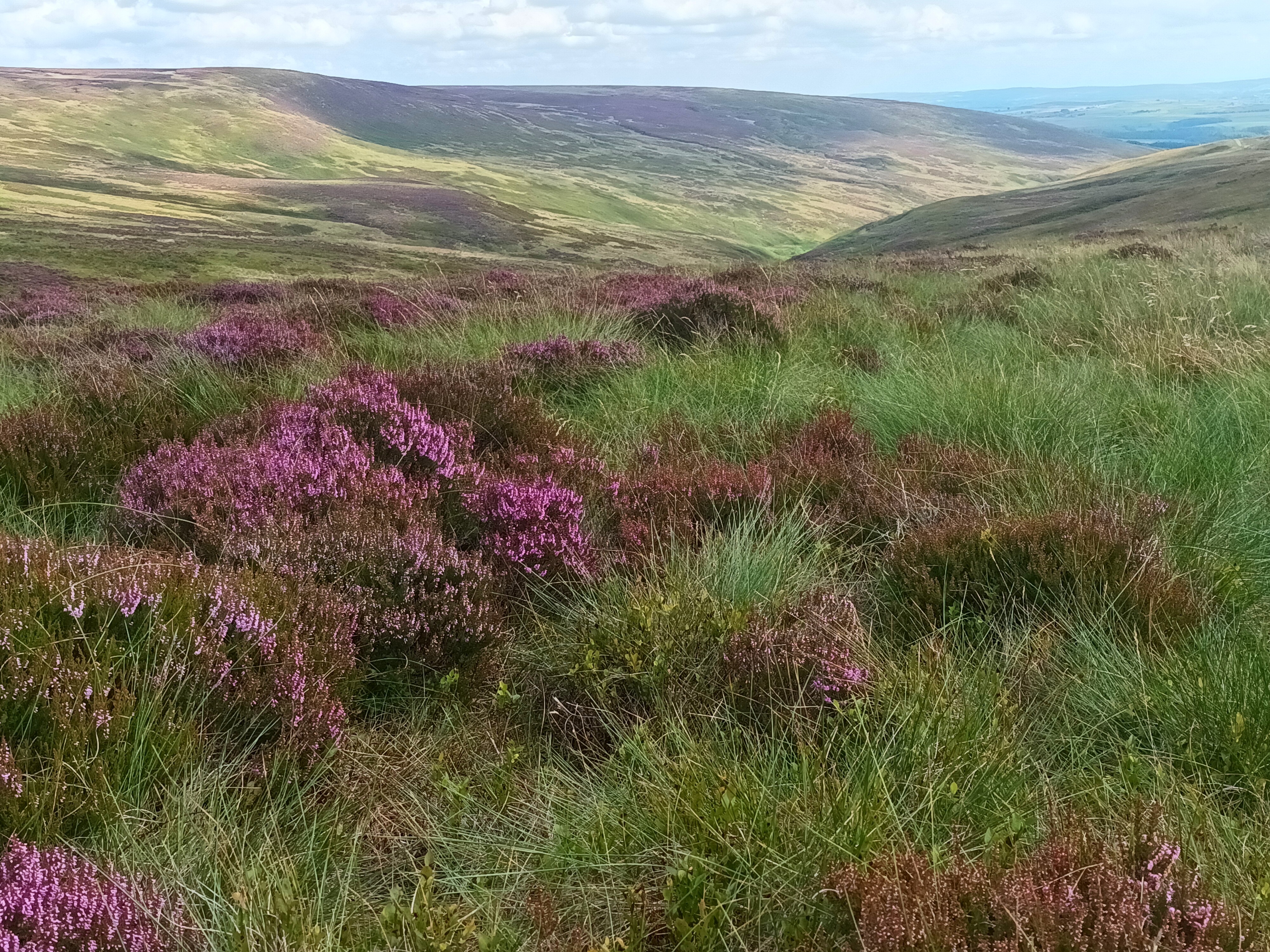
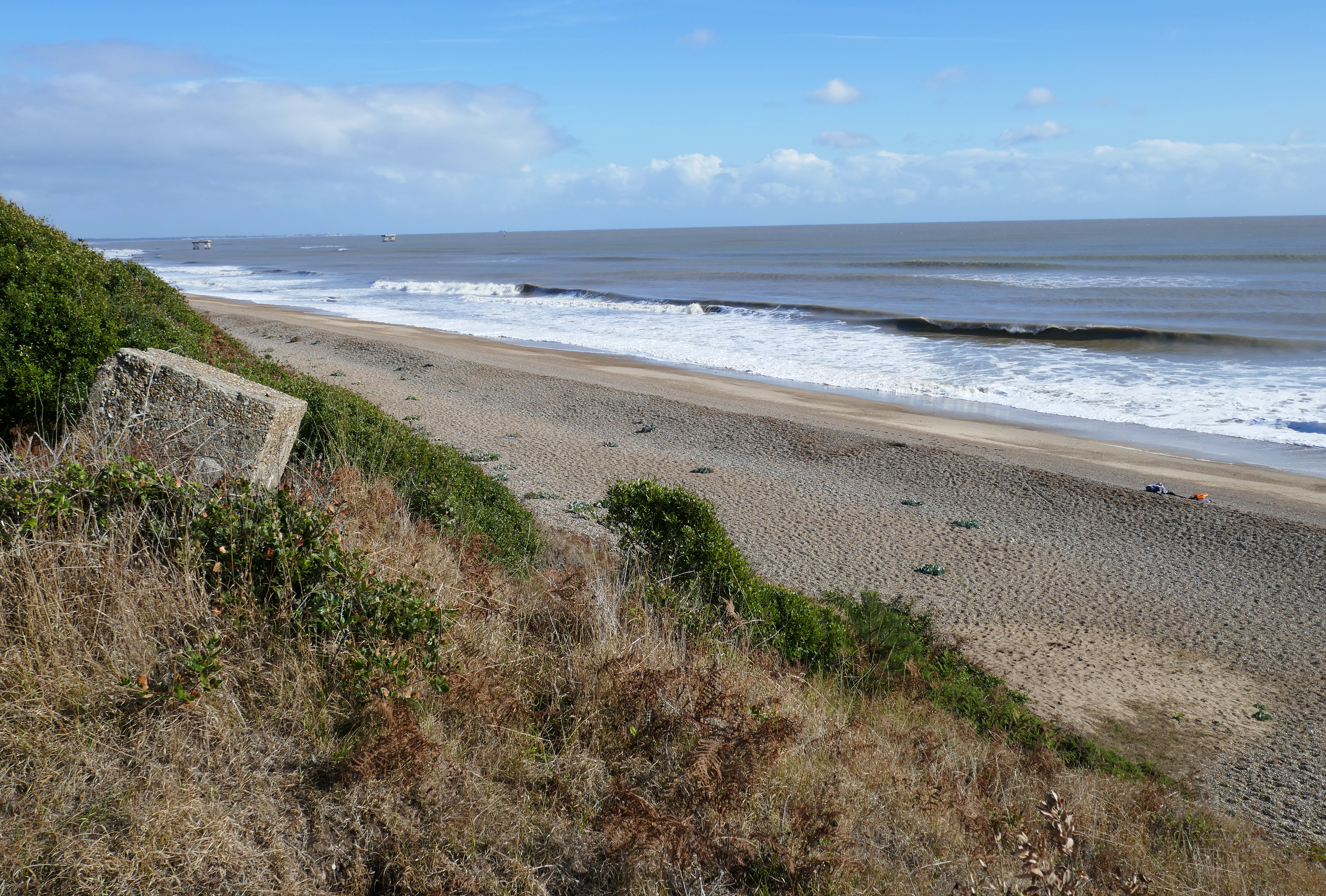
Even in winter some good weather is never too far away and we wandered around the ruins and pretty village at Sweetheart Abbey in sunshine the next day. The impressive lighthouse at Southerness was an idyllic beach combing and rockpooling spot and at Sandyhills Bay we kicked along the soft sand with views across the Solway. This Dumfries coast is packed with pretty coves and bays, craggy cliffs and charming villages.
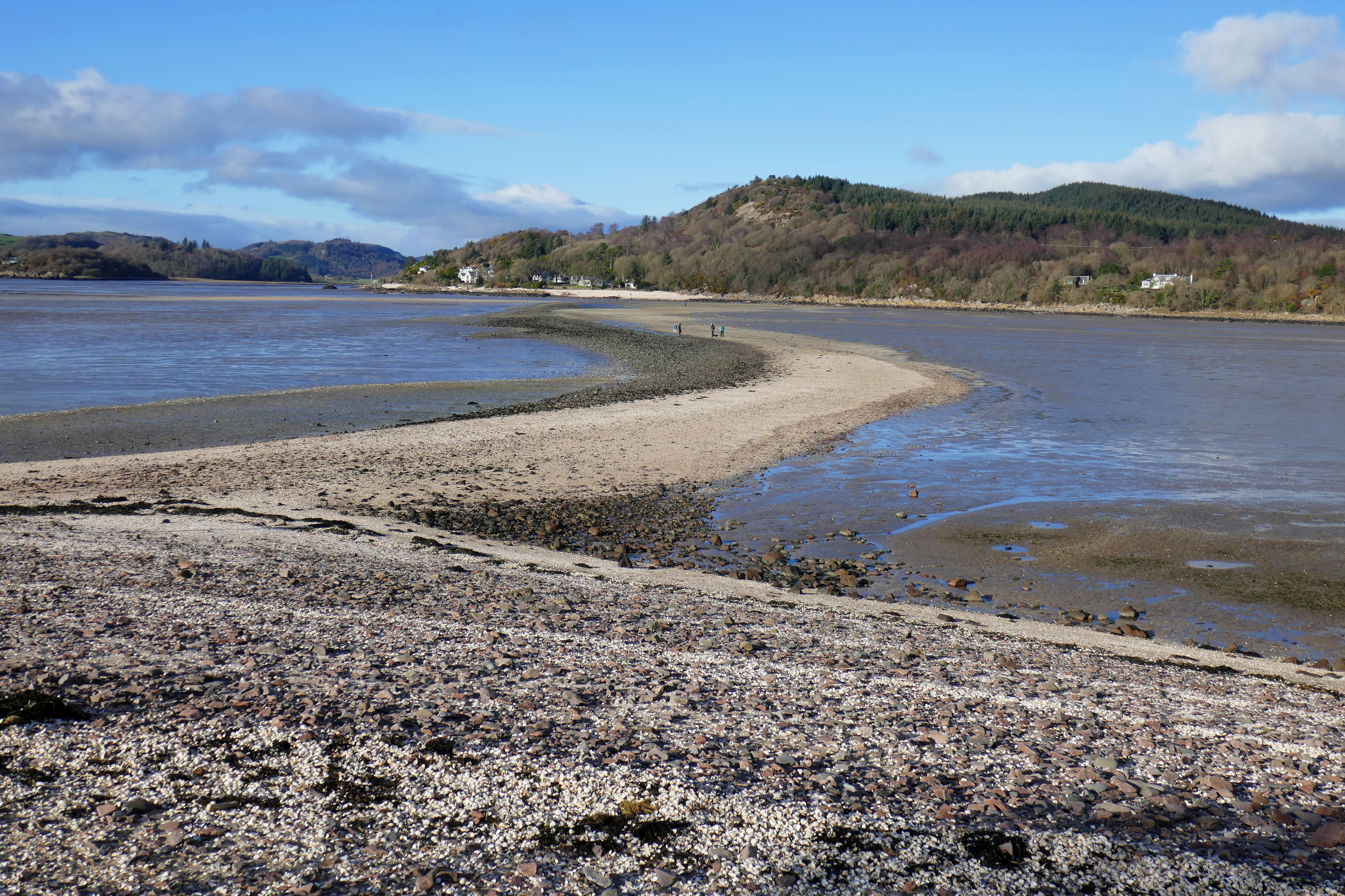
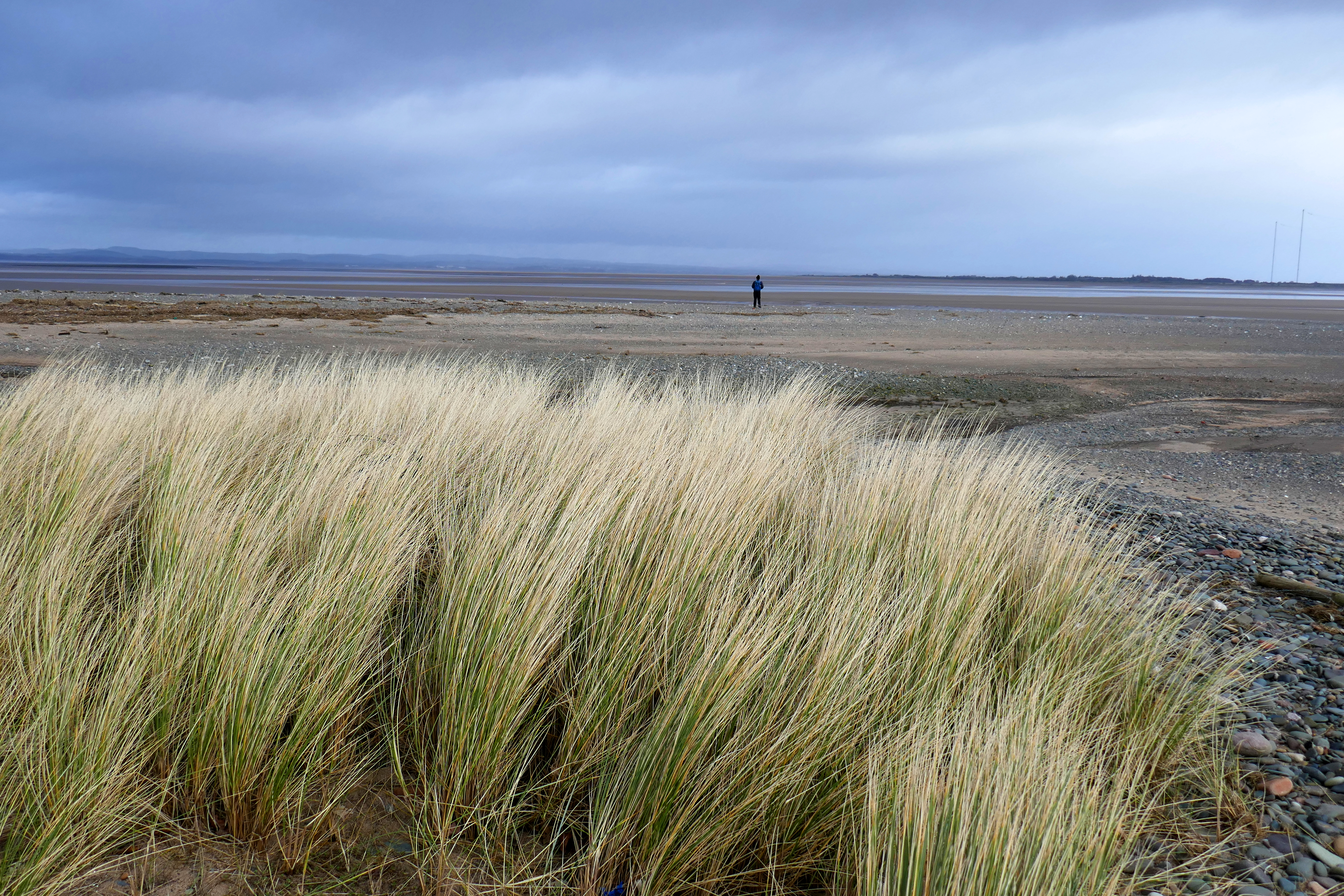
On a sheltered inlet with a picturesque outlook, Kippford is delightful. It was low tide and we could crunch our way along the shell-strewn tidal causeway to Rough Island that sits in a sheltered estuary off the Solway Firth. A narrow path climbed from the causeway through bushes to the grassy high point of the island and rewarded us with spectacular views across the water to clusters of white cottages on tree-covered hillsides.
In the evening we were treated to a stunning sunset from the campsite above Kirkcudbright while cozily drinking tea in our ‘van. Less enjoyable were the strong winds that rocked the ‘van alarmingly in the small hours and disturbed my sleep!
The storm passed over and the sun returned the next day as we explored the handsome town of Kirkcudbright. Sitting on the River Dee that flows into the Solway Firth, Kirkcudbright is a vibrant and lively town with something for everyone. We strolled around the castle and along the harbour with colourful fishing boats and admired the houses painted in pastel shades. We picked out two of the three museums and just one café to visit. Later we hiked to Kirkcudbright Bay, returning to the campsite on inland lanes that wound uphill and descended on woodland paths.
Our campervan trip under the big skies of the Solway Firth had delivered light of every shade from blue skies to gun-metal grey stormy clouds and deep-red sunsets. As we drove home I suggested to Anthony that campervan trips should be available on the NHS because there was no doubt I now felt refreshed, upbeat and ready to ride out the remaining winter days.
The pictures below show Rough Island, the swans at Caerlaverock and a Dumfries beach.
We are never put off by chilly weather and walking under wide and luminous skies and beside sparkling seas on the Solway Firth is a winter treat. The dark days of the year can seem endless and an injection of this clean light and a few colourful west-coast sunsets help me feel optimistic about spring. This is an isolated corner of England, no one just passes by these coastal towns along the Solway, and for me, this sense of being on the edge adds to the charm.
The estuary known as the Solway Firth separates England and Scotland and we began our tour on its English shores in the small Cumbrian seaside resort of Allonby. The hazy February sunshine was welcome, the sea shimmered with a pearly light and across the water we could see the distinctive hill called Criffel in Scotland.
Wrapped in layers we headed for the beach for some invigorating fresh air. Anthony watched for birds and I walked along the tideline, constantly stopping to admire a shell, pebble or piece of pottery that caught my eye. The chilly breeze whipped up the sand and we both had a healthy sand-blasted glow as we wandered back along Allonby’s street. A quiet backwater out of season, Allonby is still a popular resort with swanky houses from its heyday. Most striking is the old Quaker Reading Room, an unusual red-brick building with a clock tower and an uninterrupted sea view. The building was a sorry derelict sight for many years but has now been renovated as a stylish private house that I yearn to peek inside.
The rolling green countryside in this corner of Cumbria is largely ignored by tourists and the quiet roads are a pleasure to cruise along. With the exception of a friendly ginger cat, we had the remains of Holme Cultrum Abbey to ourselves. I was delighted to find one of my favourite flowers, snowdrops brightening up the rambling graveyard and ruins with their shiny green stems and bobbing brilliant-white heads. Snowdrops cheer up the dreariest day.
Planning our trip, Grune Point had caught my eye. This remote spit of land, shaped by the tides, stretches along the Solway Firth from the town of Silloth. Before walking along Grune Point the next morning we went in search of an essential warming coffee and stumbled into the Fairy Dust Emporium Café, a flamboyant and charming café with welcoming staff. Sitting at one of the wooden tables surrounded by fairies of every shape and size, we rang a bell for service and another fairy gained her wings. As well as hot coffee the irresistible warm cheese scones with fiery chilli jam were a tonic.
Striding out along the wide promenade above the beach, the Solway Firth and Scotland were to our left and houses with an enviable sea view to our right. After a larger-than-life metal sculpture of a man and his dog and East Cote Lighthouse we picked up a lane lined with yellow flowering gorse bushes that held the promise of spring. Nearer to the point we walked along a beach that alternated shingle of colourful pebbles and soft deep sand blown into mini dunes and dotted with bleached driftwood. The blues of the sea merged into the huge sky, sharp calls of oystercatchers filled the air and the sun warmed our backs; it was as stunning as I had hoped.
Turning the corner of Grune Point we were looking over a vast area of salt marsh and mud flats, wriggling with channels. The cheese scones and coffee had worn off and we found shelter near an old pill box and cupped our hands around mugs of hot chocolate from our flask, another winter essential. In a clamour of honking, hundreds of barnacle geese rose from the salt marsh and flew over our heads in unruly v-shaped skeins. A heavy shower followed the geese and we hurried back to Silloth.
We received another warm Silloth welcome in the Motorcycle Museum, a Tardis-like place packed with bikes and motorcycling memorabilia that will delight anyone. Silloth once had a racing circuit at the airfield and the owner talked passionately about his experiences of racing there and on the Isle of Man. Wistfully I recalled my visit to the TT in the 1970s but couldn’t pinpoint the year; of course the knowledgeable owner soon pieced it together from my muddle of vague memories.
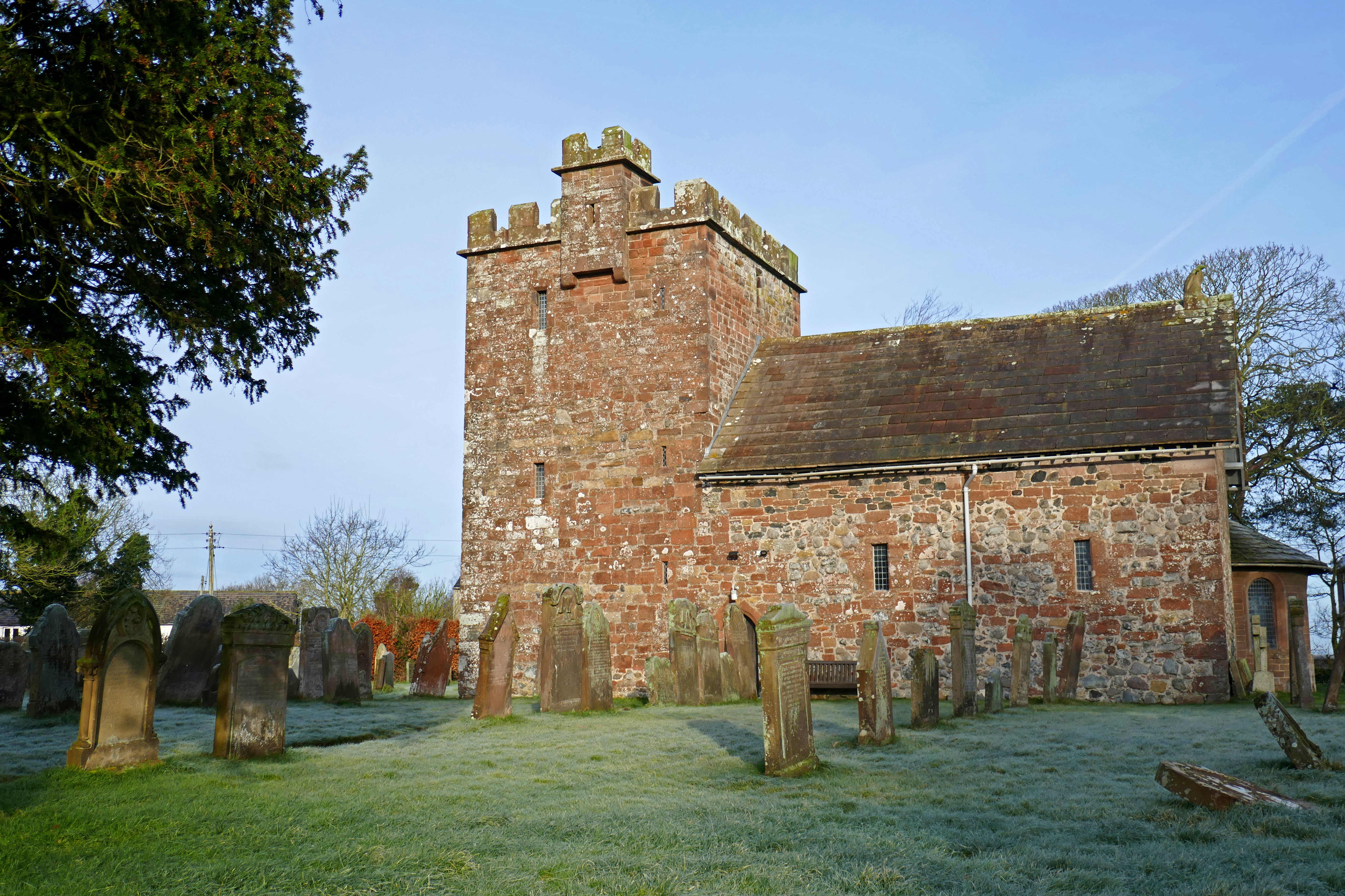
A frost had turned the green countryside into a winter-wonderland white the next morning as we drove to Newton Arlosh to see the fortified church. In this border area churches were built with thick walls, narrow doorways and a tower as a refuge for people and animals during attacks from Scotland. This medieval church fell out of use and became a roofless sheep pen but was restored in the 19th century by Sarah Losh, a local wealthy and determined woman and it now has many fascinating features including a stone eagle on the roof.
The Solway Firth had narrowed when we picked up its shores again and pulled into the RSPB reserve at Campfield Marsh where the pools were frozen and the ducks waited patiently for the water to melt. A railway line once crossed these marshes and a viaduct took it over the Solway to Scotland. In the cold winter of 1881 ice, up to 6ft thick, bumped against the pillars of the railway viaduct destroying sections. A local paper reported that workmen on the viaduct were distracted when they spotted a hare stranded on a block of ice and floating out to sea! The railway closed in 1921 and the disused line became part of an ambitious and dangerous pub crawl. Thirsty Scots would cross the viaduct on foot to take advantage of the more lenient Sunday licensing laws in England. There are stories of inebriated individuals missing their footing on the bridge and never making it home and until the viaduct was demolished a guard was employed to try and prevent these fatal journeys.
We wandered around the quayside remains at Port Carlisle before parking in Burgh by Sands to hike onto the salt marsh to the monument to Edward I who died here on his way to invading Scotland. This land is the grazing for prized salt marsh lamb and an annual auction for parcels of land called stints is still held every year. Across the River Eden we could see traffic on the M6 and The Metal Bridge Inn, [not surprisingly] named after the metal bridge over the River Esk. This would be our stop for the night.
The Metal Bridge Inn is a landmark for anyone driving north on the M6 and a place that combines isolation with six-lanes of traffic. Under another orange-red sky I climbed the steps of the railway bridge and looked down on the River Esk as it wound its way through salt marshes to the Solway and the Irish Sea. Skeins of pink-footed geese flew overhead, their energetic honking so loud and uninhibited they drowned out the traffic on the M6!
Although I was craving light, coziness is also essential to get through the winter months and this snug pub welcomes campervans on a dedicated parking area and serves good beer and hearty food. By the time we walked back to the Blue Bus in the dark all the ‘pitches’ were taken and I was pleased to see we weren’t the only campers enjoying our ‘van all year.
Part Two and our journey into Scotland and the Scottish shore of the Solway will be in my next post.
Photographs of the Allonby’s old Reading Room, Grune Point and Newton Arlosh church below.
One of the sculptures at Les Lapidiales near Port-d’Envaux in France
We think we want things to be real, but does anyone really want to read about an anxious travel writer? I’m not sure they do and so recently I haven’t actually lied, as one segment of my head adores our campervan travels, but there is a dark wedge of my brain I have kept to myself.
It was during our last trip to France that I noticed how contradictory I was feeling. While relishing exploring the beautiful country in our campervan I was also secretly doom-mongering. Anything that could go wrong [and probably wouldn’t] spun around and around in my head, driving my anxiety levels through the roof. My brain convinced itself it knew the future and it was bleak!
At first I tried ignoring my anxious feelings thinking that would make them go away. This didn’t work! Changing tack, I gave my anxiety some attention. This helped me see how my fears were familiar from our trip to Germany last year. I had muddled along then but this time my anxiety levels were higher and overwhelming and going home seemed the only answer!
Anxiety can sound trivial but it multiplies, feeding on itself. It starts in my brain but very quickly affects my whole body. Always the writer, my notes from the time describe the physical symptoms of a tight chest, nausea and fast and shallow breathing. And all because my head was busy imagining the worst things that might never happen.
Healing begins with sharing
I struggled to understand why I would be anxious when I was living the dream and travelling with my partner in our campervan. I felt guilty and stupid for having these negative feelings. I did not want to let anxiety about tomorrow spoil our trip and I thought the best thing was to keep my anxiety to myself, keep calm and carry on.
It took a few weeks to admit to my partner in campervanning how I was feeling. He is a caring individual and didn’t tell me I was being ridiculous. Being open about my anxious feelings shone a light on them, revealing the deceit they wallowed in. Saying them out loud helped me see how my anxiety was so clever it could fool me into thinking my imagined threats were real. It helped me to engage the rational side of my brain, calm my adrenaline-fuelled body and see that these worst-case-scenarios were fantasies. To even imagine I could predict the future was an illusion!
His caring approach didn’t make the anxiety go away but it helped. He recognised how difficult it was for me to admit that something in my brain was broken. There were no visible wounds to soothe but he gave me the love and patience I needed. Sympathy and talking were positive but no cure, so together we came up with a few strategies to ease my anxiety and be able to continue our holiday.
Small Steps
Firstly, we slowed down our tour, staying in one place for longer so that I could settle in, feel at ease and work at re-booting my brain. We travelled short distances on the days that we moved too and this relaxed approach to our trip worked well for us both.
As well as driving less, I lived at a slower pace. We had no deadlines and were footloose and it wasn’t necessary to rush to see a particular attraction or place. We adopted a calm approach to our days, taking a leisurely breakfast, lunch and evening meal when we would talk and laugh together. We stayed away from large towns and cities, choosing countryside locations where we were surrounded by nature.
Daily exercise has always been important for my wellbeing and the French countryside is perfect for the active holidays we enjoy. We walked or cycled, taking time to stop to watch wildlife, identify flowers or read about the local history of the village we were in. I focussed on joyful things that made me smile.
Strange as it seems, I also made time to fret, allowing an early evening worry-time slot. I used this to write down all the things I was anxious about and how I was feeling. I practiced some controlled breathing and worked at being more accepting of uncertainty. I was mindful of my anxious and racing thoughts and the accompanying rush of adrenaline and allowed them to have their moment without a fight. I used the My Possible Self app to give some structure to this time.
After a few days I would recognise the doom-laden thoughts as soon as they popped into my head. I would acknowledge these thoughts and sing, ‘Hello darkness my old friend, I’ve come to talk to you again.’ Sometimes this enabled me to see the dishonesty of my fears and stop the out-of-control downward spiral in its tracks. Whether cycling, cooking or pottering around the campsite, The Sound of Silence became my holiday tune!
I worked at being nice to myself and tried to accept that everyone has something that is hard to do. I occasionally felt positive that I would once again be an anxious-free traveller.
Letting in the light
This anxiety has crept up on me since the Covid-19 lockdowns. Covid-19 proved to all us naysayers that bad things can be just around the corner. The pandemic led to many changes and for me having to stay at home and worry about catching a potentially deadly bug was enough to trigger anxiety.
Although I am pleased that we are much more open about mental health issues in the UK than we used to, I am not convinced anyone wants to open their motorhome or campervan magazine and read travel articles peppered with mental health worries. So my articles dwell on the light, rather than the daily grind. Sharing in this blog post is a big step, so please be kind.
I don’t want to be the person that is ruining my own day, I know how few I have left! I do want to reduce my anxiety levels and become ME again and I am hopeful I can do that … so watch this space.
A quick note on resources: As well as the My Possible Self app I have worked through Joshua Feltcher’s book Anxiety: Practical About Panicand I signed up for his Anxiety Josh newsletters, the NHS Every Mind Matters emails and The Friendly Mind.
Red Kite Touring Park in Llanidloes in mid-Wales is an adult-only high quality campsite. Staying there had been on our wishlist for a while and this year we got the chance to enjoy the excellent facilities it offers for three nights.
If you don’t know the campsite, it sits above the small town of Llanidloes and has hard-standing pitches with views down the valley. The facilities are modern and excellent and the welcome is friendly.
We like to leave our campervan on our pitch and walk and a quick look at the map suggested there would be no shortage of options and this was true. The campsite is well-run and reception keep a folder of walks from short strolls to long hikes. There are multiple copies of each walk so you can take away the instructions, pack a picnic and set off into the Welsh countryside.
Llyn Clywedog & Old Lead Mines (approx 13 km / 8 miles)
Red Kite Touring Park sits on the hillside above the Afon Clywedog that flows into the River Severn. From the campsite dog walk we picked up a lane that follows the Afon Clywedog away from Llanidloes. The lane climbed steadily through woodland to a farmhouse where we turned right and joined the Glyndŵr’s Way. This is a 217 Km long-distance path that meanders from Knighton to Welshpool. It is named after Owain Glyndŵr who was a Welsh prince and leader who led a rebellion against Henry IV in 1400.
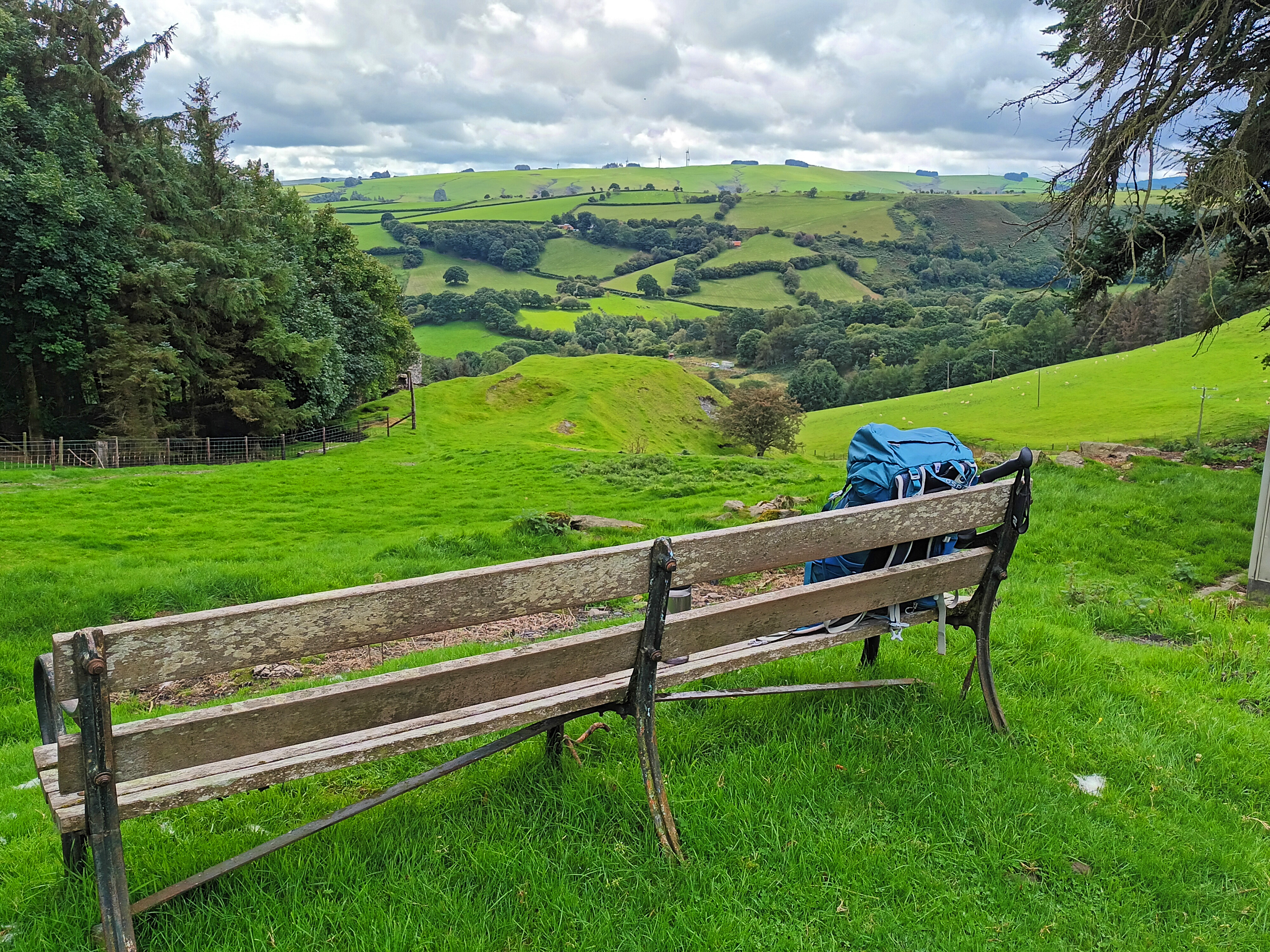
The section of this path by Bryntail, passing a former outdoor centre, had open views across the valley and was so enjoyable we stopped for lunch on the bench in the photograph above.
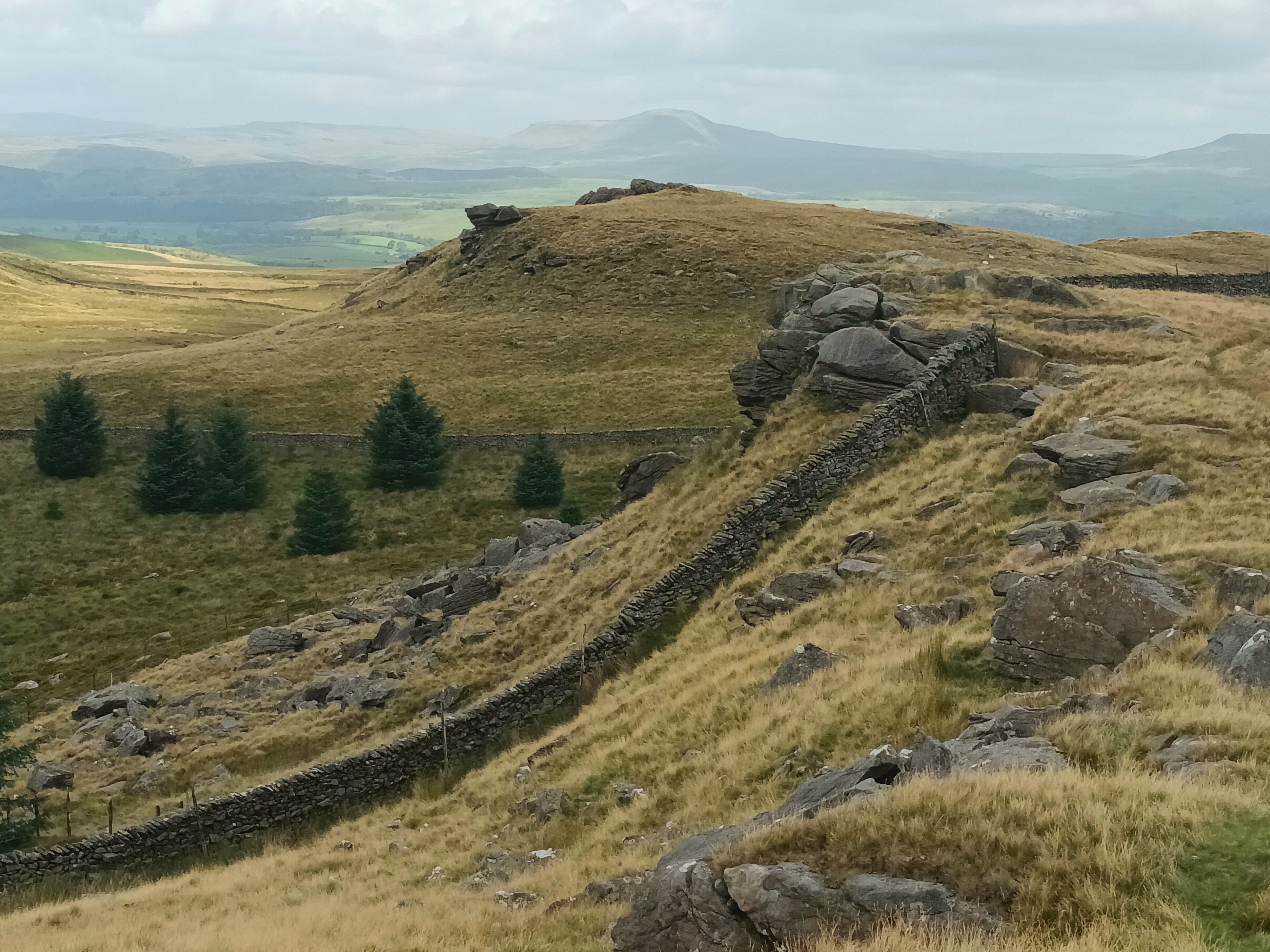
Dropping down the hillside we could see the massive dam holding back the waters of Llyn Clywedog. We explored the buildings of the old lead mine and appreciated the information boards that explained the grimy processes that were carried out in this industrial site.
We chose to take a path around the head of a small valley to Cwm Deildre. The first section of this path traversed the steep-sided valley and was tough going as we fought our way through flourishing bracken. This was so arduous we were relieved to reach the head of valley and an easier-going track. At Cwm Deildre we joined lanes that took us to paths back to the wooded banks of the Afon Clywedog which we crossed the bridge back to the campsite.
This walk had plenty of interest and big views and I would recommend it.
Llanidloes, the Severn Way & Glynbrochan (approx 16 km / 10 miles)
From Red Kite Touring Park you can either walk into Llanidloes the pretty way, crossing Afon Clywedog and skirting the valley side through woodland. This is about 2.5 km (1.5 miles) or you can walk along the pavement by the road which is slightly shorter. We followed the campsite instructions for the pretty route and after looking around some of Llanidloes elegant and interesting buildings we sought out a coffee shop. The Wild Oak Cafe was an excellent choice for the range of food, good coffee and comfortable atmosphere.
We left Llanidloes on the minor road that follows the River Severn, turning left to cross the river on the quiet lane towards Glynbrochan. Leaving the tarmac we picked up paths on the hillside to our right and became just a little lost until we realised which side of a hedge we should be on! Eventually we scrambled down a steep path through trees to reach the dam of a small reservoir where we had our picnic lunch.
The path from the reservoir to the farm was boggy and we were glad to reach the tracks without our feet getting soaked. A farm track took us downhill back towards the River Severn where we joined a lane that led back to the bridge where we had crossed the river earlier and we were soon back in Llanidloes and climbing the hill back to the campsite on the road route.
Apart from Llanidloes, which is worth a visit, this walk only had the reservoir as a focus for our interest but we stretched our legs and felt we had deserved tea and cake later!
Occasionally we have a holiday without our campervan [honest] [And we always miss the Blue Bus when we leave it behind]. Our latest short break hardly took us out of Lancashire. Here is the story of our mini adventure over a couple of days when we hiked across the Forest of Bowland.
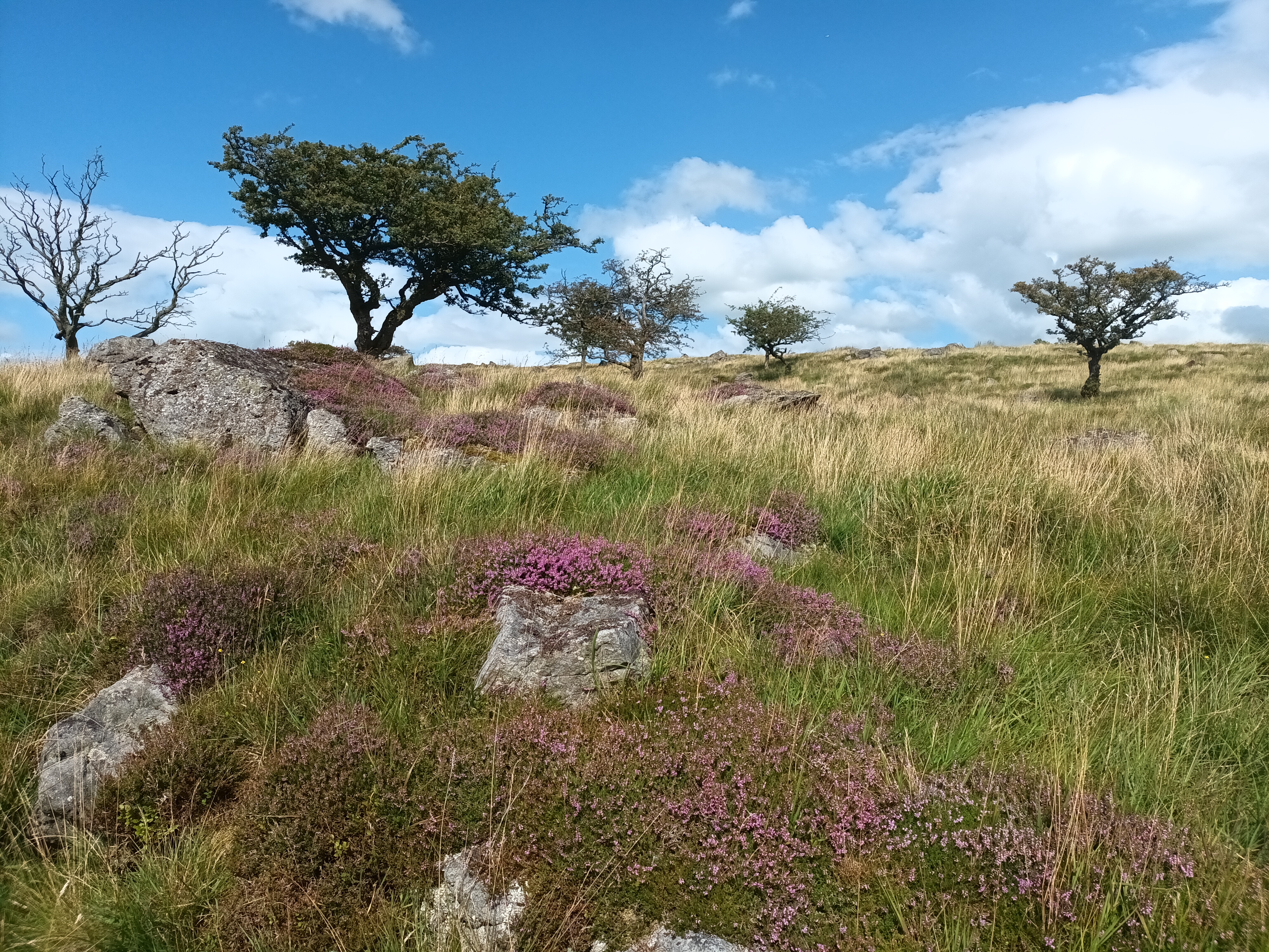
The walk of around 40 kilometres is best done over two days with an overnight in Slaidburn. You have some options on the route and you may vary it depending on the weather, time of year and how much time you have available. The hike features in the Cicerone Walking in Lancashire book as a 45 kilometres (28 miles) walk and if you want a detailed description this would be worth purchasing.
We put the walk on our wish list recently and for the last six weeks I had been keeping a close eye on the weather forecast but July just got wetter and wetter. This wasn’t the weather I wanted for hiking across empty moorland and I had to wait until early August for a break in the rain and a window of sunshine. Excited, I rang the Hark to Bounty Inn in Slaidburn to book our overnight accommodation and we packed the rucksacks with essentials.
We caught the early bus from Lancaster towards Kirkby Lonsdale, getting off in the village of Wray. From here, if you have time you can take the paths up the wooded Roeburn valley but we headed straight up the lane to High Salter, reducing the walk by two kilometres. This lane was quiet and enjoyable with panoramic views over the Lune valley and to Ingleborough, Pen-y-Ghent and Whernside, the Yorkshire Three Peaks. We passed some rustic wooden sculptures and a well-kept memorial bench surrounded by flower beds.
At High Salter we left the last of the farms and reached the gravel track of Salter Fell Road that crosses the moorland to Slaidburn. At first the track climbs steadily up to the watershed, the River Roeburn tumbling below us. From the summit the streams no longer flowed into the River Lune but were heading towards the River Ribble. In this treeless high land the views across the moorland were wide open with the stony track snaking across the landscape. There isn’t much obvious wildlife on these grouse shooting moors but a lizard scuttled away from our feet and a couple of kestrels hovered over the slopes. A herd of belted galloway cows ambled towards us on both verges of the track, forming a moving guard of honour. These calm cows are nevertheless bulky and we walked between them quickly but cautiously.
We stopped on a rocky outcrop near the watershed for lunch taking in the view across purple flowering heather. The track is used by off-road bikers and cyclists and a group of scramblers dented the peace and our solitude as they bounced by.
Walking with a heavier than usual rucksack was tiring and we stopped again in the mid-afternoon for cake and I lay back on the heather gazing up at the wispy clouds in the blue sky, waking up a short while later! Up to now route finding had been easy but this changed as we left the Salters Fell Road for Croasdale House on a soggy and overgrown path. Negotiating nettles, farms, stiles, cattle and dogs we eventually reached a lane into Slaidburn. Staying on the track and lanes into Slaidburn would have been easier going and a similar distance although it was harvest time and the narrow country lanes were busy with farm vehicles.
We reached the Hark to Bounty just after they opened at 17.30 and were grateful for a room to rest in with a hot shower and a kettle for tea. The Hark to Bounty is an old inn that is full of character and has a heart of the community feel. The bedrooms are comfortable and individual but not ultra-modern. That evening we ate hearty food in the bar and slept the deep sleep of backpackers. [The Hark to Bounty closed in October 2024, although new tenants are being sought.]
Slaidburn is an unusual village. At first glance it looks timeless and this is in part because it is owned by one family. Sitting in agricultural Lancashire Slaidburn has no modern buildings and is not wall-to-wall holiday lets. The 17th century cottages and farms are rented, the school remains viable and there is still a village shop and pub. Slaidburn also has a handmade chocolate shop, a cafe and a youth hostel available for sole use.
There had been some rain showers overnight but the next morning was fine and after breakfast we once again heaved our rucksacks onto our backs and set off along the River Hodder to Stocks Reservoir and Gisburn Forest. Built in the 1930s, Stocks Reservoir get its name from Stocks-in-Bowland, the village that was flooded.
Gisburn Forest is vast, apparently almost 3,000 acres vast, so it was no surprise that it took us most of the morning to cross it. As is often the way when we can’t see the route for the trees, we got lost more than once and without GPS we would probably still be wandering around the forest! All Gisburn’s acres have plenty of variety and from the shores of Stocks Reservoir we walked through magical vivid-green treescapes, alongside sunny verges where peacock butterflies were thriving and, of course, through dark pine forests. Eventually we emerged with some relief at the highest point, Whelp Stone Crag, and stopped for lunch looking across the farmland towards Yorkshire and our walks end.
The relief was short lived as we still had some kilometres to walk and a bus to catch. We tried to choose the best route from the many lanes and footpaths on the map but twice ended up on an overgrown walled lane that no one had tramped along for some time. Both of these were thick with nettles and brambles and, wearing shorts we emerged with legs covered in scratches and stings. I always react badly to nettle stings and my tingling legs were soon attractively covered in swollen red lumps that only antihistamines can deal with. Anthony doesn’t suffer in the same way but did collect a tick.
After more encounters with young bullocks that herded and trotted curiously behind us, way too close for comfort. We tried to stay calm and walk rather than giving way to the urge to run! A hare bounding over a wall delighted us and we climbed gates that were tied shut with string despite being on a right of way and heaved ourselves and our rucksacks over so many stiles we lost count until we reached the A65 and the bus stop by The Craven Arms in Giggleswick. There is a railway station here but we caught the cheaper bus home, changing in Ingleton.
There is something satisfying about completing a linear walk while carrying your kit and we enjoyed our short trip. The warm weather meant we weren’t laden with lots of extra clothing but we did carry plenty of water as well as spare food [apart from Slaidburn there were no shops or cafes on our route] and our emergency first aid kit.
In May and June this year [2023] we travelled through France for around just over six weeks. We moved around the west [Atlantic] coast in a fairly adhoc way, deciding where to go next as we went along and booking nothing. To help anyone planning their own trip to France I have listed where we stayed by departments below, rather than in the order we visited them.
Every campsite we stayed on was offering a discount with an ACSI card. In France this discount is generally available out of season until the beginning of July and again from the end of August or the beginning of September. The amount we saved varied from just a couple of Euros a night to more and we recovered the cost of the card in around a week. Over a six week trip the ACSI card more than paid for itself.
With a couple of exceptions, the sites all had unisex facilities, most provided toilet paper but not all of them and some provided soap at the sinks in the sanitary blocks. Many of the sites had swimming pools too. We also always paid a tourist tax of around €1/night each. We were often only travelling short distances between campsites and sometimes we arrived before the 12.00 lunch break and this was never a problem.
Loire-Atlantique & Maine-et-Loire
These are the regions around Nantes and Angers. Maine-et-Loire is inland from Nantes around the River Loire and the Loire-Atlantique is the coastal area north and south of the Loire estuary.
Camping Paradis La Promenade, Montjean-sur-Loire This large site on the banks of the Loire has good-sized marked pitches, some open views and indoor and outdoor pools. The facilities are fine, although the showers were warm rather than hot. There was no bread available early in the season but there is a fantastic bakery 700m away in the village that baked their own rich brioche. The village also has a corner shop. We cycled on pleasant off-road paths and quiet lanes by the Loire. ACSI price €17.00/night.
Camping La Guichardière (Flower Campings), La Plaine-sur-Mer – Just a five minute walk from the sea, this slightly sloping site has good-sized hedged pitches with some shade. The pitches are separate from but surrounded by bungalows. The facilities are very smart with good hot showers in roomy cubicles that also have a sink. The site has an indoor and outdoor pool and a pleasant snack bar. We could order bread for the morning. The coast is rugged here with sandy coves and we walked and cycled on the coastal path and inland agricultural tracks. The ACSI price €19.00/night.
Camping Les Paludiers (Flowers Campings), Batz sur Mer – This sandy undulating site has very little shade and some uneven pitches. The facilities are dated and really need a refurbishment. The showers are roomy but not adjustable and only just warm. You were lucky if there is one hook in the shower! We have stayed here before as we have friends who live nearby. It is close to the beach, a pretty town and an area of salt pans. ACSI price €19.00/night.
The Vendée & Deux-Sèvres
These areas are south of the River Loire. The Vendée has a popular Atlantic coastline of sandy beaches but inland is mostly agricultural. La Roche-sur-Yon is the place to go for out-of-town shopping. Deux-Sèvres is also rural, growing cereals and potatoes and apples. The idyllic Marais Poitevin, an area of marshland crisscrossed by picturesque canals and drainage ditches, is in this area too.
RCN la Ferme du Latois, near Coex – This large site has clearly marked grassy pitches around ponds in peaceful countryside. There are four facility blocks and three of these were open when we visited in May. The showers were good and hot with adjustable temperature control and the facilities clean. RCN is a Dutch organisation that runs campsites in the Netherlands and France. They use the profits to provide holidays for people who otherwise would not have the opportunity. The site is north of Lac du Jaunay and we walked there and around half of the reservoir and cycled a local route. ACSI price €17.00/night.
Camping Le Martin-Pêcheur, Magné – On the edge of the Marais Poitevin and near to Niort, this small site suited us very well. The pitches are generous, the facilities are modern and clean with the best showers we had all holiday. There was toilet paper and soap too. They didn’t have morning bread but I enjoyed my five minute cycle ride to the smart bakery in the pretty village before breakfast. There is a supermarket in the village too. The site is handy for picking up the cycle route along the canal to Coulon and there are buses too. We cycled on different lanes and paths through the woodland and fields and fell in love with this picturesque area. ACSI price €19.00/night.
Camping Paradis La Bretonnière, St Julien des Landes – A grassy site with some hedged pitches and touring pitches separate from bungalows. The site is in peaceful countryside south of Lac du Jaunay and has a pool. The showers and toilets are open to the outdoors and this is fine in warm weather and there was plenty of hot water. The village is 2kms away and this has a convenience shop and a cafe. We cycled to Lac du Jaunay and around the quiet countryside. ACSI price €15.00/night.
Charente-Maritime & Charente
The beautiful River Charente runs through these two departments. La Rochelle and the Ile de Ré are in the north of the Charente-Maritime and this coast is popular with tourists. Inland, Charente is quieter and has a tradition of producing cognac and pineau, an aperitif of wine and cognac.
Camping La Tour des Prises, Ile de Ré – This is a popular campsite but well positioned in the centre of the island, allowing us to cycle to either end of the island. The site is walled and the pitches are not enourmous but many of them have solid hedges giving privacy. There are two facilities blocks which are clean and the showers are good with temperature adjustment. There is a pool and morning bread is available. We were given a cycling map when we arrived so we could explore the island. Despite being easy to access and cycle from, the campsite is peaceful. It is about 10 minutes cycle ride to a small supermarket about 2.5kms away. ACSI price €21.00/night.
Camping de Cognac, Cognac – This grassy and shady site by the river is about a 30 minute walk [or a quicker cycle ride] into the city of Cognac. The site has some road noise from the surprisingly busy road that crosses the river. The male and female facilities were roomy and the shower temperature is adjustable. There was no morning bread out of season. La Flow Vélo, a long distance cycle route passes the campsite and you can cycle by the river in either direction. ACSI price €17.00/night.
L’Ile Madame Camping, Jarnac – This level and prettily laid out grassy site is on the edge of Jarnac and a short and attractive walk into the town centre. Jarnac is a lovely place with a small shopping area, an indoor market, an edge of town supermarket and some Cognac houses. The campsite facilities are fine, with good hot showers, although the washing up sinks are outdoors. Campers have to walk to the bakery. Off road cycle routes by the river go in either direction as part of La Flow Vélo. ACSI price €19.00/night.
Camping des Ribieres, Confolens – This popular site has a riverside setting and is near to the tourist town of Confolens that has restaurants, shops, some charming buildings and a 13th century arched bridge. The site has two kayaks you can take onto the River Vienne and you can rent huts and ready-erected tents. Unusually, we found that campers are allocated a pitch even out of season. The facilities are fine, the showers warm but somewhat cramped. The road alongside the campsite is busy and there is some road noise but if you are nearer the river this is negligible. There is a snack van that does a roaring trade. ACSI price €15.00/night.
Dordogne
The large rural Dordogne Department in southwest France is mostly north of the River Dordogne. We spent a few weeks in the Périgord area in the north of the Department. This historical region is sparsely populated and has abundant woodlands and meadows of cattle and crops, cut through by winding steep-sided river valleys.
Camping Chateau le Verdoyer, Champs Romain – In the Périgord countryside this campsite is in the grounds of a traditional-style chateau. Many of the pitches have open views over meadows and woodland and they are marked and some have hedges. There are also pitches with private bathrooms on your pitch but not for the ACSI price! The showers are timed for five and a half minutes and are warm rather than hot but kept clean. The washing up sinks that were available when we stayed here had no roof but others do. There is an indoor and outdoor pool and reception has a small shop, snack bar and morning bread is available. Good evening meals are available in the chateau and they have a vegetarian option. We purchased a local walking map for a few Euros and hiked on the waymarked paths over a few days. The village is about 30 minutes walk away and has a cafe, a corner shop and a free weighbridge. ACSI price €19.00/night.
Camping Brantôme Peyrelevade, Brantôme – This is a large riverside site with plenty of pitches with shade and three sanitary blocks, although they were not open fully when we were there out of season. The pitches are marked out. The facilities are okay and the showers hot. The site is well run and close to the busy tourist town of Brantôme which has an abbey and gardens to visit. There is a good network of local waymarked walks in the woodland and meadows from the site. ACSI price €17.00/night.
Camping La Chatonnière, Jumilhac-le-Grand – This terraced campsite was a big hit with us. It is family-run and friendly, our shady pitch overlooked the river and it was peaceful and tidy. The three facilities blocks are kept clean and eventually we found that the ones nearest reception had the hottest showers. Bread is available at reception and they sell some essentials including local honey. The campsite also sells takeaway pizzas in the evening that are good. The village of Jumilhac-le-Grand is a short walk away uphill and has a corner shop, a pharmacy, a couple of cafes and a beautiful chateau. There are numerous waymarked walks from the village and we hiked along the valley and up and down the steep hillsides of this idyllic countryside. ACSI price €15.00/night.
Ille-et-Vilaine
One of the departments in Brittany, Ille-et-Vilaine spreads inland from the coast around Saint-Malo and Dinard. Rennes, its main town, is in the centre of the department and the name comes from two rivers in the area, the Ille and the Vilaine.
Camping des Chevrets, St Coulomb near Saint-Malo – If we have visited a campsite more than once it means it certainly has our seal of approval. This large and popular site was busier in June than it was at the end of August when we last visited. The weather was warmer too and we chose a shady pitch. There are red squirrels in the trees and direct access to beaches and coastal walks. The facilities are fine although I would have liked some soap for handwashing as we were paying more than other campsites. The campsite has a cafe overlooking the beach and a shop that has morning bread and other essentials. ACSI price €21.00/night.
Domaine de la Ville Huchet, Saint-Malo – We stayed at this site with some trepidation having read very mixed reviews. We would now use it again for one or two nights as it was okay and has good bus [about ten minutes walk to the stop] or cycling access into the fascinating town of Saint-Malo. The site is grassy with trees and marked pitches that are allocated. The reception and snack bar are bright and modern and campers are given maps for Saint-Malo. The facilities are light and airy and the shower temperature is adjustable and so can be as hot as I like it and the cubicles are roomy. ACSI price €21.00/night.
We were lucky! February was a fairly dry month in 2023 and this helped us make the most of our week on the North Yorkshire coast in our campervan. Without wind and rain to hide from we were able to spend our days being relaxed, exploring the coastal towns and villages and walking on the coastal paths.
Knaresborough
We reached the coast after breaking our journey in Knaresborough. The sun was shining so we took the opportunity to walk through the woodland by the River Nidd into the town and strolled along Knaresborough’s riverside under the soaring arches of the railway bridge. We had drinks in The Blind Jack, an atmospheric pub with wooden floors soaked with years of beer and jolly lanterns strung around the ceiling. It was still February but walking back at sundown blackbirds sang loudly from the trees heralding spring was in sight and really only just around the corner.
Robin Hood’s Bay
Reaching the North Yorkshire coast, we stopped at Crook Nest car park north of Scarborough and followed the cliff path. Waves whispered below us, the yellow gorse was flowering and Scarborough Castle was visible in the distance. We returned on the Cinder Track cycle route, an old railway line that links Whitby with Scarborough.
Middlewood Farm Holiday Park isn’t a perfect campsite for facilities but it is well located for exploring the coast around Robin Hood’s Bay. There is a regular bus service and we used this one day to get to Whitby and walk back. On another day we put together a circular walk to Ravenscar.
The coastal path from Whitby to Robin Hood’s Bay is around 11kms that begins with a lung-busting climb up the steep steps to the abbey. After taking in the views over the town and harbour while I got my breath back we took the easy-to-follow undulating path along the cliffs. Oystercatchers searched for food on the shore below us and fulmars huddled on ledges. The path meandered around the white buildings of Whitby High Lighthouse that have an uninterupted sea view.
Robin Hood’s Bay is an attractive jumble of houses that tumble down facing slopes. Strolling between the huddle of buildings you reach the sea. On the way you pass a number of pubs and cafes and we were drawn into The Laurel Inn by the promise of Old Peculier. We stumbled into a cosy room that could have been a set for a 1950s film. The room was heavy with coal smoke; a family were playing card games opposite the corner bar and Johnny B Goode played on the music system.
Like all visitors to Robin Hood’s Bay we wandered through the narrow streets, peeking into quiet corners and dead ends finding picturesque cottages on every junction. We did some window shopping and had morning coffee leaning on sunny railings looking over the beach and the North Sea.
More undulating coastal walking along the Cleveland Way took us to Ravenscar. The descent to Boggle Hole and back up the steps to the clifftops was particularly arduous. No matter how far we walked, the picturesque red roofs of Robin Hood’s Bay were always visible behind us. In front was the prominent headland of Ravenscar. Climbing up to the headland we walked around the castellated gardens of Raven Hall Hotel and, thanks to a more observant couple, watched the large group of seals hauled up on the rocks below. In the hotel we ordered tea and their homemade shortbread biscuits. These were heart-shaped for Valentine’s Day! The Cinder Track made for an easy walk back to the campsite.
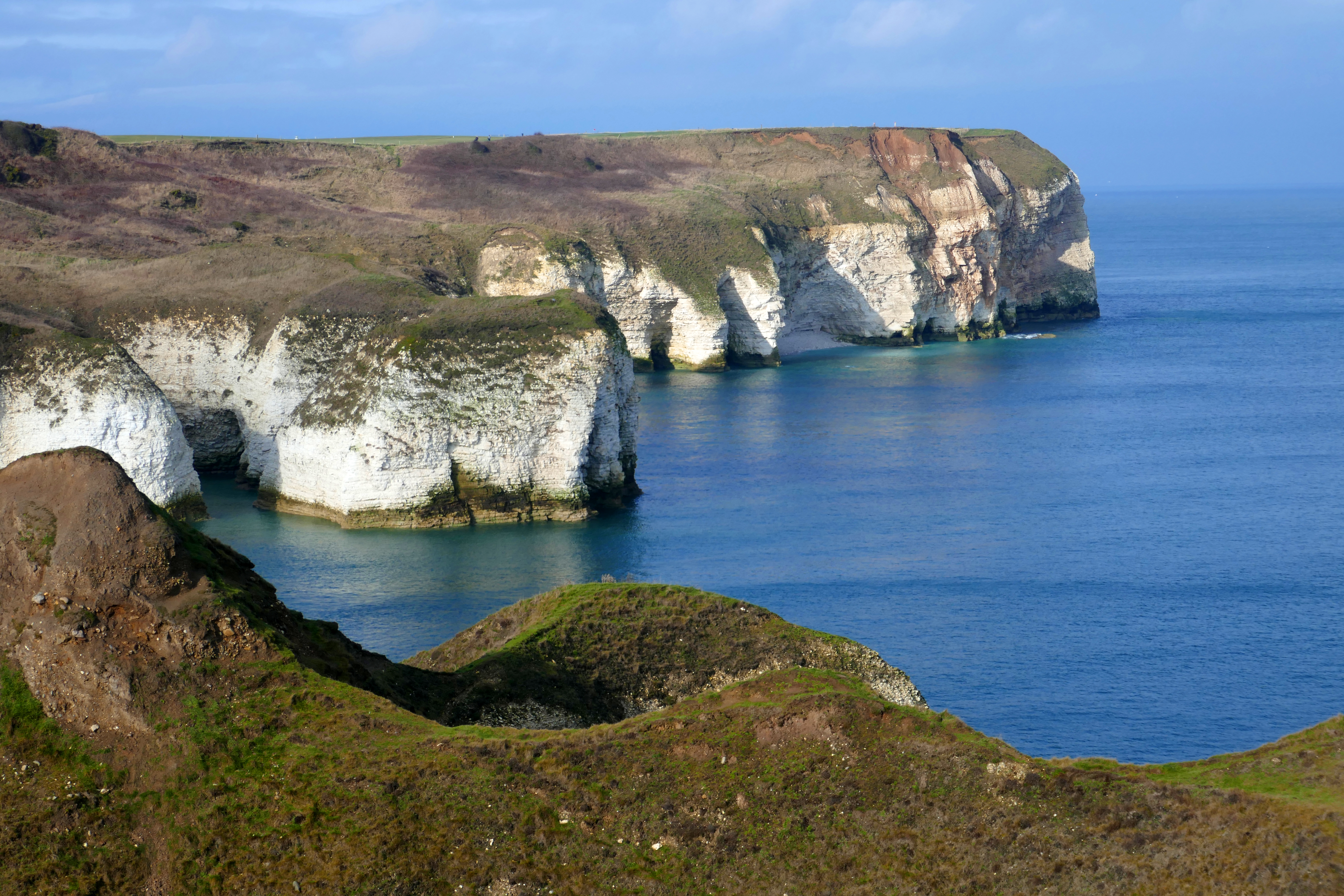
Bridlington
Moving on, we drove south to Bridlington, diverting inland to Burton Agnes Hall for a favourite February treat, carpets of snowdrops. The woodland garden here has waves of small white flowers with their glossy-green leaves. At Bempton Cliffs RSPB reserve we walked to the viewing platforms and watched guillemots, gannets and fulmars getting their crowded nests ready and claiming territory. This sign of spring was both riotous and joyful.
Once again the bus was helpful with linear coastal walking. From the Caravan and Motorhome Club’s Bridlington site we caught the bus to North Landing and walked around Flamborough Head back to the ‘van for about 13kms. Ahead of the sunshine, a faint mist cloaked the lighthouse and the fog horn moaned. Steep sections of the path were sticky with mud and our boots were soon messy but the nesting birds on the cliffs and seals on the shore made this a fabulous walk. Standing above one remote cove we listened to the melancholic seal songs echoing around the rocks.
We had chosen a pitch on the edge of the campsite. This means a longer walk to the facilities but has other rewards. From the Blue Bus bird hide we spotted deer making their way through the woodland and long tailed tits on the trees.
On a windy [but still dry] day seafront paths took us into the seaside resort of Bridlington. Living in Morecambe we compare every seaside resort to our home town. Like many of the north of England’s seaside towns, Bridlington doesn’t ooze wealth but we found lively and attractive corners. After coffee in the faded opulence of The Pavillion we caught the train to Filey, another resort where the buildings tell stories of former fortunes. Filey Brigg, a rocky and narrow sandstone promontory on the edge of the town was bracing in the breeze but gave us our last views along the wonderful North Yorkshire coast until next time.
The pictures below show public art in Bridlington, a guillemott at Bempton Cliffs and Robin Hood’s Bay.
It isn’t surprising that I like guidebooks. On our trip around Suffolk and Norfolk we had the pleasure of being accompanied by a pair of tattered 1940s Penguin guides. These dated companions steered us through East Anglia, pointing out the must-see sights of 80 years ago. So much has changed since the post-war period I felt like a time traveller but when we pulled up at Burgh Castle I was also confused as this featured in our Suffolk guidebook but is now in Norfolk.
Whichever county it is in, the scale of the Roman ruins at Burgh Castle are the big story. The rough stone walls and round corner tower soar to over 4m high and I wondered why this building hasn’t been on my wish list for some years. It was only chance that I had chosen it from the out-of-date guidebook. And it is free to visit! I have paid £££s to visit Roman ruins that are pretty much just an ankle-height floor plan in stone, Burgh Castle has scale and presence.
After wandering around the large site I walked down to the banks of the nearby River Yare. The East Anglian coastline has changed in the last 2,000 years and the ruins would originally have guarded a ‘Great Estuary’ that flowed over the rooftops of Great Yarmouth. In those days ships would have docked below the castle.
According to our 1940s guide Great Yarmouth, ‘is sometimes called the Venice of East Anglia.’ I don’t know if anyone still makes that particular comparison! The short stretch of town walls are a reminder of an older Great Yarmouth but I was more interested in the modern Banksy painted on a brick gable end. The artist has cleverly positioned a couple so that they appear to be dancing on the roof of an adjacent bus shelter while an accordion player sits casually on the corner. Later we walked along the prom and gave ourselves a sugar rush with donuts and ice-cream.
We have visited some of the Norfolk coast before but the Norfolk Broads were new territory. From the Caravan and Motorhome Club site we caught the bus to Wroxham and Hoveton on a drizzly day. These two villages merge around a bridge over the River Bure that funnels the never-ending stream of trafic. Cars were less in your face in the 1940s but the local institution, Roys, was already here. Known as the biggest village shop, there are actually many shops; a Roys department store; a food hall; a garden centre and a DIY shop; this isn’t quite a one-shop village but they give it a good try.
Despite the abundant motorcars, the villages are dedicated to boating. This is the place to hire boats, visit boat yards and do other boating things. On the bus we fell into conversation with a man who described himself as a ‘water gypsy.’ No one else would talk to him so he told us he had received no schooling from nine years old, his mum had studied psychology at Hull University and he described his life on the move from 24-hour mooring to 24-hour mooring.
From the campsite we walked along a grassy dike that meandered through reed beds, the chugging of boats on the River Ant in the distance. A marsh harrier flew by, a fish dropped from the talons of a herring gull and was lost in the reeds and a flock of teal rose from a pool in a shudder of wing beats and circled overhead. Approaching a windmill, cormorants perched along the wooden sails, their wings spread out to catch the weak September sun.
I was keen to experience the watery nature of the broads and we were booked on the morning electric boat trip from Toad Hole Cottage. Waiting for our guide we sat drinking coffee on a bench, lazily watching a sailor polishing the already gleaming wood on a handsome wooden wherry.
It turned out we were the only people who wanted to explore the Broads in a quiet electric boat that morning and we had the luxury of spreading out on the small craft. After a short distance on the main river we turned left into a channel where the reeds leaned in against the boat. As the thrum of the river boats melted away I found myself in the backwater world of Swallows and Amazons.
Later we had our lunch in a hide, thrilled to see a kingfisher fly back and forth. We explored How Hill House’s verdant and dripping secret garden before taking the paths to the village of Ludham and joining the river again by the ruins of St Benet’s Abbey.
In Cromer I led Anthony along the beach to find another Banksy on the sea wall. ‘Luxury Rentals Only,’ a comment on our broken housing market, is out in all weathers and fading. I liked Cromer with its prom and pier, its beach dotted with colourful pebbles and tall breakwaters crossed by metal steps dripping with black seaweed. Our 1940s guidebook ignores the pier but was right about the ‘excellent beach.’
Another showery September day was ideal for taking the train to Norwich. Here we visited the cathedral and I walked round and round the font that is made from two polished copper bowls. These were given to the Cathedral when the Rowntree Mackintosh Norwich chocolate factory closed in 1994. Colourful modern stained glass gave a vibrant glow to otherwise gloomy corners of the cathedral and the cloisters radiated peace and light. We did wander some of Norwich’s pretty streets but, as the rain got heavier, we lost the desire to explore and probably didn’t do it justice.
Sitting outside at the Priory Maze café near Sheringham the waitress moved between the tables gathering up all the sachets of mayonnaise. ‘The rooks take them away and eat the contents,’ she told us, leaving the salad cream which apparently is less appealing to these connoisseur rooks! From the campsite we had hiked to the top of Norfolk (if there is a hill we will find it). Cromer Ridge is just inland and reaches the dizzy heights of 102m so it wasn’t a tough ascent! Our route passed a village green with a pebble-built house before climbing through woodland where we stepped carefully over tree roots. We descended through heathland and skirted the fields of a horse sanctuary before reaching Priory Maze and Gardens.
Copper beech and hornbeam have been planted using the layout of the ruined priory as the basis for the maze. We began in a disciplined way, alternating who chose which direction to turn to find a way to the centre. Very soon we were lost and our choices became random and haphazard and it was only luck that eventually led us to the central viewing platform.
The maze and gardens were fun but couldn’t beat the walk along the beach from Sheringham to East Runton. The soft sandy cliffs that are basically a giant sandcastle erode easily and attempts have been made to protect these from the sea. The futile remains of wooden revetments littered the beach and we wound our way around vertical posts and under buttresses of grey weathered wood studded with rust-red nails.
I had been looking forward to Blakeney Point and it was a memorable day but not for the reasons I was expecting. Our Penguin guide noted that this four-mile long shingle ridge backed with salt marshes was given to the National Trust in 1912. We parked at Cley Beach and turning to make coffee in the back of the ‘van I was floored by a hot pain that shot from my spine to the back of my legs. I assumed it would wear off and, after drinks, carefully put on my waterproofs.
The squally wind and the deep pebbles along the ridge made walking agony and I shuffled down the slope to meander on the sand by the crashing waves, where the going was a little easier. At the old Watch House or Halfway House we scrambled back to the shingle bank to look over the salt marshes and the remote building. Exhausted, I sat down and as we ate our picnic lunch we made the decision to head back. Walking was easier with a tailwind. We collected a few bits of litter and admired some of the multitude of shells. Seals popped their heads above the waves and a group of Brent geese flapped low over the sea.
Dosed up on ibuprofen I could manage to walk around Wells-next-the-Sea for the next couple of days. The sun returned and watching it set from the beach was as idyllic as I could have hoped. Waking up to the joyful honking of geese as they flew over our campervan was special too. Our 1940s guide doesn’t mention the beach huts that are now a Wells-next-the-Sea icon and also doesn’t firmly place the town on the coast, it is just called Wells.
Striding out to Holkham Hall it seemed that I was okay walking upright. I just needed to avoid bending, easier said than done in a small campervan! Our guidebook told us that visitors were welcomed at Holkham Hall 80 years ago and they still are. We took paths and tracks around the house and through the estate and ate our lunch on a bench overlooking Well’s harbour. Our guide told us that in 1940s Wells ‘… you will find no piers or funfairs …’ but ’if you are in search of ‘local colour’ drop in at the Shipwrights’ Arms one evening.’ Unfortunately, this pub is now closed so we sought out local colour in the many quaint corners.
Opening the blinds on our final day in Norfolk it was a pleasure to see blue sky. We arrived at Titchwell RSPB reserve as the staff were holding an outdoor team meeting and we spent a fabulous hour walking by the pools to the dunes and the sandy beach. The blue sea met the blue sky on the horizon and the space felt phenomenal.
By the time we reached Castle Rising the weather had changed to misty and chilly autumnal weather. The castle has a circular ditch or moat to cross to the gatehouse and a well-preserved stone keep. We climbed up to the different floors finding details that have survived the centuries.
After sitting for even an hour in the ‘van I would unravel myself from the seat in a shambles of bent and staggering bones. This acute pain lasted just a short time and once everything had loosened up I could stand and walk normally. I was grateful we weren’t making the long journey back to Lancashire in one run and had Derbyshire friends to stay with on the way.
Footnote on the pain I was experiencing. This became sciatic pain in my right leg. I had lots of physio through October and November 2022 and eventually visited my GP and started taking amitriptyline which meant I could sleep peacefully all night. By January 2023 I was more or less pain free.
Where we stayed
We used two Caravan and Motorhome Club Sites, Norfolk Broads and Seacroft near Cromer. We liked the former, it was a well-run site with a bus service into Norwich and a walk along the River Ant and to St Benet’s Abbey from the site. Seacroft is an excellent location for Cromer and Sheringham but is in need of an upgrade.
We also stayed at Pinewoods at Wells-next-the-Sea, an expensive site with a fantastic location. For the money I would have liked heating in the facilities at the end of September but our pitch in the reeds was heavenly.
Shingle beaches that stretch to the horizon, coastal villages packed with cottages and ancient flint churches were what drew me to Suffolk. This was our first visit to this county and I was delighted to find all these things and more on our autumn trip. We rolled into Suffolk at Bury St Edmunds in our Blue Bus and stayed firstly near Ipswich before following the coast eastward.
Beaches
In the couple of weeks we were in Suffolk we walked miles along shingle beaches deep with pebbles and soon learnt how tiring wading through this is. We also found sandy beaches that were made for buckets and spades. In Orford we took the boat to Orford Ness and were spell-bound by the combination of post-war military structures and hardy plants. You couldn’t miss the power of nature. Between Minsmere and Dunwich seal pups sat in the surf as we meandered between the clumps of sea kale that breaks up the shingle and climbed up to the heath-covered cliffs.
In Southwold we kicked along the soft sand below rows of colourful beach huts, each one individually decorated, and stood under the pier watching the tide crashing against the complicated lattice of pier struts. Later we sampled a glass of Adnams, the local beer, in a pub off the seafront.
Villages
While Thorpeness seems hardly real with its holiday villas that are straight from Disney, the weatherboard houses of Aldeburgh felt real and charming. The brick and stone Martello Tower is solid and dense in comparison to the village. This is now a Landmark Trust property you can rent and what a treat it would be to stay there. If you’re interested in unusual places to stay in, the famous House in the Clouds old watertower in Thorpeness is also available as a holiday rent.
At Aldeburgh we gazed across the sea, guessing there was nothing between us and the Netherlands. From the edge of the village, the dyke path took us on a lovely green route around Aldeburgh passing productive allotments. Leaving the houses we picked up a path through a nature reserve where trees arched above the sandy path, sunshine dappled through the foliage and blackberries glistened by the path and we picked ripe ones as we walked.
Lavenham is hard to beat in the charming village awards. Over 300 buildings are listed in this well-preserved medieval village that was once a wealthy wool town and walking the narrow streets and lanes to the market place is like undertaking a crash course in timber-framed building designs.
Towns & Cities
We were initiated into the sights of Suffolk in Bury St Edmunds and it was the perfect introduction to the county for two Suffolk newbies. We began in the park of this small town, wandering around the abbey ruins to the monumental and richly-decorated stone gatehouse. Later we visited the cathedral, spent a fascinating hour or so in the Moyse’s Hall Museum and finished off our trip in a sunny square with coffee and cake.
From our campsite near Ipwich we visited Ipwich and Felixstowe. The bus to Felixstowe took the slow road and we sat on the top deck until the end of the line at Landguard Fort. You can visit the fort but we were keen to walk and after watching the huge cranes picking up the containers and placing them on the ship like a giant tetras game we set off along the seafront. The sea defences were easy to follow back to Felixstowe with views to the pier and more ships out at sea.
In Ipswich we began with the waterfront, a marina surrounded by old warehouses, the Custom’s House and some shiny new buildings. We had coffee and watched students learning filming techniques with the boats as a backdrop. We wandered through the city centre, passing all the shops you would expect, to Christchurch Park, a large green space with grass, woodland and a pond. Christchurch Mansion is a free museum with a collection of paintings from local artists Constable and Gainsborough.
In Lowestoft we found our way around a sprawling Bird’s Eye factory, no doubt pumping out boxes and boxes of fish fingers, to find England’s most easterly point. I expected a bit more of an attraction here but the orientation circle in the concrete promenade was informative. Checking out the distances we realised we were closer to mainland Europe than we were to Lancashire! Walking along the promenade we could see a lower prom had been washed away by the sea, so I guess Europe is getting further away. Inland we climbed one of Lowestoft’s scores, narrow steep alleys, to the High Street, an old shopping street with some historic buildings and quirky shops
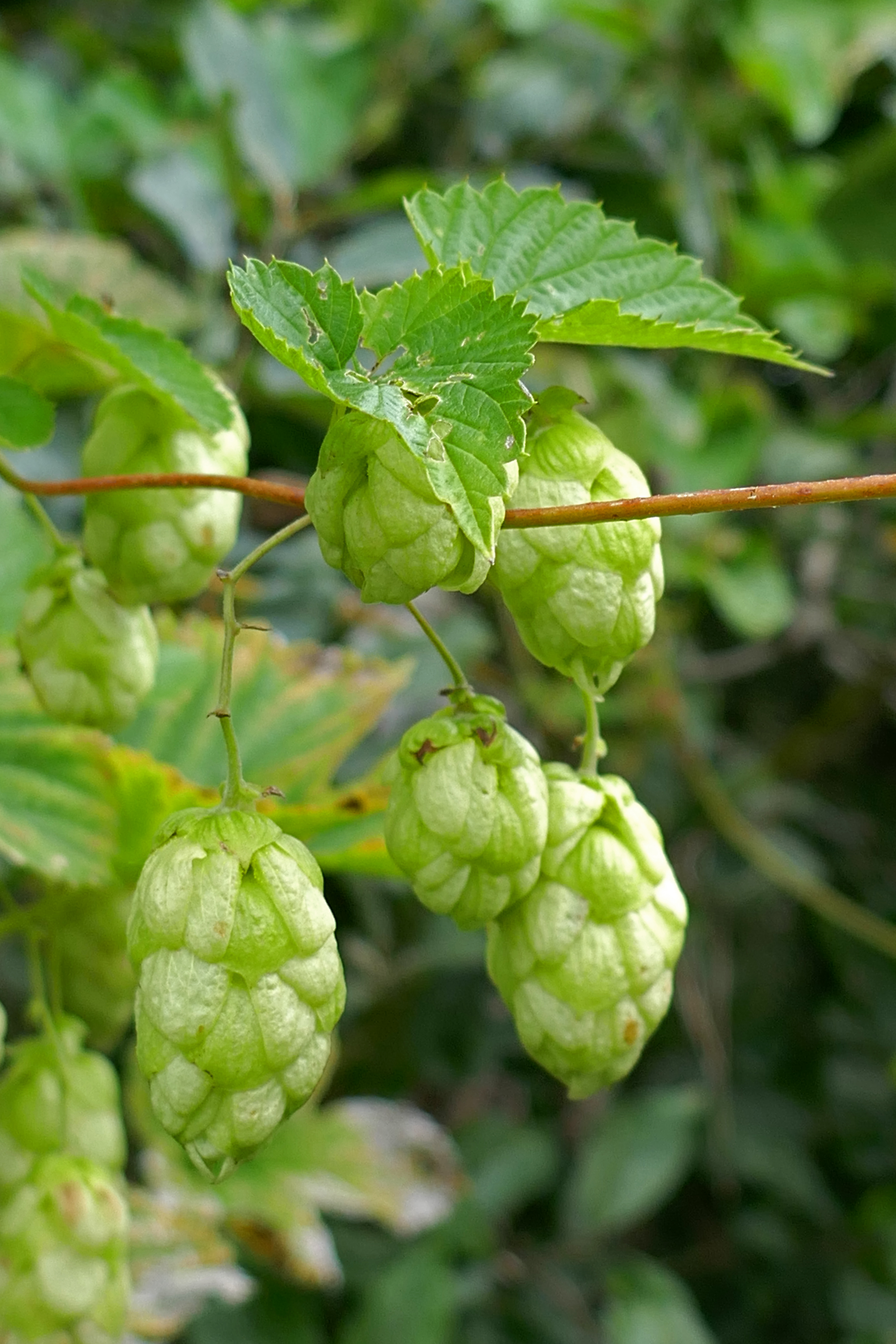
Sitting by the River Waveney between Beccles and Lowestoft a kingfisher flew low over the water and minutes later a swan landed perfectly in front of us and harrumphed occasionally and gently until its partner negotiated an equally skilful landing and they slipped away together. A buzzard emerged from the trees opposite, circled the field and flew away as a group of geese passed overhead. Beside us were bushes decorated with bright-green hop fruits that look too exotic to be British. We had caught the bus to Beccles and after coffee and cake in a cosy but wildly expensive café we followed the Angles Path along the Waveney, a watery highway busy with boats but few other walkers. The weather was quiet, with no wind and the cloud hung in the sky like a billowing duvet. In the wet meadows alongside the river we spotted plenty of Chinese water deer with their teddy bear ears and strange hare-like run.
Churches & Abbeys
I had read about Blythburgh Church but that didn’t prepare me for the loveliness of this medieval church. The exterior flint has been worked and arranged to look like chequer-board tiling. Inside the wonky tiled floor held stories from thousands of feet and I stepped up to the high medieval font. We had come to see the painted angels on the wooden ceiling who peered down on mortals in the nave, their magnificent wings outstretched. While I admired the carved wooden pew ends, Anthony found an information panel about JF Kennedy’s brother, Joe, who died in a Second World War plane explosion nearby.
Leiston Abbey, a ruined abbey not far from Sizewell, today suffers from metal-fence-itis. Ugly temporary fencing circled every part of the ruins that presumably are unsafe. Nevertheless, beyond the fencing we could appreciate the structures, the 14th century arches and windows and the cloisters that retained their sense of peaceful space.
In Pakefield on the edge of Lowestoft, we walked around All Saints and St Margaret’s Church on the seafront. Technically two churches built next to each other, you will notice the tower is attached to one half of the M-shaped roof. These churches were once some distance inland but coastal erosion has led to the loss of many houses here as the sea has nibbled at the land. In the Second World War the buildings took a direct hit and were rebuilt.
Southwold‘s parish church was another church we took the time to visit. This church is fascinating for its Jack. This is a wooden statue dressed in armour, and holds a sword and an axe, which can be used to ring the bell at the start of a service. The Jack has been in the church since the 15th century and it is thought it was originally made to strike the hour for a clock and was repurposed.
Byways
Off the main roads, Suffolk seemed to be characterised by narrow lanes, plenty of them going nowhere but to a small coastal village. We took the Blue Bus to the end of the road at Orford and caught the National Trust boat to Orford Ness (see above). Driving to the RSPB reserve at Minsmere the lanes became narrow and then even narrower as we got closer to the sea. The lanes wound around fields and woodland until I had no idea which way was north and whether we were heading in the right direction or not. The only thing you can do is trust the RSPB signs! After our walk we had to follow the same byways in the opposite direction.
Sizewell was an exception. We immediately noticed what a good road it was to Sizewell, presumably for the traffic to the nuclear power station.
Where we stayed
We stayed at some Caravan and Motorhome Club sites on the way down [Grafham Water] for one night and at White House Beach which was handy for Lowestoft. These were both the usual standard.
For Ipswich we stayed at Little Sage Hill, Copenhagen Cottage Caravan and Camping Club Certified Site. I reviewed this site here.
Beach View Holiday Park at Sizewell is a large independent site that was okay for a couple of night and was well situated for walks to Thorpeness and Aldeburgh.
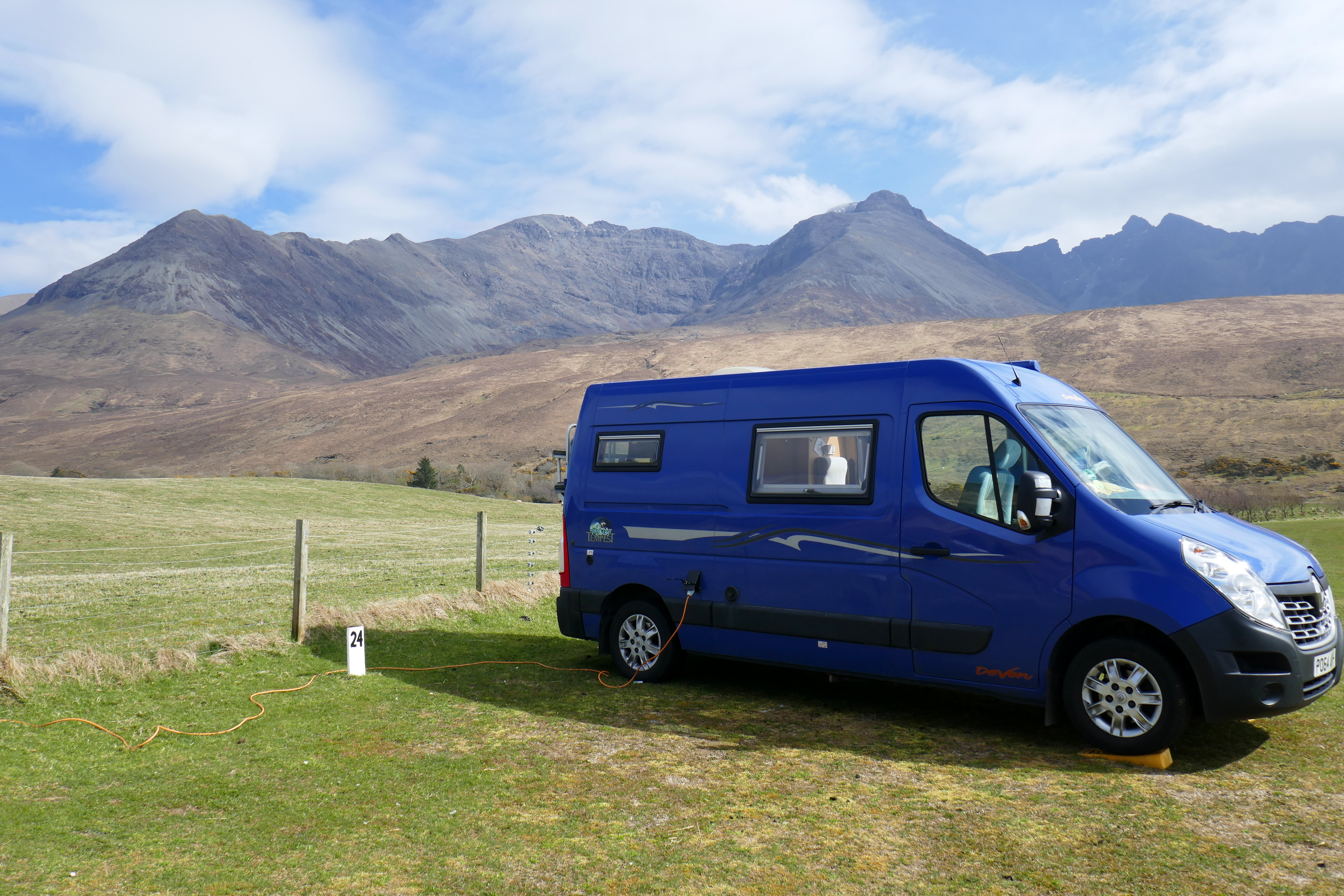
The Blue Bus, our Renault Master Devon Tempest campervan, is now eight years old and has travelled almost 70,000 miles. In 2022, with no lock downs and Covid-19 restrictions, we enjoyed 124 nights in our campervan in 60 different places, stretching from Meissen in south-east Germany to the Isle of Skye off the west coast of Scotland.
We spent at least one night in the ‘van in every month of 2022, from a chilly weekend with friends in the Ribble Valley in January to a night parked on a Manchester residential street on New Year’s Eve. Using our campervan all year keeps it aired and means that I always have a camping trip to look forward to.
Looking through our log book of our nights away we paid between nothing for an overnight when we free camped to £38 a night at Pinewoods at Wells-next-the-Sea. Spending a night off-grid for free is a big plus to owning a campervan and we have parked up and had some enviable views to ourselves. Pinewoods is a beautifully positioned campsite within walking distance of Wells-next-the-Sea that came highly recommended and was a bit of a one-off treat during our Suffolk and Norfolk trip.
As we all know, campsite overnight costs have increased in 2022 and we mostly paid between £20 and £25 a night, even on Certified Locations [Caravan and Motorhome Club] and Certified Sites [Camping and Caravanning Club]. Due to our age we receive a discount on Camping and Caravanning Club sites and these often work out cheaper for us than Caravan and Motorhome Club sites. For the most part we are lucky enough to have enough money to be able to choose on location rather than cost. We have also found that, when it comes to campsites, the overnight charge seems to have little to do with the standard of the facilities!
During our trip to Germany and the Netherlands in May and June we made good use of our ACSI discount card, although, as we were sticking to the River Elbe, we also used sites not part of this scheme. ACSI discount sites were a maximum of €21 a night, including EHU, in 2022. I noticed when our new ACSI book arrived before Christmas that you can now pay as much as €23 a night. Germany also has a couple of public holidays in May and school holidays and some sites were full price [and very busy] during this period. German campsites generally have high standards but there are always exceptions and we found one or two of them!
We stayed on plenty of idyllic campsites while we were in Germany but our favourite was Campingplatz Rehbocktal near to the gorgeous city of Meissen. This small site tucked into a valley with a babbling brook running through it is immaculately kept, friendly and just a short distance away from Meissen. I didn’t really want to leave this delightful spot and it was well worth the £27.50 a night [the most expensive campsite we stayed at in Germany].
It is hard to pick a favourite UK campsite from 2022 but if I was pushed, Silverburn Park near Leven has to be up there and not just because we had a light covering of snow when we were there and also had the small site to ourselves. The friendly welcome, the open views across the beach and the Firth of the Forth, the campsite cat and the birds in the walled garden all made it perfect. Add to this the knowledge that you are supporting a charity and happiness is off the scale.