It was a neighbour who first inspired me to visit Culross, ‘Have you been?’ he asked when we bumped into him on our street. We hadn’t but I made a cursory note in my head after he described the exceptionally pretty village. This top tip may have gone unheeded but, as is often the case, Culross turned up again to nudge my easily distracted brain. We were catching up on the BBC programme Villages by the Sea [gentle viewing for when you have had enough of the news and murder mysteries] and as irresistable views of Culross flashed across our screen a possible visit became a certainty.
Looking for a campsite nearby, Highland Gateway Glamping and Caravanning popped up in my searches and reading the good reviews we booked. Happily, and again, as often happens, a campsite that we have booked merely for its convenient location turned out to offer much more than a useful overnight.
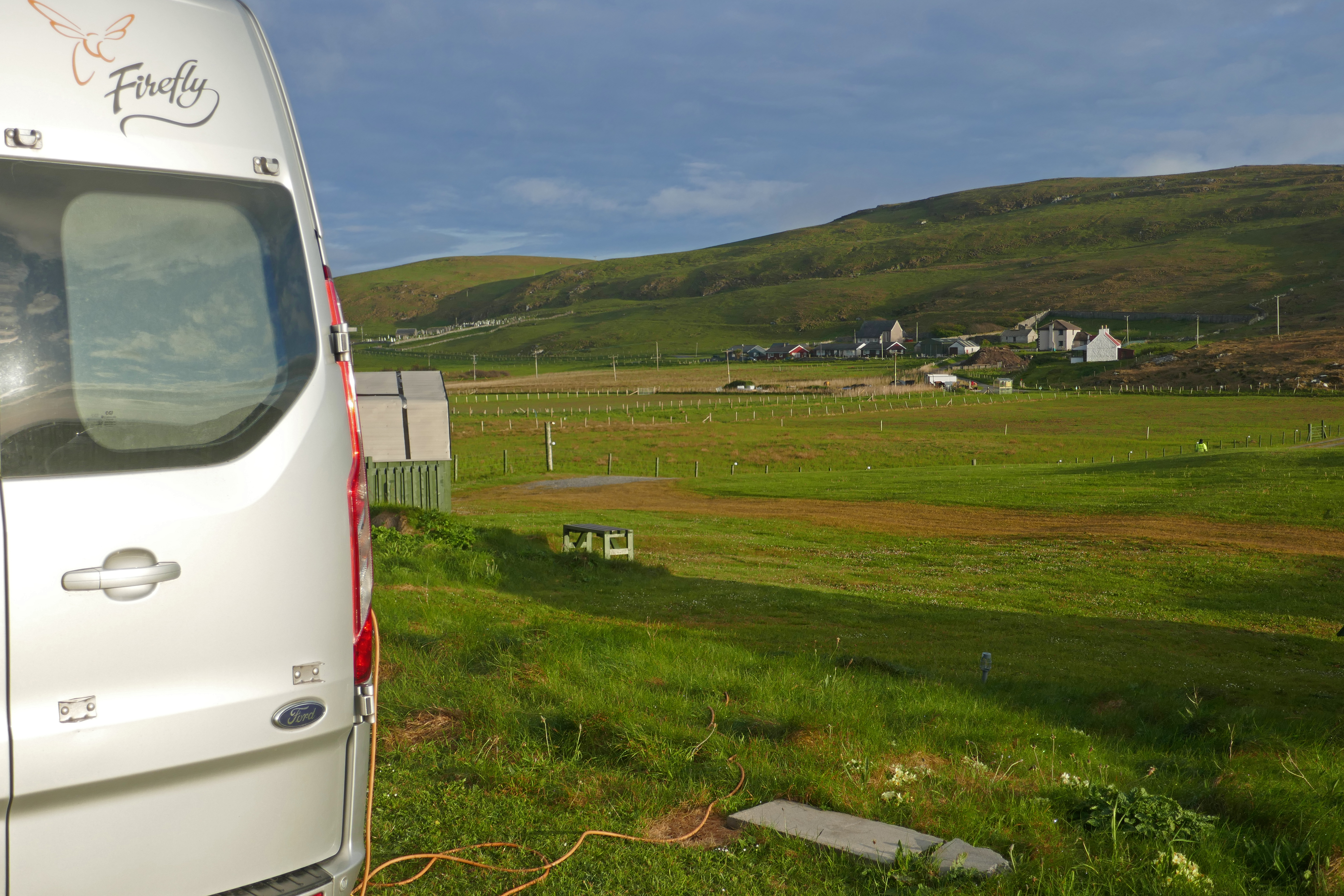
If you like campsites that are small and have wide open views, then this is one for you. The pitches at Highland Gateway look over agricultural fields on all sides, with the range of hills called the Ochils as a northerly backdrop. The site only has eight serviced hard-standing pitches. There are two small sanitary blocks with two showers and three toilets between them and there is a sink for washing-up and also two pods for non-campers. There is a low rumble of traffic from the busy roads off the bridges over the Forth, but nothing that distracts from the feeling of space.
Clackmannan
It was a sunny afternoon when we arrived and picking up a leaflet for Heritage Walks in Clackmannan we realised we had time to fit in the 5.6km Kennet Walk that connected to the grassy lane that ran by the campsite.
Leaving the campsite, we were soon in woodland, the sweet scent of flowering bluebells and soothing birdsong surrounding us. Climbing gently uphill and skirting a field we reached a viewpoint over Clackmannan before walking through more woodland into the town. We were in the centre of the small town of Clackmannan in under an hour.
The stone belfry tower on Clackmannan’s main street is what remains of the 16th century Tolbooth and is the centre of the town along with the Mercat Cross. Next to these, on a block, stands the stone (or Clack) of Mannan (from the Celtic god Manau) which gave Clackmannan its unusual name.
After sauntering around the historic part of Clackmannan, we returned along a minor road with the romantic name of Lookaboutye Brae. More tree-lined paths led us to the walls around the site of the former Kennet House where we picked up the lane back to Highland Gateway.
Culross
Our main goal, the village of Culross on the banks of the River Forth, was an easy 15-minute drive from the campsite. Culross has two car parks but it is a popular destination so it is worth arriving early. If you have bikes there are good cycle paths to the village from the campsite.
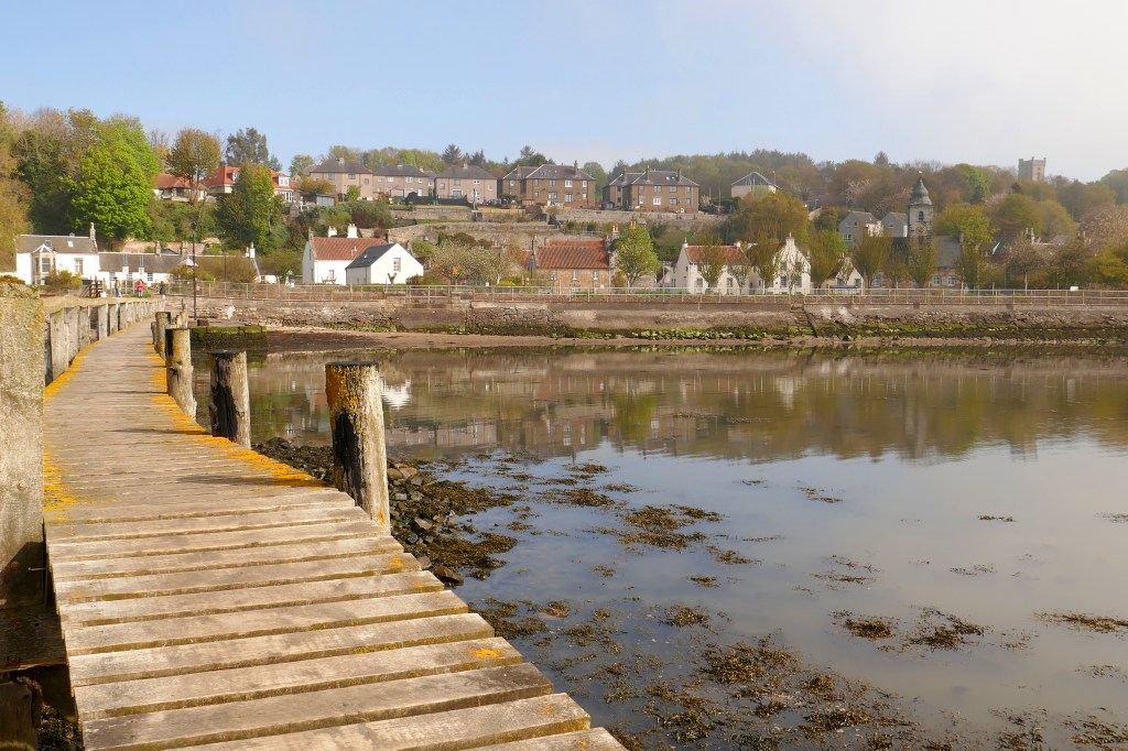
In Culross we walked along the shore and on narrow cobbled streets among the traditional houses, many owned by the National Trust. The sun was breaking through the morning mist and the sprawling Grangemouth Refinery across the river shimmered in the light.
We had coffee and scones in a friendly cafe full of chattering regulars and then explored further. Climbing Haggs Wynd we reached the hanging gardens viewpoint and could quickly see why this village is loved by film crews, including Outlander, as we soaked in the centuries. We climbed further to the ruins of what was a large abbey in the 13th century.
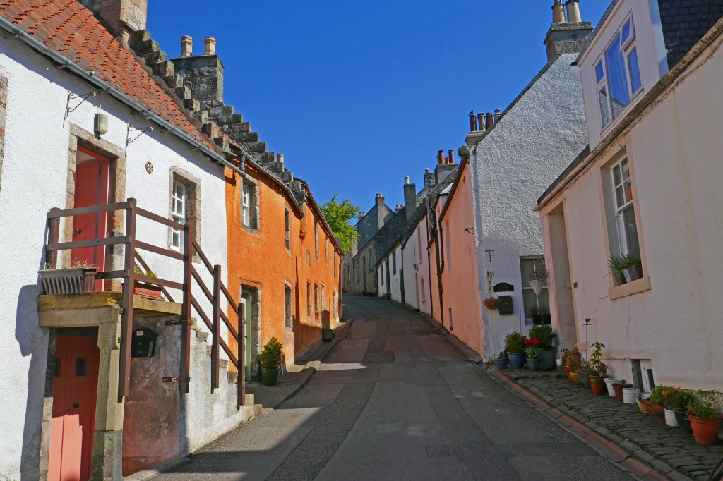
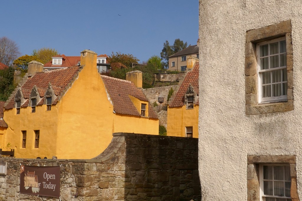
In contrast to the abbey, the houses and cottages of Culross from the 16th and 17th centuries have been preserved and restored. Shades of coral pink and creamy custard contrast with the white-walled cottages and floral planters line the streets. The attractive ochre-coloured buildings known as Culross Palace, were a wealthy merchant’s house, and are now a National Trust property. Culross Palace can be visited but check opening times as filming events can disrupt these.
The campsite is adult only [18 years and over] and accepts a maximum of four adults on pitches. The site is open every month except January. Dogs are welcome [maximum of three].
In May 2026 we travelled through the Outer Hebrides. We watched golden eagles on Lewis in the north and crossed the hills of Harris to camp by its sweeping beaches. Sailing to North Uist, Benbecula and South Uist we heard and saw the rare corncrake and wandered through flower-rich machair under boundless skies. Barra, the most southerly of the Outer Hebrides showcased local producers in its community shop and gave us wind, rain and sunshine on our hill walk. Visiting the Outer Hebrides was fascinating and relaxing.
We used campsites every night and stayed two or three nights in most of the campsites below. The campsites were all around £30/night, in addition some of the sites charged for showers.
Many of the campsites were small and family-run or were income generation for community development trusts. This meant that the money we spent during our visit to the islands benefitted islanders and stayed local.
Laxdale Holiday Park, Stornoway – This small, family-run and friendly campsite uses every space possible for pitches. It is on the edge of Stornoway and about a 30-minutes walk to the town centre [there is a bus service from the main road five minutes walk away]. The site is popular and it is worth booking if you want to stay here. Our pitch was the best on the site, with trees on one side and grass on the other and a view across countryside to the sea. There are other good pitches but some are on sloping gravel and concrete. The site is well kept and we found the showers to be good with continuous flow and hot water. The windows and doors are kept open to keep the facilities aired and there was no heating on when we were there, so it might be bracing. The washing up is indoors. Stornoway is certainly worth a visit to see the harbour and castle and the larger supermarkets are here.
Eilean Fraoich Campsite, Shawbost, Lewis – We received a friendly welcome at this family-run site. The site is level and grassy with wide-open views and the pitches are fitted in like a jigsaw around the buildings. The campsite is in a peaceful crofting township, with the coast about 30 minutes walk away. The shower were continuous flow and adjustable temperature and cost 50p for four minutes. The washing up is in an indoor kitchen and there are some separate unheated bathrooms. This campsite asked that you didn’t put washing out on a Sunday. The site is around 20 minutes drive from the main Calanais Standing Stones site and the museum at Geàrrannan Blackhouse Village is around 15-minutes drive.
Pairc Niseaboist, West Harris – This site is one run by the West Harris Trust, who work to develop the area’s economy and housing and support the community. We liked the space between pitches and the sea view on the campsite. The online booking system worked well and enabled us to choose our pitch. The level area has just seven pitches and a smart pre-fab with two bathrooms and a kitchen. This was kept spotlessly clean. The electric shower wasn’t powerful but was continuous and with adjustable temperature. The sea is just across the quiet road from the site and you can walk around the small headland and to MacLeod’s Stone with views over white sandy beaches. There is a good community cafe and gift shops next to the camping area.
Balranald Camping, North Uist – This was the largest campsite we stayed at in the Outer Hebrides. It is well-run by a family and is mostly level. It sits within an RSPB reserve and so is perfect for bird watchers. There are farm buildings along one side of the site and we had some noise from the cattle and machinery but otherwise it was peaceful. There are two small modern facilities blocks where showers are £1 for 7.5mins. The cubicles are just big enough and the water is continuous flow with temperature control. The walk around the bay and the headland is spectacular, taking in white beaches, machair and dunes and you will see plenty of birds. We went to sleep to the sound of corncrakes. The campsite has a food truck at lunch times with drinks, meals and cakes. Next door is something I’ve not seen before, inside a large industrial-looking building there is a help-yourself farm shop with vending machines selling a limited selection of food and snacks.
Otters Edge, Benbecula – This level site has marked pitches and a beach just beyond the dunes. The owners are friendly and welcoming. The dated facilities block is kept clean but there is no heating and little natural light. The temperature in the showers is not adjustable and they are the push-button type. There is a kitchen with a washing up sink. The Dark Island Hotel is just five minutes walk away and serves delicious food. The Co-op is about 45 minutes walk away. We enjoyed a good walk along the coast and on inland lanes and the island bus goes past the site a few times a day.
Kilbride Campsite, South Uist – This site is on a slightly sloping grassy field. It is popular with tents as well as campervans and there is a hostel and cafe alongside, making it a busy site. The facilities are modern and the showers have adjustable temperature control and are continuous flow but they do have the dreaded shower curtain! They weren’t the cleanest showers in the Outer Hebrides but this was partly because the site is so busy. The small kitchen with two washing up sinks got particularly hectic at times. Behind our campervan there were corncrakes calling in the scrub and we were thrilled to spot one here. We took the bus to Eriskay from the campsite [the bus stop is about 20 minutes walk away] and we walked around the island, shopped in the village shop and had drinks and food sitting outside the Am Politician pub with a sea view. The Polochar Inn is about 30 minutes walk away from the campsite but we didn’t try this.
Barra Sands, Barra – Another friendly Hebridean welcome at this campsite. The site is grassy and terraced with slightly lumpy ground. Some pitches have sea views. The facilities are two showers and two toilets each for men and women and a washing-up sink in each block. The showers are £1 for five minutes and have adjustable temperature control and are continuous. Everything is kept clean and tidy. A gate from the site takes you to the beach in minutes. We walked over Dun Sgurabhal on a damp day and along the fabulous stretch of sand backed by dunes, returning by the airport cafe.
Wavecrest Campsite, Barra – This grassy site on the west coast of Barra has narrow pitches, most with a slight slope, and sea views over the Atlantic. The new facilities are modern and clean, with impressive individual toilets and showers. However, £2 for a five minute shower each was more than we were prepared to pay, although the cubicles are roomy enough to share! The pleasant kitchen with windows overlooking the sea has washing up, a book exchange and wi-fi. Walking to the nearby chapel and burial ground across the machair is a perfect in the Hebridean evening light.
‘Some travel writer [not me] wrote that May was the best time to visit the Outer Hebrides as there are no midges, so now it is our busiest time,’ a campsite owner told me. We were on the Atlantic coast of Lewis in the Outer Hebrides and I furrowed my brow, wondering how tiny midges withstand the Hebridean winds. He nodded and smiled, telling me, ‘midges aren’t really a problem here.’
We were certainly not the only campervan travelling through all the islands of the Outer Hebrides in May but there rarely felt too many. Some commentators suggest that responsible motorhome owners should stay away from these islands but, to me, that doesn’t seem helpful. Many businesses and small, family-run campsites rely on seasonal visitors for income. We booked the ferry, willingly spent our money in the campsites and frequented cafes and local shops as we travelled from north to south through all the Outer Hebrides from Lewis to Barra.
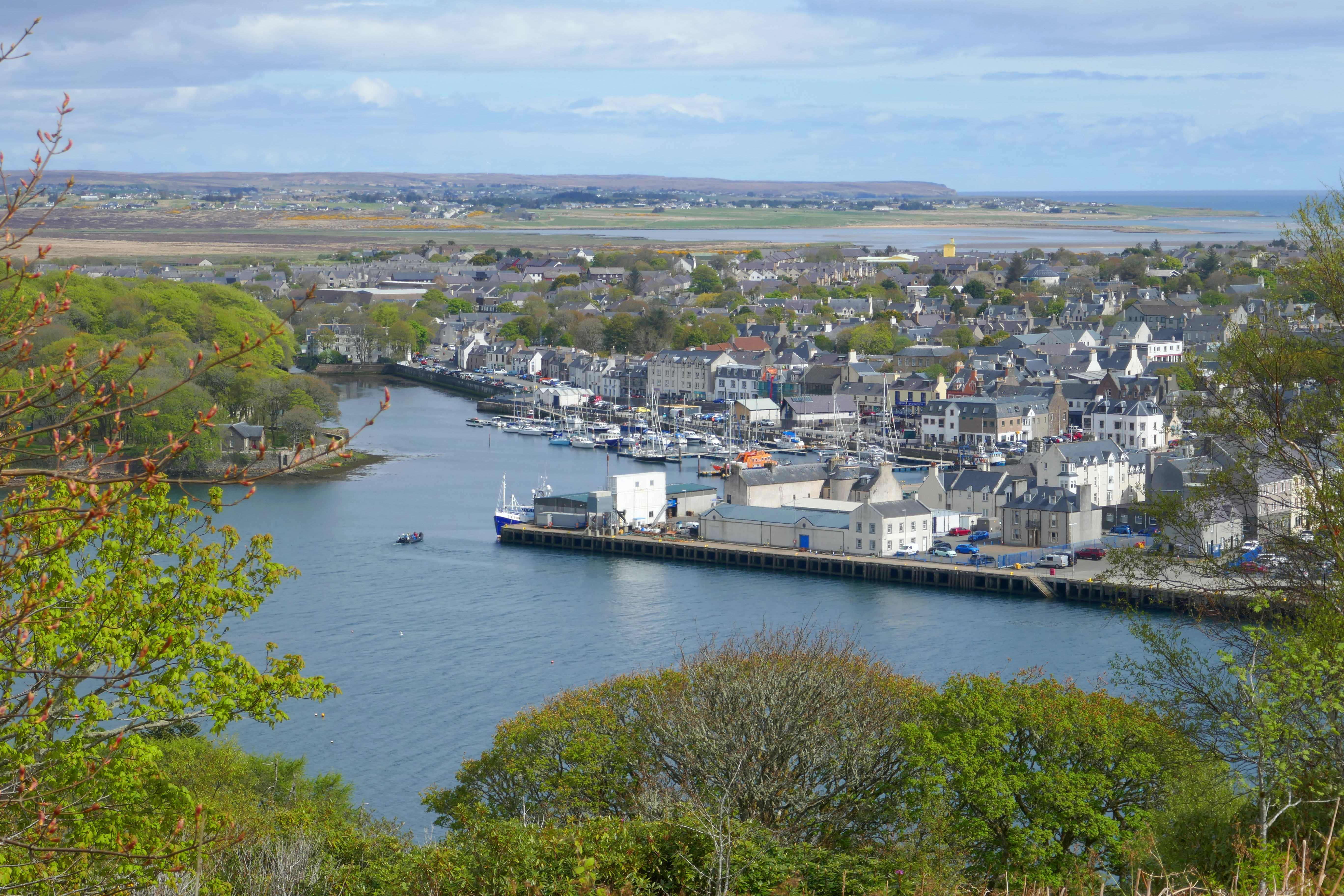
Stornoway, the main town on Lewis, was buzzing when we visited. The sun was shining but the buzz was mainly because of the huge cruise ship moored at the deep sea terminal. This gave the town a thriving cosmopolitan air and we met a large French group in a cafe, Australians in the woodland around Lews Castle and Canadians pottering around the shops.
Stornoway, Lewis
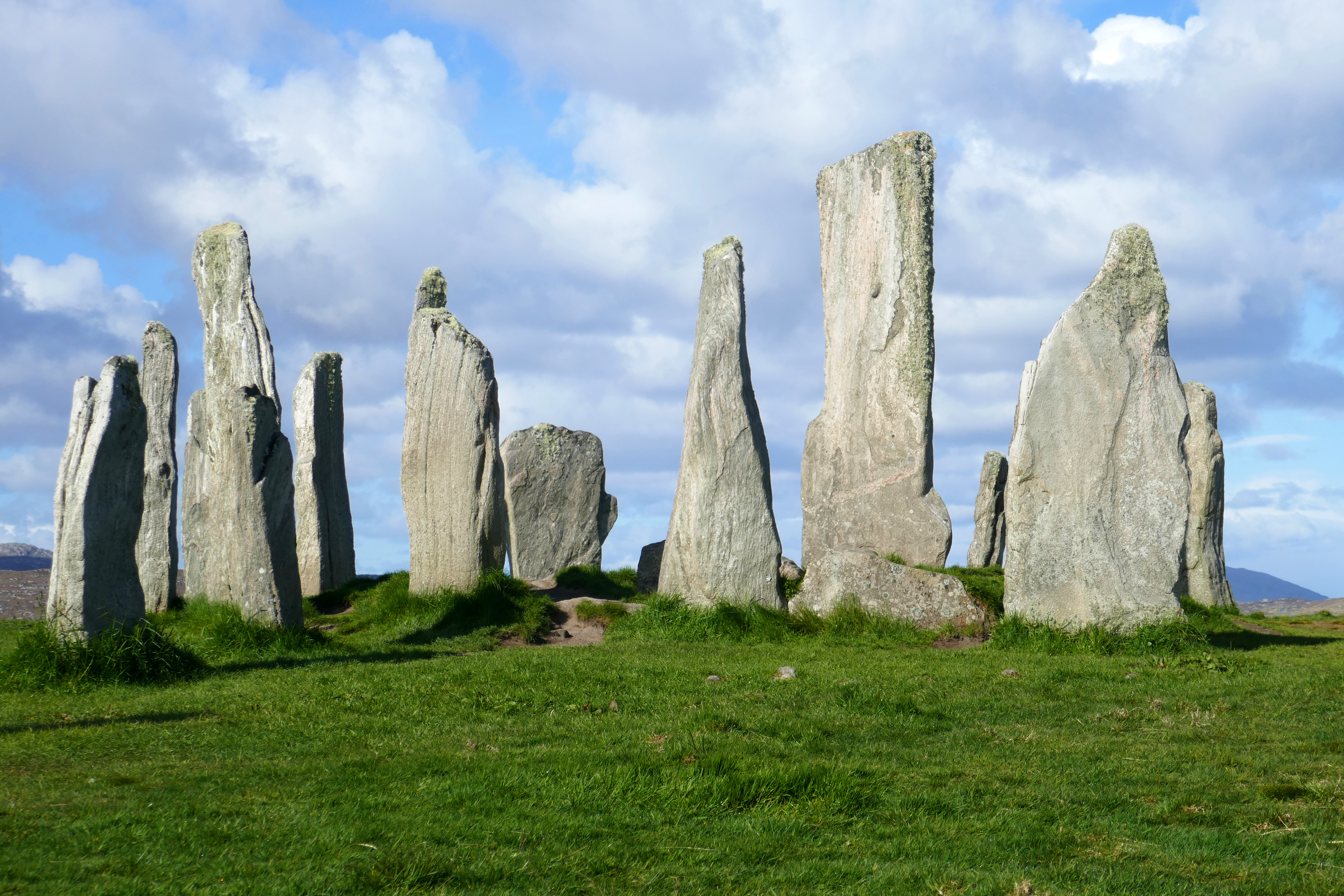
We were on the road early to have the Calanais Stones (sometimes referred to as Calanais I) to ourselves. They sit on a ridge and silhouetted against the sky they are visible from a distance. If seen from above these Neolithic stones form a Celtic cross shape with a circle and lines radiating in four directions. Walking among these old stones in the quiet was a special experience. We also visited Calanais II and III, from where we could see Calanais I on the horizon. Here we chatted to two visiting enthusiasts who were finding fertility links among the stones.
Calanais I Stones
Wildlife. Travelling this far north gave us a longer spring season. Plants that were growing in north Lancashire in April were still flowering on the Outer Hebrides in May. The trees were just unfurling their leaves and the birds were nesting. The bird song was a backdrop to every day in the Outer Hebrides. After a week, you almost take for granted that the call of curlews. lapwings and oystercatchers will be there. Skylarks launched themselves high in the sky as we walked through machair and moorland and on North and South Uist we dropped off to sleep to the sound of corncrakes [and even saw some]. The long light evenings were perfect for strolling.
Shops & Eating Out. After Stornoway there are no large supermarkets on the islands but there are excellent shops that sell a good variety of fresh food and staples, important as we cook for ourselves most of the time. We stopped off in lots of cafes, including the outstanding Oystercatcher Bakery on North Uist that served the tastiest cinnamon buns and creamy baked cheesecake. On Benbecula we had delicious and creative vegetarian meals in the elegant Dark Island Hotel. Part of a group of three hotels on the Outer Hebrides.
Inland Benbecula view
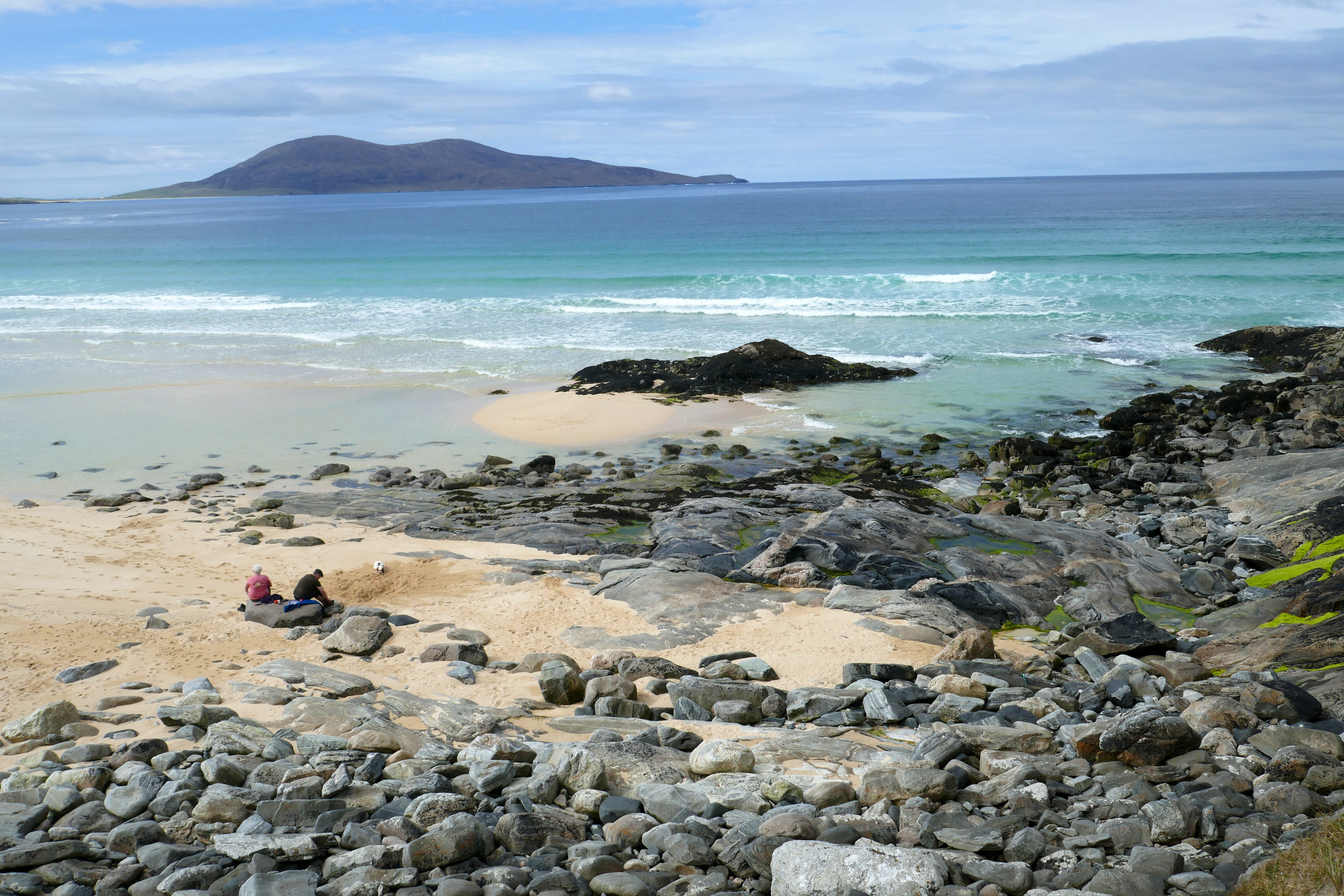
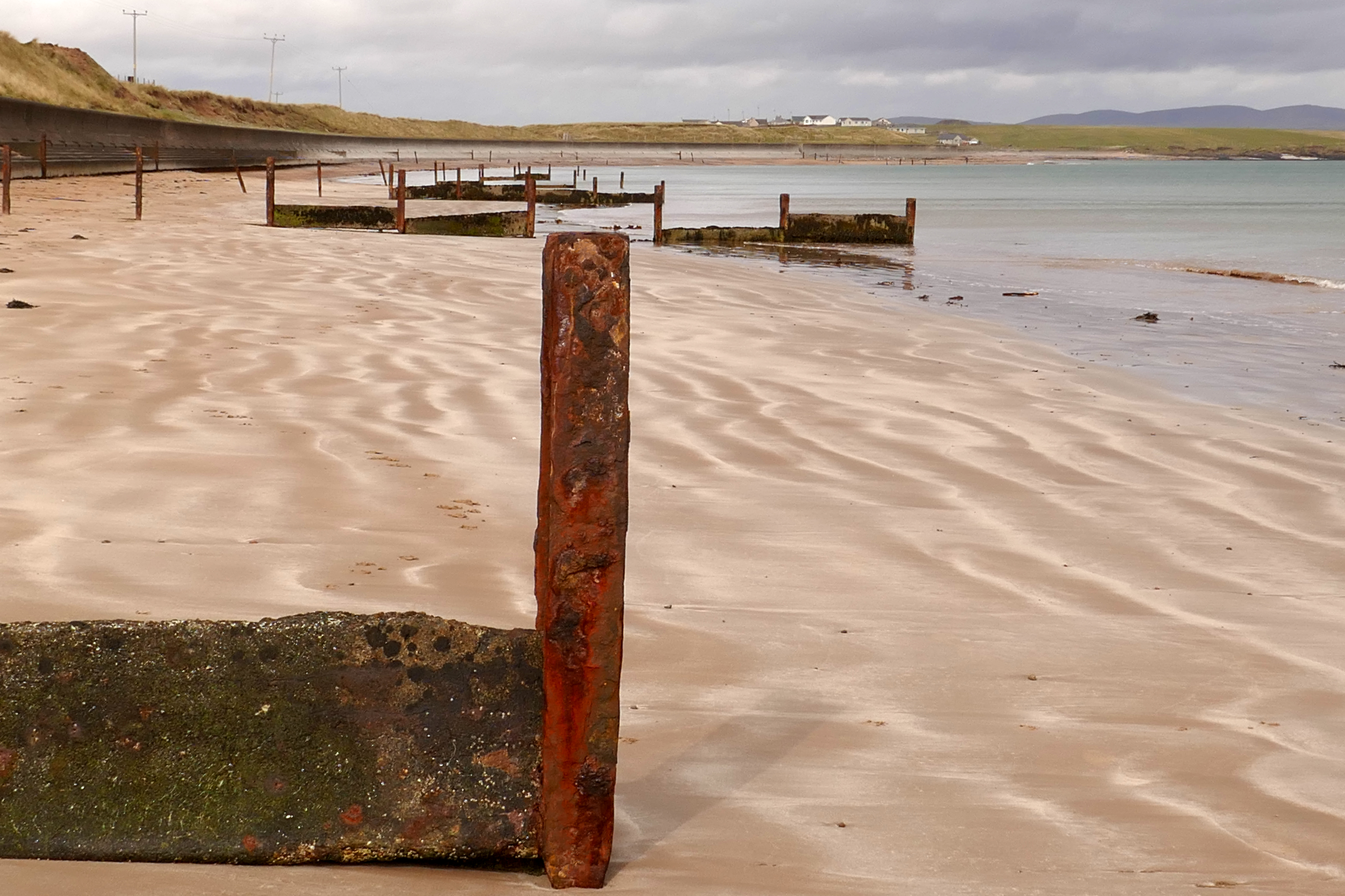
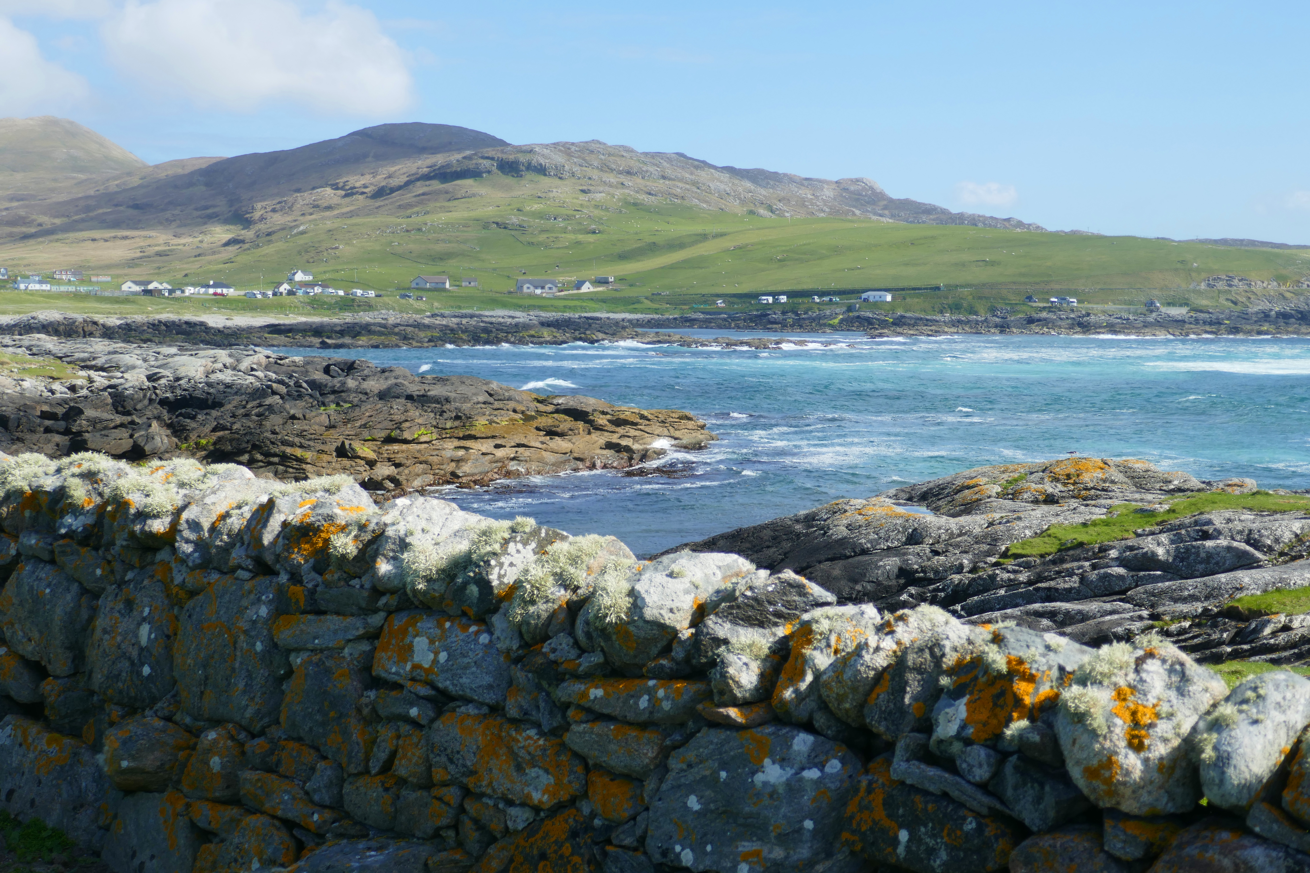
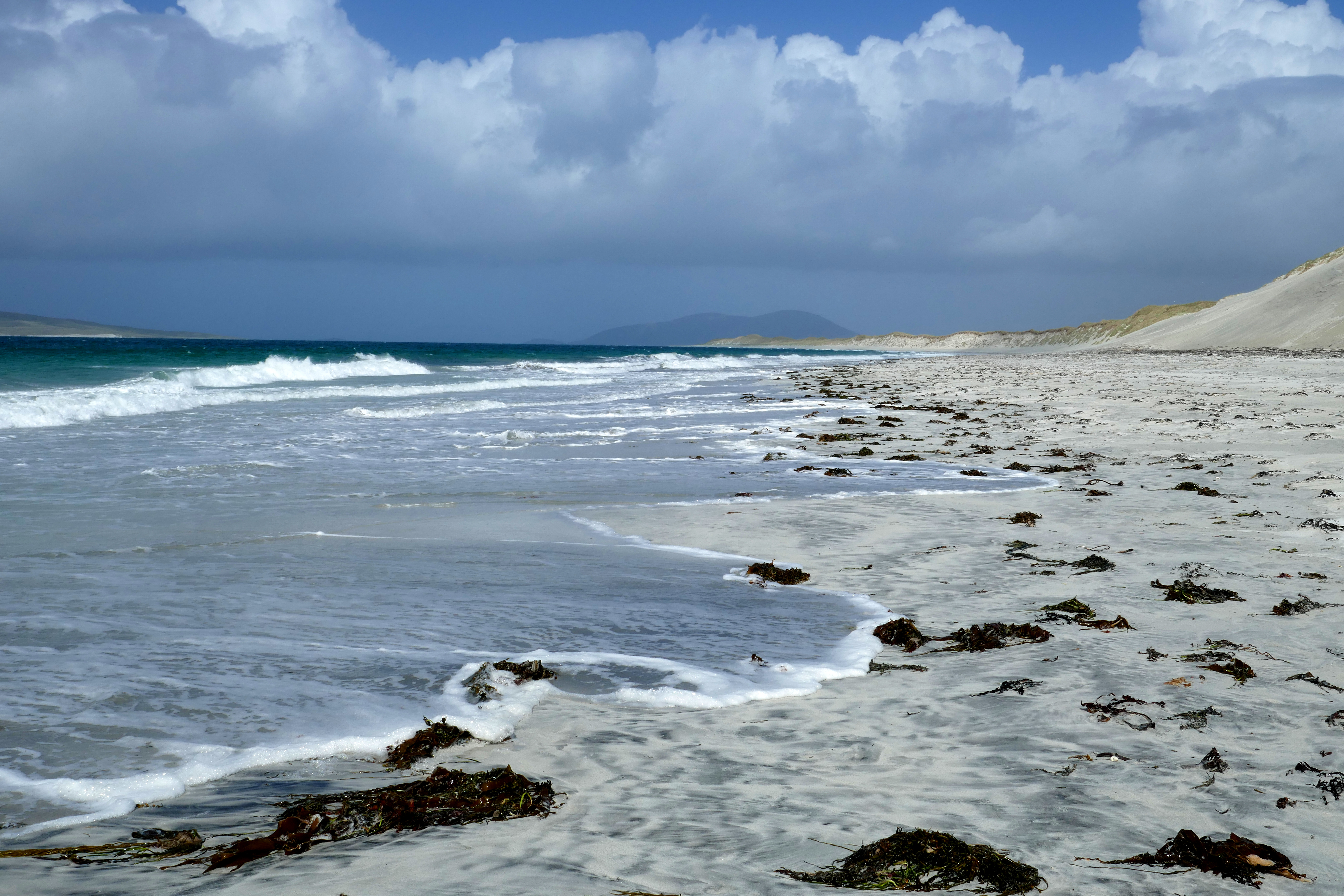
Beaches were, of course, a constant feature of our trip through all the islands and each one was magnificent, from the small bays below cliffs to the long sweeps of sand. On a sunny day the white sandy beaches washed by clear turquoise water are a great place to walk and stunning photographs are easy to take. I particularly liked the stipes of colours in the sand between the rusty groynes on the beach on the north side of the tombolo that links Point to the rest of Lewis. There was some shelter on this beach from the dunes, but on the other side of the tombolo I was almost blown off my feet!
The north side of the tombolo to Point, Lewis
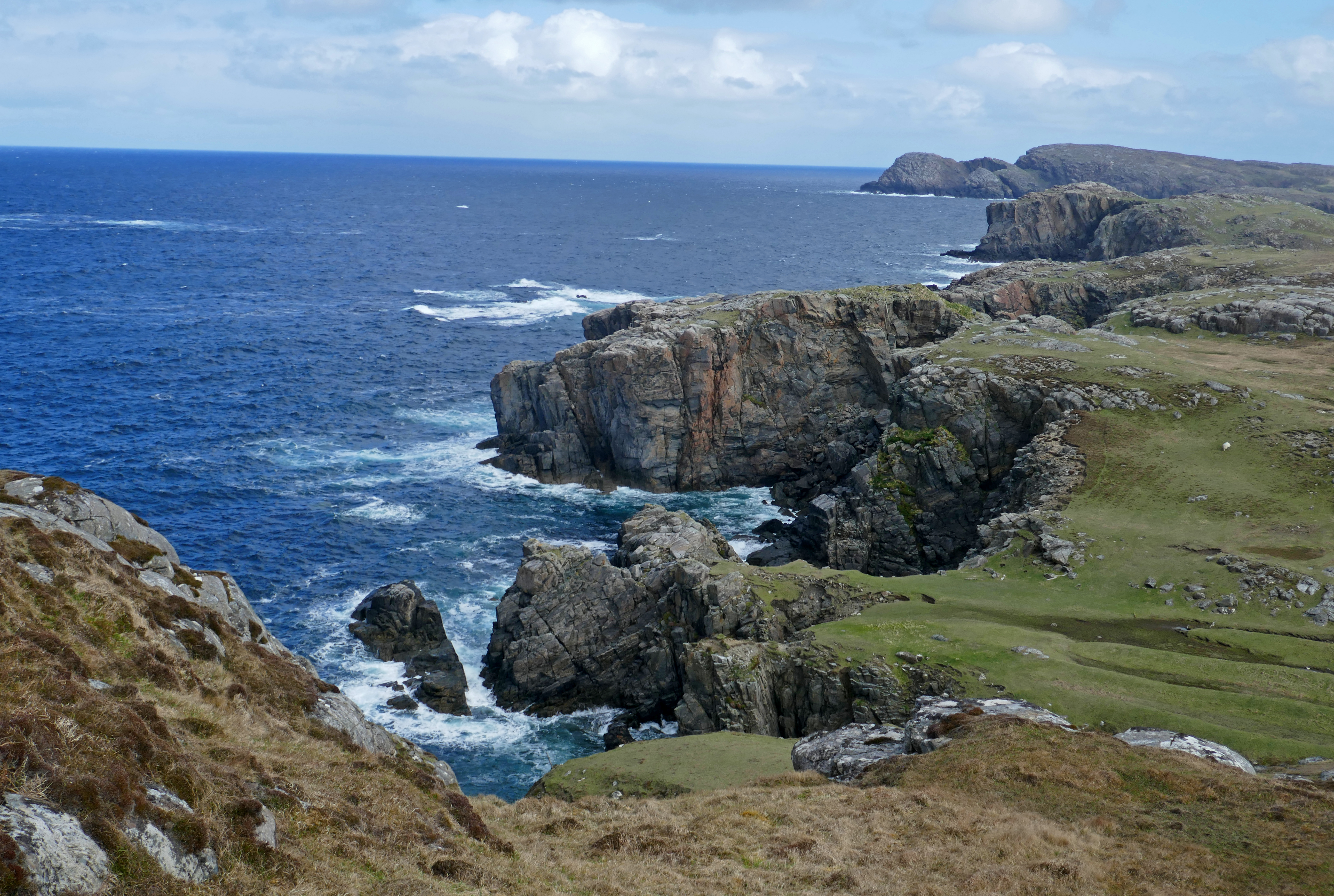
Walking. We walked most days, using the Walk Highlands App, but the best walk for scenery and variety was with friends who live on Lewis. They took us around the rocky headland from the Garenin Blackhouse village. We were lucky to have sunshine and I stopped to take in the stunning clifftop scenery and the blue sea as often as I could. We walked to the small modern lighthouse, by the ruins of Laimishader, one of the first townships on Lewis to be cleared in the 18th century, and along an established track where we added our footprints to the many that had walked there before.
The rugged coast from Garenin Blackhouse Village
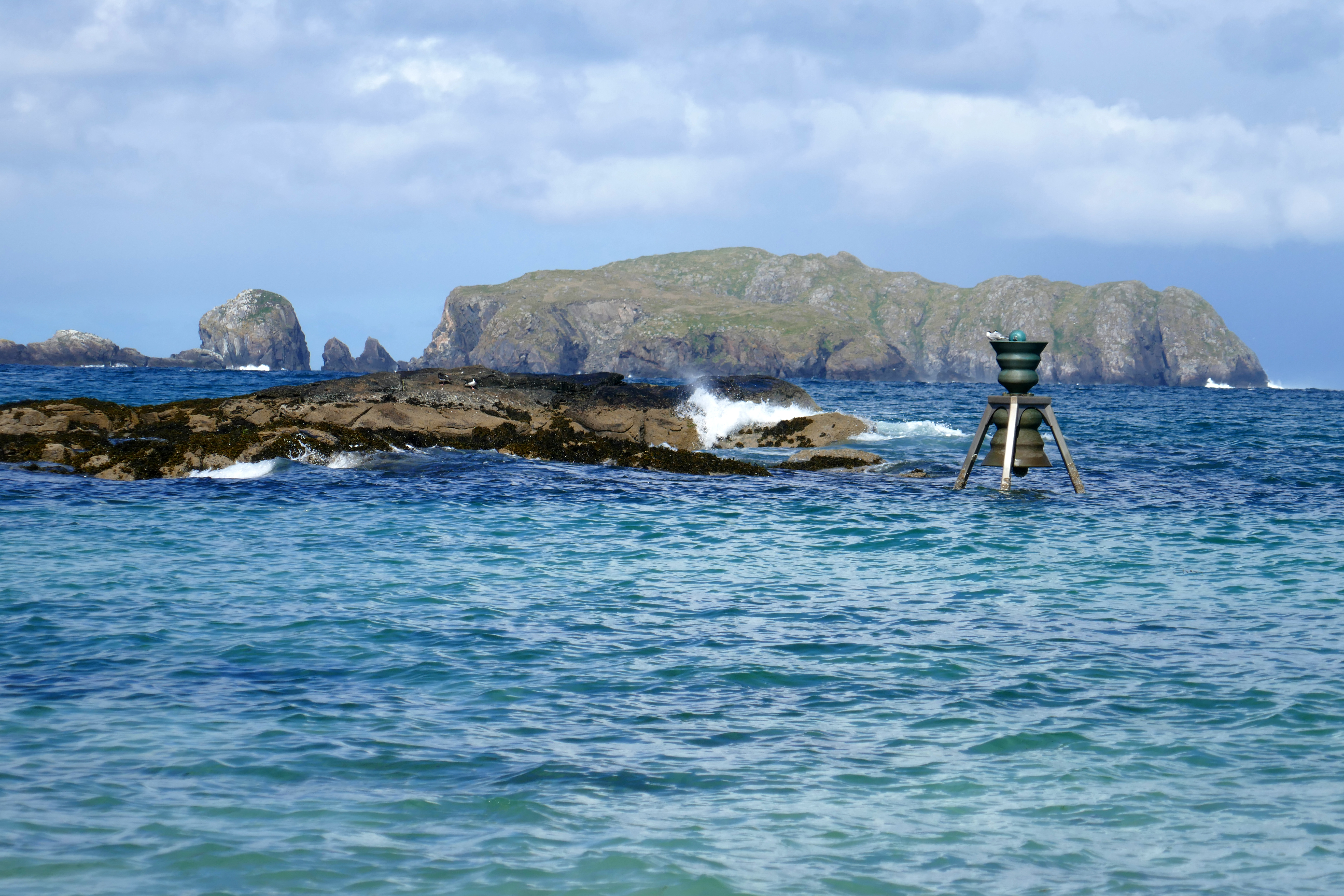
In Morecambe we have a Time and Tide Bell and having read there was one of these on Lewis, we had to visit. Whereas in Morecambe, the bell sits on the side of the Stone Jetty and only rings at a high tide, On Lewis, the bell is in the waves of Bosta Beach [top photograph in the collection below]. It made an excellent perch for a pair of common terns. These Time and Tide Bells were designed by Marcus Vergette, to highlight the tides and our relationship to the sea. Morecambe Bay is transformed twice a day by the tides and the difference between the two can be as much as 10 metres. In the Outer Hebrides I noticed how the tides only differed by a few metres.
It is no surprise on this western edge of the UK that the weather changes quickly. While we were on the Isle of Barra, the most southerly of the Outer Hebrides, we had persistent rain one day and blue skies the next, all accompanied by the wind! The rain and accompanying low cloud meant that we weren’t able to see any planes landing at the beach runway. The sunshine meant that Vatersay, joined to Barra by a causeway, was the only island where we might have agreed there were too many motorhomes and campervans on the islands, as every parking space was crammed with vans. The Vatersay cafe had a car park with space but their sign said campervans were not allowed as their insurance did not cover them for vehicles with gas on board! Not something I’ve ever seen before. We left the crowds of Vatersay and wandered along a deserted beach on Barra.
Camping on Barra
My final impression is the most notable, it is the wind! We have plenty of breezy and stormy days in Morecambe but they didn’t prepare me for the Outer Hebrides, where the wind was an almost constant companion. Even when the sky was blue and the sun shone all day, we were still wrapped up in layers due to the wind. My face was the only part of my body that got a tan! My top tip would be visit the Outer Hebrides in May but take your February or March wardrobe!
When I think back to our trip to the Isle of Islay, I can still hear the murmuring of waves on a soft sandy beach and the joyful song of sea birds; I can still feel the warmth of the sun on my arms and the gentle heat of the sand under my toes and I can still smell the sharp air with a hint of alcohol.
Is it always sunny on Islay? Probably not, but on our spring campervan trip to this Scottish west-coast island we had sunshine and blue skies every day, so I could be forgiven for thinking this was normal! Seduced by the delightful weather we took every opportunity to kick off our shoes along deserted bays and scramble around the craggy coast of Islay. On an island seemingly powered by whisky, we did visit some distilleries too!
We had four days on the island. This was dictated by ferry availability, but it was about the right amount of time for us.
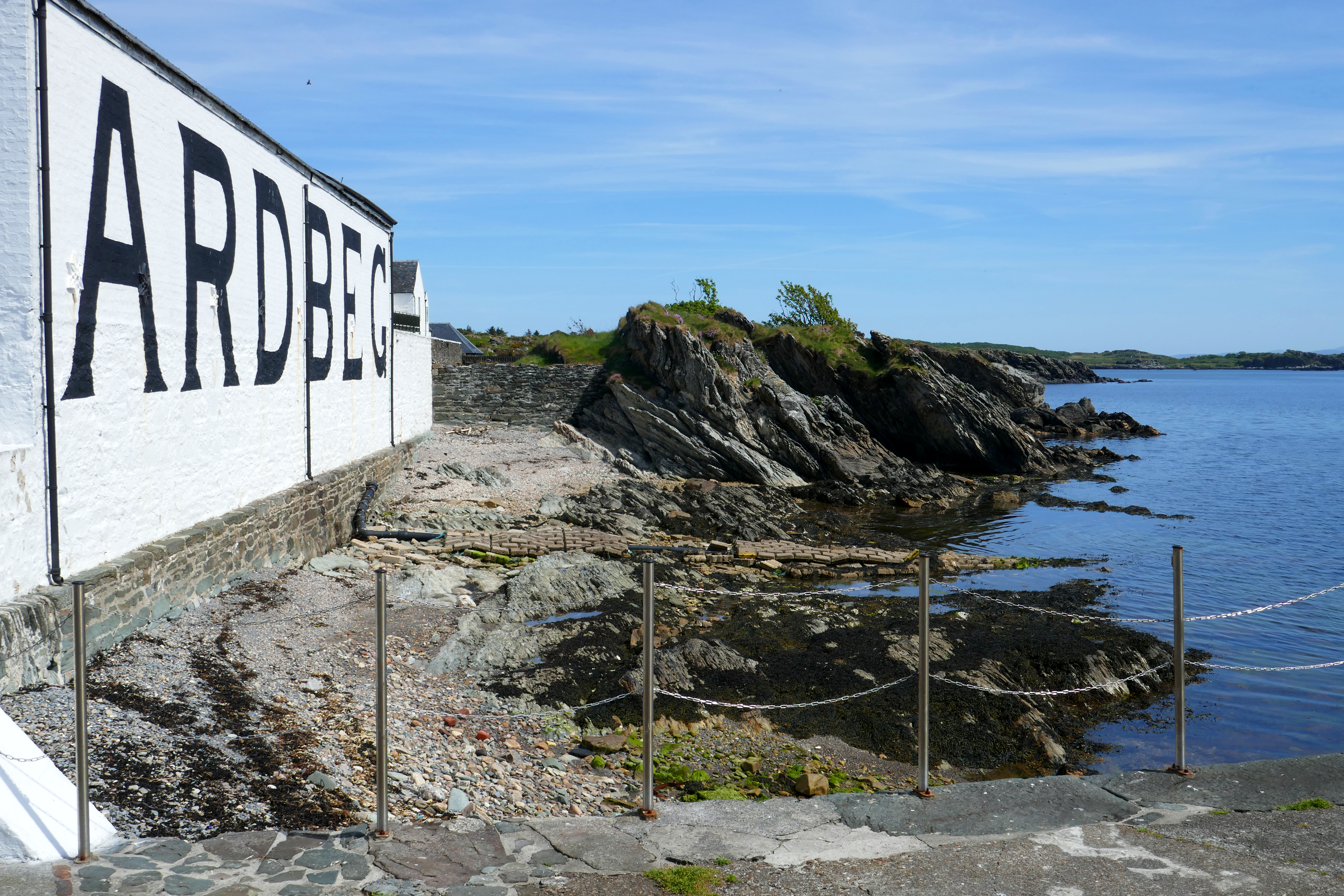
The Ardbeg Distillery
Walks on Islay
All the walks we followed were found on the must-have Walk Highlands app. Their website is free to use and the app is only a small cost. On the app you can download walks to navigate off-line and I can’t praise this tool enough. Here are links to the walks we enjoyed.
The Distilleries Coast Walk from Port Ellen, 6.25km (one-way). If you only do one walk, then this is the one. It passes three historical distilleries, finishing at Ardbeg which has a great cafe and bar. You can walk back or catch the bus back from Ardbeg to Port Ellen.
Port Ellen Standing Stones Loop, from Port Ellen, 5km. A short walk mostly on inland lanes that buzzed with insects when we were there.
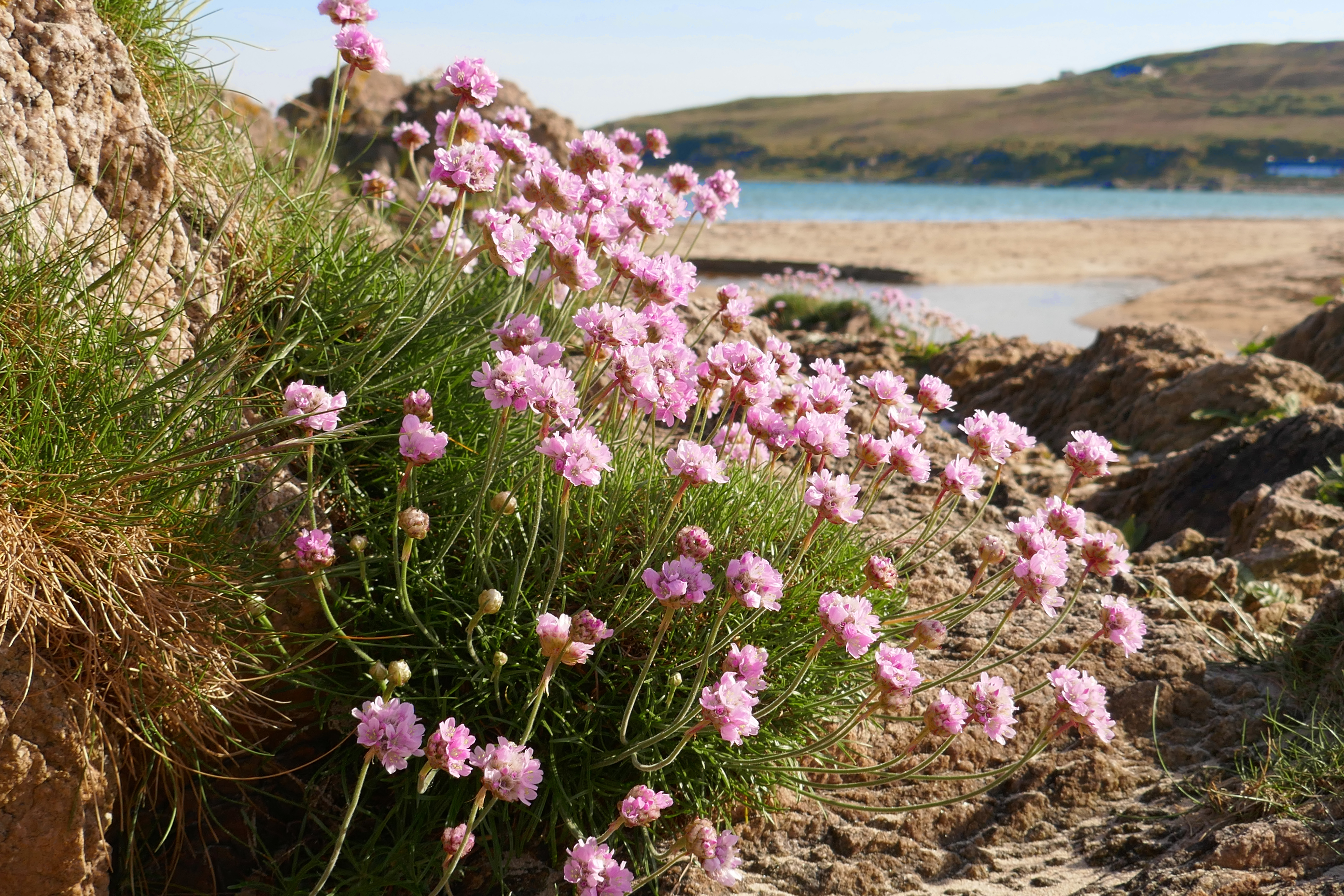
Carraig Fhada and Singing Sands from near Port Ellen, 4.5km. An unusual lighthouse, a fine sandy beach and, in May, rocks festooned with pink thrift, what more do you need!
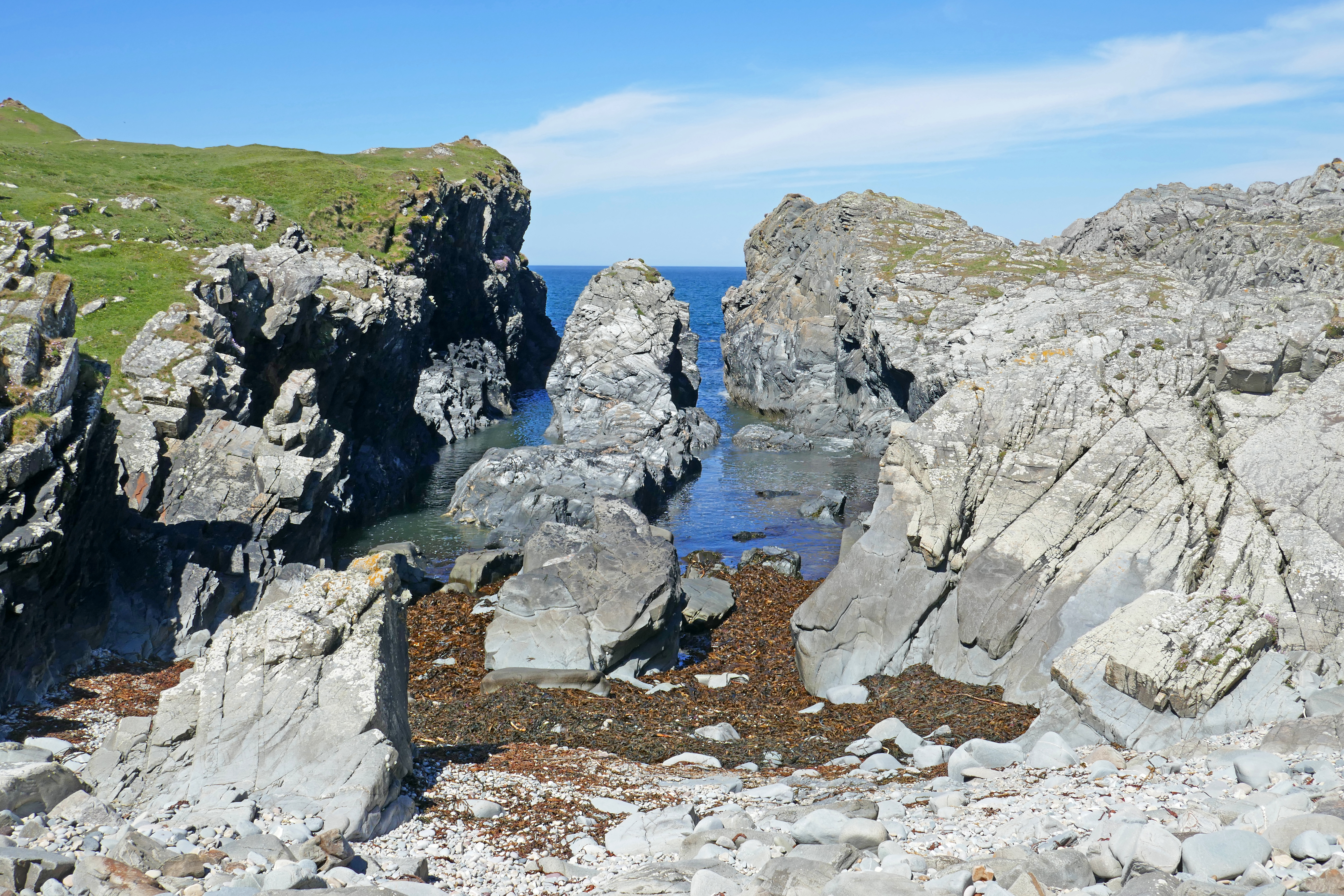
Laggan Point Circuit from Bowmore, 14km. After you have left the industrial buildings behind and reached the beach, this is a fantastic walk for bird watching and beach combing. We walked around stranded sea stacks and had our picnic lunch watching seabirds on a deserted stretch of coast.
Saligo Bay beach and arches from Saligo, 5.25km. A scenic and geologically interesting, stretch of beach with craggy rocks festooned with thrift and yellow bird’s-foot trefoil. This westerly coast is breezier than the sheltered parts of Islay.
RSPB Reserves
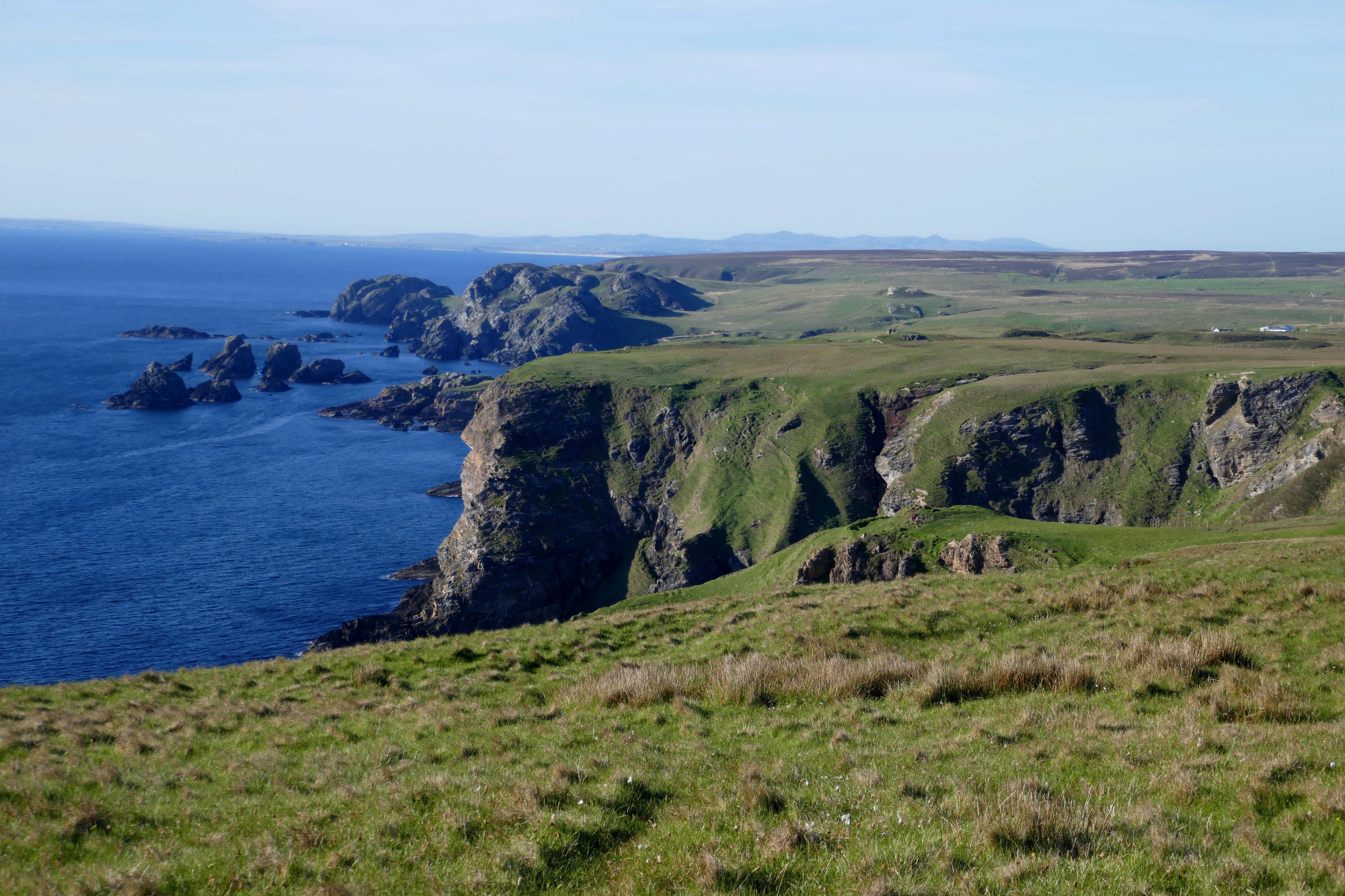
The Oa Nature Reserve is reached on a narrow and bumpy road where even 20mph felt too fast! There was plenty of parking on our evening visit. We walked up to the American memorial that remembers the dead from two ships that sank in World War One. Here the coastal cliffs are impressive and across the sea we could see Northern Ireland. We saw wild goats, a hare and a hen harrier, its wings and underbody catching the evening sunlight.
Loch Gruinart Nature Reserve is a contrast to The Oa. There are two marked trails, one through the woodland, with hides looking over the loch and marshes and another that climbs over the moorland, with views out to further islands. On our visit we encountered hordes of butterflies and various birds.
At Oa Head
Other Sights
Kildalton Cross, an 8th century carved Celtic cross with early Christian images, is arresting for its intricacy and age. The drive there is along around 12km of quiet road that becomes narrower and bumpier as you get nearer to the cross and church. It was fine for our 5m long campervan and when you arrive, like us, you will be surprised how much parking there is, particularly as we had it all to ourselves.
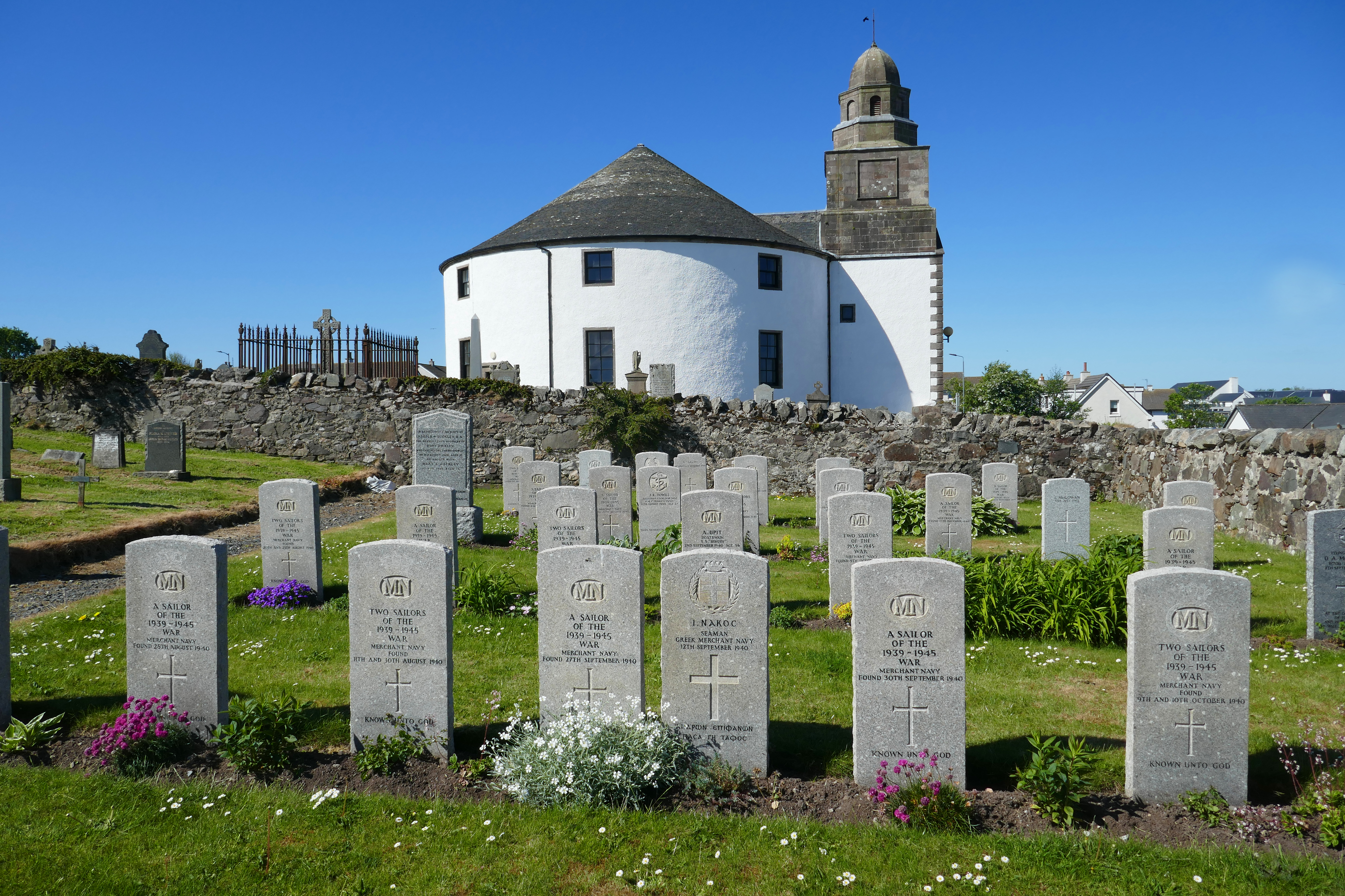
The Round Church in Bowmore is intriguing and, as you will probably find yourself in Bowmore for shopping or a cafe stop during your trip, worth taking the time to see. There isn’t loads of parking in Bowmore but there are small car parks off School Lane and towards the harbour. We parked in a viewpoint parking area off the A846 towards Bridgend about 10 minutes walk from the main shopping street. The Round Church looks over the main street and you can’t miss it.
The Round Church s in Bowmore
Distilleries – There are lots of these and most of them offer tours. The tours for the big Islay names, like Laphroaig, Lagavulin, Ardbeg and Bowmore fill up quickly, so if you want to visit a particular favourite distillery book early! We visited Kilchoman Distillery, a fairly new farm distillery that also grows barley for their distillery. The tour had all the smells and colour of every distillery tour and was delivered by a knowledgeable and engaging guide. As we were driving we went away with two small bottles of different whiskies and souvenir whisky glasses.
Bottlenose dolphins. We were lucky to see a small pod of dolphins from the Port Charlotte campsite. Walking on the shore looking across Loch Indaal sea loch, we watched common terns, shelducks and greylags. As we walked back we spotted a dark shape in the water and hoped. Then it leapt out of the water and we knew it was a bottlenose dolphin! Soon, we were watching a small group of dolphins and most of the campsite had joined us to enjoy their antics.
The Ferry
We tried to book our ferry in February for our trip in May. This wasn’t early enough and we struggled to find a crossing that had space for even our small campervan. This should be easier when the larger boat is working this route, but I would still suggest booking as soon as timetables are available in December or January.
The crossing from Kennacraig on Kintyre to Port Askaig takes around two hours. The route to Port Ellen is about 20 minutes longer. On a good day, the views of Jura and the Paps of Jura are mesmerising.
Campsites
In 2026 there should be two campsites on Islay. We stayed at:
Port Mòr Campsite near Port Charlotte – this coastal site has a limited number of electric hook-up pitches that are soon booked by organised holidaymakers and many more grassy and unspecified non-electric pitches. There are facilities in the building and a cafe. It is open March till the end of November and has a great view over Loch Indaal.
Port Ellen Motorhome Parking in Port Ellen is a new facility that opens in 2026. We had a look at the almost finished site and it seems it will be a tidy small site in a lovely position close to the beach, shops and eateries of Port Ellen. The site has EHU pitches and toilets and showers.
In addition, an unofficial but very lovely place to park a campervan or motorhome is at the head of Loch Indaal on the north side between Bridgend and Bruichladdich.
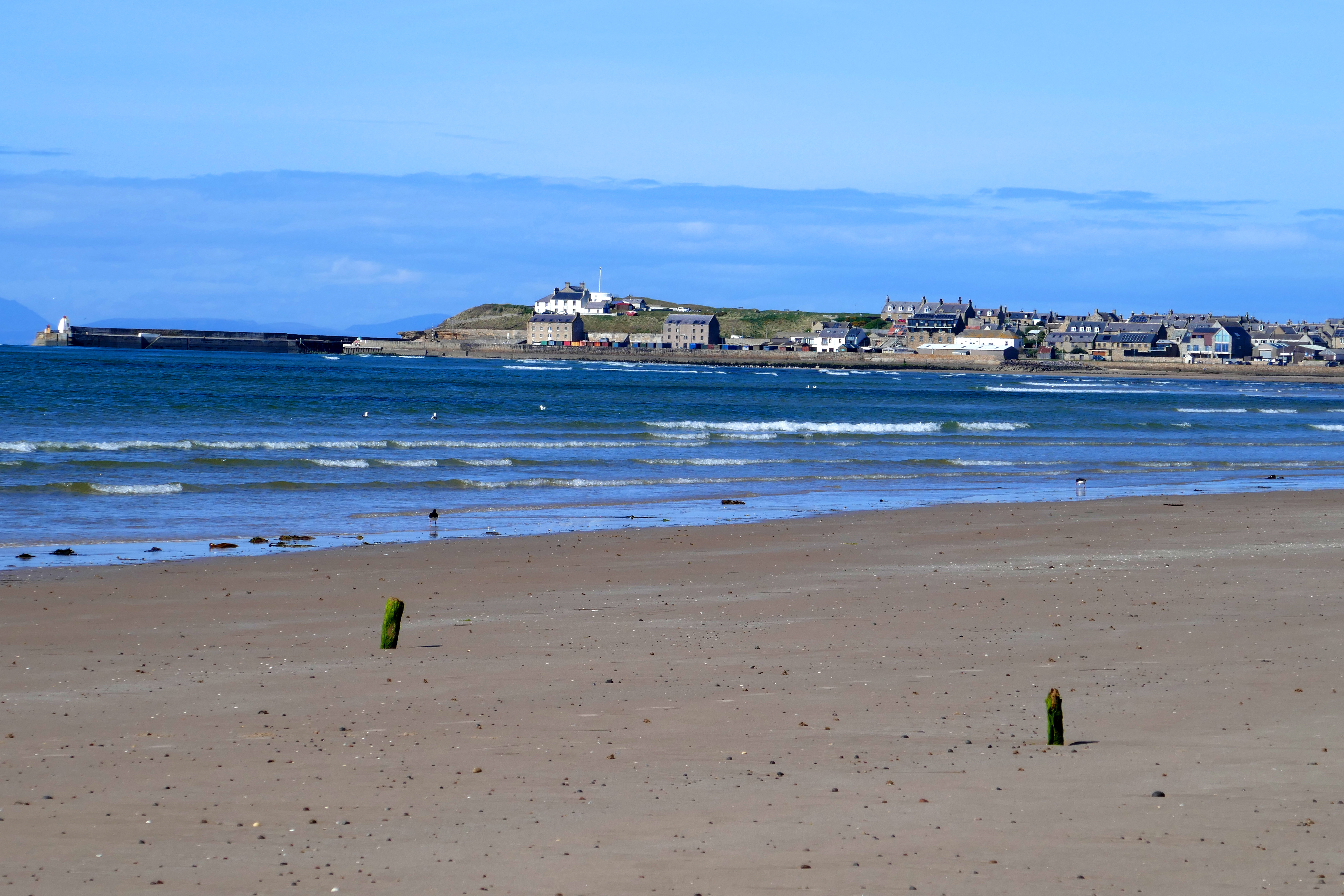
The villages along the Moray Firth in northeast Scotland are some of my favourite parts of the UK. One of these villages, Findhorn, we had visited before but never stayed at; it turned out to be an outstanding place for a few days camping. Findhorn sits on a sheltered bay at the end of the road, the village and harbour tucked into a corner of Findhorn Bay, where the river of the same name widens before reaching the sea. Just north of the village, the sea ebbs and flows onto a long sandy beach, lined with dunes and forest.
Findhorn has been a village for centuries, storms occasionally forcing it to uproot and today you stroll around its third location. The village is known for the Ecovillage and spiritual organisation that emerged from a small group moving to the Holiday Park here in the 1960s.
Findhorn combines history, location and landscape to make a perfect place for a holiday.
Findhorn Holiday Park
For us, the first essential is a good campsite and the one in Findhorn suited us well. The campsite has a circle of touring pitches with EHU, as well as pitches for tents. Everyone has use of luxurious modern individual bathrooms with good hot showers that were always clean. The touring area is separate from the static caravans and small lodges. There are washing up sinks, a laundry, wi-fi and the usual disposal points.
The Phoenix Shop is only a short walk from the pitches and sells a wide range of food and gifts. When we were there we had a voucher to save money in the shop and made good use of this on a shopping spree. The cafe is also not far away.
Walking from Findhorn
The Neighbourhood [1-6km or more]- The first thing I wanted to do once we had pitched up and had a brew was walk around some of the interesting community buildings and ecohouses. We wandered on paths through Wlkies Wood and among the sandy heath of gorse and low dunes to the beach. You can make this walk as long or as short as you wish, incorporating the village and harbour if you want to walk further.
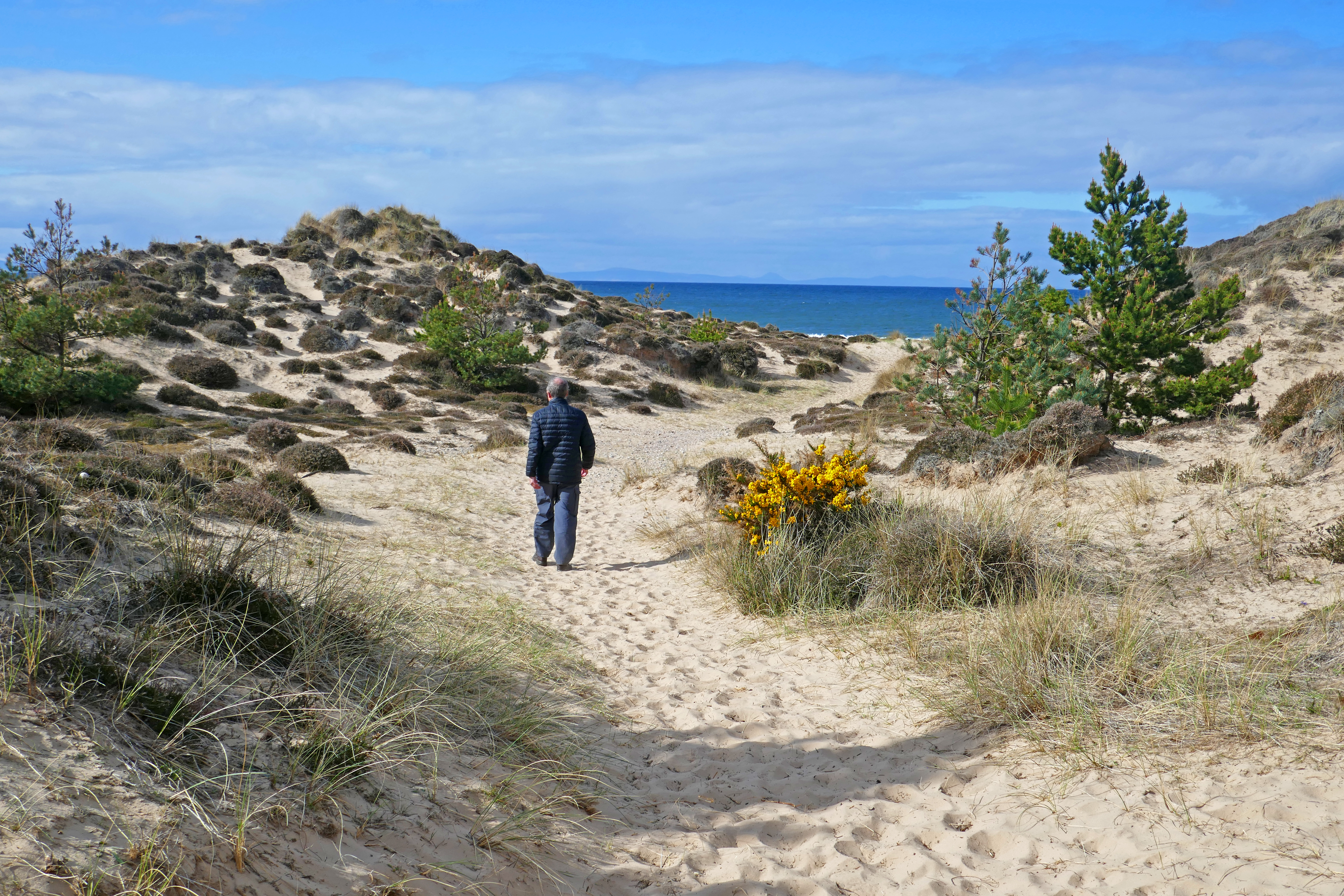
The sand dunes between the campsite and the beach
To Burghead and Back [23km] – On a sunny morning with a May chill in the air, we walked to Burghead, the next village along the bay, and back. On the way out we followed the good path above the beach around the Kinross RAF site and then through pine woodland, stopping to watch yellow hammers in the trees, the sea beyond. We met few other walkers until we were near the Roseisle Beach car park. The view across the bay to Burghead, highlighted by the sunshine, is unbeatable. In Burghead we walked around the harbour and found the memorial to the wartime Shetland Bus, some personnel of which operated from Burghead. We walked up to the head, where the distinctive white former coastguard lookout sits [closed when we were there] and looked across the Moray Firth. On the way back we followed the shore, a shorter route and the sunshine encouraged us to take off our shoes and paddle through the surf. Groups of herring gulls and solo oystercatchers were on the beach and sand martins nested on the sandy bank below the forest.
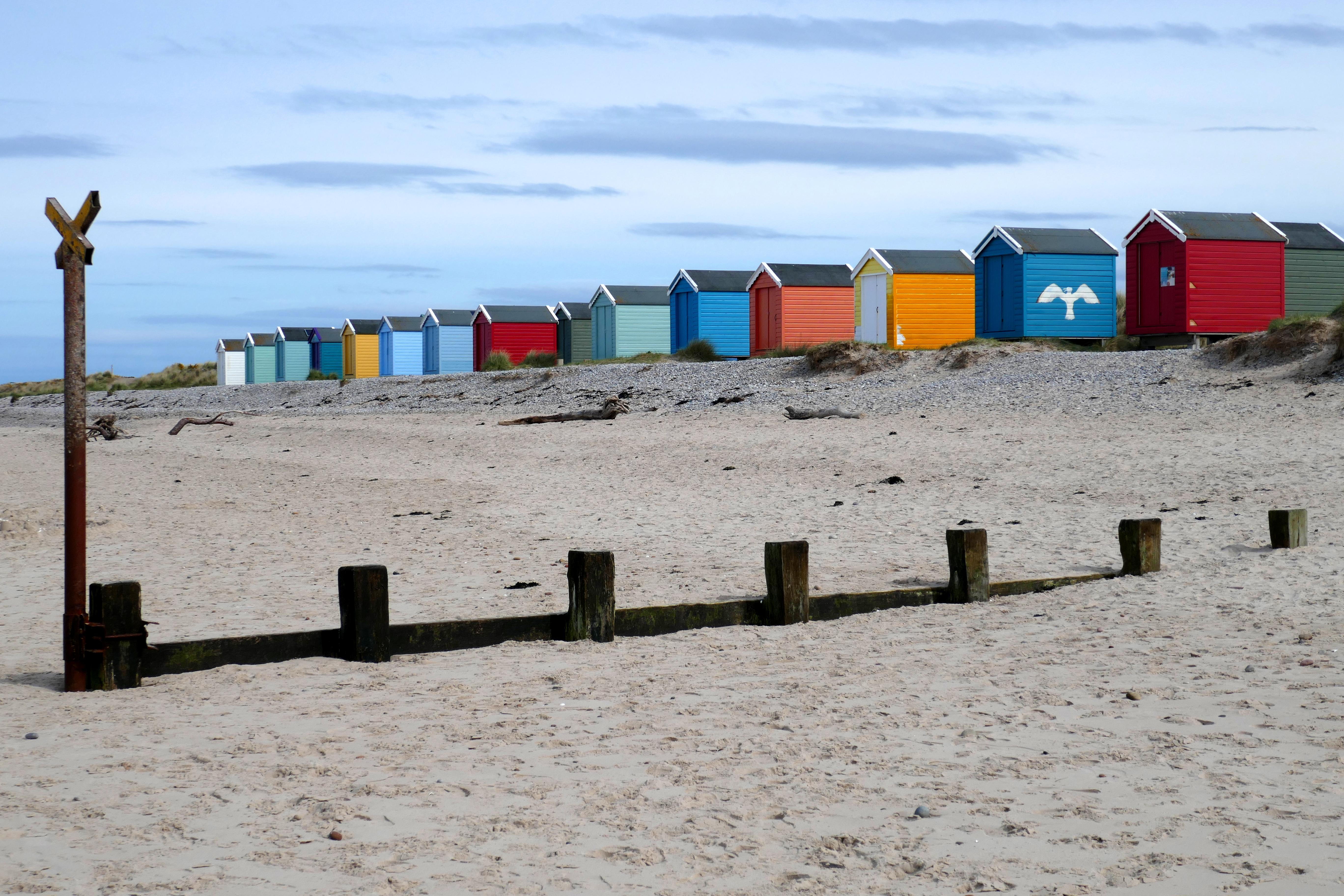
Findhorn Harbour [Around 5km]- Walking to the village from the campsite you are soon following the river, with houses to your right. We sauntered, taking in the views from the stone piers across the water to Culbin Forest. We admired the boats and the old fishing village’s stone buildings. There are refreshment options and we ate ice-creams sitting on a bench overlooking the sheltered harbour. In summer a short ferry leaves here and crosses the river mouth to the vast Culbin Forest. Reaching the sands, we walked around the shingle spit of land that has formed in the mouth of Findhorn Bay. This hook-shaped land builds as the waves shift the sand and shingle, always drifting and progressing west. Heading east along the sandy beach dotted with stones and lined with colourful beach huts these were dwarfed by the vast sky. In the sea a seal surfaced and its whiskery head watched us. We left the beach for a track and grassy path through dunes and sandy heath packed with flowering gorse and made our way through the eco-community houses to our campervan.
The beach huts at Findhorn
A Short Drive Away
Brodie Castle – If you want to take your campervan out for a drive, Brodie Castle is about 15 minutes drive away. When we are in this area we like to stop at Brodie Countryfare cafe and shop for coffee or lunch first. There is parking at the castle and you can visit the sprawling pink building [it is run by the National Trust for Scotland]. We prefer to stay outdoors and explore the grounds. The stroll down the tree-lined avenue to the pond gives you ample opportunity to snap a photograph of the castle. There are shady tree-lined paths around the pond and chances to see the ducks and swans. Back at the castle there is plenty to see in the gardens, with traditional planting and the Playful Garden, which is as much fun as it sounds! No doubt designed for children, no adult can resist messing about on the giant white rabbit.
Burghead – If you didn’t walk there [see above] then drive and spend time enjoying this village that is full of character and stories. There is parking near the harbour on Station Road. A short detour on your drive would take in Roseisle Country Park where you can walk through the tall trees of the forest to the beach and appreciate the view to Burghead.
Forres & Nelson’s Tower – About 10 minutes drive from Findhorn is Forres and as you approach the town you might spot Nelson’s Tower on the top of Cluny Hill. There are a number of car parks in Forres, including the one on High Street and it is just a 15-minute hike uphill through the trees to this 21-metre-high octagonal structure built in the 19th century to commemorate Nelson’s victory at the Battle of Trafalgar. The tower is often open to visitors in the afternoons and after climbing the 96 steps you can enjoy a view over the town. Afterwards, take some time to explore the pleasant town centre, finding the Tolbooth and the mercat cross
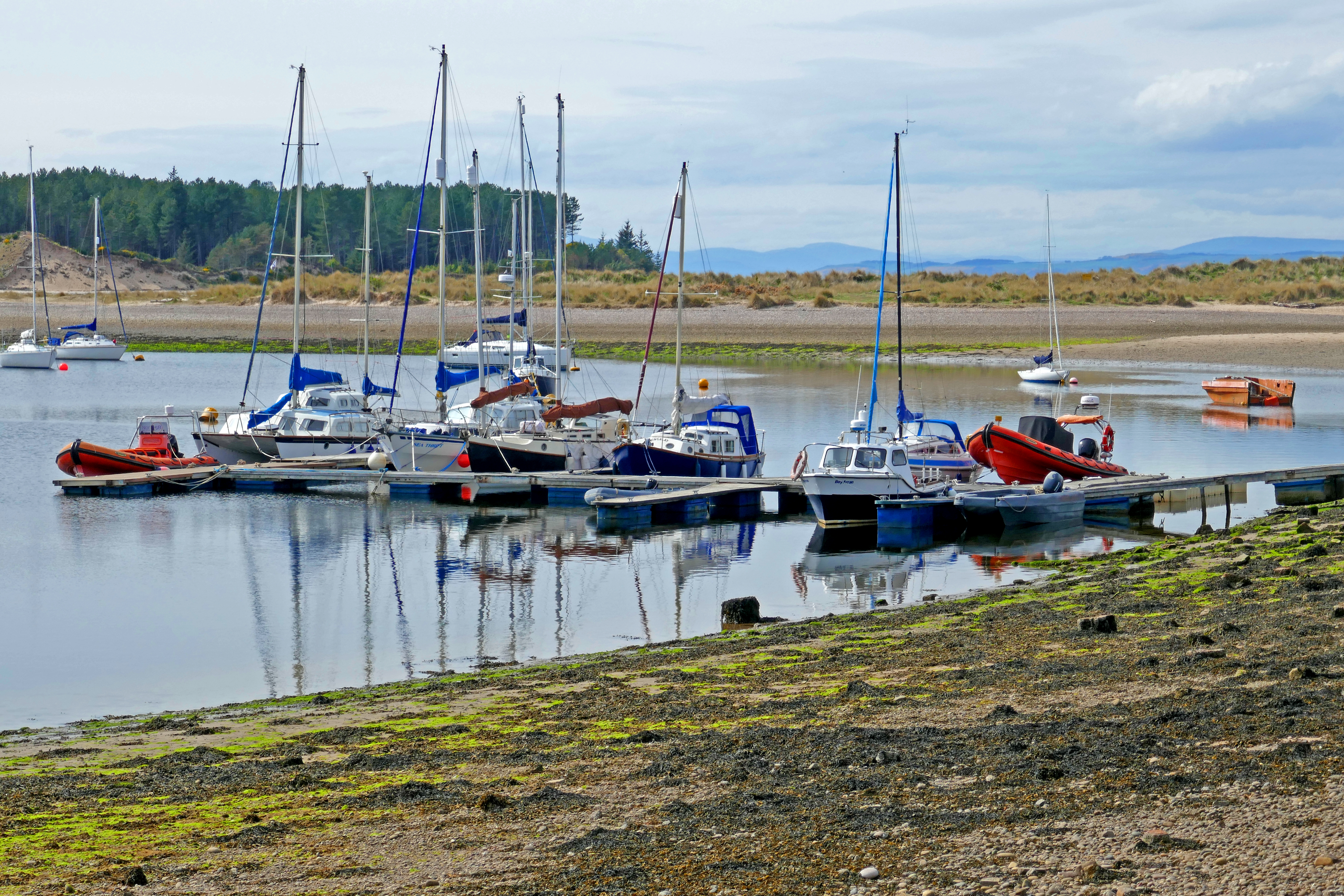
The harbour at Findhorn
Other Overnight Options
Findhorn West Beach allows campervans to overnight for a charge. Places must be pre-booked and there are toilets.
Heading north into the heart of the Vendée we were sure we would find cooler weather but the storm was a surprise. My smile faded when the receptionist insisted that we walk around the campsite to find a pitch. Peering outside, lightning was flashing, thunder was rolling and rain poured in sheets and I really would have preferred to take the ‘van around the large site. But keen to get the kettle on, we set off, sheltering in the sanitary blocks when the storm was in full force. The weather wasn’t conducive to finding the ideal pitch but I eventually returned dripping to reception with a number.
The rain had spring cleaned the Vendée and the next day we hiked around the nearby Lac du Jaunay on easy-to-follow paths that undulated around the reservoir’s wooded valley. The birds sang their bestsellers, fresh-scented flowers perfumed the air and buzzards soared above our heads. Passing a shuttered chateau we rested on a rocky outcrop overlooking the water and watched a group slowly glide around our headland on inflated float tubes, languorously combining fishing with eating sandwiches.
We are not even beginner-level table tennis players but always have a couple of paddles and balls in the Blue Bus as European campsites often have outdoor ping-pong tables. Spotting one in the field near our pitch we wandered across, quickly giving up playing seriously as the breeze repeatedly whipped the ball across the table top into the long grass! We giggled as time after time one of us raced to retrieve the ball!
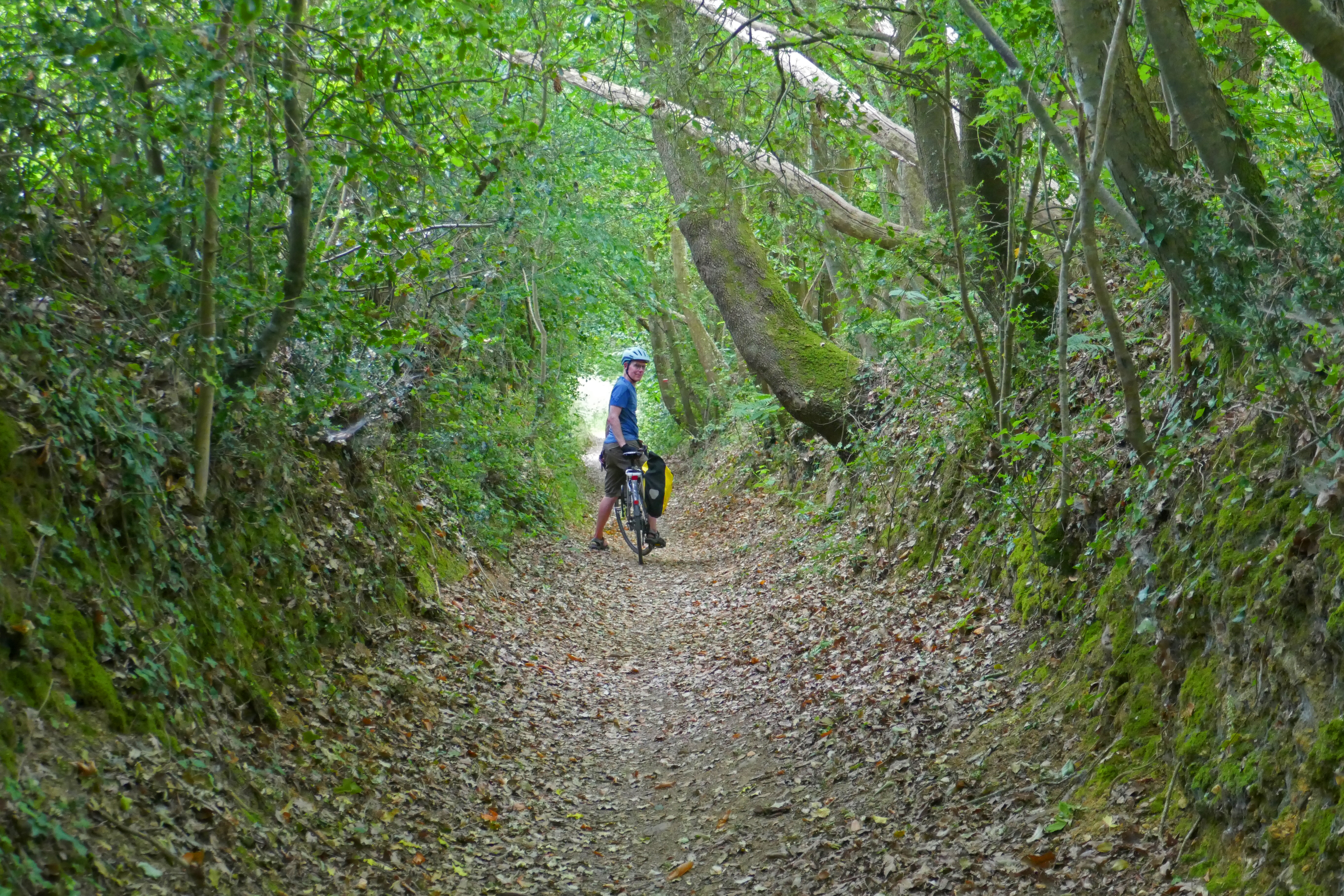
As well as walking, we cycled from the campsite to the winding trail around Coëx that led along the shore of a small reservoir to open fields where hares lolloped and pools where egrets silently strutted. Another route took us back to the banks of Lac du Jaunay and a shallow inlet where a nursery of mallard ducklings stayed close to mum. Hearing a clamour of bird calls we searched the surrounding trees and spotted a noisy group of cormorants shuffling and fidgeting among the branches. Climbing out of the valley we cycled up a shady sunken track and stumbled on an unusual pilgrimage chapel near Martinet. La Chapelle de Garreau has an ornate outdoor ringing chamber on a balcony below the bell tower. Inside were colourful abstract stained glass windows and paintings celebrating a local legend that Mary was seen here washing clothes in the River Jaunay.
From Lac du Jaunay we cycled up a sunken track
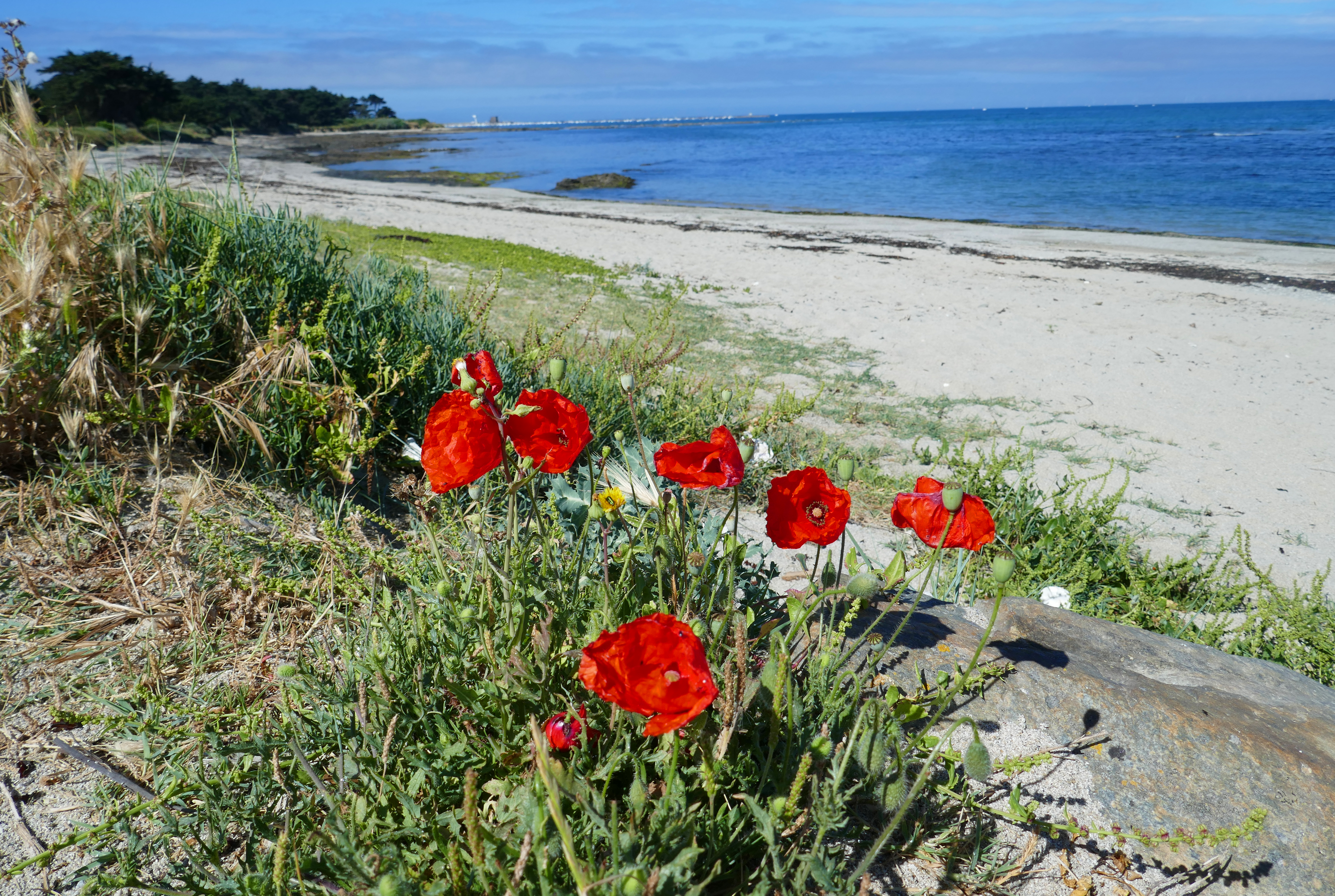
After the pastoral calm of the Vendée interior, La Plaine sur Mer on the Côte de Jade had a breezy buzz. Geared up for active holidays, we explored the area around Saint-Gildas Point on foot and bikes. From small harbours and long sandy beaches where red poppies danced in the breeze we reached Saint-Gildas Point, a boating paradise that reverberated with flapping sails and clanking chains. We ambled around the jumble of concrete bunkers, remnants of the Second World War German occupation, and looking north across the mouth of the River Loire we could see the huge port of Saint-Nazaire and towards Batz-sur-Mer.
Beyond the point the landscape changes as the coastal path meanders around sheltered coves and bigger waves attract surfers. We passed wooden shacks perched on stilts above the sea reached by slatted pontoons. Fishermen apparently suspend a net from poles on these pêcheries to catch plaice. A series of information boards showed how artists have interpreted these picturesque views over the centuries and we admired the shoreline houses from Victorian turreted mansions with balconies to modernist concrete and glass and cute bungalows with shutters. The sea was the brightest blue and clusters of yellow flowers clung to the rocks. We sat on a promontory watching terns diving in the sea and at La Grande Plage in Préfailles we kicked off our sandals and crossed the gritty sand to paddle in the cool Atlantic water.
Red poppies danced in the breeze near La Plaine sur Mer
A network of inland farm tracks took us south of La Plaine sur Mer to a natural area of coastal moorland that slopes down to the sea cliffs and contrasts with the built-up seaside. Butterflies sweep among the abundant thistles and gorse bushes and the aroma of sweet-smelling grass after haymaking hung in the air. We followed sandy paths under wind-gnarled trees to secluded beaches where families played and found our own isolated viewpoint for a picnic
Crossing the impressive bridge that arches over the River Loire at Saint-Nazaire we reached Batz-sur-Mer, where friends of ours live. The seaside towns of Batz-sur-Mer and Le Croisic were once craggy islands and are now chic resorts, popular with Parisians in search of cooler climes in summer. The beaches are beautiful and the lively towns abound with stylish shops.
Our friends live near to the campsite and we were soon sitting in their sunny garden catching up over drinks. Our friends are impeccable hosts and that evening they surpassed expectations. Collecting us in their open-top car we enjoyed an evening of French elegance and taste, beginning with cocktails at a beach bar. Sitting with a ritzy cocktail, a view of the sea and my toes in the warm sand I was living the high life. We ate in a restaurant overlooking Le Croisic’s harbour where we were welcomed with glasses of pink fizz and an appetiser that got the taste buds working overtime. The owners were expecting two vegetarians and they had prepared a delicious menu that pleased every sense. Our main meal, a creamy risotto with roasted vegetable garnishes, was a triumph of colour, flavour and artistry served in a classy black bowl. It was so perfect I savoured every mouthful and didn’t want it to end.
The next day we drove north through Brittany to Saint-Malo with a campervan full of deliciously warm memories of France and friends.
Saint-Gildas Point is a boating paradise
We stayed at:
Camping RCN La Ferme du Latois – near the village of Coëx, this is a large, peaceful and green campsite with ponds and trees.
We also stayed in two (very different) campsites from the Flower Campings group.
Flower Camping La Guichardière – near to La Plaine-sur-Mer and the sea, a well-run site with hedged pitches.
Flowers Camping Les Paludiers – we use this site because of its proximity to our friends but it is a bit tired. It is a rambling and sandy site that is popular but the facilities need refurbishment.
From our pitch I was easily distracted from learning French on Duolingo as a dipper flew along the burn below us and disappeared under the bridge where hardy campers walked to the camping field. Further distractions came with the evening insects, as the acrobatic wheeling of sandmartins around our campervan was so much more interesting than language learning!
This was Glengoulandie, a glen in the hills between Loch Tay in the south and Loch Tummel in the north and about 15 minutes drive from the small town of Aberfeldy. Here, if all this avian activity becomes boring [never!] you can always move your attention to the herd of farmed deer on the hillside.
At Glengoulandie we were camping in a hope-filled future. Back in 2001 when a local upland farm came on the market, the community saw land that was overgrazed with limited biodiversity and wanted to manage it better. Today this land is owned and managed by a community land trust. The centre of the land is the hill across the burn from our pitch, Dùn Coillich, at 572m high. Planting and natural regeneration on and around this hill over the past two decades has already created attractive native woodland and the wildlife has followed. This positive story is being repeated in many other communities in Scotland and carries the burden of my hopefulness.
On our first evening we made the most of dry weather and took a short walk through the deer park, contouring around the slopes of Dùn Coillich and down to the burn. As we strolled our first cuckoo of the year called from the woodland.
Following the paths from the glen
The next day we had planned a longer walk up the hill but the drizzle and low cloud led to a rethink and we enjoyed being lazy in the shelter of our campervan.
By the afternoon, we were ready to stretch our legs and, togged up in waterproofs, we set off on the marked paths around the community land, first following the red route and then the green and white path after climbing the short link path. This was a total of around five kilometres.
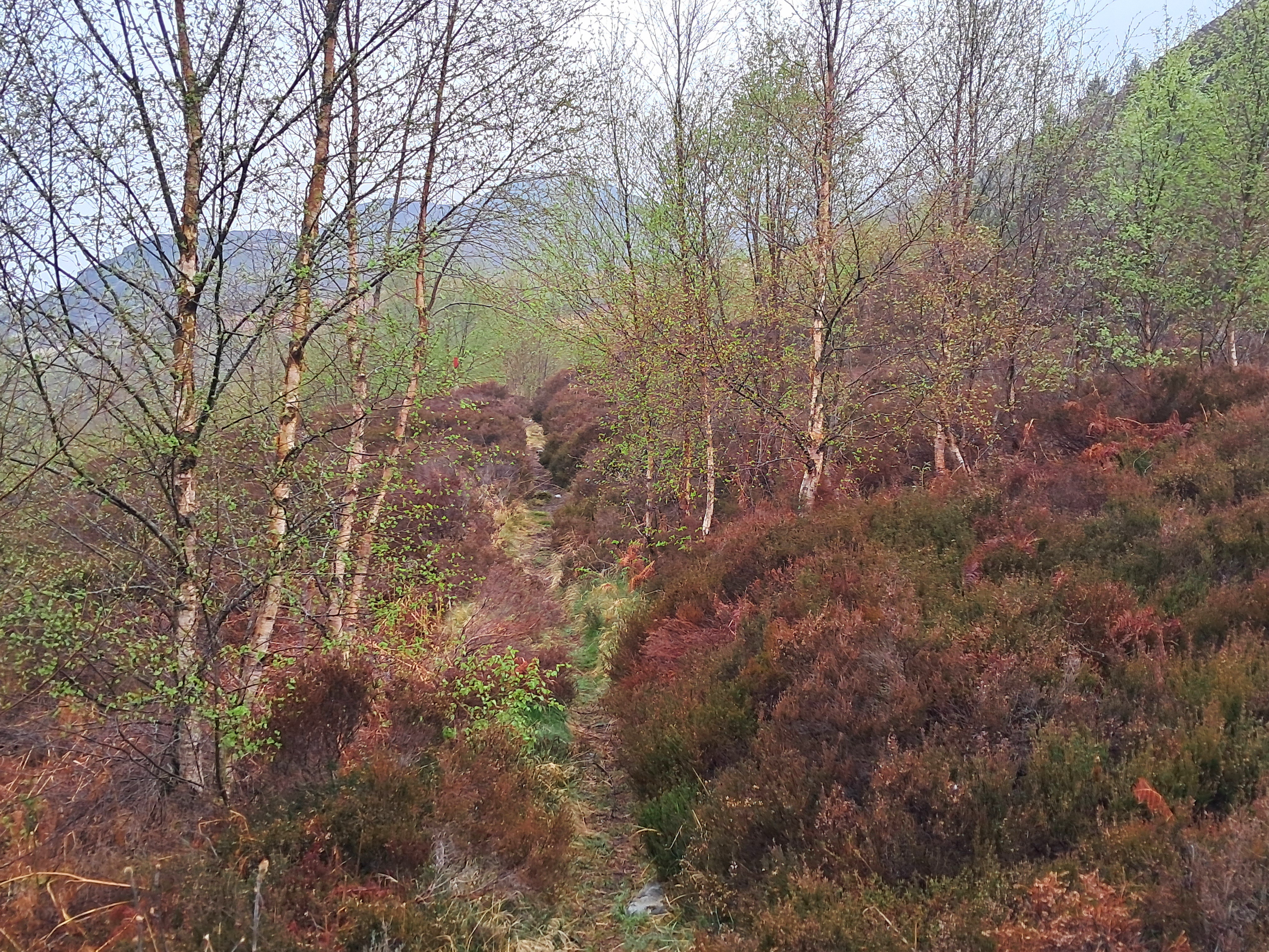
This red route follows an old path above the gorge of the tumbling waters of the Allt Mor, taking us through regenerating woodland of birch and rowan and thickets of sweet-smelling bog myrtle.
Climbing up to the green and white route we were walking through the heart of Dùn Coillich. Even on a damp day the landscape was beautiful and the peace enveloping . The route to the summit branches off from this path but the low cloud put us off climbing higher. Instead, we continued back towards our campervan and reaching the burn we walked on winding paths through delightful lush planted woodland and climbed up to the road to reach the campsite.
Colours on a grey day in Glengoulandie
The regenerating woodland on the community land made Glengoulandie a special place to visit and offers a vision for the future of Scottish landscapes. I am sure we will be back to climb the hill.
The campsite
Glengoulandie Camping and Caravanning is a small site, so don’t all rush there at once! If you like quiet campsites with a laid back feel this will suit you. It has just a few campervan pitches, some static caravans, cabins and space for tents, so with or without a campervan you can stay in this special place. You’ll receive a warm welcome and enjoy hot showers, with adjustable temperature settings. The campsite has a cafe and sells a few essentials but there are no pubs or shops within walking distance.
Looking below me and taking in the view in to the steep-sided hollow of The Devil’s Beef Tub I was aware we weren’t far from the source of the River Tweed. The ridge we were following over Annanhead Hill and Great Hill is a dividing line, a watershed. To the south and Moffat I could see the valley of the River Annan as it flows west to the Solway. To the north of the ridge the Tweed flows east to the North Sea. I peered over the trees and grassy lumps and bumps but the young Tweed was still hidden.
The River Tweed runs for 156 kms from the hills above Moffat to Berwick-on-Tweed in England, near the Scottish border. The river flows through the borderlands and some suggest its name comes from an old word for border but this name is also closely associated with a woven woollen fabric. Tweed is often in herringbone or hounds tooth check patterns and has been used for years for coats and jackets.
Moffat
From the high ridge above the unforgettably named Devil’s Beef Tub we descended through restored woodland. Since 2009 The Borders Forest Trust have been bringing back the native woodland, wetlands and heathlands around Corehead, restoring the Ettrick Forest. This already flourishing woodland was delightful walking, with the hillside to ourselves we hiked through varied montane scrub and wildflower meadows, joined by butterflies and bird song. We reached the road at Ericstane from where the walking was long but easy back to Moffat, where we were camping.
When in Moffat we always visit Cafe Ariete, a tradition that began some thirty years ago when we lived in Preston and Moffat was the perfect distance for our first brew stop on any trip north. In all this time the cafe has hardly changed, the coffee is excellent and the breakfasts, lunches and cakes are all tasty and served with a smile. Cafe Ariete is always worth the short detour off the M74!
Grey Mares Tail
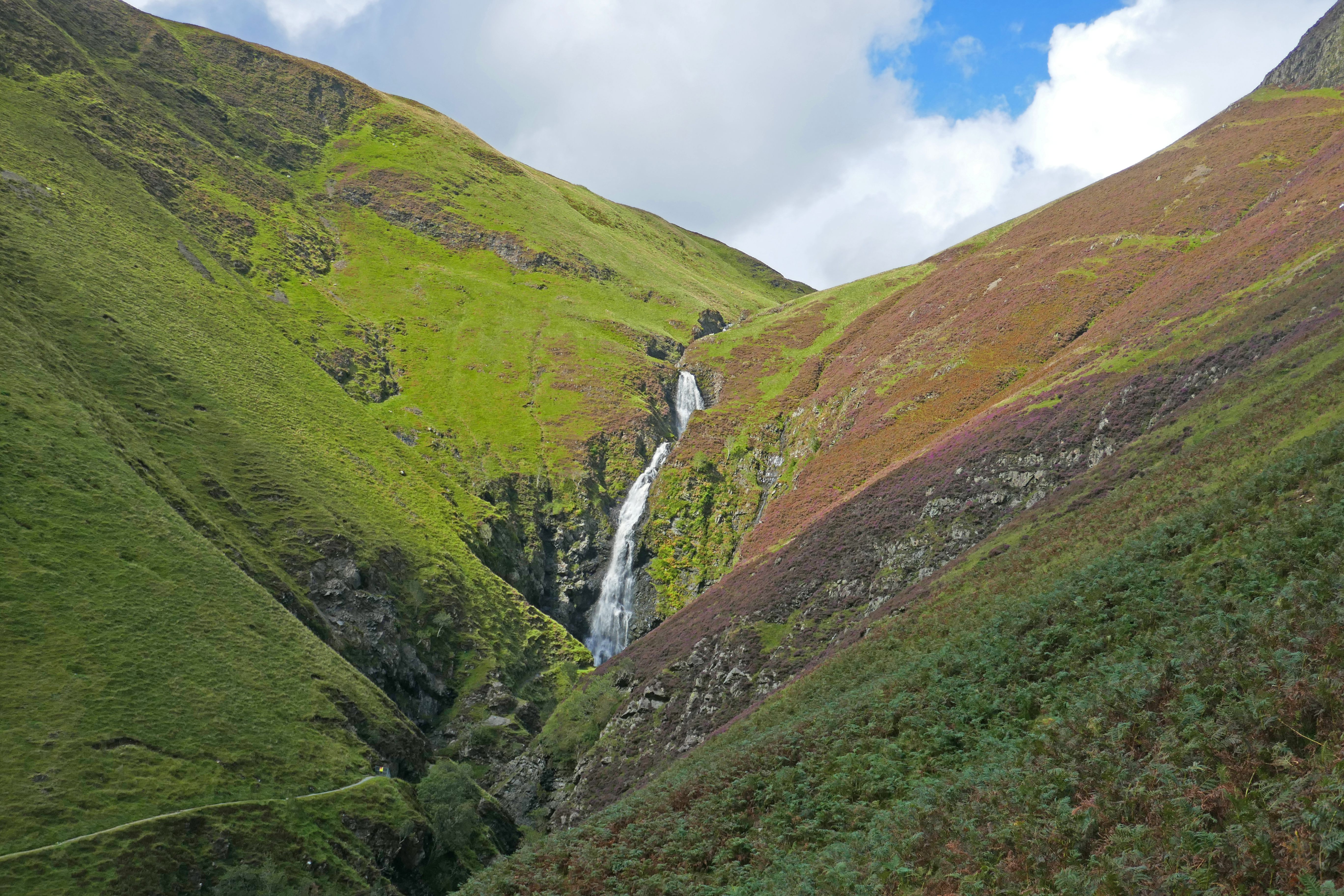
Grey Mare’s Tail, a waterfall with a 60m drop, is about 20 minutes drive from Moffat. There are two National Trust car parks at the foot of the cascade and from there you can take the short walk to view the falls. We wanted to do more and climbed the steep well-made path above the series of waterfalls. Eventually, the path levels out and meanders through a hummocky landscape to the hidden shore of Loch Skeen, a mountain loch surrounded by crags.
This trip had been planned to follow the River Tweed and we picked it up on the road to Peebles, stopping at Dawyck Botanic Gardens, one of four botanic gardens in Scotland, including Edinburgh. The woodland garden of Dwyck climbs the hillside from the River Tweed floodplain. The landscaping has created a network of sinuous paths among the trees and along the stream, dotted with sculptures and information boards about plant collectors and notable trees. It is a joyful place to visit and worked well on a sunshine and showery day; we could run back to the cafe when dark clouds loomed or shelter under a huge redwood. In September the autumn crocuses were flamboyant and there were early signs of leaves turning.
Peebles & Innerleithen
We had planned this trip after stopping in Peebles briefly last year. It seemed such a lovely small town we wanted to get to know it better. The next morning we parked by the river and walked into the town, filling our bags with goodies, including Selkirk Bannock, from the bakery, browsing the charity shops and enjoying coffee in one of the many cafes.
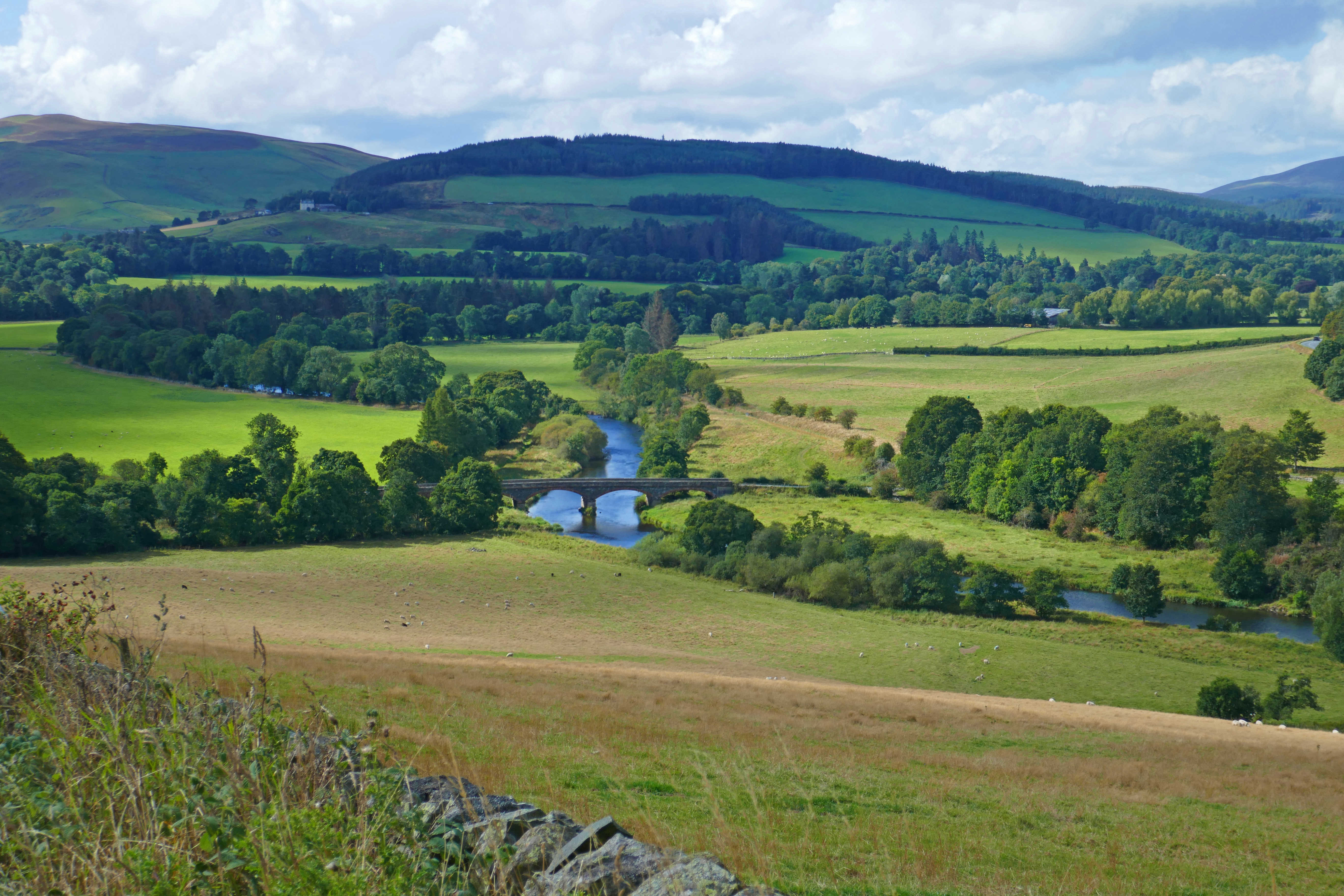
Our circular walk from Peebles along the River Tweed was only six kilometres long but packed in so much, including natters with friendly locals! From the riverside path we spotted a kingfisher and dippers and had views of Neidpath Castle. On the opposite bank we joined centuries of walkers crossing the hump-backed Old Manor Bridge and climbed uphill, stopping to enjoy the views over the Tweed valley. Our descent through the shady lushness of South Park Wood eventually took us to the old railwayline and back to Peebles.
A little further downstream is the small town of Innerleithen, a spa town and former woollen mill centre. We explored the lovely town and its history and were surprised to meet a local with a grumpy dislike of Peebles! Climbing Pirn Hill [apparently known locally as Windy Knowe], we found a set of stone cairns topped with carved tablets on the Iron Age hillfort site. The view over the town and the Tweed valley is well worth the exertion and I can confirm, it is windy!
The garden at St Ronan’s Well
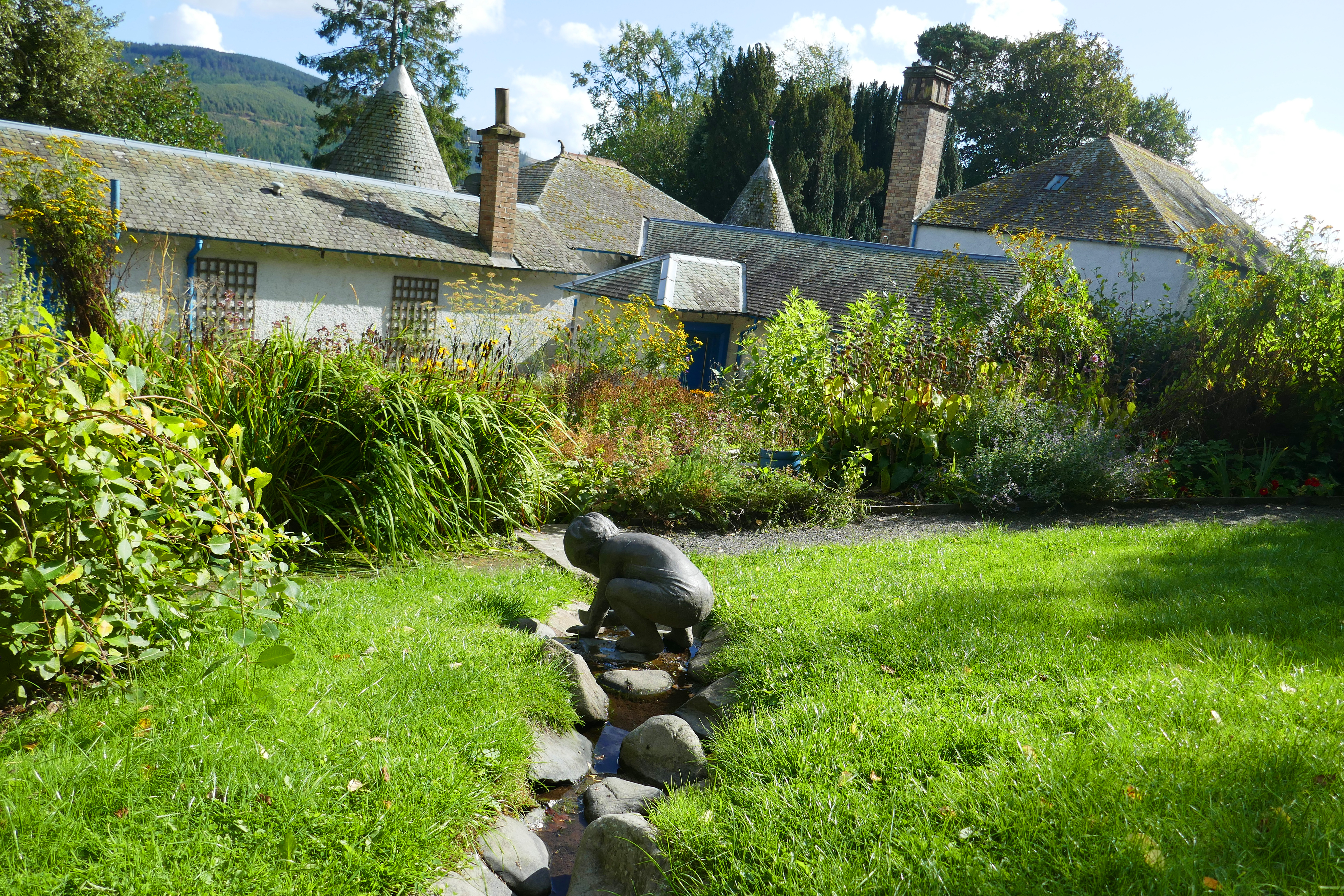
Back in the warmth of the valley, we made our way to Innerleithen’s St Ronan’s Wells. The elegant and colourful 19th century pavillion is unmissable on the hillside. In the past two Scottish writers provided advertising for the health-giving properties of the local springs. Robert Burns wrote about the spa during his 18th century travels and Walter Scott’s novel St Ronan’s Well in 1823 encouraged literary tourism. Behind the pavillion we found an idyllic community garden. Full of flowers and herbs, insects and butterflies, with a trickling spring running through it, the garden has winding paths, seating areas and the love that created it seeps from every leaf.
Selkirk
Selkirk is a hilly town that sits on Ettrick Water, a tributary of the Tweed. It is a thigh busting walk from the campsite at the leisure centre to the town, but worth it for the good and ethically-sourced coffee from Three Hills Coffee on the main street.
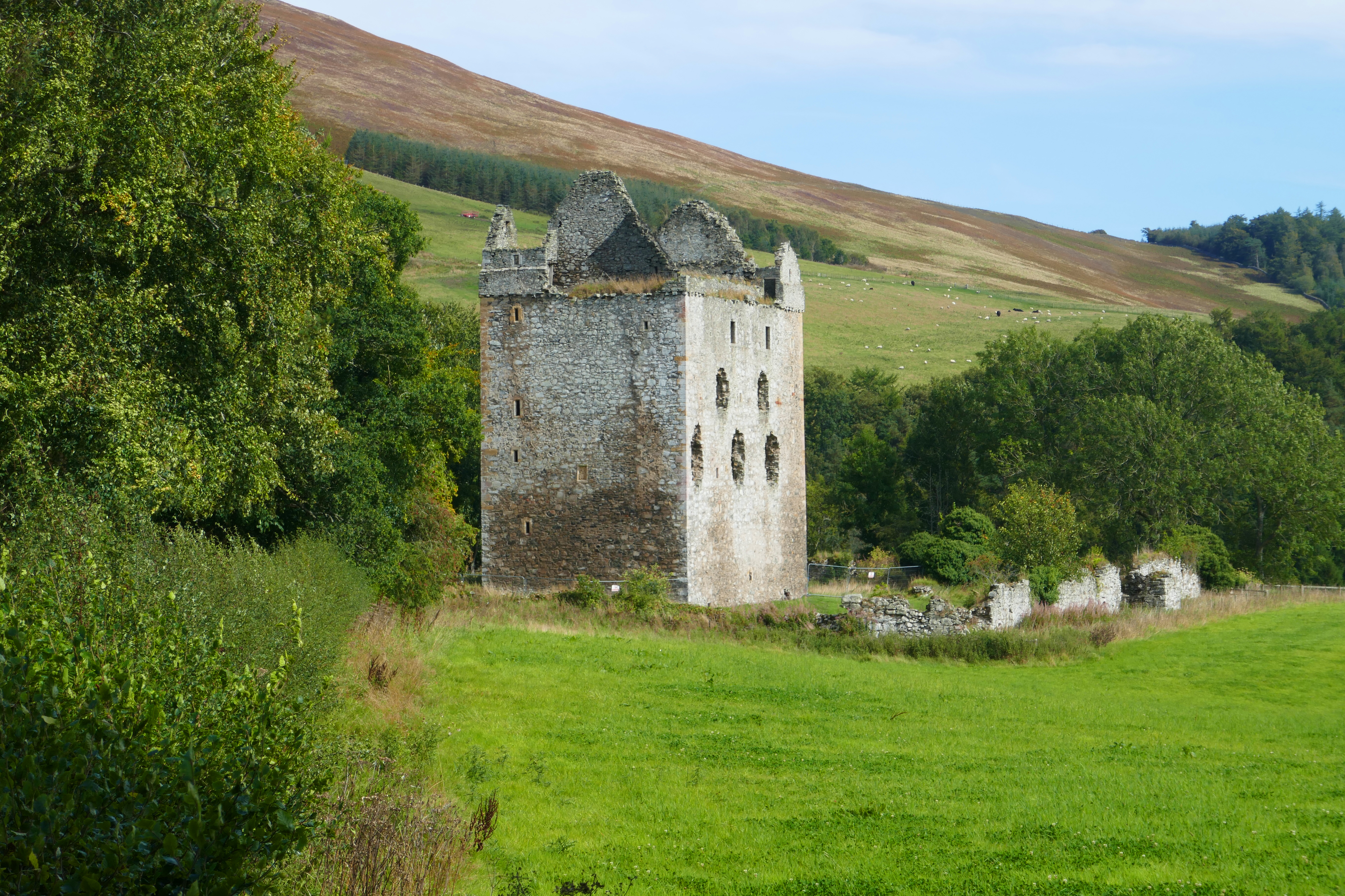
The sun was shining and we planned to complete the Three Bretheren Walk, a classic hike near Selkirk. However, the small car park was packed by the time we arrived. Checking our trusty Walk Highlands app we drove the short distance to Bowhill Estate. The Duchess’s Drive route on the Bowhill Estate was designed for showing off the land to visitors, ascending through woodland to the open moorland. Although on good tracks, the walk was more exhausting than we expected but full of variety and good views across the lumpy Borders countryside. We returned to the car park by the ruins of Newark Tower, whose white stones were bleached by the sun.
Newark Tower at Bowhill
Melrose
We picked up the River Tweed again at Abbotsford, the home of the writer Walter Scott. The large rambling house looks interesting to visit but we concentrated on walking up to Cauldshiels Loch, returning along the bank of the secluded Faldonside Loch before completing our circuit on a woodland path along the River Tweed.
In Melrose we visited the abbey, although due to works being carried out we could only walk around the outside, admiring the red sandstone that blushes when caught by the evening sun. Nearby are two National Trust gardens, Harmony House and Priorwood and, keeping an eye on the weather as showers were heading our way, we sauntered through these two walled gardens. They were both well-stocked and interesting, still full of colour and scents even in mid-September. Priorwood Garden also has an orchard and a stall selling produce from the gardens.
We had planned to spend some time at Berwick-on-Tweed, completing our trip along the River Tweed. However, stuff at home unexpectedly got in the way and Melrose was as far as we got. Until next time!
Faldonside Loch near Abbotsford through the trees
Walking details
Unless otherwise noted, the walks can be found on the Walk Highlands website and app.
The full Devil’s Beef Tub circuit from Moffat is 22.5 km with 521m of ascent. We used a taxi [Moffat Taxis] to get us to the Devil’s Beef Tub viewpoint on the A701 [£10] and walked along the ridge and back to Moffat, reducing the exertion to approximately 15.25 km of walking and only 230m of ascent while retaining lots of interest.
Grey Mare’s Tail and Loch Skeen in the Moffat hills, this 4.5 km walk with 278m of ascent climbs past the series of waterfalls and on to Loch Skeen that is overlooked by craggy hills.
Neidpath Castle and the Tweed walk from Peebles is 6.25 km long with just 89m of ascent. Kingsmeadows car park in Peebles is a large car park and has motorhome spaces.
Pirn Hill Fort Trail in Innerleithen is 2.5 km long with 79m of ascent. Parking is available in a roadside parking area near the entrance to the paths.
The Duchess’s Drive, Bowhill is 11.25 km and 339m of ascent on easy to follow tracks and lanes. There is good parking on the Bowhill Estate for a small charge. The walk is through woodland and across moorland and on lanes by Newark Castle.
Abbotsford has a leaflet of walks you can download, with routes from 2 to 10 km. The Cauldshiels Loch walk is 6.5 km long and takes about two hours from the car park. It was mostly easy to follow, although we did resort to our OS maps as we descended to the River Tweed.
Tweedside Caravan Park at Innerleithen – this site on the edge of Innerleithen has a small touring area, surrounded by static caravans.
Selkirk Victoria Campsite – on the edge of Selkirk, the pitches are marked out on the tarmac car park at the community-run leisure centre. Campers have keycode access to move the height barrier and access to the three shower rooms and a wash-up sink.
Lilliardsedge Holiday Park – in the countryside between St Boswells and Jedburgh, this is a large site with many statics and a tidy touring area of hardstanding pitches. The site has a restaurant and golf course.
We had been pottering around France for over a month and crispy baguettes, pungent cheeses and fruity plonk had become our new normal. Our French, while decades away from word-perfect, improved daily and we were firmly in the campervan relaxation groove. But southwest France was sweltering and heading north to escape the heat was the only sensible thing to do. Beyond meeting friends in a couple of weeks time in Batz-sur-Mer on the rugged coast north of the Loire estuary we had no plan. Sitting by the River Vienne in Confolens we opened the road map and turned the pages, tracing possibilities with suntanned fingers.
Confolens
A rough route north hatched we climbed on our bikes to explore from our riverside campsite. Negotiating the narrow streets of Confolens we found medieval timber-framed houses, views over its red roofs from a stone gateway and traces of the walls. We crossed the arched 13th century bridge and pedalled along the Vienne to Saint-Germain-de-Confolens where a ruined castle perches above the picturesque village. After climbing up to the castle for the panoramic view we chose a shady wobbly table at the hip riverside bar and toasted the sunshine with a heady glass of Pineau.
Confolens
The Vendée, on France’s Atlantic coast, is loved for its miles of sandy beaches with a rolling green hinterland. It stretches from almost the River Loire in the north to the edges of the Marais Poitevin in the south and the latter was our first stop. The Magné campsite near Niort, on the edge of the Marais Poitevin, has spacious pitches, good facilities and was almost perfect. Morning bread was the only thing missing but an immaculate patisserie was just a few minutes cycle ride away. My pre-breakfast trips to the bakery were effortless but also agonising as it was jam-packed with temptation and I drooled over the lavish display of cakes every morning.
Cycling Around Coulon
The Marais Poitevin is a verdant arcadia, criss-crossed with waterways that divide forestry and meadows. With tracks and lanes joining villages of traditional cottages it offers blissful pedalling and, for less than the cost of a pastry, you can buy a useful map showing waymarked cycling circuits. The path alongside the canalised Sèvre Niortaise from Magné to Coulon was a good introduction to the natural treasurers of the area. Reaching tourist-welcoming Coulon’s whitewashed riverside buildings with rustic shutters we wound through the streets to the main square and people watched over a coffee.
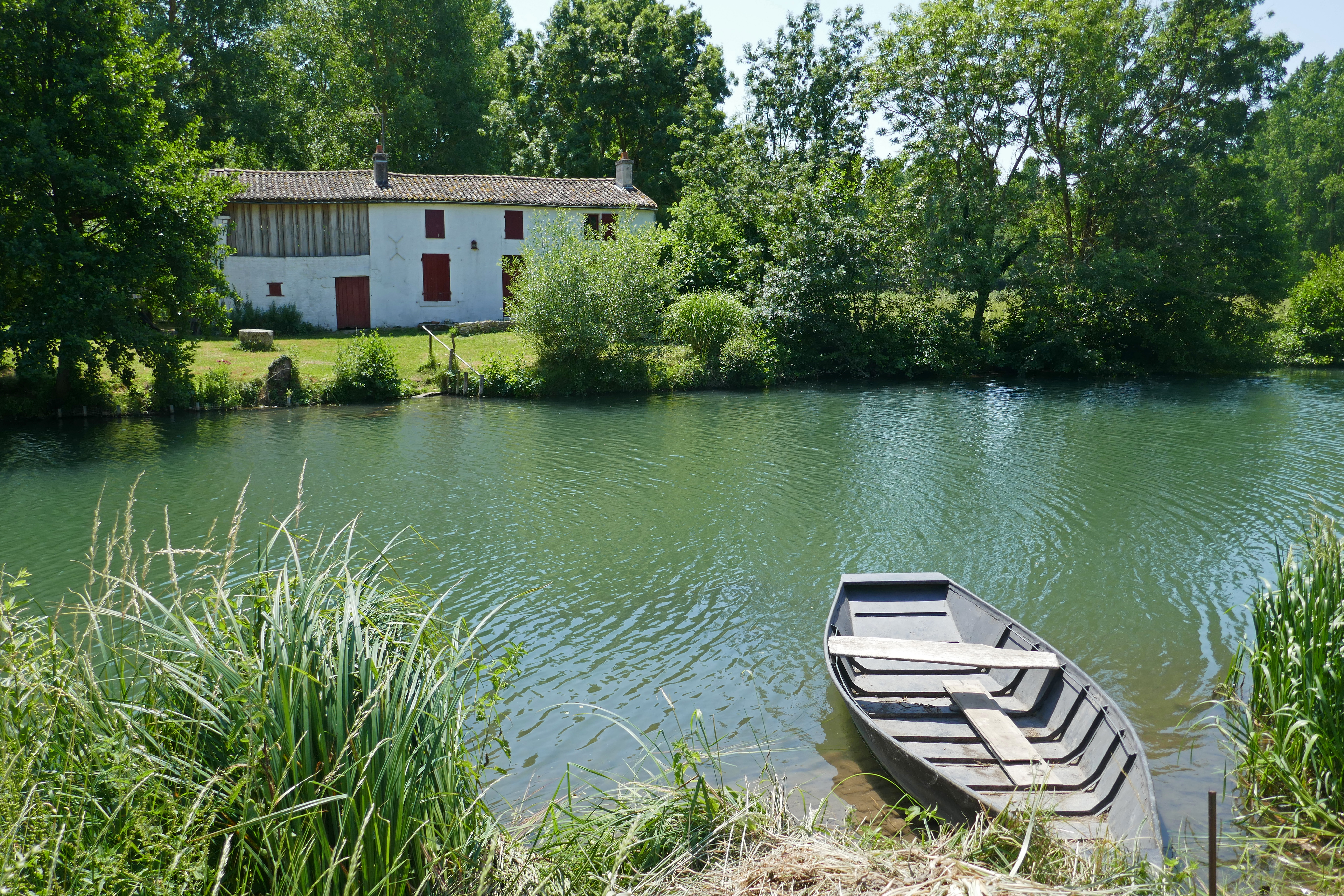
From Coulon we snaked along lanes and tracks through countryside where storks moved stealthily across mown fields and kites wheeled behind combine harvesters. Between Coulon and Irleau is a raft of waterways only accessible via tracks and dinky arched bridges. This landscape has been managed for agriculture for centuries and the aquatic labyrinth of conches, or narrow channels, only accessible by kayak or a local flat-bottomed boat, drains into the Sèvre Niortaise. I had to stop myself photographing every view along a stream luxuriantly overhung with trees or a boat tethered to the bank alongside an isolated cottage, as each seemed better than the last. We cycled on dazzling white tracks between meadows and unhurriedly watched a herd of drowsy cows. Cattle egrets prowled around their soft bulky bodies, occasionally stopping and appearing to look deep into the vast depths of a cow’s eye.
An Unexpected Hill
I had expected a fen-like flat landscape but somehow we always found a hill. North of Coulon on the Number Seven Circuit the green waymarkers were camouflaged among the green roadside vegetation and we were soon on the wrong lane. Backtracking, we honed our detection skills at junctions as we hunted among bushes for the signs. Climbing a gravel track in the heavy heat of the afternoon, golden wheat rippled in a breath of wind as we sweated by like slow versions of hill-climbing Tour de France cyclists. Stopping at the summit we could see across the sweep of the Marais Poitevin to the tower blocks of Niort. Descending to the Sèvre Niortaise we envied the young people frolicking in the cool water after school and watched a working boat negotiating a lock before tackling the pleasant stretch of towpath back to Magné’s handsome lifting bridge and attractive tree-lined square overlooked by a squat stone church.
On Sunday morning Magné’s square bustled with a lively second-hand clothes market and we joined the shoppers looking for vintage bargains. Later that day in Coulon we ate our picnic on a shady bench by the river, next to the easels of a group of artists. While the painters enjoyed their long and convivial French lunch we discreetly admired their artistic impressions of the view.
Whatever Floats Your Boat
On our last day in the Marais Poitevin we put together our own greatest hits, joining up our favourite paths in an ultimate cycle ride. Our first stop was for coffee in La Garette, a wall-to-wall attractive village where houses with sun-bleached shutters jumble together along the main street. Our genial waiter wanted to practice his English and we gamely struggled to identify the words among his strong accent, but were grateful when he was distracted by a couple arriving on a flat-bottomed boat with a guide wearing a hat festooned with flowers.
By the afternoon the heat was smothering as we hugged the shady paths lined with pollarded trees and fragrant flowers, finding any excuse to rest. At La Sotterie we crossed the Sèvre Niortaise and followed it back to Coulon where groups of school children in matching baseball hats were chattering as they climbed into boats. I noticed the flower-hat guide paddling sedately by, not even breaking a sweat.
Once the Marais Poitevin has seduced you, you won’t want to leave and will certainly return, or maybe that is just me!
We stayed at Camping Le Martin Pecheur. This is a small French basic site, just a short distance from the town.
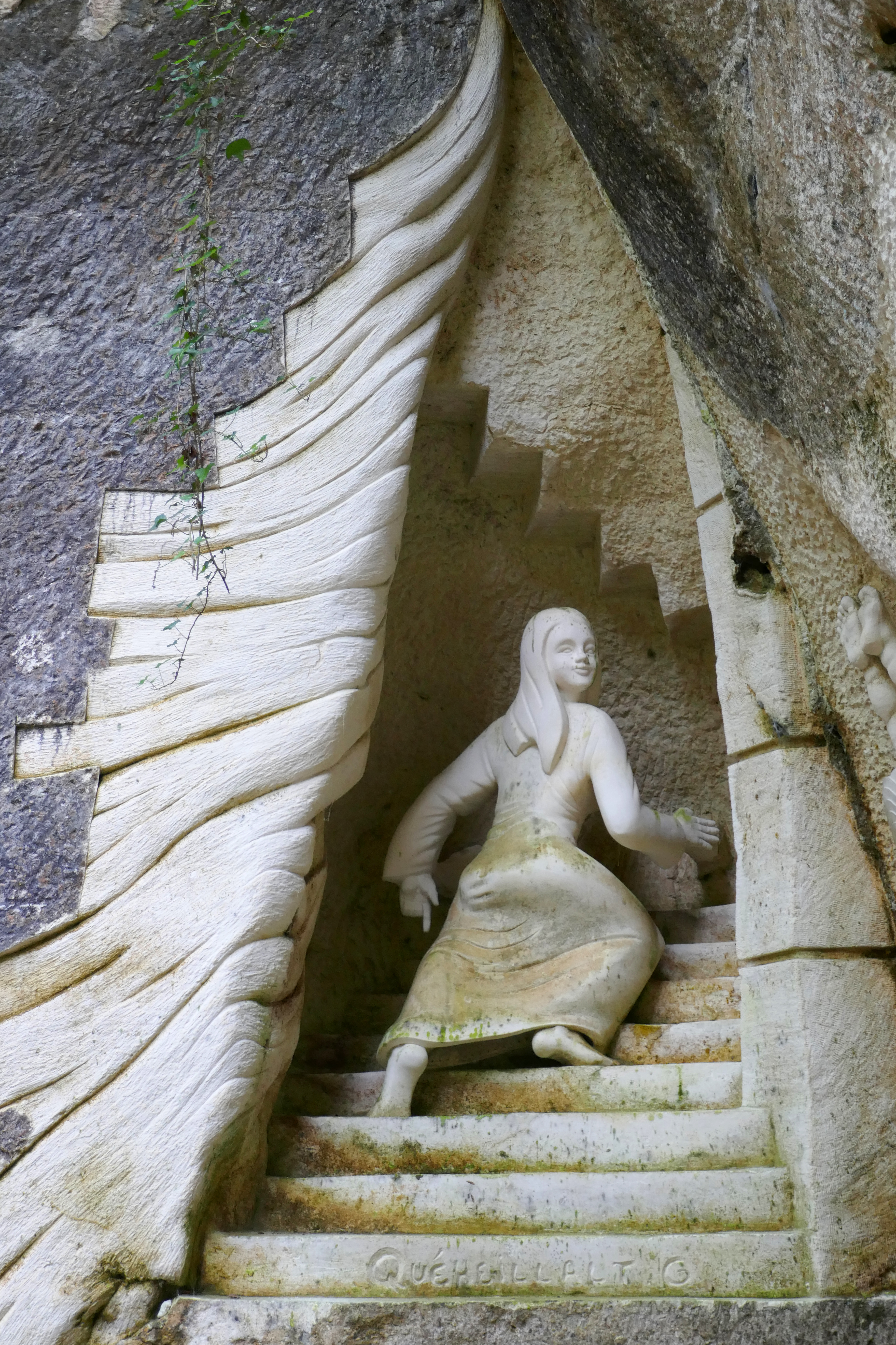
Driving from Îlé de Ré and Cognac we pulled into Les Lapidiales, a sculpture park in a former quarry. Still being added to, if you are lucky you might see one of the artists at work as they chisel imaginative and fantastical images from rock faces and boulders. We walked among figures, massive stone heads that peered from overhangs and hidden mythical creatures. The newer carvings were brilliant white and the greenery on the older sculptures mirrored the surrounding forest. Many of the works made an impact but the barefoot woman boldly looking back as she climbs a staircase into the rock particularily spoke to me, as the woman’s eyes seemed to say, ‘Follow me!’
A bewitching sculpture at Les Lapidiales
Cognac: City of Taste
Like many people, for us Cognac conjures up the world-famous spirit and exploring the city it was clear it leans on this beverage’s reputation considerably. There is, however, more to Cognac and we were here because La Flow Vélo, a 290 kilometres (180 miles) cycle route, follows the River Charente through Cognac.
Leaving our bikes near the riverside Cognac warehouses we walked through the city gates and climbed streets of polished cobbles that gleamed in the sunshine. In the city centre elegant squares and handsome houses festooned with sweet-scented roses oozed taste and prosperity. We had coffee in the square and bought fresh bread and cheese for a picnic lunch by the duck pond in the central park.
Walking among the Cognac cellars in the afternoon heat we spotted the familiar names of Hennessy and Martell and I was soon intoxicated by the alcohol-rich air. Tempted into a bar we sipped elegant glasses of Pineau des Charentes Blanc, a heady aperitif of white wine and Cognac that immediately became a firm favourite.
Cobbled streets of Cognac
Jarnac and a Cognac Tour
We planned to stay a few days in Cognac to make the most of the cycling but that evening the campsite suffered a plumbing incident that flooded the shower block and there was no hot water! Undeterred, we moved our campervan the next morning just half-an-hour upstream to Jarnac, still on La Flow Vélo. In France, no one bats a Gallic eyelid when you arrive at a campsite at ten in the morning and we were soon bowling along the Charente on two wheels.
The mainly traffic-free riverside paths and tracks through woodland, meadows and vineyards were blissful and easy cycling. We sat on a bench looking over the clear water of the Charente having lunch while red kites soared overhead, a deer peaked through the trees and swallows skimmed over the water hunting insects as a kingfisher streaked by.
From the leafy edge-of-town campsite we could stroll into Jarnac across a breathtakingly picturesque quay with locks and watermills, or potter around the adjacent island park and nature reserve alive with dragonflies. In the small shopping area we bought delicious French pastries and scrumptious handmade chocolates shaped like cobble stones.
Among the streets of typical Charente houses was the family home of the station master whose clever fifth child, François Mitterrand, was French President from 1981 until 1995. The pinacle of Jarnac’s elegance is the extravagant riverside Maison Courvoisier built in the 19th century Parisian style. There are a number of Cognac houses in Jarnac but Courvoisier has centre stage and an English tour the next day was a fitting finale to our time in this region.
Cycling before drinking Cognac was sensible and the next morning we pedalled southeast along La Flow Vélo to Châteauneuf-sur-Charente. The Charente sparkled in the sunshine and the cycling was almost effortless as we followed tracks connecting rustic farmhouses. A short climb raised the heart rate and swung us away from the river to Bassac, a charming village of stone houses and a former Benedictine monastery.
Back in Jarnac, our Courvoisier guide spoke excellent English, impressed us with her knowledge of British novels and shared our passion for the Lake District. She led us into shadowy rooms stacked with barrels where I savoured the fiery aromas of maturing Cognac, each cask chalked with its pedigree. Courvoisier’s logo is a silhouette of Napoleon Bonaparte and the story is that Napoleon took several barrels of Courvoisier to his exile on Saint Helena.
As our guide described the soils and the Cognac year, we learnt about the local grapes and the complex blending process to produce consistent quality. The tour finishes with a tasting of three different Cognacs, beginning with the VS (very special) Cognac served in a long cocktail. The neat Cognacs were poured reverently into tulip-shaped glasses to intensify the bouquet. After the VSOP (very special old pale) we finished with the XO (extra old) which came with a square of dark chocolate and had an intense rich flavour of earthy dried fruits.
We left with new respect for Cognac, the drink and the area, and a new favourite aperitif in pineau des Charentes blanc.
We stayed at:
Camping de Cognac – a great campsite (when they don’t have a water problem) not far from the town centre.
Camping L’ile Madame – a green campsite only 10 minutes walk from the town and quiet out of season.
Both were offering discounts with the ACSI card when we visited.