ÃŽle de Ré: Perfect Camping & Cycling

Cycling towards a storm on the Île de Ré

Exploring the Île de Ré

The ÃŽle de Ré, on France’s Atlantic coast, had been on my must-visit list for as long as we’ve had a campervan. Photographs on social media of the network of traffic-free cycle lanes on a low-lying and beautiful island tempted me, so my expectations were high as we crossed the elegant arched bridge that joins the island to the mainland at La Rochelle.  At just 30 kilometres long, rarely more than a few kilometres wide and almost flat, it didn’t take us long to reach our chosen campsite on the ÃŽle de Ré and already we had spotted throngs of cyclists.   I felt as if the toll bridge had sneaked in a trip through a space-time portal and we had been swept away to the Netherlands!

Based near central La Couarde-sur-Mer, we quickly settled on our hedged pitch and exchanged smiling nods with our Belgian neighbours. We studied the cycling map we had been given by the polite receptionist and my fingers excitedly followed cycle paths heading to every point of the compass.

Saint-Martin-de-Ré

Our first excursion took a path that hugged the coast to the town of Saint-Martin-de-Ré.  The tailwind propelled us like flying machines but highlighted the only downside to cycling on the Île de Ré; the breeze sweeps off the Atlantic and a headwind is hard to avoid. Those social media posts never mentioned the daily battle with the wind!

Crossing the moat into Saint-Martin-de-Ré we admired the herd of Poitou donkeys.  These special donkeys have a shaggy coat that takes the uncombed look to the extreme and they are adorable. Entering through the monumental Porte des Campani we found ourselves inside a fortified enclosure, designed to protect the residents from siege.  Narrow cobbled streets lined with handsome ivory-coloured houses, each trimmed with eye-catching shutters, led to the harbour.  Roses arched over doorways and self-seeded flowers poked through pavements; it is literally wall-to-wall attractive.

Securing our bikes we drank strong French coffee at a pavement café overlooking the boats while chatting to an English couple in search of an oyster-focussed lunch, a local speciality.  We pointed them in the direction we had come as we had passed several oyster bars.  The extent of the harbour fortifications suggested the Île de Ré was once strategically important, but it was the aerial view when we climbed the steep narrow steps to the top of the Saint-Martin bell tower that laid out the town’s defences most clearly. I took photographs of the town’s red roofs that contrasted prettily with the deep-blue sea.  Carefully descending I flinched as the bells loudly boomed the hour. 

Salty excusions

Over the coming days, the winding paths though the ÃŽle de Ré’s salt marshes unrolled before my wheels revealing new panoramas.  We pedalled around mudflats that changed with the ebb and flow of the sea; shallow pools that are managed to produce salt from evaporation and marshland packed with a disarray of colourful wild flowers.  There were so many excuses to stop and take in the natural beauty our progress was never fast!  At salt producers’ stalls we propped up our bikes and dithered over which salt to buy before popping coins in the honesty box.  We halted often to watch graceful avocets and long-legged black-winged stilts on the pools and admire the swifts that performed acrobatics overhead.  One afternoon a gecko crossed our path, scurrying into the grass and a tiny rabbit huddled as cyclists raced by.

Cyclists need food and drink and these were another excuse to rest.  A café in Ars-en-Ré provided good coffee and a bonus was the treasure trove of memorabilia inside, including a collection of oars arranged in the shape of a fan on the ceiling.  Stumbling upon weekly markets we meandered through the colourful and tastefully arranged stalls that sold everything from bread to soap and fresh vegetables to sunhats.

An area of forested dunes that sheltered us from the usual breeze was a perfect picnic spot.  While we ate I took deep breaths to get the full benefit of the sharp woody scent of the pine trees.  Beyond the woodland the tall Phare (lighthouse) des Baleines became visible.  This turned out to be a tourist hotspot with rows of busy restaurants and shops and we bought creamy pistachio ice-cream that was exquisite sustenance for two hot cyclists.

Picturesque villages

Climbing out of the ‘van to get our breakfast bread I noticed the calm; the usual breeze was taking a day off.  After a cycle trip along a lane lined with plush white bungalows shaded under umbrella pines to the supermarket and a long French-style lunch, we set off for a short cycle ride to Loix.  From the salt marshes, we crossed a narrow bridge to Loix’s attractive and sheltered port.  If we had noticed the looming dark clouds we would have stayed in this safe haven.  As it was we were cycling along an exposed stretch of coastline when a squall rushed across like a wet puppy, drenching us before we could reach the inadequate shelter of a hedge until the sun returned.

The scattered villages of the ÃŽle de Ré punctuated our cycling trips.  The island is busy in high season but in May the winding narrow village streets, tightly packed with impossibly lovely white cottages trimmed with shutters painted ice-blue or sage, are sleepy backwaters.  The labyrinth of streets was often confusing but by aiming for the church spire we usually found a square with a café, grocery shop and a stylish homeware establishment.  The distinctive steeple in Ars-en-Ré is visible for some distance.  It is painted black and white and served as a landmark for sailors before the lighthouse was built.

 Île de Ré is an island of two halves.  The salt pans dominate the north and west and in the southeast forest and agriculture separate the villages.  Between Le Bois-Plage-en-Ré and Sainte-Marie-de-Ré we cycled around rows of potatoes, dodging the sprinklers.  There were grapevines and meadows dotted with bright-red poppies that led to a forest trail deep with pine needles that crossed the island to the seaside at La Flotte.

In La Flotte we sat on the delightful promenade lined with benches overlooking an azure sea awash with boats.  The village was buzzing with lunchtime diners as we wandered through. We continued to a peaceful ruined abbey, where the former cloisters have been transformed into a pretty garden.

 ÃŽle de Ré had certainly not disappointed as a place to explore all that is fabulous about France by bicycle. If you don’t have your own, there are plenty of places to hire bikes on the island, including at our excellent campsite, La Tour des Prises.

Pretty streets in Saint-Martin-de-Ré

Light and Shadow in Wharfedale

Grassington is always a buzzing village, but on our last visit the throng were in high spirits. A film crew were in town and the usual paved streets were covered in earth and shop windows had drab displays that lacked elegance and light. We learnt they were filming the latest All Creatures Great and Small, the cosy 1930s veterinary TV drama and time in Wharfedale was being wound back almost 100 years.

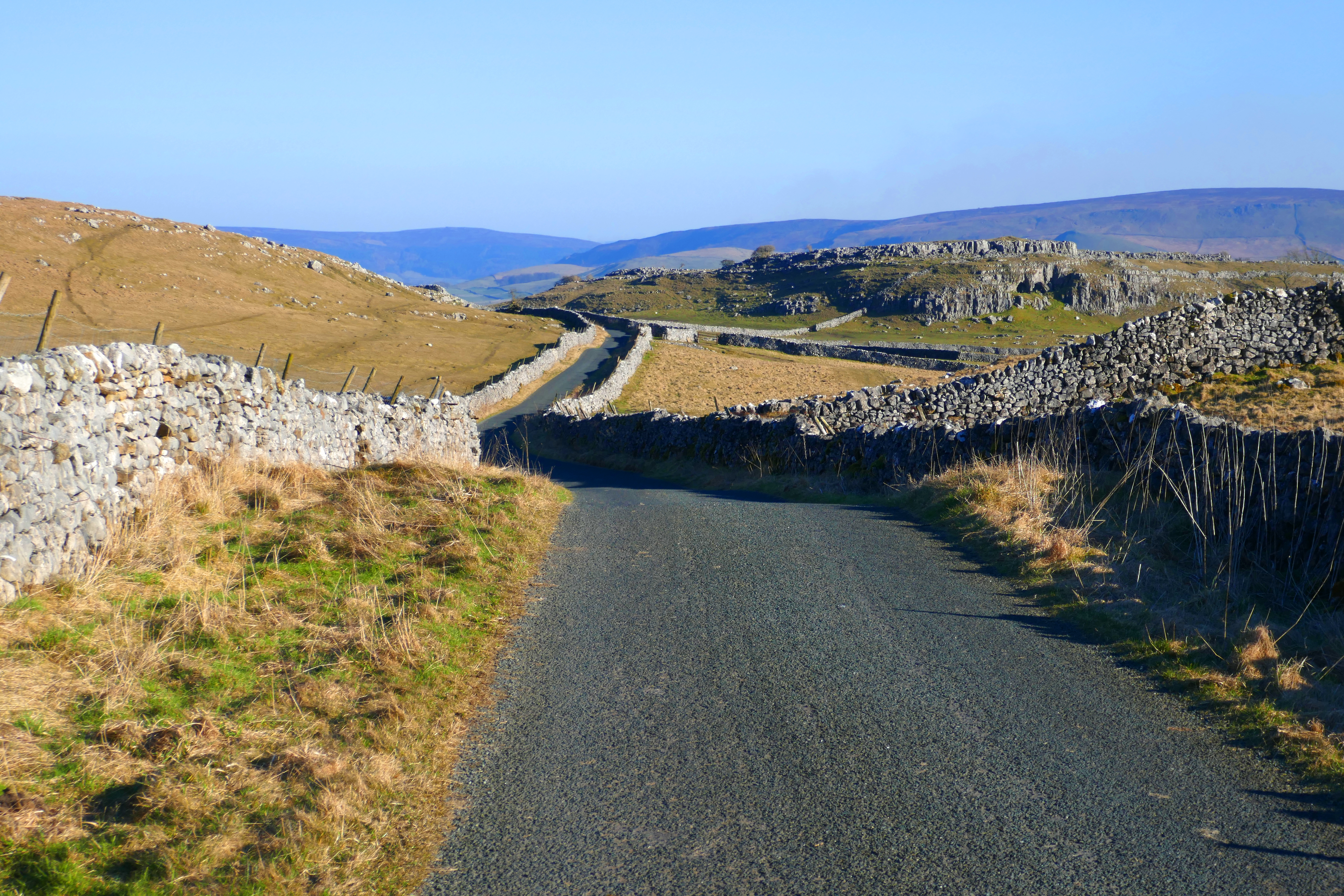
We stayed almost in the present, browsing the second-hand book shelves in the library for a couple of bargains and grabbing a coffee in a cafe with a 21st century coffee machine before climbing the hill out of the pretty, but hectic, village. We were focussed on completing a favourite walk that has open views over Wharfedale, a craggy hill, a scramble down [or up when we walk in the opposite direction] a dry gorge and numerous stiles over dry-stone walls.

We had started at the Caravan and Motorhome Club Wharfedale site, which is about a 40 minute walk from Grassington. We stay on this campsite regularly and it was an obvious place to use the free overnight voucher the club had sent to members.

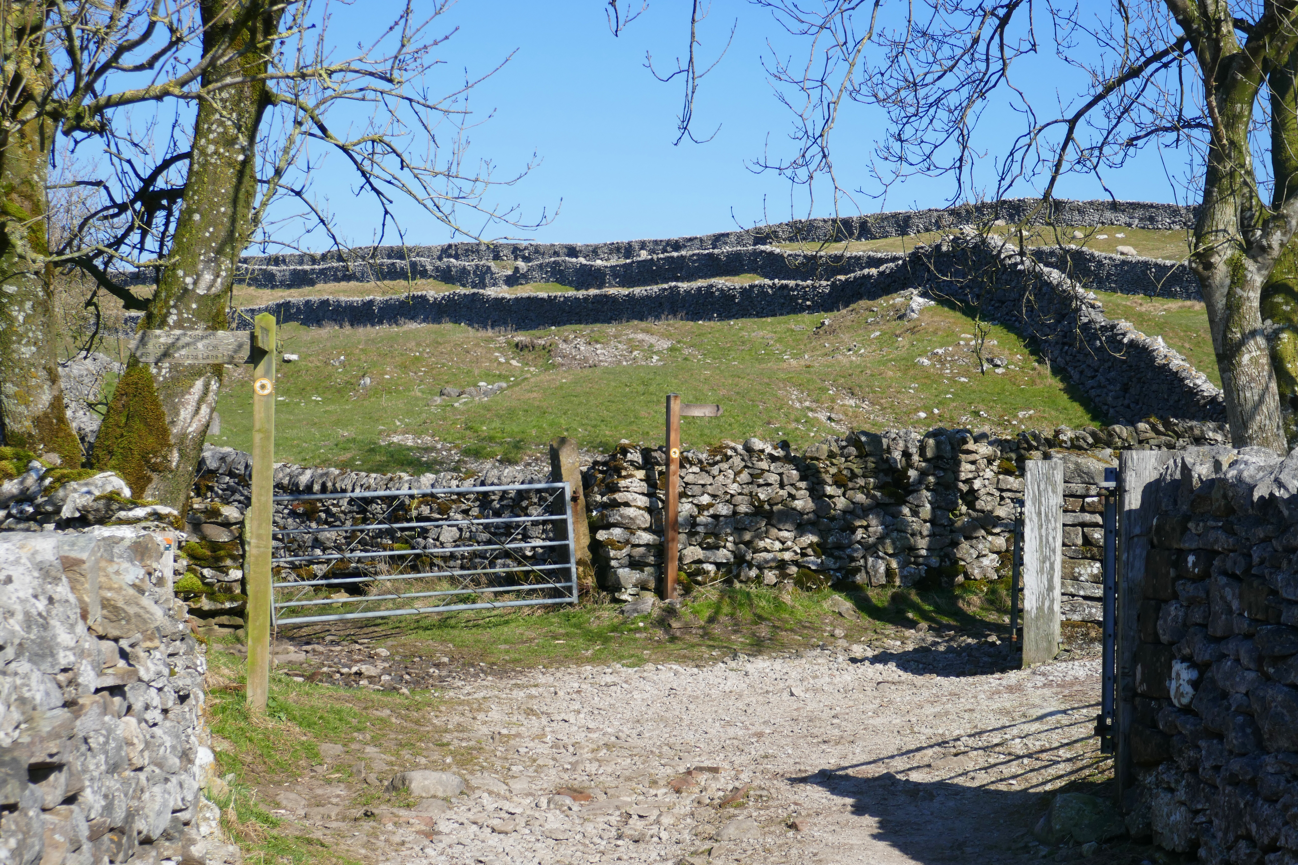
From Grassington’s narrow streets we picked up the Dales Way [an 80-mile long distance footpath from Ilkley to the Lake District] on a track that soon opens out to grassy paths across the open moorland. It was a bright spring day and curlew were flying across the moor, their exuberant bubbling call making me smile and evoking memories of previous spring walking days.

The light was so bright it dazzled and the sun had that remembered warmth that gets lost in the dark of winter. A stiff breeze searched out gaps in our clothing, making sure we didn’t get sweaty and another walker wearing shorts had cold-red knees! Below us the River Wharfe’s green flat valley floor was dotted with stone barns.

Leaving the edge of the dale, the moorland is almost treeless, only occasional bushes and trees, still unclothed and baring their winter branches, have managed to avoid the sheep and achieve stunted growth from a gap in a limestone crag. The blue sky is cloudless and vibrant but the startlingly bright March sun washed out any colour in the grasses and rushes. The air tasted fresh and sharp and I breathed in deeply, trying to store the memory of it.

Skirting around the top of Conistone Dib, a dry limestone valley, we continued to Conistone Pie, a flat-topped limestone outcrop that someone once thought was shaped like a pie. In March the sun is still low and on the northern edges of the outcrop the rock created shadows but the south-westerly wind blustered around the sunny side. We circled the outcrop until we found a just-right spot for our lunch and sat with a view over Yorkshire.

After eating, we doubled back to descend Conistone Dib. This dry limestone valley was most likely formed by glacial meltwaters after the last ice age. Whenever we walk here I stop and shut my eyes, imagining the lively stream that once flowed over the crests of the now-dry waterfalls and became tumbling rapids. I can hear the pulse of the clear water as it falls over rocks. After a grassy and less steep section, Conistone Dib narrows and it is even easier to imagine the long-gone waterfall funnelling into the narrow channel, eroding a plunge pool before carving a deep twisting gorge through the limestone. The sun glanced over the gorge and we were walking in shadowy blue depths. Then suddenly, we emerge from Conistone Nib and are once again bathed in bright sunshine as we walk through the village and over the River Wharfe.

We stopped for drinks at the cafe by the fishing lakes and shared a cake. We were looking across to Kilnsey Crag, the limestone overhang that is another glacial remnant. Our final climb of the day was up the track to Kilnsey Moor. The grassy path that cuts across to Malham Moor always has lapwings in the spring and it didn’t disappoint. We followed the quiet lane back to the campsite enjoying the golden evening light after covering about 19km over around eight hours of perfect leisurely walking.

Blair Drummond Caravan Park, Scotland: Walks & Things to do

The short read – This is a tidy and peaceful campsite near Stirling and sitting in woodland just south of the village of Doune. With local walks and a farm shop and a castle nearby. it is perfect for a few days away in the ‘van.

We like the campsite and often use it as a one-night stop on the way north or south. Last time we decided to stay longer and explore the area.

The Campsite

Most of the pitches at Blair Drummond are within a sheltered walled garden. This was particularly welcome on our last visit as a gale blew across Scotland from the west. There are pitches around the outside of the walled garden too, but we have never tried any of these as we like the feel of the walled garden. The pitches are level and the hardstanding is surrounded by grass with tarmac roads around the site.

Everytime we have visited, the reception staff have been friendly, welcoming and helpful. They will give you a campsite leaflet with ideas for things to do and information about two walks, a long and short walk. It was this leaflet that inspired us to stay longer. Reception also has a small shop for basics and it is only a short way to a farm shop [see below].

The site has one facilities block. This is modern inside and kept clean. It is often wintery weather when we visit and we appreciate that the building is kept warm and the showers are good.

Things to do

The Short Walk – The campsite’s short walk through woodland will take you on winding paths through a woodland garden and eventually to the Smiddy Farm Shop, where you can grab a quick brew or lunch as well as buy good food. On our last visit we spent our first afternoon spotting spring flowers on this delightful walk.  It was a sunny but blustery day and daffodils and primroses were emerging from the mossy ground.  The route meandered among trees, up to an obelisk and around a cemetery.

Doune – This longer walk of around 9km is fairly level and easy. If you prefer to drive, there is a handy Park and Stride car park on the edge of Doune on the A84. The walk to Doune is mostly on tracks through the estate and takes you by Quarry Loch and the River Teith, with views of the castle. In the village there are a few shops and an information and heritage centre and the activities below. A stroll around the village might take you around the castle and over a stunning modern wooden bridge.

We are generally more informal teashop than hotel people but The Woodside Hotel advertised itself as unpretentious so we gave it a go.  Even two scruffy campers were welcomed with a smile and this turned out to be a comfy place for coffee and scones.

Doune Ponds Nature Reserve, flooded gravel pits surrounded by woodland can be accessed from the Park and Stride car park, making it perfect for a stop and leg stretch on a longer journey.  The reserve is taken care of by volunteers and there is a network of paths as well as benches for picnics and wildlife watching. Cross the A84 from the same car park and you can walk through woodland to the River Teith, opposite the distillery.

Doune Castle is certainly worth a visit. This solid castle was used for filming Monty Python and the Holy Grail in the 1970s and has been on our must-do list for years.  At the entrance we were given an audio guide narrated by Python member Terry Jones.  In his warm, comedic style Terry introduced us to the castle’s 14th century builder, Robert Stewart, the First Duke of Albany and the power behind the Scottish throne for years.

Doune Castle doubled up for a number of locations in the film and, along with the history, Terry Jones narrates stories from the shoots, interspersed with clips from the film.  We were soon reminiscing and giggling in a corner of the sunny courtyard looking up to the battlements where they filmed the scene of a guard insulting Arthur and Sir Galahad.  Doune is also Castle Leoch in Outlander and there is an audio guide for fans of that TV drama.

Even without a film interest Doune Castle turned out to be one of my favourite castles to visit. The Great Hall is impressive and I could picture lavish and rowdy dining here.  I’m fairly sure if I had been a medieval woman I would be a kitchen maid and the castle kitchen has an intimidatingly large fireplace, easily big enough to roast a small and inept kitchen maid!  We both found the grooves in the stone where cooks sharpened their knives and puzzled over the unusual double fireplace in the Duke’s Hall while in our ears Terry Jones mused on whether this was an early version of the two-bar electric fire.

We finished in the gift shop, laughing to see they sold coconut shells, which must baffle anyone who hasn’t seen Monty Python and the Holy Grail! 

Deanston Distillery – We haven’t visited this distillery but it has an interesting and unusual history. The 18th century buildings were originally a cotton mill, which closed in 1965. The owner saw the potential of the riverside position of the old buildings and opened Deanston Distillery a year later. Tours are available.

For more information about the campsite, visit their website.

View from Doune Castle

From T-shirts to Woolly Hats around the coast of Eastern Scotland

Dolphins at Chanonry Point

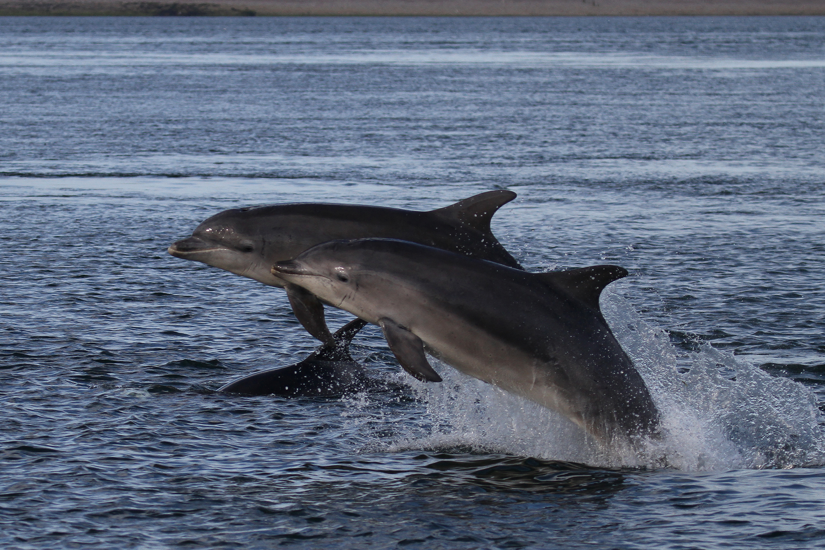
Fans of dolphins know the best time to see them at Chanonry Point near Inverness is an hour or so after low tide when the dolphins follow the current, chasing the fish up the Moray Firth.  It therefore wasn’t surprising that even in arctic conditions (I was wrapped up like Nanook of the North) we found a small crowd on the pebbly beach below the lighthouse.  Among them was the Whale and Dolphin Conservation’s Field Officer and, knowing him from previous visits, we caught up while we shivered in the bitingly cold wind, constantly looking hopefully across the choppy water.  ‘You can say you’ve seen The Black Isle turn white,’ he quipped as we turned around to see the fields above Chanonry Point dusted in snow.  Our bone-chilling patience was eventually rewarded with an acrobatic and cheering display from five dolphins.

Scottish Gaming

Our Scottish trip had started in much warmer temperatures in the pretty town of North Berwick on the Firth of the Forth.  It felt like mid-summer not late March when we walked to Tantallon Castle that sits dramatically on the cliffs near North Berwick.  Skylarks fluttered high in the blue sky, joyfully singing their hearts out and seabirds were already bagging their spots on the cliffs below the castle’s stone walls.  Shimmering in the blue sea was the volcanic island lump of Bass Rock, home to gannets,

In North Berwick we had more fun than I expected in the Scottish Seabird Centre thanks to an array of interactive games that are popular with children and adults who haven’t quite grown up!  The games were challenging for a non-gamer and I was soon a hungry seal and a dead fulmar chick!  There are more traditional exhibits too and watching the close-up film of flying geese I was mesmerized, feeling part of the flock.  Used to seeing these birds high in the sky, witnessing the power radiating from their necks and wings was remarkable.

Fog rolled in that evening ending the unseasonably warm weather and lingered into the next morning as we left North Berwick.  Driving down a narrow lane, a hare raced towards us hugging a mossy stone wall.  Knowing how devastating it would be to hit one of these mythical symbols of good fortune we pulled in and watched the beautiful animal gallop by.

Wildlife Havens

It was chilly at Loch Leven RSPB reserve and we walked briskly between the hides around the pools.  Despite the cold the birds seemed to sense spring was on the horizon and pairs of lapwings twirled in the air, their swanee whistle call reminding me of Sooty’s fun and accident-prone friend, Sweep.  The noisiest neighbours, the black-headed gulls, mixed up their own raucous mating dance with swooping attacks at the swans.  Unperturbed the male swans, feathers impressively puffed up, powered through the water in pursuit of nonchalant females.

The woodland uphill trail not only warmed us up but showed that Loch Leven has more than birds.  A couple of adorable red squirrels bounded around the trees, a roe deer raced up the hill when it spotted us and another lucky hare crossed our path.  From the top we had a birds-eye view over the reserve.

Sometimes a campsite immediately feels like home and Silverburn Park near Leven was one such place.  The tree-lined entrance road opens out to a camping area with views across the golf course to the sea.  Run by a charity, campers receive a warm welcome and as well as the beach, have the run of a delightful walled garden.  While I eyed up the cakes in their café a biscuit-coloured cat with a deep purr rubbed around my legs.

Looking out the next morning there was a colourful sunrise and a flurry of snow which soon melted.  In fresh weather we walked along the sandy beach to the charming seaside village of Lower Largo.  Here creative and colourful gates and sculptures adorned with local scenes and seafaring themes brightened up the streets.  In the opposite direction the beach took us to Leven.  Returning through golf courses we had views across the Firth of the Forth with Bass Rock highlighted by the sun.

Fine and Dandy

Shopping for some essentials in Dundee we admired The Discovery, one of Scott’s ships displayed on the quayside, and stumbled upon the amusing and energetic Desperate Dan statue.  The publishers of The Dandy and Beano comics were based in Dundee and a life-size Dan struts confidently across a square dragging his sidekick Dawg on a lead while Minnie the Minx is ready with her catapult.

Before driving to the campsite at Stonehaven, a favourite of ours, we stopped at Fowlsheugh Cliffs.   Even this early in spring this crinkly coastline was packed with noisy kittiwakes, the birds balancing on the narrow ledges of their high-rise accommodation.  Stonehaven campsite has fabulous coastal cliff walking, a castle and a picturesque harbour on the doorstep.  An added bonus are the quirky metal sculptures of boats, planes and lighthouses that line the bay, but don’t take my word for it, if you’ve never been add it to your list!

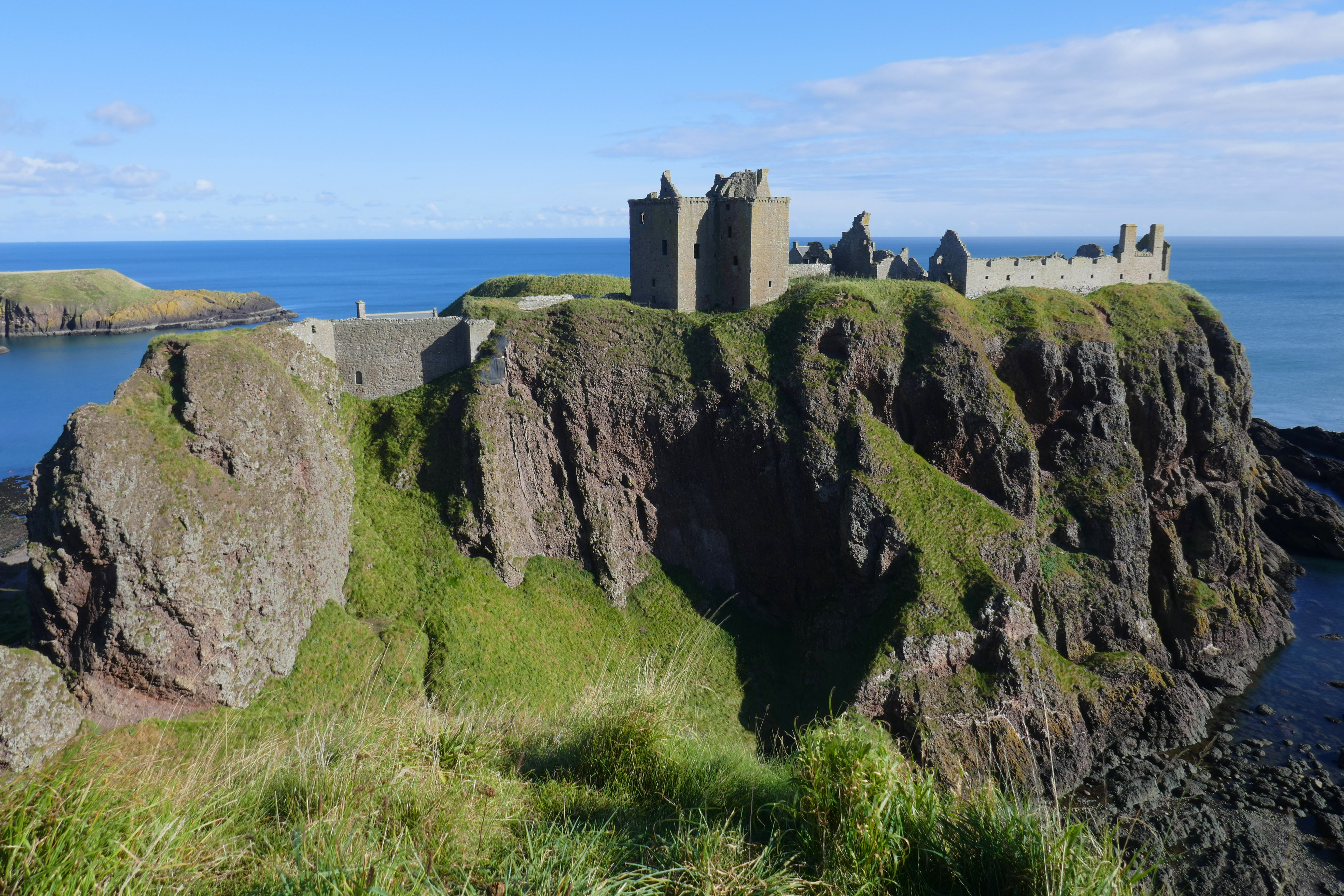
The cliff path to Dunnottar Castle is packed with breathtaking views, starting with Stonehaven and its harbour.  Spring weather had blown in and we stopped at the temple-like war memorial to take in the panoramic views that now included the towers of Dunnottar Castle that perches on a rocky outcrop above the sea.  We’ve visited the castle before so returned through Dunnottar Woods where, judging by the profusion of tiny doorways, the fairies hang out.

Happiness Comes in Waves

Heading north, we were treated to the magical sight of a marsh harrier at Loch of Strathbeg.  Parking at the ruined Rattray Chapel that overlooks the loch we had lunch watching the birds.  The narrow road deteriorates after the chapel so we hiked the mile or so to Rattray Head, a remote and striking stretch of coast.  Sand dunes sculpted by the wind and sea to form mini-mountains covered in spiky grasses that whispered in the wind led us to the beach.  The tide was high and water surrounded the small lighthouse.  Walking along the beach watching the waves and the cormorants we felt so lucky to have this spot to ourselves.

The sea stayed close at the Fraserburgh campsite and as warming sun streamed through the ‘van windows I was comfy watching the tides, the surfers and some hardy swimmers in the bay.  Anthony muttered about salt and mud and made the most of the good weather to clean the worst muck off the ‘van.  Later we strolled around the harbour packed with boats of different sizes and colours and watched scores of herring gulls skilfully wheeling through the air, amazed you never see them collide.

To the Lighthouse

The next morning the weather reminded us it was still only March as dark clouds obscured the sun and hail bounced off the pavements while we sheltered in a doorway before running to a café for coffee.  Once the sun returned we made for the Scottish Lighthouse Museum, the highlight of which was climbing the spiral staircase of the disused Kinnaird Head lighthouse where from the light and gallery we had blustery views over the sea and Fraserburgh.

Later we walked along Fraserburgh Bay, a sweep of golden sand where children paddled in a shallow stream and gleefully raced up and down the largest sand dune.  At the end of the bay we headed inland by a serene river and returned on sheltered paths between the dunes.

Back on the road we pulled in to Cullykhan Beach car park for a short walk by a stream that tumbles through a gorge to a delightful sandy cove.  Beyond we could see the row of white cottages of Pennan.  We have explored this north-facing coast between Fraserburgh and Inverness many times and I have happy memories of the beaches, cliffs and picturesque villages but there are still new corners to explore.

Tweet of the Day

A bumpy farm track took us to the car park for Troup Head where RSPB signs directed us to the cliffs where gannets nest.  Graceful gannets always take my breath away.  About as big as a goose, gannets are experts in elegance as well as being accomplished fishers.  Close up we could see their heads were the colour of thick clotted cream and their fearsome-looking beaks were baby-soft blue.  Huge-winged gannets soared below us, their throaty call filling the air and we watched others gathering clumps of grass for nesting.

We had never visited Lossiemouth so, as the weather cranked up for an autumn-like wet and windy storm, we pulled into the East Beach car park hoping to explore.  In a break in the heavy showers we strolled around the harbour and the grid pattern of streets before battening down for a windy night in the ‘van.  Always looking for the bright side, Anthony hoped the torrential rain would clean off some of the mud we had picked up during the day.

Culbin Forest and Nairn’s East Beach are so vast, even though we have visited before we were soon on unfamiliar paths through the fragrant pine trees.  There is plenty of space for everyone here and even though Nairn isn’t far away we easily found quiet corners.  Leaving the trees and dunes we reached the sandy beach and I spotted handsome black and white oystercatchers with their long orange beaks that are perfectly designed for probing mud.  As they deftly flew along the tideline we grinned at each other as we heard their exuberant sharp calls. 

Dancing Dolphins

If you’re lucky at the Rosemarkie campsite you will bag one of the pitches with an uninterrupted sea view.  We were fortunate perhaps because everyone else had seen the wintery weather forecast and stayed home.  It was bitterly cold and the next morning we once again woke to sleet.  Undeterred, after breakfast we walked along the shore to Chanonry Point, the best land-based place in Scotland to watch dolphins.  After our amazing dolphin encounter we thawed out in the ‘van and spent a cosy afternoon relaxing, eating and drinking, occasionally glancing up to watch the birds on the shore.

Before leaving Scotland’s east coast we had a date with our favourite pizza place north of Gretna Green.  The sleety-snow had ceased but it remained chilly as we parked in the village of Cromarty.  Whatever the weather pizza has to be earned and before ordering at Sutor Creek Café we had a brisk walk around the harbour, seafront and pretty streets.

The bonny Cromarty Firth was dotted with a bizarre collection of rustic (or rusting) defunct oil platforms.  These strangely beautiful structures loom like industrial dinosaurs and contrast sharply with the picturesque cottages and attractive streets of Cromarty.  Striding out along The Links we came upon The Emigration Stone, a tall artwork that commemorates the ships packed with people that left these shores for the New World.  It is inscribed with the description of one ship’s bittersweet departure.

While our pizza cooked in the wood-fired oven at Sutor Creek we enjoyed the warmth of the café and chatted to the chefs about the oil platforms.  They told us some locals complain but others have become so accustomed to them they’re almost invisible!  We ate our pizza back in the ‘van overlooking the firth and it was as delicious as expected (my mouth is watering just writing this).

We have been to Scotland more times than I have fingers and toes to count on so it is remarkable that we still find new and awesome sights to see, but then it is an outstanding country.  As usual we experienced every season but there is no doubt we will be back again for pizza and dolphins and so much more.

North Ledaig Caravan Park, Scotland: Two Walks from the Site

The view from Beinn Lora

North Ledaig Caravan Park north of Oban in Scotland is a popular campsite. For us it has good and bad points but we made the most of a couple of nights here, leaving our campervan onsite and walking from the site.

The Campsite

This is a large site with different areas for Caravan and Motorhome Club members and non-members. This isn’t a club site but it is affiliated. The site slopes down to the coast and many of the pitches have a sea view but you have to deal with the tilt, unless you carry large levelling blocks. There are some pitches that are level, often tucked away without a sea view. Pitches are allocated by the site, and, as we found, changing the pitch you have been given is more of a palaver than it really should be.

There are two facilities blocks, one in the centre of the site and one by reception and the shop. These are both kept clean and have modern showers that are okay.

As well as the sea view and colourful sunsets, the disused railwayline that is now a cycle path and runs through the site is the other big plus at North Ledaig. This is part of the Caledonia Way from Campbeltown to Inverness. It is a mixture of road and traffic-free cycling. Most of the 49-mile section between Oban and Fort William [the stretch this campsite sits on] is on this disused railwayline and it is a fairly level route with fantastic views.

A Walk around the Lanes – approx 8km

This is an almost completely flat walk. We turned right on the cycle path and walked down to North Connel on the traffic-free route. Crossing the main road, we took the lane through Black Crofts and around the shore of Loch Etie.  We were walked around the Moss of Achnacree and caught glimpses of the heather moss occasionally through individual houses and we could gaze along Loch Etive.  This is a residential road with houses of different ages and sizes and there is some traffic. It became quieter once we turned onto the straight road back to North Ledaig.  A signed along here warned us about red squirrels and sure enough, one bounded up a lane towards us and scampered under a fence into the trees. 

Walk up Beinn Lora – approx 9km

With a sunny day forecast, we decided to climb Beinn Lora, a small hill that overlooks the campsite. It is only 308m high but being on the coast it is a marvellous viewpoint.  This time we turned left on the cycle path to Benderloch, which is only 1.5km from the campsite. We were disappointed that the lovely café here closed on Mondays and Tuesdays so we took a flask.  From Benderloch we climbed steeply through the woodland on well-made paths with regular picnic benches and viewpoints.  We could look down on the coast and see the rows of caravans and motorhomes at North Ledaig below us, as well as the runway of the hardly-used airport.

Stopping for coffee and an early lunch on the last picnic bench, we had views north over Benderloch to Morvern. Walk Highlands suggested the final push to the summit can be boggy but it was okay on our September walk. On the open hillside of rock and short wet sections, skeins of geese flew over honking enthusiastically.  From the rounded trig point we could see Ben Cruachan and along Loch Etive and laid out below was the moss we had walked around the day before.  It was clear enough to see over Lismore and across to Mull and in the distance were the Paps of Jura. For effort vs reward, Beinn Lora tips the scales very much towards reward. We returned to the campsite the same way.

Tal-y-mignedd Campsite, North Wales: Campsite, Walks & Things to do

The Nantlle Valley

Tal-y-mignedd Campsite in the Nantlle Valley is a campsite that is made for the word nestling. Tucked away between steep hills on the edge of the Eryri National Park [Snowdonia] in North Wales, this is a place to find tranquility, fabulous hiking and, maybe surprisingly, good coffee.

The Campsite

Pitches – At Tal-y-mignedd, the camping is divided over a number of fields from large to small enough for just a few tents. These are all either totally level or mostly level and all have open views. For campervans there are a few hardstanding pitches with electric hook up and some grass pitches with electric too. There is also plenty of room for non-electric pitches for tents and ‘vans on grass.

Facilities – There is one facilities block with male and female showers and toilets, an accessible bathroom and a kitchen with sinks for washing up, a microwave, hob, kettle and fridge/freezer and washing machine and dryer. There is also a second campers kitchen which wasn’t open when we were there. There is a chemical toilet disposal point and fresh water taps. Everything was kept clean and tidy. A pleasant surprise in a valley that has little in the way of phone signal was good and free wi-fi.

Access – The B4418 between Rhyd-Ddu and Nantlle is single-track in places. You either have to drive three miles on this quiet narrow road from the Beddgelert to Caernarfon road or around two miles from the village of Nantlle.

The campsite wasn’t busy when we were staying there. It was mid-week and May and only three or four other pitches were in use. This didn’t put any strain on the facilities but a stay here would be a livelier experience during a busy summer weekend.

Reception is in the farmhouse and the family were always friendly and helpful. This is still a working farm and their vehicles drive up and down the track but this was never intrusive. Sheep sometimes find themselves on the camping field and the sound of birdsong is interupted by cattle!

We paid £27/night with electric hook up and it is £20/night without. This seemed good value for hot showers and fabulous views.

Things to do

The campsite sits on the Snowdonia Slate Trail. This 83-mile long circular route starts and ends in Bangor and visits sites associated with the slate industry of North Wales and takes walkers through forests, by lakes and into villages. The section along the Nantlle Valley is fairly level and reasonably well signed. From Tal-y-Mignedd we picked the trail up in both directions.

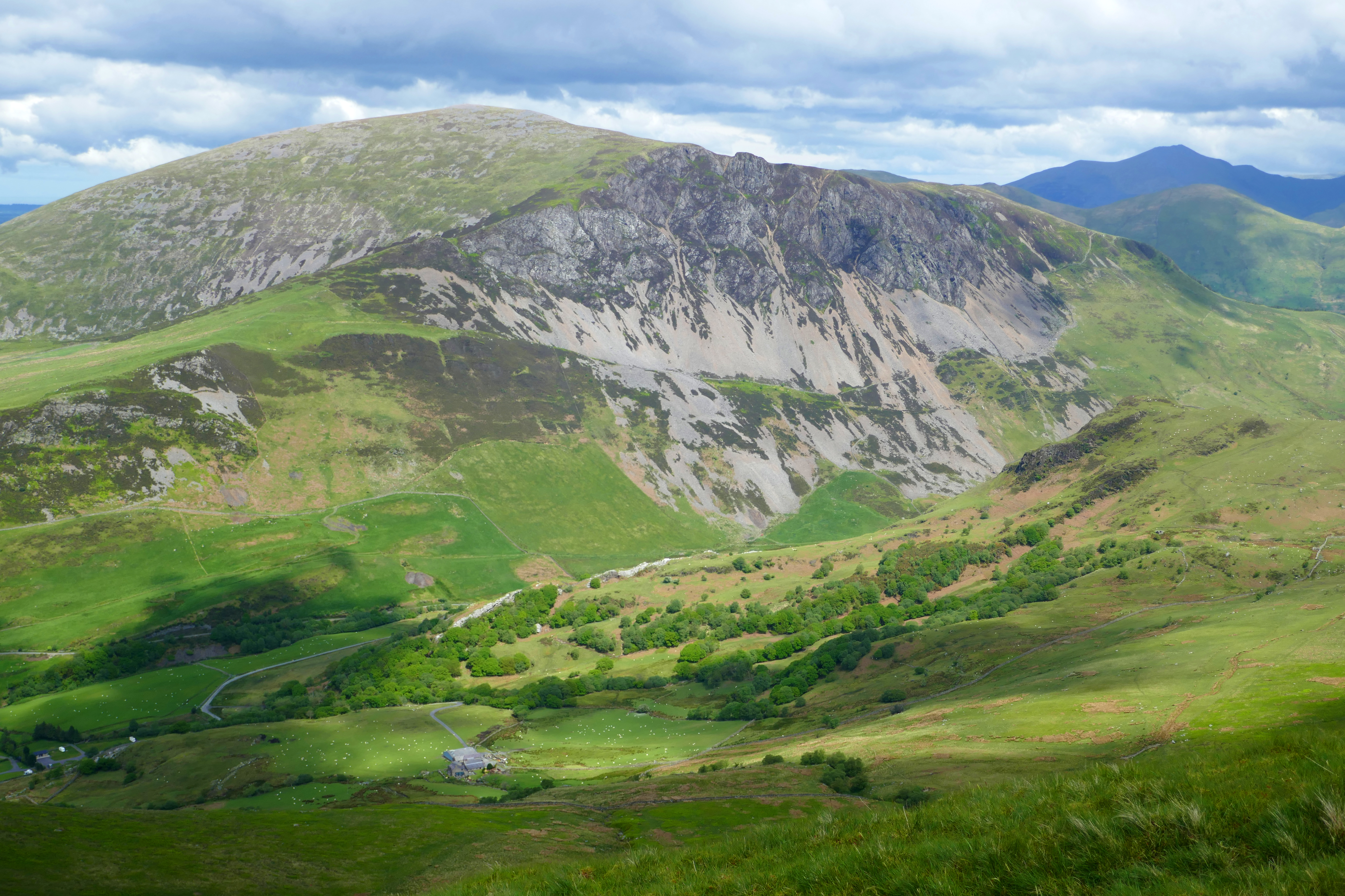
Walking East – Heading towards the peak of Yr Wyddfa [Snowdon], we joined the narrow lane for a short distance, through the hamlet of Drws y Coed where we left the road and followed an increasingly damp path past an unused dam towards woods.  A cuckoo called from across the valley and making our way around the craggy Clogwyn Y Garreg we had views of Yr Wyddfa. You could extend this walk and make a day of it with a rest at the pub in Rhyd-Ddu.  

Amazing sunsets – The valley is aligned pretty much east-west and watching the light soften as the sun goes down is special.

Walking West – We also followed the Snowdonia Slate Trail along the valley bottom into Nantlle village and walked back along the lane, making a circular walk. The farm track passes a lake, Llyn Nantlle Uchaf, before reaching the village. At one time there were 40 slate quarries in the Nantlle valley and the village developed at the end of the 18th century to serve this industry, many of the quarrymen coming from Ynys Môn [Anglesey] and Arfon [the mainland of Wales facing Ynys Môn. For more about the history of Nantlle see the Dyffryn Nantlle website.

Drinking good coffee – In Nantlle we visited Poblado Coffi. In a unit in the old quarrymen’s barracks, coffee experts roast and blend beans. All the beans are sourced from sustainable coffee growers and they have strong relationships with these growers and pay a fair price for the coffee. We sat in the courtyard tasting the delicious coffee of the day, along with a slice of ginger flapjack and left with a couple of bags of coffee in the rucksack. If you find yourself anywhere near this gem, take the time to visit.

Walking up – We couldn’t resist climbing the hill that the farm shares its name with. This is a relentless steep climb but worth it for the views over the mountains, including Yr Wyddfa and to the sea. The first section is on a zig-zag track that climbs through sweet-smelling bluebells in May. The hill is only 653m high but punches above its weight and the rocky summit has a tall obelisk that you can see from the valley. Once at the top, fit and experienced walkers will continue along the stunning Nantlle Ridge for a longer walk and in warmer weather we would probably have done the same.

Walking in the Nantlle Valley

A Campervan trip to Buxton & Five Walks

Three Shires Head

The Derbyshire market town of Buxton is famous for water; having the highest market place and its graciously curved Georgian crescent. We have visited many times and find it perfect for two campervanners who like hiking. Buxton has a number of campsites [see below] and does offer sights for those who don’t want to spend the day in the surrounding countryside. But if, like us, you enjoy a warm day in the great outdoors, below are five of my favourite walks for five days camping in Buxton.

The distances on the walks below are approximate and are based on walking from the Caravan and Motorhome Club’s Buxton site. I haven’t given step-by-step directions but the paths in this popular part of the country are well-walked and I hope that you can pick up our route [or make up your own] from an OS map.

Day One – Exploring Buxton [at least 7kms]

Buxton’s heritage trail leaflet will help you make the most of a stroll around the town. But first you have to walk to the town centre and leaving the campsite, you will immediately be distracted by the delightful paths through Grin Low Woods and to Solomon’s Temple.

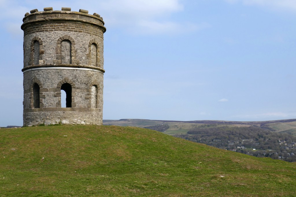
Solomon’s Temple is a perfect introduction to Buxton. Climb the winding staircase of the hilltop tower and Buxton is laid before you, clustered around the dominating slate-grey Devonshire Dome.

Having taken in the view, we head downhill on the woodland paths with occasional wooden sculptures and reaching the streets by Poole’s Cavern. If you’ve never visited you might want to dally and explore this underground cavern.

We like to amble through the town’s restored Pavilion Gardens. There might be an art fair being held in the Octagon Hall or we will idly watch the ducks and look hopefully for chicks on the lake. I also like to admire the preserved tree trunk sculpted into figures and animals that stands in the park.  The water-carrying figure of Arnemetia is a reminder that in Roman times Buxton was named Aquae Arnemetiae after this Romano-British goddess.

Our next stop is The Crescent, a Georgian grade one listed masterpiece and the pride of Buxton, recently restored as a luxury hotel.  The gracious symmetrical curve of the stone building, the ground floor colonnade and fountains playing at the front are stunning.  Opposite is St Anne’s Well which is decorated with flowers in the annual well dressing, a tradition followed in many Derbyshire villages and towns.  The Pump Room has a tap and souvenir glass bottles, and I did once fill one with Buxton spa water to taste the lukewarm mineral-rich water. It is an aquired taste!

Buxton’s spring water emerges from the ground at around 28°C and has been exploited since the Romans, who built a bath and threw coins into the spring for luck.  In the 16th century visitors took the water and in the Georgian era the Duke of Devonshire developed a spa resort.  A ‘Well Woman’ was appointed to care for the well and tourists, a post that continued into the 20th century.

After all this strolling, we are ready to sit and there are plenty of cafes and tearooms in Buxton. Later we will walk over for a close-up of The Devonshire Dome.  This building has an interesting history and has been used as stables, a hospital and is now a University.  Finally, we will climb the paths up The Slopes to the upper part of Buxton, where the town’s oldest buildings surround England’s highest market place and from there head back to the campsite.

Day Two – Goyt Valley and Errwood Reservoir [about 14kms]

After the streets of Buxton, day two is a contrasting and challenging hike over moorland. A map will be essential to find your way around these moors but you will be rewarded with the sounds of lapwings and curlews and buckets of fresh air.

From the A53 near the campsite, we picked up Bishop’s Lane and climbed the hillside until a path took us to the disused railway line. Views over the two reservoirs in Goyt Valley will open out before you.

Reaching a lane, we descend to the shores of Errwood Reservoir. From here we chose paths that climb through the trees to the ruins of Errwood Hall. We are walking through what was once the grand ornamental garden where fountains played and the Grimshawe family, who lived here, relaxed on the lawns.  Demolished in 1934 after the last of the Grimeshawes died, Errwood Hall was originally a dressed-stone building with a tower above an impressive entrance and rooms packed with fine furniture and art works.  In those days the hall enjoyed views over the valley but is now surrounded by trees and rhododendrons.  For me, the ruins have always retained a sense of romance tinged with loss but on our last visit it seemed particularly woebegone.  The site deserves a little more care and I was disappointed there isn’t even an interpretation board to show what used to be here. However, there is an app and more information here.

From the hall we headed uphill finding the small circular St Joseph’s shrine that huddles in a hollow with pine trees.  Dedicated to Dolores, a Spanish companion to Jessie Grimeshawe in 1889, the shrine has an elaborate altar of Spanish tiles and there are often fresh flowers.  As we descended the moorland back to the reservoir a grey cloud threatened rain and we followed a circling buzzard towards the trees and shelter but the storm never arrived. 

Walking south along the valley beyond Errwood Reservoir we crossed the old packhorse bridge and picked up a path over the moorland and back to Buxton. More walks in the Goyt Valley and its history can be found here.

Day Three – Three Shires Head [Around 17kms]

If you only have time for one day of hiking around Buxton, make it this one! The walk begins on the Dane Valley Way and you soon leave the traffic behind as you cross Axe Edge Moor, an expanse of moorland that holds the headwaters of four rivers, the Manifold, Dane, Wye and Goyt.  Despite the warm weather, it was just us on this path enjoying the gurgling streams and passing a few isolated farms and old mine workings.

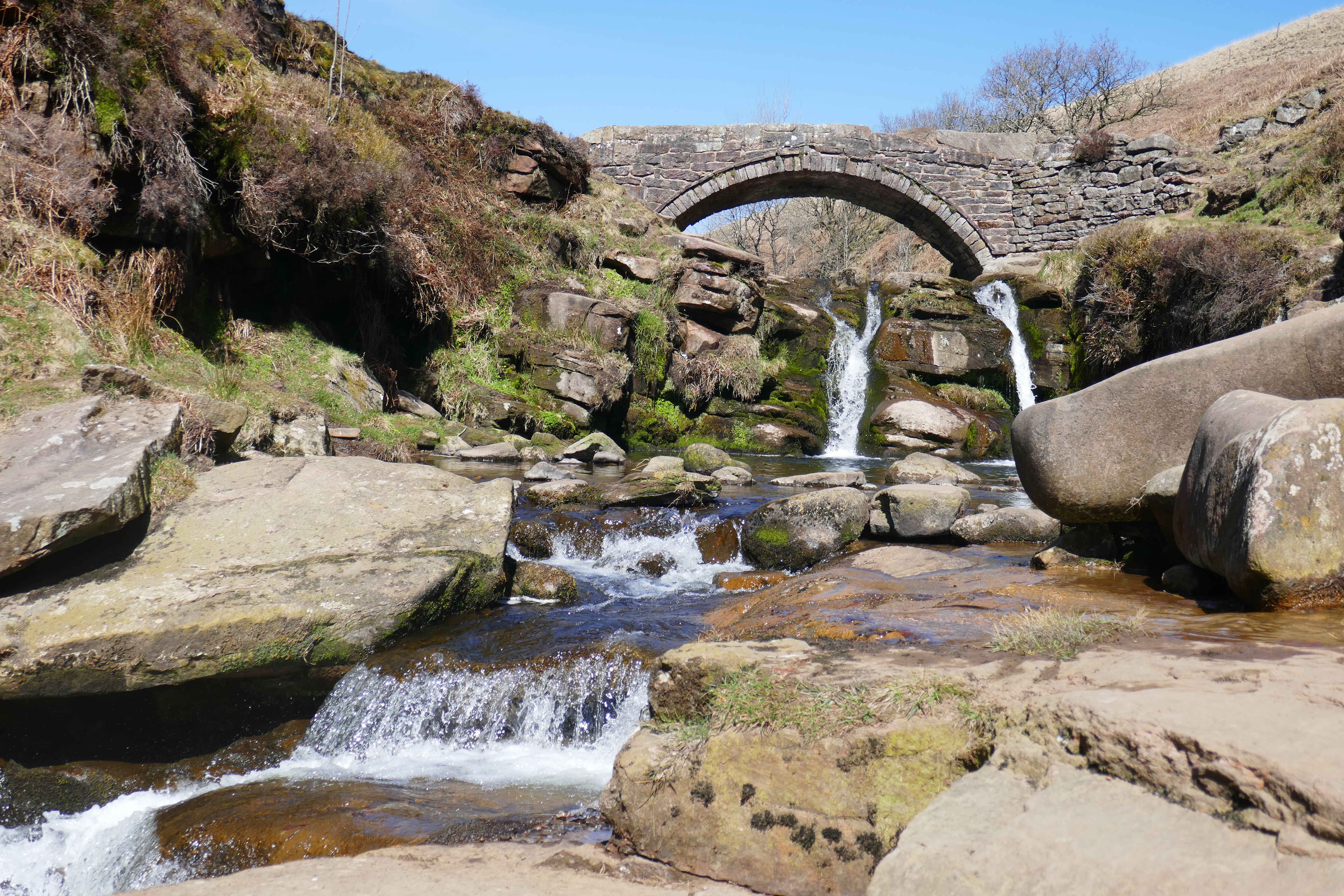
At Three Shires Head, where Staffordshire, Derbyshire and Cheshire meet, we joined the throng. These falls are a popular picnic and wild swimming spot.  Sitting by the waterfalls I slipped off my shoes and dipped my toes in the gaspingly-cold water of the River Dane.  As I dried my tingling feet I watched the hardy woman swimming in Pannier’s Pool in admiration.

Climbing up the hillside to Flash, a sheltered lane alive with butterflies took us to Flash Bar Stores where we devoured two of their delicious homemade vegetable pies at an outdoor table.  A popular halt for cyclists, we chatted to a young man who was fuelling up having cycled from the West Midlands and was surprised how hilly the Peak District was!

Exuberant skylarks sang as we crossed the fields, criss-crossed by stone walls, below Flash. Multitudes of signs heralded the Health and Safety Executives huge Science and Research Centre. We skirted the buildings on the public footpath and picked up a lane that took us back to the road below the campsite.

Day Four – Five Dales from Tideswell [13kms]

On a perfect spring day we drove the short distance to the car park in Tideswell Dale. This perfect Derbyshire walk took us along, in and out of five dales.

We began in Tideswell Dale where a winding stream lined with bright yellow celandine wound beside us and rock cress hung from the limestone cliffs.  Ash trees grow here but many have been chopped down due to ash dieback, a destructive fungal disease.

Miller’s Dale, not surprisingly, is home to many disused mills along the River Wye, often now converted to housing.  I was concentrating on looking along the river for kingfishers. I didn’t see a kingfisher but a birdwatching couple pointed out a peregrine they had spotted on the skyline above us.

At Cressbrook we sat by the millpond watching the climbers on the crags and a pair of tufted ducks. The ducks dived into the shallow water to feed, stirring up the silt into billowing muddy streaks so that we could watch their underwater progress.  Cressbrook Dale is thickly wooded with pungent wild garlic and carpets of soft green moss covering the dry stone walls.

The landscape opened out as we reached the short Tansley Dale where we found cowslips just coming into flower among the grasses.  We climbed up to the patchwork of walled fields above the dales where lambs gambolled in the sunshine and the shallow Litton Dale led us back to the ‘van.

Day Five – Five Wells & Deep Dale walk (13kms)

In more sunshine, we walked through the wood to Buxton to catch a bus towards Bakewell. We hopped off near the village of Taddington and walked back to Buxton.

Our first stop was Five Wells Chambered Cairn. Here the stones that remain of a circular chambered cairn  perch on high ground above the source of five springs.  Although many of the stones have been taken, the two back-to-back chambers can be recognised.  Descending to the village of Chelmorton we passed Bank Pit Spring, inexplicably and bizarrely known locally as Illy Willy Water.

The path into the wooded Deep Dale was steep but the sheltered dale was perfect for a lunch stop.  As we ate, three sheep nose-to-tail went purposefully by on a lower path.  When minutes later a fourth sheep appeared we assumed she was lagging behind and helpfully pointed in the right direction.  Instead she came over and nudged my arm with her nose demanding food.  We were eating more delicious pastries from Flash Bar and so there was no chance we would share!

The scenic uneven path along Deep Dale, over moss-covered stones and between trees, took us below the cave known as Thirst House before climbing up to King Sterndale and returning into Buxton under the 13 arches of Dukes Drive viaduct.  Back in Grin Low Woods, we found a thick carpet of wood anemone and on the way back to the campsite picked up part of Buxton’s Ring of Trees Walk, a circular route through surrounding woodland. 

Solomon’s Temple, Buxton

We stayed at:

The Caravan and Motorhome Club Buxton campsite. Set in a quarry, this is a peaceful site with walks from your campervan door.

Alternatives that we have stayed at:

Lime Tree Holiday Park – We have stayed here a few times. It is in a peaceful position just a short walk from Buxton.

Beech Croft Farm – this family-run site is between Buxton and Bakewell and in quiet countryside. Walk Five is near here.

Longnor Wood Camping – This adult-only site is near the village of Longnor. There is good hiking from the campsite and some cosy country pubs in the vicinity.

Where the river meets the sea at the north-west corner of England

The Solway near Silloth

We are never put off by chilly weather and walking under wide and luminous skies and beside sparkling seas on the Solway Firth is a winter treat. The dark days of the year can seem endless and an injection of this clean light and a few colourful west-coast sunsets help me feel optimistic about spring.  This is an isolated corner of England, no one just passes by these coastal towns along the Solway, and for me, this sense of being on the edge adds to the charm.

The estuary known as the Solway Firth separates England and Scotland and we began our tour on its English shores in the small Cumbrian seaside resort of Allonby.  The hazy February sunshine was welcome, the sea shimmered with a pearly light and across the water we could see the distinctive hill called Criffel in Scotland.

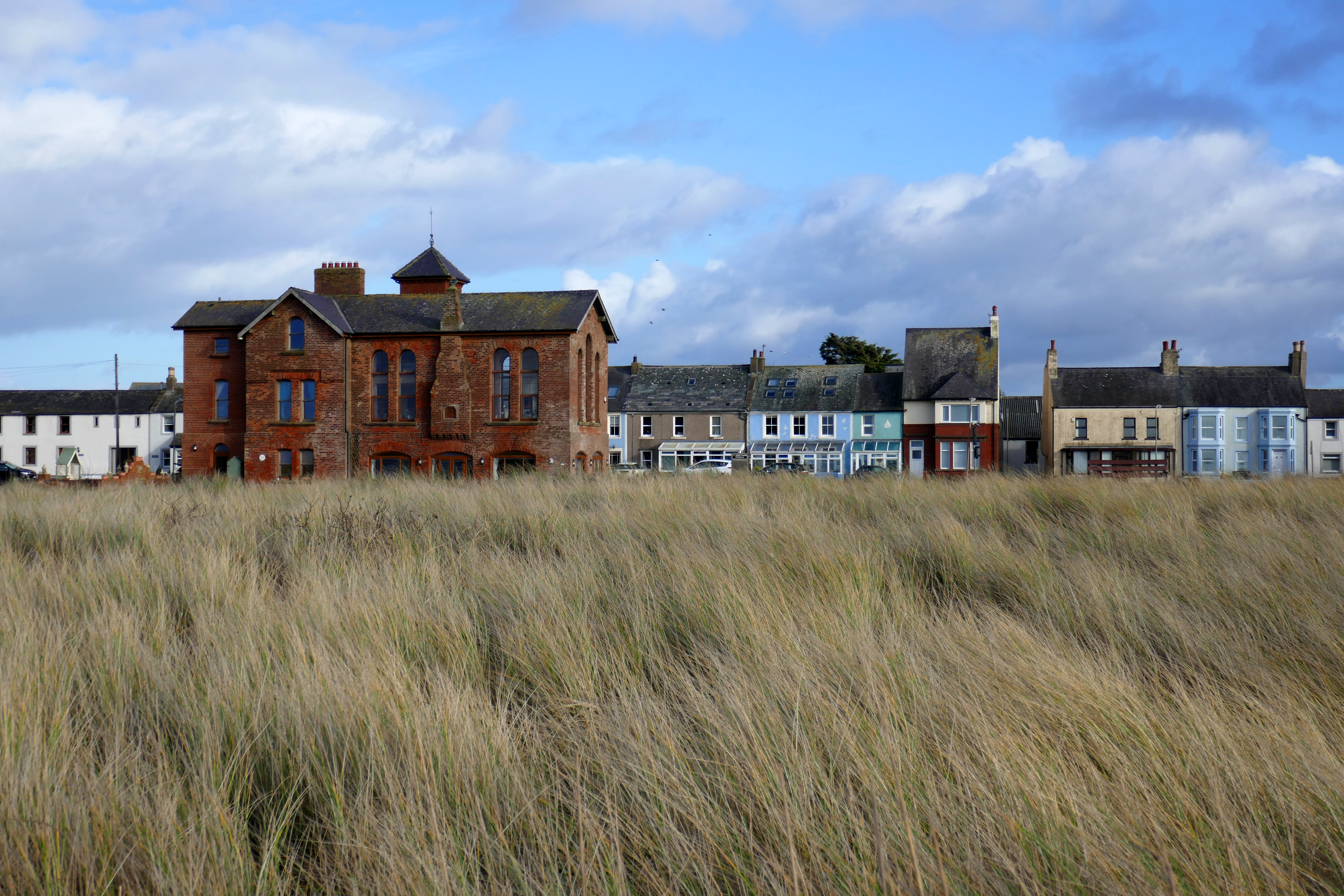
Wrapped in layers we headed for the beach for some invigorating fresh air.  Anthony watched for birds and I walked along the tideline, constantly stopping to admire a shell, pebble or piece of pottery that caught my eye.  The chilly breeze whipped up the sand and we both had a healthy sand-blasted glow as we wandered back along Allonby’s street.  A quiet backwater out of season, Allonby is still a popular resort with swanky houses from its heyday.  Most striking is the old Quaker Reading Room, an unusual red-brick building with a clock tower and an uninterrupted sea view.  The building was a sorry derelict sight for many years but has now been renovated as a stylish private house that I yearn to peek inside.

The rolling green countryside in this corner of Cumbria is largely ignored by tourists and the quiet roads are a pleasure to cruise along.  With the exception of a friendly ginger cat, we had the remains of Holme Cultrum Abbey to ourselves.  I was delighted to find one of my favourite flowers, snowdrops brightening up the rambling graveyard and ruins with their shiny green stems and bobbing brilliant-white heads.  Snowdrops cheer up the dreariest day.

Planning our trip, Grune Point had caught my eye.  This remote spit of land, shaped by the tides, stretches along the Solway Firth from the town of Silloth.  Before walking along Grune Point the next morning we went in search of an essential warming coffee and stumbled into the Fairy Dust Emporium Café, a flamboyant and charming café with welcoming staff.  Sitting at one of the wooden tables surrounded by fairies of every shape and size, we rang a bell for service and another fairy gained her wings.  As well as hot coffee the irresistible warm cheese scones with fiery chilli jam were a tonic.

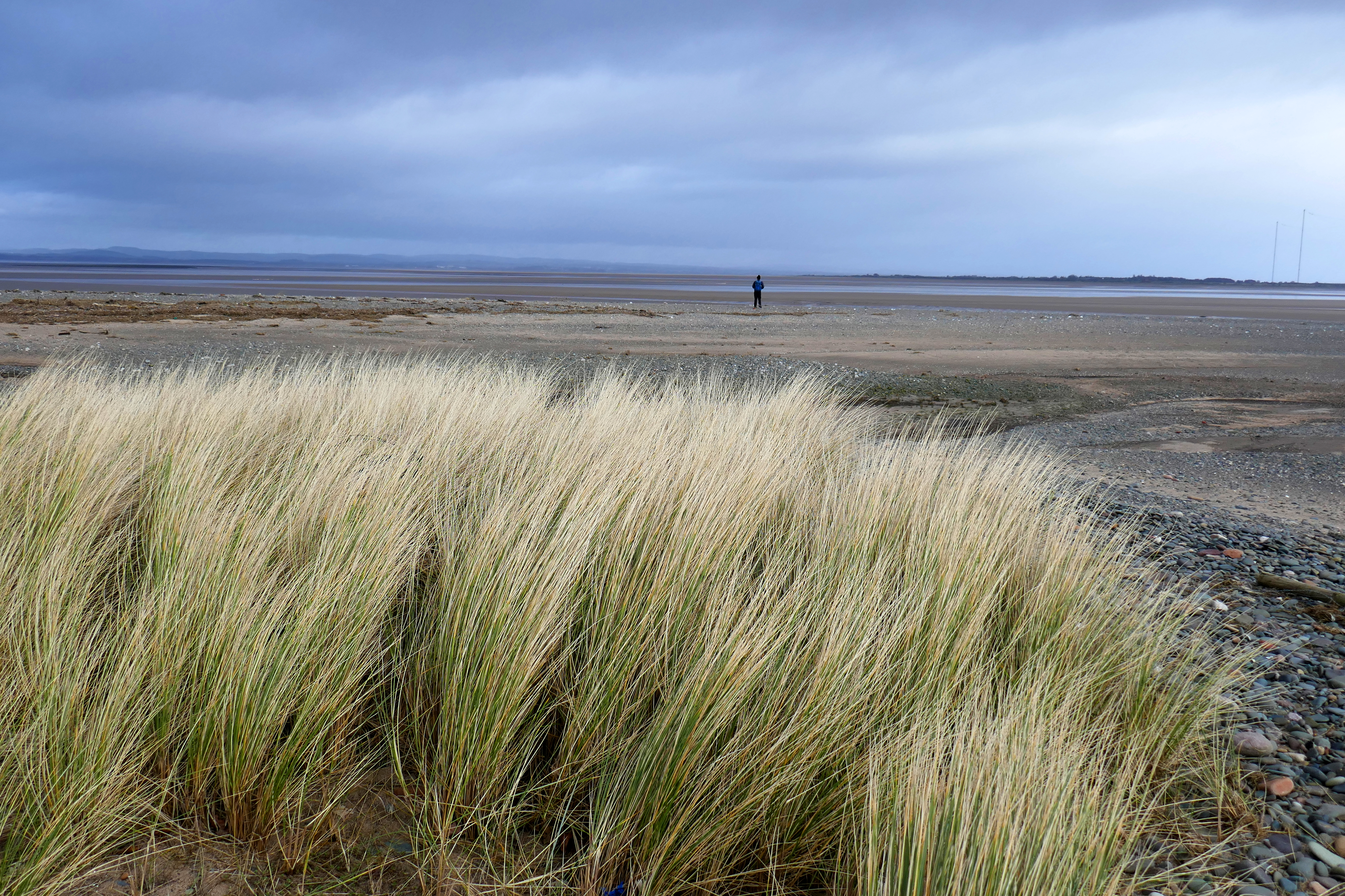
Striding out along the wide promenade above the beach, the Solway Firth and Scotland were to our left and houses with an enviable sea view to our right.  After a larger-than-life metal sculpture of a man and his dog and East Cote Lighthouse we picked up a lane lined with yellow flowering gorse bushes that held the promise of spring.  Nearer to the point we walked along a beach that alternated shingle of colourful pebbles and soft deep sand blown into mini dunes and dotted with bleached driftwood.  The blues of the sea merged into the huge sky, sharp calls of oystercatchers filled the air and the sun warmed our backs; it was as stunning as I had hoped.

Turning the corner of Grune Point we were looking over a vast area of salt marsh and mud flats, wriggling with channels.  The cheese scones and coffee had worn off and we found shelter near an old pill box and cupped our hands around mugs of hot chocolate from our flask, another winter essential.  In a clamour of honking, hundreds of barnacle geese rose from the salt marsh and flew over our heads in unruly v-shaped skeins.  A heavy shower followed the geese and we hurried back to Silloth.

We received another warm Silloth welcome in the Motorcycle Museum, a Tardis-like place packed with bikes and motorcycling memorabilia that will delight anyone.  Silloth once had a racing circuit at the airfield and the owner talked passionately about his experiences of racing there and on the Isle of Man.  Wistfully I recalled my visit to the TT in the 1970s but couldn’t pinpoint the year; of course the knowledgeable owner soon pieced it together from my muddle of vague memories.

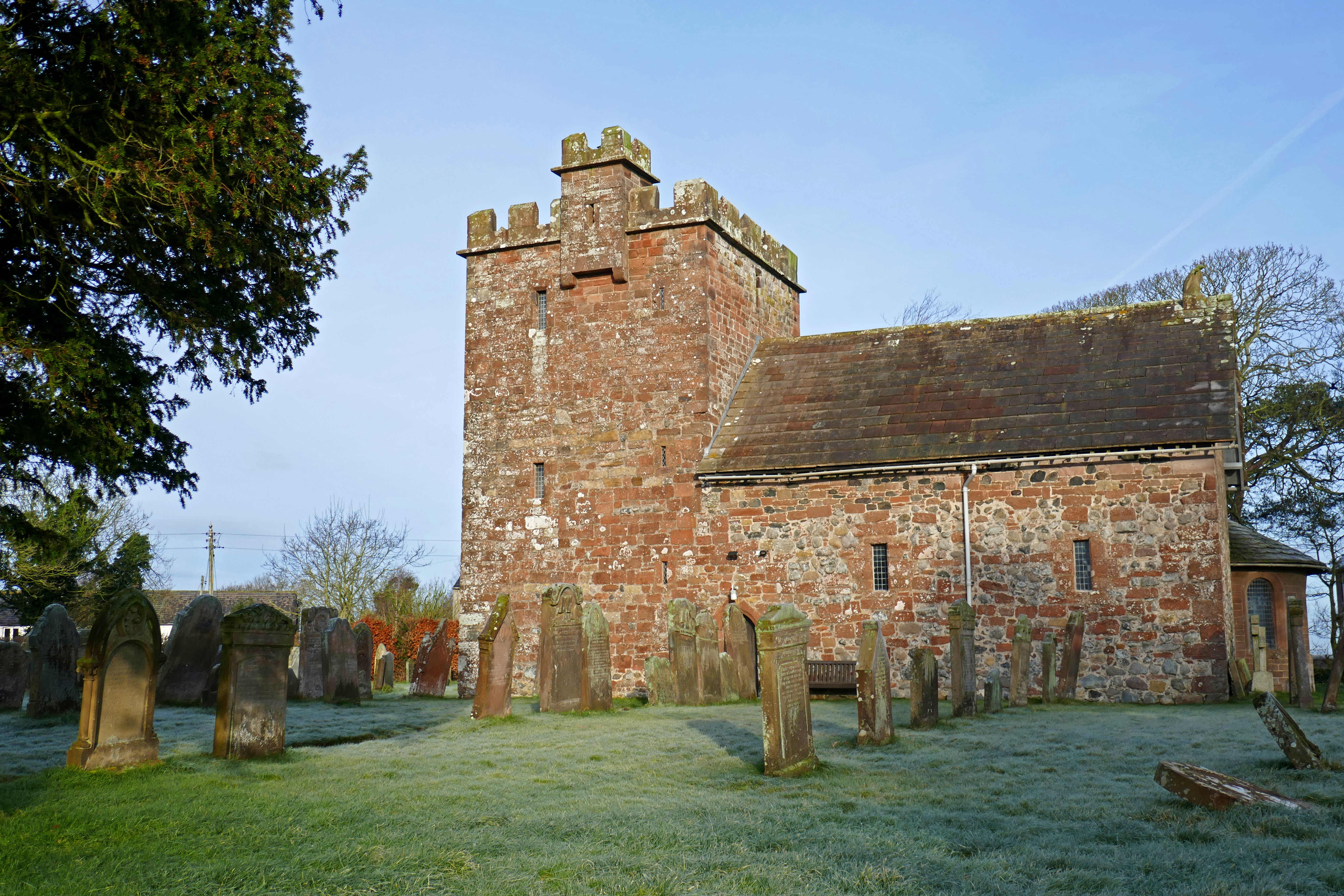
A frost had turned the green countryside into a winter-wonderland white the next morning as we drove to Newton Arlosh to see the fortified church.  In this border area churches were built with thick walls, narrow doorways and a tower as a refuge for people and animals during attacks from Scotland.  This medieval church fell out of use and became a roofless sheep pen but was restored in the 19th century by Sarah Losh, a local wealthy and determined woman and it now has many fascinating features including a stone eagle on the roof.

The Solway Firth had narrowed when we picked up its shores again and pulled into the RSPB reserve at Campfield Marsh where the pools were frozen and the ducks waited patiently for the water to melt.  A railway line once crossed these marshes and a viaduct took it over the Solway to Scotland.  In the cold winter of 1881 ice, up to 6ft thick, bumped against the pillars of the railway viaduct destroying sections.  A local paper reported that workmen on the viaduct were distracted when they spotted a hare stranded on a block of ice and floating out to sea!  The railway closed in 1921 and the disused line became part of an ambitious and dangerous pub crawl.  Thirsty Scots would cross the viaduct on foot to take advantage of the more lenient Sunday licensing laws in England.  There are stories of inebriated individuals missing their footing on the bridge and never making it home and until the viaduct was demolished a guard was employed to try and prevent these fatal journeys. 

We wandered around the quayside remains at Port Carlisle before parking in Burgh by Sands to hike onto the salt marsh to the monument to Edward I who died here on his way to invading Scotland.  This land is the grazing for prized salt marsh lamb and an annual auction for parcels of land called stints is still held every year.  Across the River Eden we could see traffic on the M6 and The Metal Bridge Inn, [not surprisingly] named after the metal bridge over the River Esk. This would be our stop for the night.

The Metal Bridge Inn is a landmark for anyone driving north on the M6 and a place that combines isolation with six-lanes of traffic.  Under another orange-red sky I climbed the steps of the railway bridge and looked down on the River Esk as it wound its way through salt marshes to the Solway and the Irish Sea. Skeins of pink-footed geese flew overhead, their energetic honking so loud and uninhibited they drowned out the traffic on the M6!

Although I was craving light, coziness is also essential to get through the winter months and this snug pub welcomes campervans on a dedicated parking area and serves good beer and hearty food.  By the time we walked back to the Blue Bus in the dark all the ‘pitches’ were taken and I was pleased to see we weren’t the only campers enjoying our ‘van all year.

Part Two and our journey into Scotland and the Scottish shore of the Solway will be in my next post.

Photographs of the Allonby’s old Reading Room, Grune Point and Newton Arlosh church below.

Don’t let anyone else ruin your day. It is your day, ruin it yourself!

One of the sculptures at Les Lapidiales near Port-d’Envaux in France

We think we want things to be real, but does anyone really want to read about an anxious travel writer? I’m not sure they do and so recently I haven’t actually lied, as one segment of my head adores our campervan travels, but there is a dark wedge of my brain I have kept to myself.

It was during our last trip to France that I noticed how contradictory I was feeling. While relishing exploring the beautiful country in our campervan I was also secretly doom-mongering. Anything that could go wrong [and probably wouldn’t] spun around and around in my head, driving my anxiety levels through the roof. My brain convinced itself it knew the future and it was bleak!

At first I tried ignoring my anxious feelings thinking that would make them go away. This didn’t work! Changing tack, I gave my anxiety some attention. This helped me see how my fears were familiar from our trip to Germany last year. I had muddled along then but this time my anxiety levels were higher and overwhelming and going home seemed the only answer!

Anxiety can sound trivial but it multiplies, feeding on itself. It starts in my brain but very quickly affects my whole body. Always the writer, my notes from the time describe the physical symptoms of a tight chest, nausea and fast and shallow breathing. And all because my head was busy imagining the worst things that might never happen.

Healing begins with sharing

I struggled to understand why I would be anxious when I was living the dream and travelling with my partner in our campervan. I felt guilty and stupid for having these negative feelings. I did not want to let anxiety about tomorrow spoil our trip and I thought the best thing was to keep my anxiety to myself, keep calm and carry on.

It took a few weeks to admit to my partner in campervanning how I was feeling. He is a caring individual and didn’t tell me I was being ridiculous. Being open about my anxious feelings shone a light on them, revealing the deceit they wallowed in. Saying them out loud helped me see how my anxiety was so clever it could fool me into thinking my imagined threats were real. It helped me to engage the rational side of my brain, calm my adrenaline-fuelled body and see that these worst-case-scenarios were fantasies. To even imagine I could predict the future was an illusion!

His caring approach didn’t make the anxiety go away but it helped. He recognised how difficult it was for me to admit that something in my brain was broken. There were no visible wounds to soothe but he gave me the love and patience I needed. Sympathy and talking were positive but no cure, so together we came up with a few strategies to ease my anxiety and be able to continue our holiday.

Small Steps

Firstly, we slowed down our tour, staying in one place for longer so that I could settle in, feel at ease and work at re-booting my brain. We travelled short distances on the days that we moved too and this relaxed approach to our trip worked well for us both.

As well as driving less, I lived at a slower pace. We had no deadlines and were footloose and it wasn’t necessary to rush to see a particular attraction or place. We adopted a calm approach to our days, taking a leisurely breakfast, lunch and evening meal when we would talk and laugh together. We stayed away from large towns and cities, choosing countryside locations where we were surrounded by nature.

Daily exercise has always been important for my wellbeing and the French countryside is perfect for the active holidays we enjoy. We walked or cycled, taking time to stop to watch wildlife, identify flowers or read about the local history of the village we were in. I focussed on joyful things that made me smile.

Strange as it seems, I also made time to fret, allowing an early evening worry-time slot. I used this to write down all the things I was anxious about and how I was feeling. I practiced some controlled breathing and worked at being more accepting of uncertainty. I was mindful of my anxious and racing thoughts and the accompanying rush of adrenaline and allowed them to have their moment without a fight. I used the My Possible Self app to give some structure to this time.

After a few days I would recognise the doom-laden thoughts as soon as they popped into my head. I would acknowledge these thoughts and sing, ‘Hello darkness my old friend, I’ve come to talk to you again.’ Sometimes this enabled me to see the dishonesty of my fears and stop the out-of-control downward spiral in its tracks. Whether cycling, cooking or pottering around the campsite, The Sound of Silence became my holiday tune!

I worked at being nice to myself and tried to accept that everyone has something that is hard to do. I occasionally felt positive that I would once again be an anxious-free traveller.

Letting in the light

This anxiety has crept up on me since the Covid-19 lockdowns. Covid-19 proved to all us naysayers that bad things can be just around the corner. The pandemic led to many changes and for me having to stay at home and worry about catching a potentially deadly bug was enough to trigger anxiety.

Although I am pleased that we are much more open about mental health issues in the UK than we used to, I am not convinced anyone wants to open their motorhome or campervan magazine and read travel articles peppered with mental health worries. So my articles dwell on the light, rather than the daily grind. Sharing in this blog post is a big step, so please be kind.

I don’t want to be the person that is ruining my own day, I know how few I have left! I do want to reduce my anxiety levels and become ME again and I am hopeful I can do that … so watch this space.

A quick note on resources: As well as the My Possible Self app I have worked through Joshua Feltcher’s book Anxiety: Practical About Panic and I signed up for his Anxiety Josh newsletters, the NHS Every Mind Matters emails and The Friendly Mind.

Walks from Red Kite Touring Park in Llanidloes

Red Kite Touring Park in Llanidloes in mid-Wales is an adult-only high quality campsite. Staying there had been on our wishlist for a while and this year we got the chance to enjoy the excellent facilities it offers for three nights.

If you don’t know the campsite, it sits above the small town of Llanidloes and has hard-standing pitches with views down the valley. The facilities are modern and excellent and the welcome is friendly.

We like to leave our campervan on our pitch and walk and a quick look at the map suggested there would be no shortage of options and this was true. The campsite is well-run and reception keep a folder of walks from short strolls to long hikes. There are multiple copies of each walk so you can take away the instructions, pack a picnic and set off into the Welsh countryside.

Llyn Clywedog & Old Lead Mines (approx 13 km / 8 miles)

Red Kite Touring Park sits on the hillside above the Afon Clywedog that flows into the River Severn. From the campsite dog walk we picked up a lane that follows the Afon Clywedog away from Llanidloes. The lane climbed steadily through woodland to a farmhouse where we turned right and joined the Glyndŵr’s Way. This is a 217 Km long-distance path that meanders from Knighton to Welshpool. It is named after Owain Glyndŵr who was a Welsh prince and leader who led a rebellion against Henry IV in 1400.

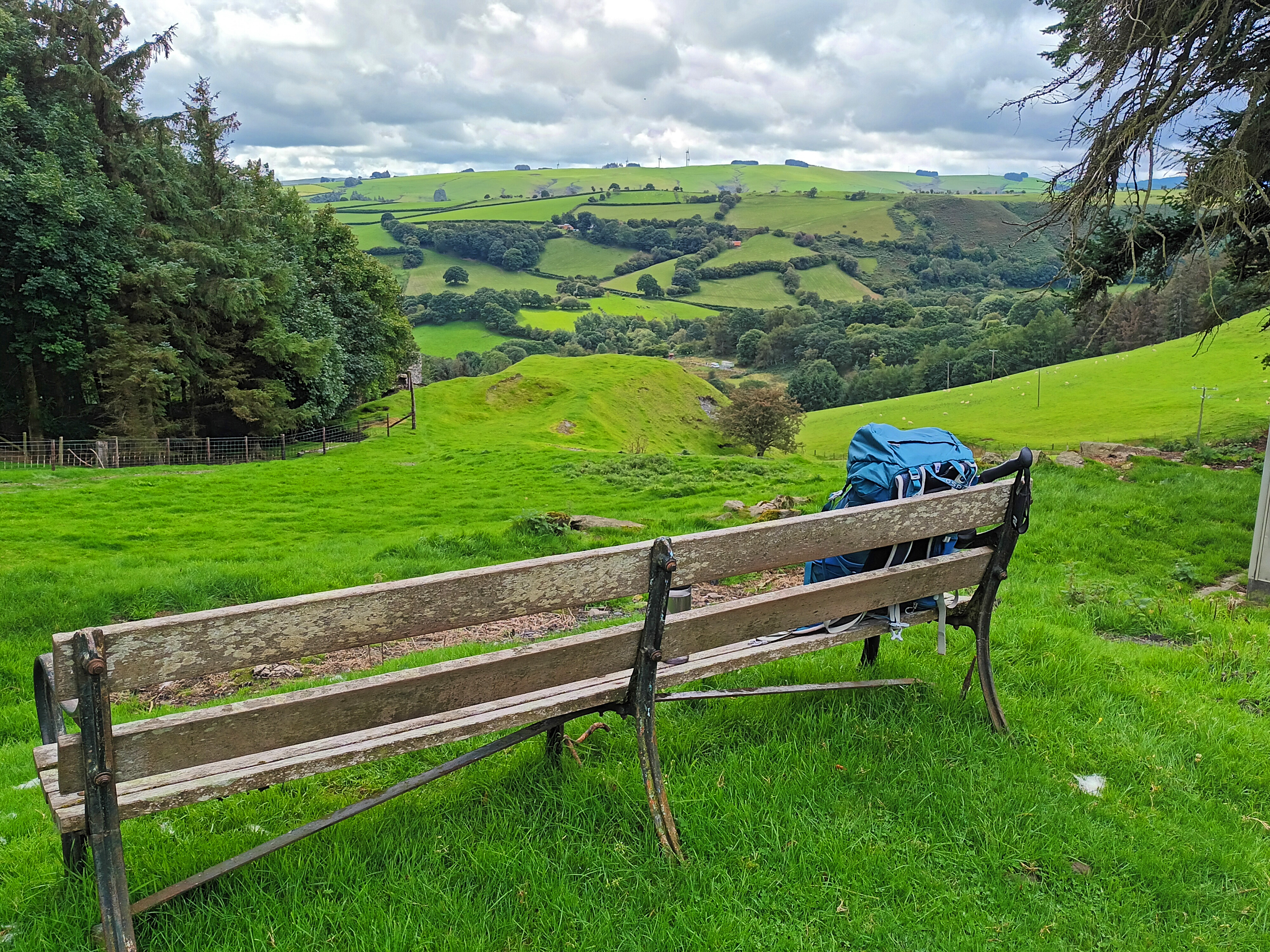
The section of this path by Bryntail, passing a former outdoor centre, had open views across the valley and was so enjoyable we stopped for lunch on the bench in the photograph above.

Dropping down the hillside we could see the massive dam holding back the waters of Llyn Clywedog. We explored the buildings of the old lead mine and appreciated the information boards that explained the grimy processes that were carried out in this industrial site.

We chose to take a path around the head of a small valley to Cwm Deildre. The first section of this path traversed the steep-sided valley and was tough going as we fought our way through flourishing bracken. This was so arduous we were relieved to reach the head of valley and an easier-going track. At Cwm Deildre we joined lanes that took us to paths back to the wooded banks of the Afon Clywedog which we crossed the bridge back to the campsite.

This walk had plenty of interest and big views and I would recommend it.

Llanidloes, the Severn Way & Glynbrochan (approx 16 km / 10 miles)

From Red Kite Touring Park you can either walk into Llanidloes the pretty way, crossing Afon Clywedog and skirting the valley side through woodland. This is about 2.5 km (1.5 miles) or you can walk along the pavement by the road which is slightly shorter. We followed the campsite instructions for the pretty route and after looking around some of Llanidloes elegant and interesting buildings we sought out a coffee shop. The Wild Oak Cafe was an excellent choice for the range of food, good coffee and comfortable atmosphere.

We left Llanidloes on the minor road that follows the River Severn, turning left to cross the river on the quiet lane towards Glynbrochan. Leaving the tarmac we picked up paths on the hillside to our right and became just a little lost until we realised which side of a hedge we should be on! Eventually we scrambled down a steep path through trees to reach the dam of a small reservoir where we had our picnic lunch.

The path from the reservoir to the farm was boggy and we were glad to reach the tracks without our feet getting soaked. A farm track took us downhill back towards the River Severn where we joined a lane that led back to the bridge where we had crossed the river earlier and we were soon back in Llanidloes and climbing the hill back to the campsite on the road route.

Apart from Llanidloes, which is worth a visit, this walk only had the reservoir as a focus for our interest but we stretched our legs and felt we had deserved tea and cake later!