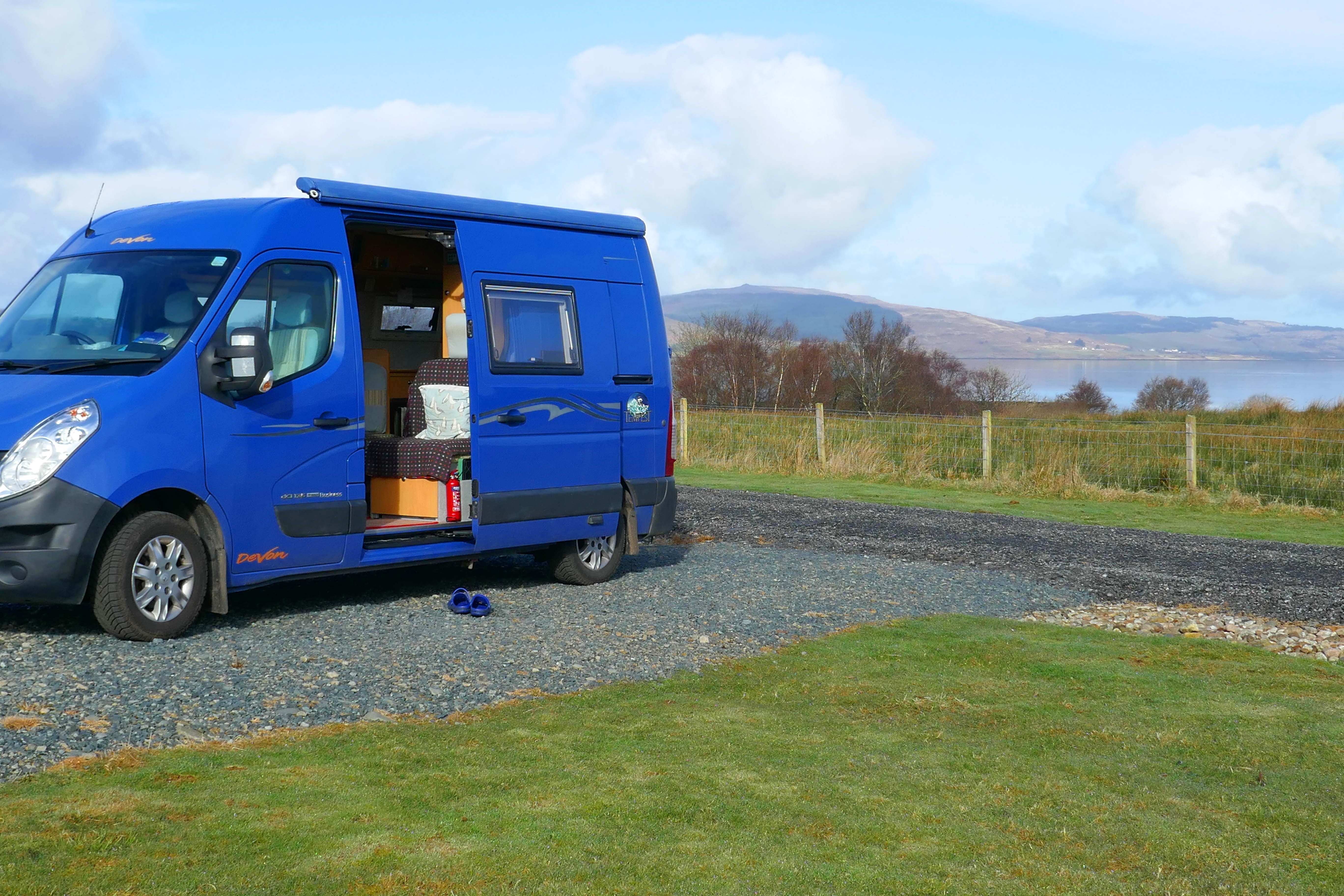
Into Scotland & the northern shore of The Solway

The lighthouse at Southerness

After exploring the southern shores of the Solway, driving into Scotland our first stop was the Old Blacksmith’s Shop in Gretna Green.  Having traditionally been a haven for young people keen to marry, today it has handed itself completely over to romance and retail.  The courtship maze, the wall of love padlocks and a sculpture called The Big Dance with two hands clasped together to form an arch all thawed my heart on a wintery morning! 

We had been blessed with fine weather on the English part of this trip but now rain hammered on the roof of our campervan as we pulled into the nearby Devil’s Porridge Museum.  This bizarrely-named museum tells the story of the huge Gretna Green site that produced cordite during World War One.  Thousands worked here in hazardous conditions and we heard their stories while the rain pounded noisily on the museum roof.  In the local history areas I was fascinated to read about the State Management Scheme for brewing and pubs which began in wartime but continued into the 1970s.  This massive experiment aimed to change the drinking culture and reduce drunkenness. State-owned pubs sold weak beer along with food, forbade the buying of rounds and encouraged games such as dominoes and darts.

The wet and windy weather followed us along the northern Solway coast to The Wildfowl and Wetland Trust’s Caerlaverock reserve.  One of the many things I like about having a ‘van is that you can see over hedges and walls and I pointed out groups of geese feeding in the fields as Anthony drove.  We were just in time for Caerlaverock’s daily swan feeding and from the hide watched the multitude of swans boisterously squabbling over shovelfuls of food.

For the next couple of nights we had an enviable pitch at Queensberry Bay Leisure Park, with an unobstructed view over the Solway Firth and acres of sky.  Watching the birds feeding on the mud, fishing boats leaving Annan harbour and the changing light of sunrises and sunsets could all be done from our snug campervan while the rain pattered on our tin roof.  When we needed to stretch our legs, the campsite bar had the same spectacular view that was perfect for a lazy morning coffee with yesterday’s papers and evening beers.

When the rain eased we walked along quiet lanes finding small moments of joy when we disturbed hares in a field, picked out lapwing calls and found more cheerful clumps of flowering snowdrops.  On Powfoot Beach the remains of wooden piers were draped in shimmering seaweed and an old circular bathing pool that was part of an early 20th century plan to develop this quiet stretch of coast into a holiday resort intrigued us.

Even in winter some good weather is never too far away and we wandered around the ruins and pretty village at Sweetheart Abbey in sunshine the next day.  The impressive lighthouse at Southerness was an idyllic beach combing and rockpooling spot and at Sandyhills Bay we kicked along the soft sand with views across the Solway.  This Dumfries coast is packed with pretty coves and bays, craggy cliffs and charming villages.

On a sheltered inlet with a picturesque outlook, Kippford is delightful.  It was low tide and we could crunch our way along the shell-strewn tidal causeway to Rough Island that sits in a sheltered estuary off the Solway Firth.  A narrow path climbed from the causeway through bushes to the grassy high point of the island and rewarded us with spectacular views across the water to clusters of white cottages on tree-covered hillsides.

In the evening we were treated to a stunning sunset from the campsite above Kirkcudbright while cozily drinking tea in our ‘van.  Less enjoyable were the strong winds that rocked the ‘van alarmingly in the small hours and disturbed my sleep!

The storm passed over and the sun returned the next day as we explored the handsome town of Kirkcudbright.  Sitting on the River Dee that flows into the Solway Firth, Kirkcudbright is a vibrant and lively town with something for everyone.  We strolled around the castle and along the harbour with colourful fishing boats and admired the houses painted in pastel shades.  We picked out two of the three museums and just one café to visit.  Later we hiked to Kirkcudbright Bay, returning to the campsite on inland lanes that wound uphill and descended on woodland paths.

Our campervan trip under the big skies of the Solway Firth had delivered light of every shade from blue skies to gun-metal grey stormy clouds and deep-red sunsets.  As we drove home I suggested to Anthony that campervan trips should be available on the NHS because there was no doubt I now felt refreshed, upbeat and ready to ride out the remaining winter days.

The pictures below show Rough Island, the swans at Caerlaverock and a Dumfries beach.

Where the river meets the sea at the north-west corner of England

The Solway near Silloth

We are never put off by chilly weather and walking under wide and luminous skies and beside sparkling seas on the Solway Firth is a winter treat. The dark days of the year can seem endless and an injection of this clean light and a few colourful west-coast sunsets help me feel optimistic about spring.  This is an isolated corner of England, no one just passes by these coastal towns along the Solway, and for me, this sense of being on the edge adds to the charm.

The estuary known as the Solway Firth separates England and Scotland and we began our tour on its English shores in the small Cumbrian seaside resort of Allonby.  The hazy February sunshine was welcome, the sea shimmered with a pearly light and across the water we could see the distinctive hill called Criffel in Scotland.

Wrapped in layers we headed for the beach for some invigorating fresh air.  Anthony watched for birds and I walked along the tideline, constantly stopping to admire a shell, pebble or piece of pottery that caught my eye.  The chilly breeze whipped up the sand and we both had a healthy sand-blasted glow as we wandered back along Allonby’s street.  A quiet backwater out of season, Allonby is still a popular resort with swanky houses from its heyday.  Most striking is the old Quaker Reading Room, an unusual red-brick building with a clock tower and an uninterrupted sea view.  The building was a sorry derelict sight for many years but has now been renovated as a stylish private house that I yearn to peek inside.

The rolling green countryside in this corner of Cumbria is largely ignored by tourists and the quiet roads are a pleasure to cruise along.  With the exception of a friendly ginger cat, we had the remains of Holme Cultrum Abbey to ourselves.  I was delighted to find one of my favourite flowers, snowdrops brightening up the rambling graveyard and ruins with their shiny green stems and bobbing brilliant-white heads.  Snowdrops cheer up the dreariest day.

Planning our trip, Grune Point had caught my eye.  This remote spit of land, shaped by the tides, stretches along the Solway Firth from the town of Silloth.  Before walking along Grune Point the next morning we went in search of an essential warming coffee and stumbled into the Fairy Dust Emporium Café, a flamboyant and charming café with welcoming staff.  Sitting at one of the wooden tables surrounded by fairies of every shape and size, we rang a bell for service and another fairy gained her wings.  As well as hot coffee the irresistible warm cheese scones with fiery chilli jam were a tonic.

Striding out along the wide promenade above the beach, the Solway Firth and Scotland were to our left and houses with an enviable sea view to our right.  After a larger-than-life metal sculpture of a man and his dog and East Cote Lighthouse we picked up a lane lined with yellow flowering gorse bushes that held the promise of spring.  Nearer to the point we walked along a beach that alternated shingle of colourful pebbles and soft deep sand blown into mini dunes and dotted with bleached driftwood.  The blues of the sea merged into the huge sky, sharp calls of oystercatchers filled the air and the sun warmed our backs; it was as stunning as I had hoped.

Turning the corner of Grune Point we were looking over a vast area of salt marsh and mud flats, wriggling with channels.  The cheese scones and coffee had worn off and we found shelter near an old pill box and cupped our hands around mugs of hot chocolate from our flask, another winter essential.  In a clamour of honking, hundreds of barnacle geese rose from the salt marsh and flew over our heads in unruly v-shaped skeins.  A heavy shower followed the geese and we hurried back to Silloth.

We received another warm Silloth welcome in the Motorcycle Museum, a Tardis-like place packed with bikes and motorcycling memorabilia that will delight anyone.  Silloth once had a racing circuit at the airfield and the owner talked passionately about his experiences of racing there and on the Isle of Man.  Wistfully I recalled my visit to the TT in the 1970s but couldn’t pinpoint the year; of course the knowledgeable owner soon pieced it together from my muddle of vague memories.

A frost had turned the green countryside into a winter-wonderland white the next morning as we drove to Newton Arlosh to see the fortified church.  In this border area churches were built with thick walls, narrow doorways and a tower as a refuge for people and animals during attacks from Scotland.  This medieval church fell out of use and became a roofless sheep pen but was restored in the 19th century by Sarah Losh, a local wealthy and determined woman and it now has many fascinating features including a stone eagle on the roof.

The Solway Firth had narrowed when we picked up its shores again and pulled into the RSPB reserve at Campfield Marsh where the pools were frozen and the ducks waited patiently for the water to melt.  A railway line once crossed these marshes and a viaduct took it over the Solway to Scotland.  In the cold winter of 1881 ice, up to 6ft thick, bumped against the pillars of the railway viaduct destroying sections.  A local paper reported that workmen on the viaduct were distracted when they spotted a hare stranded on a block of ice and floating out to sea!  The railway closed in 1921 and the disused line became part of an ambitious and dangerous pub crawl.  Thirsty Scots would cross the viaduct on foot to take advantage of the more lenient Sunday licensing laws in England.  There are stories of inebriated individuals missing their footing on the bridge and never making it home and until the viaduct was demolished a guard was employed to try and prevent these fatal journeys. 

We wandered around the quayside remains at Port Carlisle before parking in Burgh by Sands to hike onto the salt marsh to the monument to Edward I who died here on his way to invading Scotland.  This land is the grazing for prized salt marsh lamb and an annual auction for parcels of land called stints is still held every year.  Across the River Eden we could see traffic on the M6 and The Metal Bridge Inn, [not surprisingly] named after the metal bridge over the River Esk. This would be our stop for the night.

The Metal Bridge Inn is a landmark for anyone driving north on the M6 and a place that combines isolation with six-lanes of traffic.  Under another orange-red sky I climbed the steps of the railway bridge and looked down on the River Esk as it wound its way through salt marshes to the Solway and the Irish Sea. Skeins of pink-footed geese flew overhead, their energetic honking so loud and uninhibited they drowned out the traffic on the M6!

Although I was craving light, coziness is also essential to get through the winter months and this snug pub welcomes campervans on a dedicated parking area and serves good beer and hearty food.  By the time we walked back to the Blue Bus in the dark all the ‘pitches’ were taken and I was pleased to see we weren’t the only campers enjoying our ‘van all year.

Part Two and our journey into Scotland and the Scottish shore of the Solway will be in my next post.

Photographs of the Allonby’s old Reading Room, Grune Point and Newton Arlosh church below.

Walks from Red Kite Touring Park in Llanidloes

Red Kite Touring Park in Llanidloes in mid-Wales is an adult-only high quality campsite. Staying there had been on our wishlist for a while and this year we got the chance to enjoy the excellent facilities it offers for three nights.

If you don’t know the campsite, it sits above the small town of Llanidloes and has hard-standing pitches with views down the valley. The facilities are modern and excellent and the welcome is friendly.

We like to leave our campervan on our pitch and walk and a quick look at the map suggested there would be no shortage of options and this was true. The campsite is well-run and reception keep a folder of walks from short strolls to long hikes. There are multiple copies of each walk so you can take away the instructions, pack a picnic and set off into the Welsh countryside.

Llyn Clywedog & Old Lead Mines (approx 13 km / 8 miles)

Red Kite Touring Park sits on the hillside above the Afon Clywedog that flows into the River Severn. From the campsite dog walk we picked up a lane that follows the Afon Clywedog away from Llanidloes. The lane climbed steadily through woodland to a farmhouse where we turned right and joined the Glyndŵr’s Way. This is a 217 Km long-distance path that meanders from Knighton to Welshpool. It is named after Owain Glyndŵr who was a Welsh prince and leader who led a rebellion against Henry IV in 1400.

The section of this path by Bryntail, passing a former outdoor centre, had open views across the valley and was so enjoyable we stopped for lunch on the bench in the photograph above.

Dropping down the hillside we could see the massive dam holding back the waters of Llyn Clywedog. We explored the buildings of the old lead mine and appreciated the information boards that explained the grimy processes that were carried out in this industrial site.

We chose to take a path around the head of a small valley to Cwm Deildre. The first section of this path traversed the steep-sided valley and was tough going as we fought our way through flourishing bracken. This was so arduous we were relieved to reach the head of valley and an easier-going track. At Cwm Deildre we joined lanes that took us to paths back to the wooded banks of the Afon Clywedog which we crossed the bridge back to the campsite.

This walk had plenty of interest and big views and I would recommend it.

Llanidloes, the Severn Way & Glynbrochan (approx 16 km / 10 miles)

From Red Kite Touring Park you can either walk into Llanidloes the pretty way, crossing Afon Clywedog and skirting the valley side through woodland. This is about 2.5 km (1.5 miles) or you can walk along the pavement by the road which is slightly shorter. We followed the campsite instructions for the pretty route and after looking around some of Llanidloes elegant and interesting buildings we sought out a coffee shop. The Wild Oak Cafe was an excellent choice for the range of food, good coffee and comfortable atmosphere.

We left Llanidloes on the minor road that follows the River Severn, turning left to cross the river on the quiet lane towards Glynbrochan. Leaving the tarmac we picked up paths on the hillside to our right and became just a little lost until we realised which side of a hedge we should be on! Eventually we scrambled down a steep path through trees to reach the dam of a small reservoir where we had our picnic lunch.

The path from the reservoir to the farm was boggy and we were glad to reach the tracks without our feet getting soaked. A farm track took us downhill back towards the River Severn where we joined a lane that led back to the bridge where we had crossed the river earlier and we were soon back in Llanidloes and climbing the hill back to the campsite on the road route.

Apart from Llanidloes, which is worth a visit, this walk only had the reservoir as a focus for our interest but we stretched our legs and felt we had deserved tea and cake later!

Crossing the Forest of Bowland in a Mini Adventure

Occasionally we have a holiday without our campervan [honest] [And we always miss the Blue Bus when we leave it behind]. Our latest short break hardly took us out of Lancashire. Here is the story of our mini adventure over a couple of days when we hiked across the Forest of Bowland.

The walk of around 40 kilometres is best done over two days with an overnight in Slaidburn. You have some options on the route and you may vary it depending on the weather, time of year and how much time you have available. The hike features in the Cicerone Walking in Lancashire book as a 45 kilometres (28 miles) walk and if you want a detailed description this would be worth purchasing.

We put the walk on our wish list recently and for the last six weeks I had been keeping a close eye on the weather forecast but July just got wetter and wetter. This wasn’t the weather I wanted for hiking across empty moorland and I had to wait until early August for a break in the rain and a window of sunshine. Excited, I rang the Hark to Bounty Inn in Slaidburn to book our overnight accommodation and we packed the rucksacks with essentials.

We caught the early bus from Lancaster towards Kirkby Lonsdale, getting off in the village of Wray. From here, if you have time you can take the paths up the wooded Roeburn valley but we headed straight up the lane to High Salter, reducing the walk by two kilometres. This lane was quiet and enjoyable with panoramic views over the Lune valley and to Ingleborough, Pen-y-Ghent and Whernside, the Yorkshire Three Peaks. We passed some rustic wooden sculptures and a well-kept memorial bench surrounded by flower beds.

At High Salter we left the last of the farms and reached the gravel track of Salter Fell Road that crosses the moorland to Slaidburn. At first the track climbs steadily up to the watershed, the River Roeburn tumbling below us. From the summit the streams no longer flowed into the River Lune but were heading towards the River Ribble. In this treeless high land the views across the moorland were wide open with the stony track snaking across the landscape. There isn’t much obvious wildlife on these grouse shooting moors but a lizard scuttled away from our feet and a couple of kestrels hovered over the slopes. A herd of belted galloway cows ambled towards us on both verges of the track, forming a moving guard of honour. These calm cows are nevertheless bulky and we walked between them quickly but cautiously.

We stopped on a rocky outcrop near the watershed for lunch taking in the view across purple flowering heather. The track is used by off-road bikers and cyclists and a group of scramblers dented the peace and our solitude as they bounced by.

Walking with a heavier than usual rucksack was tiring and we stopped again in the mid-afternoon for cake and I lay back on the heather gazing up at the wispy clouds in the blue sky, waking up a short while later! Up to now route finding had been easy but this changed as we left the Salters Fell Road for Croasdale House on a soggy and overgrown path. Negotiating nettles, farms, stiles, cattle and dogs we eventually reached a lane into Slaidburn. Staying on the track and lanes into Slaidburn would have been easier going and a similar distance although it was harvest time and the narrow country lanes were busy with farm vehicles.

We reached the Hark to Bounty just after they opened at 17.30 and were grateful for a room to rest in with a hot shower and a kettle for tea. The Hark to Bounty is an old inn that is full of character and has a heart of the community feel. The bedrooms are comfortable and individual but not ultra-modern. That evening we ate hearty food in the bar and slept the deep sleep of backpackers. [The Hark to Bounty closed in October 2024, although new tenants are being sought.]

Slaidburn is an unusual village. At first glance it looks timeless and this is in part because it is owned by one family. Sitting in agricultural Lancashire Slaidburn has no modern buildings and is not wall-to-wall holiday lets. The 17th century cottages and farms are rented, the school remains viable and there is still a village shop and pub. Slaidburn also has a handmade chocolate shop, a cafe and a youth hostel available for sole use.

There had been some rain showers overnight but the next morning was fine and after breakfast we once again heaved our rucksacks onto our backs and set off along the River Hodder to Stocks Reservoir and Gisburn Forest. Built in the 1930s, Stocks Reservoir get its name from Stocks-in-Bowland, the village that was flooded.

Gisburn Forest is vast, apparently almost 3,000 acres vast, so it was no surprise that it took us most of the morning to cross it. As is often the way when we can’t see the route for the trees, we got lost more than once and without GPS we would probably still be wandering around the forest! All Gisburn’s acres have plenty of variety and from the shores of Stocks Reservoir we walked through magical vivid-green treescapes, alongside sunny verges where peacock butterflies were thriving and, of course, through dark pine forests. Eventually we emerged with some relief at the highest point, Whelp Stone Crag, and stopped for lunch looking across the farmland towards Yorkshire and our walks end.

The relief was short lived as we still had some kilometres to walk and a bus to catch. We tried to choose the best route from the many lanes and footpaths on the map but twice ended up on an overgrown walled lane that no one had tramped along for some time. Both of these were thick with nettles and brambles and, wearing shorts we emerged with legs covered in scratches and stings. I always react badly to nettle stings and my tingling legs were soon attractively covered in swollen red lumps that only antihistamines can deal with. Anthony doesn’t suffer in the same way but did collect a tick.

After more encounters with young bullocks that herded and trotted curiously behind us, way too close for comfort. We tried to stay calm and walk rather than giving way to the urge to run! A hare bounding over a wall delighted us and we climbed gates that were tied shut with string despite being on a right of way and heaved ourselves and our rucksacks over so many stiles we lost count until we reached the A65 and the bus stop by The Craven Arms in Giggleswick. There is a railway station here but we caught the cheaper bus home, changing in Ingleton.

There is something satisfying about completing a linear walk while carrying your kit and we enjoyed our short trip. The warm weather meant we weren’t laden with lots of extra clothing but we did carry plenty of water as well as spare food [apart from Slaidburn there were no shops or cafes on our route] and our emergency first aid kit.

A week in North Yorkshire in a Campervan

The cliffs at Flamborough Head

We were lucky! February was a fairly dry month in 2023 and this helped us make the most of our week on the North Yorkshire coast in our campervan. Without wind and rain to hide from we were able to spend our days being relaxed, exploring the coastal towns and villages and walking on the coastal paths.

Knaresborough

We reached the coast after breaking our journey in Knaresborough. The sun was shining so we took the opportunity to walk through the woodland by the River Nidd into the town and strolled along Knaresborough’s riverside under the soaring arches of the railway bridge. We had drinks in The Blind Jack, an atmospheric pub with wooden floors soaked with years of beer and jolly lanterns strung around the ceiling.  It was still February but walking back at sundown blackbirds sang loudly from the trees heralding spring was in sight and really only just around the corner.

Robin Hood’s Bay

Reaching the North Yorkshire coast, we stopped at Crook Nest car park north of Scarborough and followed the cliff path. Waves whispered below us, the yellow gorse was flowering and Scarborough Castle was visible in the distance.  We returned on the Cinder Track cycle route, an old railway line that links Whitby with Scarborough.  

Middlewood Farm Holiday Park isn’t a perfect campsite for facilities but it is well located for exploring the coast around Robin Hood’s Bay. There is a regular bus service and we used this one day to get to Whitby and walk back. On another day we put together a circular walk to Ravenscar.

The coastal path from Whitby to Robin Hood’s Bay is around 11kms that begins with a lung-busting climb up the steep steps to the abbey. After taking in the views over the town and harbour while I got my breath back we took the easy-to-follow undulating path along the cliffs. Oystercatchers searched for food on the shore below us and fulmars huddled on ledges. The path meandered around the white buildings of Whitby High Lighthouse that have an uninterupted sea view.

Robin Hood’s Bay is an attractive jumble of houses that tumble down facing slopes. Strolling between the huddle of buildings you reach the sea. On the way you pass a number of pubs and cafes and we were drawn into The Laurel Inn by the promise of Old Peculier. We stumbled into a cosy room that could have been a set for a 1950s film. The room was heavy with coal smoke; a family were playing card games opposite the corner bar and Johnny B Goode played on the music system.

Like all visitors to Robin Hood’s Bay we wandered through the narrow streets, peeking into quiet corners and dead ends finding picturesque cottages on every junction.  We did some window shopping and had morning coffee leaning on sunny railings looking over the beach and the North Sea.

More undulating coastal walking along the Cleveland Way took us to Ravenscar.  The descent to Boggle Hole and back up the steps to the clifftops was particularly arduous.  No matter how far we walked, the picturesque red roofs of Robin Hood’s Bay were always visible behind us. In front was the prominent headland of Ravenscar. Climbing up to the headland we walked around the castellated gardens of Raven Hall Hotel and, thanks to a more observant couple, watched the large group of seals hauled up on the rocks below.  In the hotel we ordered tea and their homemade shortbread biscuits.  These were heart-shaped for Valentine’s Day! The Cinder Track made for an easy walk back to the campsite.

Bridlington

Moving on, we drove south to Bridlington, diverting inland to Burton Agnes Hall for a favourite February treat, carpets of snowdrops. The woodland garden here has waves of small white flowers with their glossy-green leaves. At Bempton Cliffs RSPB reserve we walked to the viewing platforms and watched guillemots, gannets and fulmars getting their crowded nests ready and claiming territory.  This sign of spring was both riotous and joyful. 

Once again the bus was helpful with linear coastal walking. From the Caravan and Motorhome Club’s Bridlington site we caught the bus to North Landing and walked around Flamborough Head back to the ‘van for about 13kms.  Ahead of the sunshine, a faint mist cloaked the lighthouse and the fog horn moaned. Steep sections of the path were sticky with mud and our boots were soon messy but the nesting birds on the cliffs and seals on the shore made this a fabulous walk. Standing above one remote cove we listened to the melancholic seal songs echoing around the rocks.

We had chosen a pitch on the edge of the campsite. This means a longer walk to the facilities but has other rewards. From the Blue Bus bird hide we spotted deer making their way through the woodland and long tailed tits on the trees.

On a windy [but still dry] day seafront paths took us into the seaside resort of Bridlington. Living in Morecambe we compare every seaside resort to our home town. Like many of the north of England’s seaside towns, Bridlington doesn’t ooze wealth but we found lively and attractive corners. After coffee in the faded opulence of The Pavillion we caught the train to Filey, another resort where the buildings tell stories of former fortunes. Filey Brigg, a rocky and narrow sandstone promontory on the edge of the town was bracing in the breeze but gave us our last views along the wonderful North Yorkshire coast until next time.

The pictures below show public art in Bridlington, a guillemott at Bempton Cliffs and Robin Hood’s Bay.

Scottish Campsites Worthy of Mention

The view from Glencoe Mountain Resort

Our trip to Scotland in March and April this year was as wonderful as ever. In the three weeks we were away we stayed on some good campsites, some average campsites and some rip-off / badly-run campsites that are best never mentioned again! Focussing on the positive, here are three I would recommend.

Ar-Dachaigh Croft Campers, Carrbridge

Millie runs a boutique [small] campsite in Carrbridge for just three campervans / motorhomes up to seven metres in length. Two of the pitches are side by side and we had the one alongside her garage with an open view. We received the friendliest of welcomes and were given some freshly laid eggs from her hens. We used the wi-fi and hooked up the ‘van. There are bins, toilet emptying and water and for this you pay £15/night (less if you don’t need electric). There are no facilities but the house is on a quiet village road and we enjoyed a peaceful night. If you don’t have your own toilet, just a few minutes walk away are the local public toilets which are kept clean and amazingly even heated in winter. We walked by the river and noticed the fish and chip van calls in the village on Friday evenings. There is a village shop and a hotel where you can eat. The site is open all year and we will certainly stay here again.

Pennygown Holiday Park, Salen, Isle of Mull

When we were looking for somewhere to stay on Mull we chose Pennygown mainly for its location. We were hoping to climb Ben More and the site isn’t too far from the path and it is also handy for some coastal walking. It turned out to be an excellent choice and this open and well-run campsite suited us very well while we were on Mull. The modern facilities block is kept spotlessly clean and warm and the showers are good. There is one indoor washing up sink and two others outdoors and there are laundry facilities. The stroll by the old cemetery and around the coast and back by the river is perfect in an evening and you will spot some of Mull’s famous wildlife. Keep your dogs on a lead here so you don’t disturb the ground nesting birds. The owner is attentive, helpful and around for much of the day. This is £31 / night which seemed to be the going rate on Mull. The bus between Craignure and Tobermory passes the campsite a few times a day.

The Blue Bus at Pennygown Holiday Park

Glencoe Mountain Resort, Glencoe

It is hard to beat Glencoe Mountain Resort for views, looking along the glen to the pyamidal shape of Buachaille Etive Mòr that dominates the entrance to Glencoe. We have stayed here before and always enjoy it and this business deserves campervanners support. There are now only a few level campervan pitches with hook up next to the rows of small huts which are popular with those walking The West Highland Way. For £22 a night [£2 less if you use your own shower] you get everything you would find on an expensive campsite and more. The facilities are heated [a luxury that we didn’t always enjoy on sites that charged £35/night!] The showers are good and hot [also not always a given]. There is a drying room [very useful and rarely found] and indoor washing up sinks. Behind the cafe are modern toilets. The light and airy cafe is open during the day and often in the evening too if you want to avoid cooking, otherwise it is a fabulous walk down to The Kingshouse Hotel. You can park overnight for free at the bottom of the car park and just pay to use the showers but if, like me, your equilibrium needs a level pitch then you might struggle to feel stable on the slope.

The bridge in Carrbridge

Norfolk seen from a Campervan

It isn’t surprising that I like guidebooks. On our trip around Suffolk and Norfolk we had the pleasure of being accompanied by a pair of tattered 1940s Penguin guides. These dated companions steered us through East Anglia, pointing out the must-see sights of 80 years ago. So much has changed since the post-war period I felt like a time traveller but when we pulled up at Burgh Castle I was also confused as this featured in our Suffolk guidebook but is now in Norfolk.

Whichever county it is in, the scale of the Roman ruins at Burgh Castle are the big story. The rough stone walls and round corner tower soar to over 4m high and I wondered why this building hasn’t been on my wish list for some years. It was only chance that I had chosen it from the out-of-date guidebook. And it is free to visit! I have paid £££s to visit Roman ruins that are pretty much just an ankle-height floor plan in stone, Burgh Castle has scale and presence.

After wandering around the large site I walked down to the banks of the nearby River Yare. The East Anglian coastline has changed in the last 2,000 years and the ruins would originally have guarded a ‘Great Estuary’ that flowed over the rooftops of Great Yarmouth. In those days ships would have docked below the castle.

According to our 1940s guide Great Yarmouth, ‘is sometimes called the Venice of East Anglia.’ I don’t know if anyone still makes that particular comparison! The short stretch of town walls are a reminder of an older Great Yarmouth but I was more interested in the modern Banksy painted on a brick gable end. The artist has cleverly positioned a couple so that they appear to be dancing on the roof of an adjacent bus shelter while an accordion player sits casually on the corner. Later we walked along the prom and gave ourselves a sugar rush with donuts and ice-cream.

We have visited some of the Norfolk coast before but the Norfolk Broads were new territory. From the Caravan and Motorhome Club site we caught the bus to Wroxham and Hoveton on a drizzly day. These two villages merge around a bridge over the River Bure that funnels the never-ending stream of trafic. Cars were less in your face in the 1940s but the local institution, Roys, was already here. Known as the biggest village shop, there are actually many shops; a Roys department store; a food hall; a garden centre and a DIY shop; this isn’t quite a one-shop village but they give it a good try.

Despite the abundant motorcars, the villages are dedicated to boating. This is the place to hire boats, visit boat yards and do other boating things. On the bus we fell into conversation with a man who described himself as a ‘water gypsy.’ No one else would talk to him so he told us he had received no schooling from nine years old, his mum had studied psychology at Hull University and he described his life on the move from 24-hour mooring to 24-hour mooring.

From the campsite we walked along a grassy dike that meandered through reed beds, the chugging of boats on the River Ant in the distance.  A marsh harrier flew by, a fish dropped from the talons of a herring gull and was lost in the reeds and a flock of teal rose from a pool in a shudder of wing beats and circled overhead.  Approaching a windmill, cormorants perched along the wooden sails, their wings spread out to catch the weak September sun. 

I was keen to experience the watery nature of the broads and we were booked on the morning electric boat trip from Toad Hole Cottage. Waiting for our guide we sat drinking coffee on a bench, lazily watching a sailor polishing the already gleaming wood on a handsome wooden wherry.

It turned out we were the only people who wanted to explore the Broads in a quiet electric boat that morning and we had the luxury of spreading out on the small craft. After a short distance on the main river we turned left into a channel where the reeds leaned in against the boat.  As the thrum of the river boats melted away I found myself in the backwater world of Swallows and Amazons.

Later we had our lunch in a hide, thrilled to see a kingfisher fly back and forth.  We explored How Hill House’s verdant and dripping secret garden before taking the paths to the village of Ludham and joining the river again by the ruins of St Benet’s Abbey.

In Cromer I led Anthony along the beach to find another Banksy on the sea wall. ‘Luxury Rentals Only,’ a comment on our broken housing market, is out in all weathers and fading. I liked Cromer with its prom and pier, its beach dotted with colourful pebbles and tall breakwaters crossed by metal steps dripping with black seaweed. Our 1940s guidebook ignores the pier but was right about the ‘excellent beach.’ 

Another showery September day was ideal for taking the train to Norwich. Here we visited the cathedral and I walked round and round the font that is made from two polished copper bowls. These were given to the Cathedral when the Rowntree Mackintosh Norwich chocolate factory closed in 1994.  Colourful modern stained glass gave a vibrant glow to otherwise gloomy corners of the cathedral and the cloisters radiated peace and light.  We did wander some of Norwich’s pretty streets but, as the rain got heavier, we lost the desire to explore and probably didn’t do it justice.

Sitting outside at the Priory Maze café near Sheringham the waitress moved between the tables gathering up all the sachets of mayonnaise.  ‘The rooks take them away and eat the contents,’ she told us, leaving the salad cream which apparently is less appealing to these connoisseur rooks! From the campsite we had hiked to the top of Norfolk (if there is a hill we will find it). Cromer Ridge is just inland and reaches the dizzy heights of 102m so it wasn’t a tough ascent!  Our route passed a village green with a pebble-built house before climbing through woodland where we stepped carefully over tree roots.  We descended through heathland and skirted the fields of a horse sanctuary before reaching Priory Maze and Gardens.

Copper beech and hornbeam have been planted using the layout of the ruined priory as the basis for the maze.  We began in a disciplined way, alternating who chose which direction to turn to find a way to the centre. Very soon we were lost and our choices became random and haphazard and it was only luck that eventually led us to the central viewing platform.

The maze and gardens were fun but couldn’t beat the walk along the beach from Sheringham to East Runton. The soft sandy cliffs that are basically a giant sandcastle erode easily and attempts have been made to protect these from the sea. The futile remains of wooden revetments littered the beach and we wound our way around vertical posts and under buttresses of grey weathered wood studded with rust-red nails.

I had been looking forward to Blakeney Point and it was a memorable day but not for the reasons I was expecting. Our Penguin guide noted that this four-mile long shingle ridge backed with salt marshes was given to the National Trust in 1912. We parked at Cley Beach and turning to make coffee in the back of the ‘van I was floored by a hot pain that shot from my spine to the back of my legs. I assumed it would wear off and, after drinks, carefully put on my waterproofs.

The squally wind and the deep pebbles along the ridge made walking agony and I shuffled down the slope to meander on the sand by the crashing waves, where the going was a little easier. At the old Watch House or Halfway House we scrambled back to the shingle bank to look over the salt marshes and the remote building. Exhausted, I sat down and as we ate our picnic lunch we made the decision to head back. Walking was easier with a tailwind.  We collected a few bits of litter and admired some of the multitude of shells.  Seals popped their heads above the waves and a group of Brent geese flapped low over the sea. 

Dosed up on ibuprofen I could manage to walk around Wells-next-the-Sea for the next couple of days. The sun returned and watching it set from the beach was as idyllic as I could have hoped. Waking up to the joyful honking of geese as they flew over our campervan was special too. Our 1940s guide doesn’t mention the beach huts that are now a Wells-next-the-Sea icon and also doesn’t firmly place the town on the coast, it is just called Wells.

Striding out to Holkham Hall it seemed that I was okay walking upright. I just needed to avoid bending, easier said than done in a small campervan!    Our guidebook told us that visitors were welcomed at Holkham Hall 80 years ago and they still are. We took paths and tracks around the house and through the estate and ate our lunch on a bench overlooking Well’s harbour.  Our guide told us that in 1940s Wells ‘… you will find no piers or funfairs …’ but ’if you are in search of ‘local colour’ drop in at the Shipwrights’ Arms one evening.’  Unfortunately, this pub is now closed so we sought out local colour in the many quaint corners.

Opening the blinds on our final day in Norfolk it was a pleasure to see blue sky. We arrived at Titchwell RSPB reserve as the staff were holding an outdoor team meeting and we spent a fabulous hour walking by the pools to the dunes and the sandy beach.  The blue sea met the blue sky on the horizon and the space felt phenomenal. 

By the time we reached Castle Rising the weather had changed to misty and chilly autumnal weather.  The castle has a circular ditch or moat to cross to the gatehouse and a well-preserved stone keep. We climbed up to the different floors finding details that have survived the centuries. 

After sitting for even an hour in the ‘van I would unravel myself from the seat in a shambles of bent and staggering bones. This acute pain lasted just a short time and once everything had loosened up I could stand and walk normally. I was grateful we weren’t making the long journey back to Lancashire in one run and had Derbyshire friends to stay with on the way.

The Suffolk half of our trip is in a previous post.

Footnote on the pain I was experiencing. This became sciatic pain in my right leg. I had lots of physio through October and November 2022 and eventually visited my GP and started taking amitriptyline which meant I could sleep peacefully all night. By January 2023 I was more or less pain free.

Where we stayed

We used two Caravan and Motorhome Club Sites, Norfolk Broads and Seacroft near Cromer. We liked the former, it was a well-run site with a bus service into Norwich and a walk along the River Ant and to St Benet’s Abbey from the site. Seacroft is an excellent location for Cromer and Sheringham but is in need of an upgrade.

We also stayed at Pinewoods at Wells-next-the-Sea, an expensive site with a fantastic location. For the money I would have liked heating in the facilities at the end of September but our pitch in the reeds was heavenly.

Suffolk in a Campervan: Beaches, Byways & some Striking Buildings

Shingle beaches that stretch to the horizon, coastal villages packed with cottages and ancient flint churches were what drew me to Suffolk. This was our first visit to this county and I was delighted to find all these things and more on our autumn trip. We rolled into Suffolk at Bury St Edmunds in our Blue Bus and stayed firstly near Ipswich before following the coast eastward.

Beaches

In the couple of weeks we were in Suffolk we walked miles along shingle beaches deep with pebbles and soon learnt how tiring wading through this is. We also found sandy beaches that were made for buckets and spades. In Orford we took the boat to Orford Ness and were spell-bound by the combination of post-war military structures and hardy plants. You couldn’t miss the power of nature. Between Minsmere and Dunwich seal pups sat in the surf as we meandered between the clumps of sea kale that breaks up the shingle and climbed up to the heath-covered cliffs.

In Southwold we kicked along the soft sand below rows of colourful beach huts, each one individually decorated, and stood under the pier watching the tide crashing against the complicated lattice of pier struts. Later we sampled a glass of Adnams, the local beer, in a pub off the seafront.

Villages

While Thorpeness seems hardly real with its holiday villas that are straight from Disney, the weatherboard houses of Aldeburgh felt real and charming. The brick and stone Martello Tower is solid and dense in comparison to the village. This is now a Landmark Trust property you can rent and what a treat it would be to stay there. If you’re interested in unusual places to stay in, the famous House in the Clouds old watertower in Thorpeness is also available as a holiday rent.

At Aldeburgh we gazed across the sea, guessing there was nothing between us and the Netherlands.  From the edge of the village, the dyke path took us on a lovely green route around Aldeburgh passing productive allotments. Leaving the houses we picked up a path through a nature reserve where trees arched above the sandy path, sunshine dappled through the foliage and blackberries glistened by the path and we picked ripe ones as we walked.   

Lavenham is hard to beat in the charming village awards. Over 300 buildings are listed in this well-preserved medieval village that was once a wealthy wool town and walking the narrow streets and lanes to the market place is like undertaking a crash course in timber-framed building designs.

Towns & Cities

We were initiated into the sights of Suffolk in Bury St Edmunds and it was the perfect introduction to the county for two Suffolk newbies. We began in the park of this small town, wandering around the abbey ruins to the monumental and richly-decorated stone gatehouse. Later we visited the cathedral, spent a fascinating hour or so in the Moyse’s Hall Museum and finished off our trip in a sunny square with coffee and cake.

From our campsite near Ipwich we visited Ipwich and Felixstowe. The bus to Felixstowe took the slow road and we sat on the top deck until the end of the line at Landguard Fort.  You can visit the fort but we were keen to walk and after watching the huge cranes picking up the containers and placing them on the ship like a giant tetras game we set off along the seafront.  The sea defences were easy to follow back to Felixstowe with views to the pier and more ships out at sea.

In Ipswich we began with the waterfront, a marina surrounded by old warehouses, the Custom’s House and some shiny new buildings.  We had coffee and watched students learning filming techniques with the boats as a backdrop. We wandered through the city centre, passing all the shops you would expect, to Christchurch Park, a large green space with grass, woodland and a pond. Christchurch Mansion is a free museum with a collection of paintings from local artists Constable and Gainsborough.

In Lowestoft we found our way around a sprawling Bird’s Eye factory, no doubt pumping out boxes and boxes of fish fingers, to find England’s most easterly point.  I expected a bit more of an attraction here but the orientation circle in the concrete promenade was informative. Checking out the distances we realised we were closer to mainland Europe than we were to Lancashire! Walking along the promenade we could see a lower prom had been washed away by the sea, so I guess Europe is getting further away. Inland we climbed one of Lowestoft’s scores, narrow steep alleys, to the High Street, an old shopping street with some historic buildings and quirky shops

Sitting by the River Waveney between Beccles and Lowestoft a kingfisher flew low over the water and minutes later a swan landed perfectly in front of us and harrumphed occasionally and gently until its partner negotiated an equally skilful landing and they slipped away together.  A buzzard emerged from the trees opposite, circled the field and flew away as a group of geese passed overhead.  Beside us were bushes decorated with bright-green hop fruits that look too exotic to be British. We had caught the bus to Beccles and after coffee and cake in a cosy but wildly expensive café we followed the Angles Path along the Waveney, a watery highway busy with boats but few other walkers.  The weather was quiet, with no wind and the cloud hung in the sky like a billowing duvet. In the wet meadows alongside the river we spotted plenty of Chinese water deer with their teddy bear ears and strange hare-like run.  

Churches & Abbeys

I had read about Blythburgh Church but that didn’t prepare me for the loveliness of this medieval church.  The exterior flint has been worked and arranged to look like chequer-board tiling.  Inside the wonky tiled floor held stories from thousands of feet and I stepped up to the high medieval font.  We had come to see the painted angels on the wooden ceiling who peered down on mortals in the nave, their magnificent wings outstretched.  While I admired the carved wooden pew ends, Anthony found an information panel about JF Kennedy’s brother, Joe, who died in a Second World War plane explosion nearby. 

Leiston Abbey, a ruined abbey not far from Sizewell, today suffers from metal-fence-itis. Ugly temporary fencing circled every part of the ruins that presumably are unsafe.  Nevertheless, beyond the fencing we could appreciate the structures, the 14th century arches and windows and the cloisters that retained their sense of peaceful space.

In Pakefield on the edge of Lowestoft, we walked around All Saints and St Margaret’s Church on the seafront. Technically two churches built next to each other, you will notice the tower is attached to one half of the M-shaped roof. These churches were once some distance inland but coastal erosion has led to the loss of many houses here as the sea has nibbled at the land. In the Second World War the buildings took a direct hit and were rebuilt.

Southwold‘s parish church was another church we took the time to visit. This church is fascinating for its Jack. This is a wooden statue dressed in armour, and holds a sword and an axe, which can be used to ring the bell at the start of a service. The Jack has been in the church since the 15th century and it is thought it was originally made to strike the hour for a clock and was repurposed.

Byways

Off the main roads, Suffolk seemed to be characterised by narrow lanes, plenty of them going nowhere but to a small coastal village. We took the Blue Bus to the end of the road at Orford and caught the National Trust boat to Orford Ness (see above). Driving to the RSPB reserve at Minsmere the lanes became narrow and then even narrower as we got closer to the sea. The lanes wound around fields and woodland until I had no idea which way was north and whether we were heading in the right direction or not. The only thing you can do is trust the RSPB signs! After our walk we had to follow the same byways in the opposite direction.

Sizewell was an exception. We immediately noticed what a good road it was to Sizewell, presumably for the traffic to the nuclear power station.

Where we stayed

We stayed at some Caravan and Motorhome Club sites on the way down [Grafham Water] for one night and at White House Beach which was handy for Lowestoft. These were both the usual standard.

For Ipswich we stayed at Little Sage Hill, Copenhagen Cottage Caravan and Camping Club Certified Site. I reviewed this site here.

Beach View Holiday Park at Sizewell is a large independent site that was okay for a couple of night and was well situated for walks to Thorpeness and Aldeburgh.

Campsite Review: Little Sage Hill, Copenhagen Cottage Caravan & Camping Club CS near Ipswich

We have used quite a few of the small campsites affiliated to the Camping and Caravanning Club and called Certified Sites [CS]. Over the years we have found these sites do vary hugely in standards and facilities. While the unexpected can be delightful it can be best to read the reviews for a CS carefully to see if it is a site for you. This one on the edge of Ipswich worked very well for us and gave us a lovely rural retreat with reasonable facilities.

The campsite, as the name suggests, is on a hill. The landscape is large fields of cereals which look a tad dreary after harvest, although there is a planning application in for solar panels which will brighten things up. At the top of the hill is a wooded idyll that contrasts with the sterile agricultural surroundings. The owners have created a vibrant oasis of wildlife that is peaceful and we watched all sorts of birds, butterflies and insects from our pitch.

The campsite is grassy and isn’t open all year but it appears to be well drained. Pitches are not marked out, although there are some nooks that are the perfect size for one campervan and other spaces that are obvious rows. Fortunately it wasn’t too busy when we were there in mid-September so we could spread out. As well as being surrounded by trees and bushes there are shrubberies dotted around that screen other campers, giving a sense of privacy.

After opening the gate using the lock code we had been sent before arrival, we took some time choosing a pitch as there were no instructions. Later we found the path through the trees behind the facilities that took us to the owner’s house to pay. The owners are friendly and, if you don’t find them at home you will most likely see them later as they regularly wander around the pitches in the early evening to check everyone is happy.

The facilities are in what I [mistakenly] called sheds! I was corrected and told they are beach huts! One of these ‘beach huts’ has a sink for washing up that was a tad lacking in elbow room. Another has a toilet and sink. The largest [and most beach-hut-like] of the huts is equipped with an electric shower [this was okay], toilet and sink and was brighter and airier. Showers were an additional £1 and this is left in an honesty box. These facilities were mostly sufficient when we were there along with only three or four other units, although we did have to queue to shower and wash up at least once. If it was busier, particularly with guests in tents, these facilities would be pressed into more action and it could get crowded. Everything worked fine although, as the September days became cooler we would have welcomed some heating in the shower room.

The fourth shed is an information hut and when we visited there was honey from the owners bees on sale.

Walk down the gravel track and turn left along the lane, cross the main road [B1113] and you are in the village of Bramford. This 10 minute walk takes you to a bus stop from where there is an irregular week day bus service into Ipswich that we used both days we were here. Bramford also has a pub that provides meals and a village shop.

Ipswich is well worth visiting. It has a fabulous waterfront, plenty of shops and Christchurch Mansion, a beautiful Tudor house that is an interesting museum and art gallery. We ate a delicious lunch in Hullabaloo Vegan Cafe, a comfy and friendly establishment on St Peter’s Street, between the marina and the city centre.

If you like cycling on country lanes, a regional cycle route, number 48, follows the lane by the campsite and is part of a 48 mile route around Suffolk.

[Not] The End of Wainwright Bagging

One of us in our house [and its not me] has completed his Wainwright fells! Although we have been walking up Lake District hills together since the 1980s, he didn’t start determinedly ticking off his 214 Lake District Wainwrights until 1998. It was one of those significant birthdays that inspired him to begin and the team [in the photograph above] climbed the Old Man of Coniston to celebrate his 40th birthday, marking the beginning of his Wainwright journey.

The Old Man of Coniston was a strange hill to choose in some way as it was one we had already climbed together twice over the previous 15 years. It was, of course, because of the name and now it is our most climbed Wainwright as we go back every ten years on my partner’s significant birthdays and follow one of the many routes up this much-loved mountain. His birthday is at the end of winter and although we were lucky to have fine weather when he was 40, the photograph of the small select group of us on the summit when he was 50 shows a different side of the mountain. Only our son and daughter-in-law and our toughest friends wanted to climb the Old Man on a cold damp day and looking at the photographs you can hardly make out any of us for the low cloud and layers of waterproofs! For his 60th we decided to be sociable and moved his birthday hill walk to June and we were rewarded with a fine sunny day with a bevy of friends.

Unless you are a very organised Wainwright Bagger, as you get to the end of your Wainwright list you will have random hills dotted around the Lake District to walk up [or maybe this is just us]. Our visits to the Lake District became dominated by walks up these outlying fells and others that we had somehow missed on previous trips. Our climbs up, down and around the Wainwrights have perhaps sometimes missed the obvious and most efficient routes and I can often be heard saying, ‘Why didn’t we walk up this hill when we were there,’ as I point to the next pimple along the ridge. This habit of almost climbing the Wainwrights one at a time will be why we have also walked up and down Fairfield more times than I can count. As well as being a fine hill, Fairfield [above Ambleside] is often on the way to another summit. Keen Wainwright Baggers will complete the handful of fells around Fairfield in one long and tiring day. We go up and down again and again! Fortunately, it doesn’t matter how many times we visit I will never tire of the Lake District fells.

Those energetic hill walkers will probably climb two fells, Hopegill Head and Whiteside above Crummock Water during the same day as they are bagging Grasmoor and maybe some other surrounding hills. For whatever reason we hadn’t done this. It might be laziness but no matter, it just means that we had another glorious day walking in this area that was particularly special after several days of heavy rain.

We have set off up the small hill called Outerside above Braithwaite previously. On that day, a couple of winters ago the slight breeze in the valley became a gale force wind that made standing up almost impossible as we ascended and we were forced onto a low-level walk instead. Our second attempt at Outerside was on a sunny autumnal day and we enjoyed a relative easy day on the hills which was appreciated after the steep slopes of Hopegill Head and Whiteside the day before. Outerside was his 208th [out of 214] Wainwright.

On the same trip we also climbed up Haystacks from Buttermere for a second or third time. Haystacks is one of those fells I imagine we will climb again and again now his Wainwright list is complete and doesn’t dictate where we go as, even on a wet day, I was pleased to revisit this wonderful craggy hill.

Two years ago we set off up Froswick, an odd hill on a ridge that was still unticked. It was winter and Froswick had other ideas and in deep snow and strong winds we had to turn back. We finally ascended this fine hill in January this year. It was still cold, I was still wearing as many layers as a human can but the wind stayed away and we had a glorious day out [see the photograph at the end of this post].

His big finish was a fantastic hillwalking day on two neighbouring fells in western Ennerdale, Great Bourne and Starling Dodd.  Starling Dodd was Wainwright’s last fell for the final volume of the Pictorial Guides to the Lakeland Fells. He descended it in September 1965 with mixed emotions. That this was my partners final Wainwright on his list wasn’t planned but it felt so right. It was a clear and breezy day but there was no fanfare on Starling Dodd just big smiles. We had views across the Lake District and we reminisced about some of our favourite days on the hills. We hugged each other, took photos and texted our son. Walking back through the woodland by Ennerdale the sun came out and made the day even more perfect.

It seems our Wainwright Bagging days won’t quite be over after that final hill-top Wainwright-completion-bash. Since retirement we have climbed the Wainwrights together but before 2017 there were quite a few of the fells that I dodged, either because I had work commitments or just couldn’t be bothered to detour to. These 20 Wainwrights have now become a list and apparently our Lake District hillwalking will continue to be at least in part dictated by Alfred Wainwright until they have all been completed! Onward and upward as they say!