Heading north into the heart of the Vendée we were sure we would find cooler weather but the storm was a surprise. My smile faded when the receptionist insisted that we walk around the campsite to find a pitch. Peering outside, lightning was flashing, thunder was rolling and rain poured in sheets and I really would have preferred to take the ‘van around the large site. But keen to get the kettle on, we set off, sheltering in the sanitary blocks when the storm was in full force. The weather wasn’t conducive to finding the ideal pitch but I eventually returned dripping to reception with a number.
The rain had spring cleaned the Vendée and the next day we hiked around the nearby Lac du Jaunay on easy-to-follow paths that undulated around the reservoir’s wooded valley. The birds sang their bestsellers, fresh-scented flowers perfumed the air and buzzards soared above our heads. Passing a shuttered chateau we rested on a rocky outcrop overlooking the water and watched a group slowly glide around our headland on inflated float tubes, languorously combining fishing with eating sandwiches.
We are not even beginner-level table tennis players but always have a couple of paddles and balls in the Blue Bus as European campsites often have outdoor ping-pong tables. Spotting one in the field near our pitch we wandered across, quickly giving up playing seriously as the breeze repeatedly whipped the ball across the table top into the long grass! We giggled as time after time one of us raced to retrieve the ball!
As well as walking, we cycled from the campsite to the winding trail around Coëx that led along the shore of a small reservoir to open fields where hares lolloped and pools where egrets silently strutted. Another route took us back to the banks of Lac du Jaunay and a shallow inlet where a nursery of mallard ducklings stayed close to mum. Hearing a clamour of bird calls we searched the surrounding trees and spotted a noisy group of cormorants shuffling and fidgeting among the branches. Climbing out of the valley we cycled up a shady sunken track and stumbled on an unusual pilgrimage chapel near Martinet. La Chapelle de Garreau has an ornate outdoor ringing chamber on a balcony below the bell tower. Inside were colourful abstract stained glass windows and paintings celebrating a local legend that Mary was seen here washing clothes in the River Jaunay.
From Lac du Jaunay we cycled up a sunken track
After the pastoral calm of the Vendée interior, La Plaine sur Mer on the Côte de Jade had a breezy buzz. Geared up for active holidays, we explored the area around Saint-Gildas Point on foot and bikes. From small harbours and long sandy beaches where red poppies danced in the breeze we reached Saint-Gildas Point, a boating paradise that reverberated with flapping sails and clanking chains. We ambled around the jumble of concrete bunkers, remnants of the Second World War German occupation, and looking north across the mouth of the River Loire we could see the huge port of Saint-Nazaire and towards Batz-sur-Mer.
Beyond the point the landscape changes as the coastal path meanders around sheltered coves and bigger waves attract surfers. We passed wooden shacks perched on stilts above the sea reached by slatted pontoons. Fishermen apparently suspend a net from poles on these pêcheries to catch plaice. A series of information boards showed how artists have interpreted these picturesque views over the centuries and we admired the shoreline houses from Victorian turreted mansions with balconies to modernist concrete and glass and cute bungalows with shutters. The sea was the brightest blue and clusters of yellow flowers clung to the rocks. We sat on a promontory watching terns diving in the sea and at La Grande Plage in Préfailles we kicked off our sandals and crossed the gritty sand to paddle in the cool Atlantic water.
Red poppies danced in the breeze near La Plaine sur Mer
A network of inland farm tracks took us south of La Plaine sur Mer to a natural area of coastal moorland that slopes down to the sea cliffs and contrasts with the built-up seaside. Butterflies sweep among the abundant thistles and gorse bushes and the aroma of sweet-smelling grass after haymaking hung in the air. We followed sandy paths under wind-gnarled trees to secluded beaches where families played and found our own isolated viewpoint for a picnic
Crossing the impressive bridge that arches over the River Loire at Saint-Nazaire we reached Batz-sur-Mer, where friends of ours live. The seaside towns of Batz-sur-Mer and Le Croisic were once craggy islands and are now chic resorts, popular with Parisians in search of cooler climes in summer. The beaches are beautiful and the lively towns abound with stylish shops.
Our friends live near to the campsite and we were soon sitting in their sunny garden catching up over drinks. Our friends are impeccable hosts and that evening they surpassed expectations. Collecting us in their open-top car we enjoyed an evening of French elegance and taste, beginning with cocktails at a beach bar. Sitting with a ritzy cocktail, a view of the sea and my toes in the warm sand I was living the high life. We ate in a restaurant overlooking Le Croisic’s harbour where we were welcomed with glasses of pink fizz and an appetiser that got the taste buds working overtime. The owners were expecting two vegetarians and they had prepared a delicious menu that pleased every sense. Our main meal, a creamy risotto with roasted vegetable garnishes, was a triumph of colour, flavour and artistry served in a classy black bowl. It was so perfect I savoured every mouthful and didn’t want it to end.
The next day we drove north through Brittany to Saint-Malo with a campervan full of deliciously warm memories of France and friends.
Saint-Gildas Point is a boating paradise
We stayed at:
Camping RCN La Ferme du Latois – near the village of Coëx, this is a large, peaceful and green campsite with ponds and trees.
We also stayed in two (very different) campsites from the Flower Campings group.
Flower Camping La Guichardière – near to La Plaine-sur-Mer and the sea, a well-run site with hedged pitches.
Flowers Camping Les Paludiers – we use this site because of its proximity to our friends but it is a bit tired. It is a rambling and sandy site that is popular but the facilities need refurbishment.
We had been pottering around France for over a month and crispy baguettes, pungent cheeses and fruity plonk had become our new normal. Our French, while decades away from word-perfect, improved daily and we were firmly in the campervan relaxation groove. But southwest France was sweltering and heading north to escape the heat was the only sensible thing to do. Beyond meeting friends in a couple of weeks time in Batz-sur-Mer on the rugged coast north of the Loire estuary we had no plan. Sitting by the River Vienne in Confolens we opened the road map and turned the pages, tracing possibilities with suntanned fingers.
Confolens
A rough route north hatched we climbed on our bikes to explore from our riverside campsite. Negotiating the narrow streets of Confolens we found medieval timber-framed houses, views over its red roofs from a stone gateway and traces of the walls. We crossed the arched 13th century bridge and pedalled along the Vienne to Saint-Germain-de-Confolens where a ruined castle perches above the picturesque village. After climbing up to the castle for the panoramic view we chose a shady wobbly table at the hip riverside bar and toasted the sunshine with a heady glass of Pineau.
Confolens
The Vendée, on France’s Atlantic coast, is loved for its miles of sandy beaches with a rolling green hinterland. It stretches from almost the River Loire in the north to the edges of the Marais Poitevin in the south and the latter was our first stop. The Magné campsite near Niort, on the edge of the Marais Poitevin, has spacious pitches, good facilities and was almost perfect. Morning bread was the only thing missing but an immaculate patisserie was just a few minutes cycle ride away. My pre-breakfast trips to the bakery were effortless but also agonising as it was jam-packed with temptation and I drooled over the lavish display of cakes every morning.
Cycling Around Coulon
The Marais Poitevin is a verdant arcadia, criss-crossed with waterways that divide forestry and meadows. With tracks and lanes joining villages of traditional cottages it offers blissful pedalling and, for less than the cost of a pastry, you can buy a useful map showing waymarked cycling circuits. The path alongside the canalised Sèvre Niortaise from Magné to Coulon was a good introduction to the natural treasurers of the area. Reaching tourist-welcoming Coulon’s whitewashed riverside buildings with rustic shutters we wound through the streets to the main square and people watched over a coffee.
From Coulon we snaked along lanes and tracks through countryside where storks moved stealthily across mown fields and kites wheeled behind combine harvesters. Between Coulon and Irleau is a raft of waterways only accessible via tracks and dinky arched bridges. This landscape has been managed for agriculture for centuries and the aquatic labyrinth of conches, or narrow channels, only accessible by kayak or a local flat-bottomed boat, drains into the Sèvre Niortaise. I had to stop myself photographing every view along a stream luxuriantly overhung with trees or a boat tethered to the bank alongside an isolated cottage, as each seemed better than the last. We cycled on dazzling white tracks between meadows and unhurriedly watched a herd of drowsy cows. Cattle egrets prowled around their soft bulky bodies, occasionally stopping and appearing to look deep into the vast depths of a cow’s eye.
An Unexpected Hill
I had expected a fen-like flat landscape but somehow we always found a hill. North of Coulon on the Number Seven Circuit the green waymarkers were camouflaged among the green roadside vegetation and we were soon on the wrong lane. Backtracking, we honed our detection skills at junctions as we hunted among bushes for the signs. Climbing a gravel track in the heavy heat of the afternoon, golden wheat rippled in a breath of wind as we sweated by like slow versions of hill-climbing Tour de France cyclists. Stopping at the summit we could see across the sweep of the Marais Poitevin to the tower blocks of Niort. Descending to the Sèvre Niortaise we envied the young people frolicking in the cool water after school and watched a working boat negotiating a lock before tackling the pleasant stretch of towpath back to Magné’s handsome lifting bridge and attractive tree-lined square overlooked by a squat stone church.
On Sunday morning Magné’s square bustled with a lively second-hand clothes market and we joined the shoppers looking for vintage bargains. Later that day in Coulon we ate our picnic on a shady bench by the river, next to the easels of a group of artists. While the painters enjoyed their long and convivial French lunch we discreetly admired their artistic impressions of the view.
Whatever Floats Your Boat
On our last day in the Marais Poitevin we put together our own greatest hits, joining up our favourite paths in an ultimate cycle ride. Our first stop was for coffee in La Garette, a wall-to-wall attractive village where houses with sun-bleached shutters jumble together along the main street. Our genial waiter wanted to practice his English and we gamely struggled to identify the words among his strong accent, but were grateful when he was distracted by a couple arriving on a flat-bottomed boat with a guide wearing a hat festooned with flowers.
By the afternoon the heat was smothering as we hugged the shady paths lined with pollarded trees and fragrant flowers, finding any excuse to rest. At La Sotterie we crossed the Sèvre Niortaise and followed it back to Coulon where groups of school children in matching baseball hats were chattering as they climbed into boats. I noticed the flower-hat guide paddling sedately by, not even breaking a sweat.
Once the Marais Poitevin has seduced you, you won’t want to leave and will certainly return, or maybe that is just me!
We stayed at Camping Le Martin Pecheur. This is a small French basic site, just a short distance from the town.
Driving from Îlé de Ré and Cognac we pulled into Les Lapidiales, a sculpture park in a former quarry. Still being added to, if you are lucky you might see one of the artists at work as they chisel imaginative and fantastical images from rock faces and boulders. We walked among figures, massive stone heads that peered from overhangs and hidden mythical creatures. The newer carvings were brilliant white and the greenery on the older sculptures mirrored the surrounding forest. Many of the works made an impact but the barefoot woman boldly looking back as she climbs a staircase into the rock particularily spoke to me, as the woman’s eyes seemed to say, ‘Follow me!’
A bewitching sculpture at Les Lapidiales
Cognac: City of Taste
Like many people, for us Cognac conjures up the world-famous spirit and exploring the city it was clear it leans on this beverage’s reputation considerably. There is, however, more to Cognac and we were here because La Flow Vélo, a 290 kilometres (180 miles) cycle route, follows the River Charente through Cognac.
Leaving our bikes near the riverside Cognac warehouses we walked through the city gates and climbed streets of polished cobbles that gleamed in the sunshine. In the city centre elegant squares and handsome houses festooned with sweet-scented roses oozed taste and prosperity. We had coffee in the square and bought fresh bread and cheese for a picnic lunch by the duck pond in the central park.
Walking among the Cognac cellars in the afternoon heat we spotted the familiar names of Hennessy and Martell and I was soon intoxicated by the alcohol-rich air. Tempted into a bar we sipped elegant glasses of Pineau des Charentes Blanc, a heady aperitif of white wine and Cognac that immediately became a firm favourite.
Cobbled streets of Cognac
Jarnac and a Cognac Tour
We planned to stay a few days in Cognac to make the most of the cycling but that evening the campsite suffered a plumbing incident that flooded the shower block and there was no hot water! Undeterred, we moved our campervan the next morning just half-an-hour upstream to Jarnac, still on La Flow Vélo. In France, no one bats a Gallic eyelid when you arrive at a campsite at ten in the morning and we were soon bowling along the Charente on two wheels.
The mainly traffic-free riverside paths and tracks through woodland, meadows and vineyards were blissful and easy cycling. We sat on a bench looking over the clear water of the Charente having lunch while red kites soared overhead, a deer peaked through the trees and swallows skimmed over the water hunting insects as a kingfisher streaked by.
From the leafy edge-of-town campsite we could stroll into Jarnac across a breathtakingly picturesque quay with locks and watermills, or potter around the adjacent island park and nature reserve alive with dragonflies. In the small shopping area we bought delicious French pastries and scrumptious handmade chocolates shaped like cobble stones.
Among the streets of typical Charente houses was the family home of the station master whose clever fifth child, François Mitterrand, was French President from 1981 until 1995. The pinacle of Jarnac’s elegance is the extravagant riverside Maison Courvoisier built in the 19th century Parisian style. There are a number of Cognac houses in Jarnac but Courvoisier has centre stage and an English tour the next day was a fitting finale to our time in this region.
Cycling before drinking Cognac was sensible and the next morning we pedalled southeast along La Flow Vélo to Châteauneuf-sur-Charente. The Charente sparkled in the sunshine and the cycling was almost effortless as we followed tracks connecting rustic farmhouses. A short climb raised the heart rate and swung us away from the river to Bassac, a charming village of stone houses and a former Benedictine monastery.
Back in Jarnac, our Courvoisier guide spoke excellent English, impressed us with her knowledge of British novels and shared our passion for the Lake District. She led us into shadowy rooms stacked with barrels where I savoured the fiery aromas of maturing Cognac, each cask chalked with its pedigree. Courvoisier’s logo is a silhouette of Napoleon Bonaparte and the story is that Napoleon took several barrels of Courvoisier to his exile on Saint Helena.
As our guide described the soils and the Cognac year, we learnt about the local grapes and the complex blending process to produce consistent quality. The tour finishes with a tasting of three different Cognacs, beginning with the VS (very special) Cognac served in a long cocktail. The neat Cognacs were poured reverently into tulip-shaped glasses to intensify the bouquet. After the VSOP (very special old pale) we finished with the XO (extra old) which came with a square of dark chocolate and had an intense rich flavour of earthy dried fruits.
We left with new respect for Cognac, the drink and the area, and a new favourite aperitif in pineau des Charentes blanc.
We stayed at:
Camping de Cognac – a great campsite (when they don’t have a water problem) not far from the town centre.
Camping L’ile Madame – a green campsite only 10 minutes walk from the town and quiet out of season.
Both were offering discounts with the ACSI card when we visited.
The Île de Ré, on France’s Atlantic coast, had been on my must-visit list for as long as we’ve had a campervan. Photographs on social media of the network of traffic-free cycle lanes on a low-lying and beautiful island tempted me, so my expectations were high as we crossed the elegant arched bridge that joins the island to the mainland at La Rochelle. At just 30 kilometres long, rarely more than a few kilometres wide and almost flat, it didn’t take us long to reach our chosen campsite on the Île de Ré and already we had spotted throngs of cyclists. I felt as if the toll bridge had sneaked in a trip through a space-time portal and we had been swept away to the Netherlands!
Based near central La Couarde-sur-Mer, we quickly settled on our hedged pitch and exchanged smiling nods with our Belgian neighbours. We studied the cycling map we had been given by the polite receptionist and my fingers excitedly followed cycle paths heading to every point of the compass.
Saint-Martin-de-Ré
Our first excursion took a path that hugged the coast to the town of Saint-Martin-de-Ré. The tailwind propelled us like flying machines but highlighted the only downside to cycling on the Île de Ré; the breeze sweeps off the Atlantic and a headwind is hard to avoid. Those social media posts never mentioned the daily battle with the wind!
Crossing the moat into Saint-Martin-de-Ré we admired the herd of Poitou donkeys. These special donkeys have a shaggy coat that takes the uncombed look to the extreme and they are adorable. Entering through the monumental Porte des Campani we found ourselves inside a fortified enclosure, designed to protect the residents from siege. Narrow cobbled streets lined with handsome ivory-coloured houses, each trimmed with eye-catching shutters, led to the harbour. Roses arched over doorways and self-seeded flowers poked through pavements; it is literally wall-to-wall attractive.
Securing our bikes we drank strong French coffee at a pavement café overlooking the boats while chatting to an English couple in search of an oyster-focussed lunch, a local speciality. We pointed them in the direction we had come as we had passed several oyster bars. The extent of the harbour fortifications suggested the Île de Ré was once strategically important, but it was the aerial view when we climbed the steep narrow steps to the top of the Saint-Martin bell tower that laid out the town’s defences most clearly. I took photographs of the town’s red roofs that contrasted prettily with the deep-blue sea. Carefully descending I flinched as the bells loudly boomed the hour.
Salty excusions
Over the coming days, the winding paths though the Île de Ré’s salt marshes unrolled before my wheels revealing new panoramas. We pedalled around mudflats that changed with the ebb and flow of the sea; shallow pools that are managed to produce salt from evaporation and marshland packed with a disarray of colourful wild flowers. There were so many excuses to stop and take in the natural beauty our progress was never fast! At salt producers’ stalls we propped up our bikes and dithered over which salt to buy before popping coins in the honesty box. We halted often to watch graceful avocets and long-legged black-winged stilts on the pools and admire the swifts that performed acrobatics overhead. One afternoon a gecko crossed our path, scurrying into the grass and a tiny rabbit huddled as cyclists raced by.
Cyclists need food and drink and these were another excuse to rest. A café in Ars-en-Ré provided good coffee and a bonus was the treasure trove of memorabilia inside, including a collection of oars arranged in the shape of a fan on the ceiling. Stumbling upon weekly markets we meandered through the colourful and tastefully arranged stalls that sold everything from bread to soap and fresh vegetables to sunhats.
An area of forested dunes that sheltered us from the usual breeze was a perfect picnic spot. While we ate I took deep breaths to get the full benefit of the sharp woody scent of the pine trees. Beyond the woodland the tall Phare (lighthouse) des Baleines became visible. This turned out to be a tourist hotspot with rows of busy restaurants and shops and we bought creamy pistachio ice-cream that was exquisite sustenance for two hot cyclists.
Picturesque villages
Climbing out of the ‘van to get our breakfast bread I noticed the calm; the usual breeze was taking a day off. After a cycle trip along a lane lined with plush white bungalows shaded under umbrella pines to the supermarket and a long French-style lunch, we set off for a short cycle ride to Loix. From the salt marshes, we crossed a narrow bridge to Loix’s attractive and sheltered port. If we had noticed the looming dark clouds we would have stayed in this safe haven. As it was we were cycling along an exposed stretch of coastline when a squall rushed across like a wet puppy, drenching us before we could reach the inadequate shelter of a hedge until the sun returned.
The scattered villages of the Île de Ré punctuated our cycling trips. The island is busy in high season but in May the winding narrow village streets, tightly packed with impossibly lovely white cottages trimmed with shutters painted ice-blue or sage, are sleepy backwaters. The labyrinth of streets was often confusing but by aiming for the church spire we usually found a square with a café, grocery shop and a stylish homeware establishment. The distinctive steeple in Ars-en-Ré is visible for some distance. It is painted black and white and served as a landmark for sailors before the lighthouse was built.
Île de Ré is an island of two halves. The salt pans dominate the north and west and in the southeast forest and agriculture separate the villages. Between Le Bois-Plage-en-Ré and Sainte-Marie-de-Ré we cycled around rows of potatoes, dodging the sprinklers. There were grapevines and meadows dotted with bright-red poppies that led to a forest trail deep with pine needles that crossed the island to the seaside at La Flotte.
In La Flotte we sat on the delightful promenade lined with benches overlooking an azure sea awash with boats. The village was buzzing with lunchtime diners as we wandered through. We continued to a peaceful ruined abbey, where the former cloisters have been transformed into a pretty garden.
Île de Ré had certainly not disappointed as a place to explore all that is fabulous about France by bicycle. If you don’t have your own, there are plenty of places to hire bikes on the island, including at our excellent campsite, La Tour des Prises.
Sometimes we want a remote campsite surrounded by mountains and on other days we enjoy staying at a site by a small town, where we can linger in a cafe with a good coffee before heading off for a walk. Such sites are not common in England, I can think of numerous lovely market towns where there is no campsite, and if you do find one you have to book months in advance! In France almost every small town has a campsite.
The roads of Normandy in northern France were mostly unknown to our campervan. In September we decided to set this to rights and spent five unplanned weeks exploring many of the corners of this mostly rural region.
With over 600kms of coastline, it isn’t surprising that we spent a lot of time walking and driving along the coast east from Cherbourg to beyond Le Havre. However, after a few weeks of seaside, we drove inland. South of Caen we turned our silver-blue campervan in to the campsite in the small market town of Falaise. Following the instructions, we chose a free pitch by the river and I immediately knew I would like it here.
Falaise’s municipal site sits under the walls of the town and by the lively river L’Ante and from our pitch we had a view to the monumental castle perched on the crag. The river carves a cleft through the limestone here, with the castle crag to our left and Mont Myrrah rising to our right. With bright clean facilities, fresh bread delivered daily and sunshine, it was perfect.
Finding out Way around Falaise
On our first wander around the town we followed our noses along narrow cobbled roads that wound uphill between pretty houses to a lofty gate, Porte Philippe Jean. Inside the town walls we found the grandiose square leading to the castle. We were drawn to an unusual art work by Jef Aerosol, a renowned French artist. Called ‘War is Hell’ a tank is covered in black and white images of adults and children affected by the brutality of war and also peace symbols. Reconstructed from many tanks and with sections damaged by bullets and mines, the Sherman tank represents the loss of soldiers and civilians in all wars. Of course, Normandy is packed with Second World War history, but in Falaise and Caen we became aware of how this war was devastating for civilians.
The Porte des Cordeliers, Falaise
Falaise played an important role in the Second World War and the liberation of France. After the landings on the Normandy beaches about 50km away on 6 June 1944, driving the German army out of Normandy took weeks of brutal fighting. The battle for Caen was merciless and the Germans did not leave the city until 9 July 1944. We had driven from Caen to Falaise in just over half-an-hour, stopping at the Canadian war cemetery and passing the Polish war cemetery on the way. These places of rembrance were reminders of the remorceless fighting in 1944: it wasn’t until 16 August 1944 that the Allies entered Falaise. The liberation of this small town marked the beginning of the end of the German occupation of France.
On that first afternoon, after visiting the Église Saint-Gervais-Saint-Protais de Falaise, which has some elements from the original 11th century church remaining, we sat in a welcoming cafe in the square and drank creamy hot chocolate while lazily people watching.
Chateau de Falaise, the large castle where William the Conqueror was born dominates the town and is certainly worth a visit. The exhibitions in the keep show historical characters telling their story, with English subtitles. We were somewhat overwhelmed with history having heard from William, his wife Mathilda, his son Henry, Eleanor of Aquitaine and others. On the roof we left the exhibits and looked over the cliffs, understanding how the castle’s position helped it survive sieges.
By contrast, the Musee des Automates was window-to-window fun. There were displays concentrating on the mechanics of the figures and the history of creating engaging Christmas window displays in Parisien department stores, but mostly visitors wander between window displays of moving figures and smile. We spent a long time spotting all the action of a comical scene from the Tour de France, a boisterous and colourful dance marathon was lively and Santa’s doll workshop was absorbingly enchanting.
In the Église de la Trinité de Falaise, near the castle, we studied the photographs of Falaise after the 1944 bombing by the allies. I read the stories from local people, feeling a need to bear witness. Their hardship and suffering was heartbreaking.
Walks in the Falaise Countryside
Our favourite holiday activity is to set off for a hike of between four and six hours under a blue sky and with a rucksack packed with lunch. Surrounded by farmland and sleepy villages, rural Normandy around Falaise offered some unforgettable walking in rolling countryside.
Les Trois Chateaux walking route is 11.5km and begins at chateau number one, William the Conqueror’s chateau in Falaise. Descending from the castle we followed roads through a delightful area by the river that was once mills and tanneries before climbing up Mont Myrrha, an escarpment with a view across the cleft to the castle. We watched a peregrine flying above the towers before descending back towards the town and picking up a traffic-free winding and walled track, the Chemin des Oliviers, to the village of St Laurent. Here we admired the 11th century church with a wooden barrel roof and ornate side chapels.
A sunken path near Falaise
Crossing open fields above the valley a wind insisted we put jumpers on until we reached the shelter of the stone buildings of Versainville. We peered through gates at chateau number two, an elegant 18th century private building. A dark sunken path opened out to a flower-strewn track by a field of corn and a flock of swallows on the wing. Climbing out of the valley back to Falaise, we walked around Château de la Fresnaye (our third chateau), on the edge of the town.
A 13km walk took us through fields above L’Ante river, beginning on a former railwayline, now a walking and cycling route. Narrow lanes wound around vast fields of crops to the village of Eraines, where we were distracted by the village church. Crossing the river on quiet lanes and by desirable houses, we returned back through St Laurent and the delightful walled path, crossing the river by an old mill that led us back to the walls of Falaise.
Entering the village of St Laurent on the Chemin des Oliviers
Useful Information about Falaise
The Medieval walled town of Falaise has a population of under 10,000, but it has all the facilities visitors in a campervan need. In the evenings, we mostly cook in our campervan, splashing our cash on morning coffee and cake. Occasionally we do enjoy a meal in a restaurant and Falaise has a few to choose from. We ate in the creperie, surprisingly busy for a weekday evening in September. We began with a kir Normande aperitif, a local tipple we had happily discovered. With our galettes, made with buckwheat flour, we drank local cider and to finish we shared a crêpe with banana and flaming rum that was delicious.
Saturday is market day in Falaise and it seemed that everyone from the surrounding villages had descended on the usual sleepy streets and we had to shuffle and meander around the shoppers and stalls of vegetables, baskets and clothing. The rest of the week there are small grocers and supermarkets in the town centre and it isn’t far to the Carrefour on the edge of town. There is a larger E LeClerc about 30 minutes walk from the campsite.
A Day out to Caen from Falaise
The 118 bus takes a winding route from Falaise, stopping in every village, to reach the city of Caen. In Caen, the bus station is about 20 minutes walk from the city centre. We were here on market day [Friday] and the streets around Place Saint-Sauveur were lined with stalls. Buskers gave the city a lively soundtrack.
As you would expect there are plenty of restaurants and shops in a city the size of Caen. We had coffee and enjoyed an excellent lunch in L’Okara Cantine on a chic narrow street.
Inside the Abbaye aux Hommes in Caen
In the immense Abbaye aux Hommes, built by William the Conqueror and rebuilt in the 18th century, there are grand arches, stained glass windows, cloisters and elaborate wrought iron features. William was buried here but disentombed during the revolution and it is said that only a thigh bone now lies in his tomb. The exhibition about the destruction of Caen in the Second World War was sobering. The Abbaye’s role as a hospital meant it mostly survived the bombing.
Exploring on foot, we also found the castle ramparts and the breezy marina before catching our return bus that was packed with young people returning from college.
For more information about the campsite in Falaise and the town, click here.
In May and June this year [2023] we travelled through France for around just over six weeks. We moved around the west [Atlantic] coast in a fairly adhoc way, deciding where to go next as we went along and booking nothing. To help anyone planning their own trip to France I have listed where we stayed by departments below, rather than in the order we visited them.
Every campsite we stayed on was offering a discount with an ACSI card. In France this discount is generally available out of season until the beginning of July and again from the end of August or the beginning of September. The amount we saved varied from just a couple of Euros a night to more and we recovered the cost of the card in around a week. Over a six week trip the ACSI card more than paid for itself.
With a couple of exceptions, the sites all had unisex facilities, most provided toilet paper but not all of them and some provided soap at the sinks in the sanitary blocks. Many of the sites had swimming pools too. We also always paid a tourist tax of around €1/night each. We were often only travelling short distances between campsites and sometimes we arrived before the 12.00 lunch break and this was never a problem.
Loire-Atlantique & Maine-et-Loire
These are the regions around Nantes and Angers. Maine-et-Loire is inland from Nantes around the River Loire and the Loire-Atlantique is the coastal area north and south of the Loire estuary.
Camping Paradis La Promenade, Montjean-sur-Loire This large site on the banks of the Loire has good-sized marked pitches, some open views and indoor and outdoor pools. The facilities are fine, although the showers were warm rather than hot. There was no bread available early in the season but there is a fantastic bakery 700m away in the village that baked their own rich brioche. The village also has a corner shop. We cycled on pleasant off-road paths and quiet lanes by the Loire. ACSI price €17.00/night.
Camping La Guichardière (Flower Campings), La Plaine-sur-Mer – Just a five minute walk from the sea, this slightly sloping site has good-sized hedged pitches with some shade. The pitches are separate from but surrounded by bungalows. The facilities are very smart with good hot showers in roomy cubicles that also have a sink. The site has an indoor and outdoor pool and a pleasant snack bar. We could order bread for the morning. The coast is rugged here with sandy coves and we walked and cycled on the coastal path and inland agricultural tracks. The ACSI price €19.00/night.
Camping Les Paludiers (Flowers Campings), Batz sur Mer – This sandy undulating site has very little shade and some uneven pitches. The facilities are dated and really need a refurbishment. The showers are roomy but not adjustable and only just warm. You were lucky if there is one hook in the shower! We have stayed here before as we have friends who live nearby. It is close to the beach, a pretty town and an area of salt pans. ACSI price €19.00/night.
The Vendée & Deux-Sèvres
These areas are south of the River Loire. The Vendée has a popular Atlantic coastline of sandy beaches but inland is mostly agricultural. La Roche-sur-Yon is the place to go for out-of-town shopping. Deux-Sèvres is also rural, growing cereals and potatoes and apples. The idyllic Marais Poitevin, an area of marshland crisscrossed by picturesque canals and drainage ditches, is in this area too.
RCN la Ferme du Latois, near Coex – This large site has clearly marked grassy pitches around ponds in peaceful countryside. There are four facility blocks and three of these were open when we visited in May. The showers were good and hot with adjustable temperature control and the facilities clean. RCN is a Dutch organisation that runs campsites in the Netherlands and France. They use the profits to provide holidays for people who otherwise would not have the opportunity. The site is north of Lac du Jaunay and we walked there and around half of the reservoir and cycled a local route. ACSI price €17.00/night.
Camping Le Martin-Pêcheur, Magné – On the edge of the Marais Poitevin and near to Niort, this small site suited us very well. The pitches are generous, the facilities are modern and clean with the best showers we had all holiday. There was toilet paper and soap too. They didn’t have morning bread but I enjoyed my five minute cycle ride to the smart bakery in the pretty village before breakfast. There is a supermarket in the village too. The site is handy for picking up the cycle route along the canal to Coulon and there are buses too. We cycled on different lanes and paths through the woodland and fields and fell in love with this picturesque area. ACSI price €19.00/night.
Camping Paradis La Bretonnière, St Julien des Landes – A grassy site with some hedged pitches and touring pitches separate from bungalows. The site is in peaceful countryside south of Lac du Jaunay and has a pool. The showers and toilets are open to the outdoors and this is fine in warm weather and there was plenty of hot water. The village is 2kms away and this has a convenience shop and a cafe. We cycled to Lac du Jaunay and around the quiet countryside. ACSI price €15.00/night.
Charente-Maritime & Charente
The beautiful River Charente runs through these two departments. La Rochelle and the Ile de Ré are in the north of the Charente-Maritime and this coast is popular with tourists. Inland, Charente is quieter and has a tradition of producing cognac and pineau, an aperitif of wine and cognac.
Camping La Tour des Prises, Ile de Ré – This is a popular campsite but well positioned in the centre of the island, allowing us to cycle to either end of the island. The site is walled and the pitches are not enourmous but many of them have solid hedges giving privacy. There are two facilities blocks which are clean and the showers are good with temperature adjustment. There is a pool and morning bread is available. We were given a cycling map when we arrived so we could explore the island. Despite being easy to access and cycle from, the campsite is peaceful. It is about 10 minutes cycle ride to a small supermarket about 2.5kms away. ACSI price €21.00/night.
Camping de Cognac, Cognac – This grassy and shady site by the river is about a 30 minute walk [or a quicker cycle ride] into the city of Cognac. The site has some road noise from the surprisingly busy road that crosses the river. The male and female facilities were roomy and the shower temperature is adjustable. There was no morning bread out of season. La Flow Vélo, a long distance cycle route passes the campsite and you can cycle by the river in either direction. ACSI price €17.00/night.
L’Ile Madame Camping, Jarnac – This level and prettily laid out grassy site is on the edge of Jarnac and a short and attractive walk into the town centre. Jarnac is a lovely place with a small shopping area, an indoor market, an edge of town supermarket and some Cognac houses. The campsite facilities are fine, with good hot showers, although the washing up sinks are outdoors. Campers have to walk to the bakery. Off road cycle routes by the river go in either direction as part of La Flow Vélo. ACSI price €19.00/night.
Camping des Ribieres, Confolens – This popular site has a riverside setting and is near to the tourist town of Confolens that has restaurants, shops, some charming buildings and a 13th century arched bridge. The site has two kayaks you can take onto the River Vienne and you can rent huts and ready-erected tents. Unusually, we found that campers are allocated a pitch even out of season. The facilities are fine, the showers warm but somewhat cramped. The road alongside the campsite is busy and there is some road noise but if you are nearer the river this is negligible. There is a snack van that does a roaring trade. ACSI price €15.00/night.
Dordogne
The large rural Dordogne Department in southwest France is mostly north of the River Dordogne. We spent a few weeks in the Périgord area in the north of the Department. This historical region is sparsely populated and has abundant woodlands and meadows of cattle and crops, cut through by winding steep-sided river valleys.
Camping Chateau le Verdoyer, Champs Romain – In the Périgord countryside this campsite is in the grounds of a traditional-style chateau. Many of the pitches have open views over meadows and woodland and they are marked and some have hedges. There are also pitches with private bathrooms on your pitch but not for the ACSI price! The showers are timed for five and a half minutes and are warm rather than hot but kept clean. The washing up sinks that were available when we stayed here had no roof but others do. There is an indoor and outdoor pool and reception has a small shop, snack bar and morning bread is available. Good evening meals are available in the chateau and they have a vegetarian option. We purchased a local walking map for a few Euros and hiked on the waymarked paths over a few days. The village is about 30 minutes walk away and has a cafe, a corner shop and a free weighbridge. ACSI price €19.00/night.
Camping Brantôme Peyrelevade, Brantôme – This is a large riverside site with plenty of pitches with shade and three sanitary blocks, although they were not open fully when we were there out of season. The pitches are marked out. The facilities are okay and the showers hot. The site is well run and close to the busy tourist town of Brantôme which has an abbey and gardens to visit. There is a good network of local waymarked walks in the woodland and meadows from the site. ACSI price €17.00/night.
Camping La Chatonnière, Jumilhac-le-Grand – This terraced campsite was a big hit with us. It is family-run and friendly, our shady pitch overlooked the river and it was peaceful and tidy. The three facilities blocks are kept clean and eventually we found that the ones nearest reception had the hottest showers. Bread is available at reception and they sell some essentials including local honey. The campsite also sells takeaway pizzas in the evening that are good. The village of Jumilhac-le-Grand is a short walk away uphill and has a corner shop, a pharmacy, a couple of cafes and a beautiful chateau. There are numerous waymarked walks from the village and we hiked along the valley and up and down the steep hillsides of this idyllic countryside. ACSI price €15.00/night.
Ille-et-Vilaine
One of the departments in Brittany, Ille-et-Vilaine spreads inland from the coast around Saint-Malo and Dinard. Rennes, its main town, is in the centre of the department and the name comes from two rivers in the area, the Ille and the Vilaine.
Camping des Chevrets, St Coulomb near Saint-Malo – If we have visited a campsite more than once it means it certainly has our seal of approval. This large and popular site was busier in June than it was at the end of August when we last visited. The weather was warmer too and we chose a shady pitch. There are red squirrels in the trees and direct access to beaches and coastal walks. The facilities are fine although I would have liked some soap for handwashing as we were paying more than other campsites. The campsite has a cafe overlooking the beach and a shop that has morning bread and other essentials. ACSI price €21.00/night.
Domaine de la Ville Huchet, Saint-Malo – We stayed at this site with some trepidation having read very mixed reviews. We would now use it again for one or two nights as it was okay and has good bus [about ten minutes walk to the stop] or cycling access into the fascinating town of Saint-Malo. The site is grassy with trees and marked pitches that are allocated. The reception and snack bar are bright and modern and campers are given maps for Saint-Malo. The facilities are light and airy and the shower temperature is adjustable and so can be as hot as I like it and the cubicles are roomy. ACSI price €21.00/night.
Shopping can be a bit of a chore but when we are abroad it is an exciting part of the holiday. There are different products, interesting labels and everything just seems so much more colourful. From the shelves of strange liqueurs to the dazzling range of cheeses it is all thrilling and a feast for the senses. This year inflation added colour to our shopping trips as I constantly expressed horror at the prices!
In May and June 2023 we spent six weeks in France, mostly exploring the Atlantic Coast and areas just inland. Last year we visited Germany and the Netherlands and I concluded that food prices were much the same as the UK. This certainly wasn’t the case in France in 2023.
In France, our supermarket shopping was 30% of our total spending [excluding the cost of the ferry]. Last year it represented 20% of our total. We spent similar total amounts on each trip but how this was distributed was very different.
Our food and drink budget while we were travelling around France came to €941/ £809. This is just our spending in supermarkets [our cafes and restaurants bills is another thing] and is an eyewatering equivalent of around £540/month. At home our supermarket bill averaged £340/month between January and April. So where did we spend this additional £200/month?
2024 update – After five weeks in Normandy in September 2024 we spent €718/£610 on supermarket shopping. This is the equivalent of around £574/month (including the same red wine consumption as 2023), so suggests a small rise in prices. Without the additional red wine we drank and carried home and the duty-free gin, we averaged around £490/month on supermarket shopping in France. At home, our UK supermarket bill is averaging around £383/month in 2024. The main difference is that while in the UK we mostly shop in Lidl, in France we didn’t use the discount supermarkets, we shopped in Carrefour, E.Leclercand Intermarché.
Some examples from our 2023 shopping baskets- 500g of penne pasta €2.08/ £1.79 (not own brand) (Tesco equivalent £1.50), 200g of Gouda slices €2.25/£1.93 (Tesco £3.75 for 50e0g), 175g houmous €2.99/£2.57 (Tesco 200g £1.20), red peppers €6.40/kg/ £5.50/kg (approx 6 peppers) (Tesco 60p each or approx £3.60/kg) and 250g of mixed cherry tomatoes €2.60/£2.24 (Tesco £1.80). One of the few things that came in cheaper were courgettes at €2.70/kg/ £2.32/kg (Tesco £2.78/kg). We mostly shopped in Super U but did occasionally use other supermarkets.
So was it our fondness for red wine that tipped the scales? We drink about three bottles of wine a week when we are away, rather than just one bottle a week at home. On top of these twelve extra bottles we returned across the Channel with 17 bottles of wine stashed away under the bed of our campervan for drinking at home. Even at an average of €5 each [and we often spent much less] these additional 29 bottles would only account for €145/£123 of that £809 or £82 per month. Of course, we have saved some money returning home with cheaper wine so hurrah for that small win.
I hope you are keeping up with the maths … Allowing for the additional wonderful red wine we purchased, we are still looking at approximately £118/month additional cost on our food shopping. This is around 1/3rd more than we spend at home, so did we do anything different? After all we were on holiday.
We ate in restaurants four times during our holiday [at home we eat out around once a month], the rest of the time we cooked in the Blue Bus. We ate similar food to home, vegetable dishes with pasta, rice or couscous. We did develop a liking for the vegetarian frankfurters you can sometimes find and these were around £3 a pack but they were a weekly, not a daily, extravagance. At home we make houmous regularly but don’t on holiday. This was more available than ever in France but was too expensive to have more than three or four times. Even peppers, that we eat kilos of at home, became a treat and I suspect, due to the cost, we ate less fruit and vegetables than we do normally. We did eat more bread and cheese than at home but this simple fare is one of the things I love about being in France. We cannot take dairy and fresh vegetables into mainland Europe since Brexit but we did pack our van with enough soya milk, teabags, tins of chickpeas and pesto to last the holiday.
Looking at these figures, the only conclusion I can come to is that almost everything was just more expensive than the UK. Fortunately, French campsites are cheap! Look out for another post soon with the full costs of our holiday.
I am certainly not saying don’t go to France, as it is fantastic for a campervan holiday, just budget for spending more on food!
In 2020 we spent three weeks touring around beautiful Brittany. We walked for many kilometres, particularly on the GR34 coastal path and enjoyed some pleasurable cycling on quiet lanes. We found stunning cliffs, sweeps of white sand and plenty of quiet corners to just sit and enjoy the scenery. Brittany proved to be a fantastic region of France for a varied activity-based holiday.
The list of campsites we stayed at is on a separate blog post. In this longer than usual post I have shared information about the wonderful walks and cycle rides we enjoyed to inspire your own trip to Brittany. Apologies if I have missed a typo in all these words!
Walks & Cycle Rides
A stroll around bays and rocky headlands of Île-Grande, nearTrebeurden
Walking among pink granite boulders from Tourony on the GR34
Finding solitude on foot and by bike on the Pays Pagan in Finistère
A walk through history along the cliffs at Pointe de St Mathieu
Walking around the ancient stones and the harbour at Camaret-sur-Mer
Picture postcard Locronan and the Bois de Nevet walks
Above the rocks & crashing waves at the Pointe du Van
Cycling on the Cap Sizun to botanical gardens and Menez Dregan
Coast and wetland walks around Beg Meil in southern Brittany
Rolling along the Nantes-Brest Canal on two wheels
Spectacular coastal walking from Saint Coulomb near St Malo
A circuit of the walls of Saint-Malo
We started our journey on the northern coast of Brittany, heading west and then gradually making our way south around the coast to Beg Meil, south of Quimper. We returned north, driving through inland Brittany to the north coast.
1. A circuit of Île-Grande, near Trebeurden
A perfect evening stroll from Camping L’Esperance near Trebeurden is across the rocky and sandy bay towards Ile Grande. If you have longer, then the circuit of Ile Grande [around 8 km] is a perfect and satisfying walk.
It was a warm August day when we set off but a sea mist was still rolling along the coast. Crossing the road from the campsite, we headed across the sands. The route you take here will depend on the tides and how much you enjoy paddling. Ile Grande, as the name suggests, is an island but you can often skirt around the sea and cross to the island without using the bridge. On the island we turned right, following the path through a varied landscape. At times we were surrounded by tall bushes, at other times we were on sandy paths just above the coast, walking around deep bays and out onto rocky peninsulas. There were butterflies and wild flowers, sculptures and information boards. The bay by the sailing club was busy with paddle board and wind surfing lessons in full swing.
More than half the way around, the League for the Protection of Birds have a centre near the Pointe de Toul-Ar-Staon that you can visit. By the island’s campsite there is an excellent restaurant We only stopped for drinks here but you could have lunch and it is worth booking as it is popular. We ate our picnic lunch in the sunshine on a sheltered bay full of boats before skirting the salt marshes around the final large sheltered cove.
After our circuit we walked into the sleepy village and followed signs uphill to an allée couverte, a late Neolithic burial site. This good example in the centre of the island has two large slabs resting on rows of upright stones. Local legend tells of dwarfs who lived here but they didn’t make an appearance on our visit and we carried on up to the outcrop of rocks that gave us a 360 degree view of the island.
2. On the GR34 Sentier des Douaniers from Tourony Port, Tregastel
The Sentier des Douaniers or GR34 is apparently France’s favourite Grande Randonnée (GR) or long-distance footpath and I soon came to realise why. The path hugs the Brittany shore for around 2,000 km (1,243 miles) from Mont-Saint-Michel to the port of Saint-Nazaire on the River Loire. Known as le Sentier des Douaniers, the path was created in the 18th century to help customs officers apprehend smugglers and it winds around many promontories, inlets and bays. It was our companion on many of our Brittany walks.
From Camping Tourony we walked around the sheltered and picturesque port and along a popular section of the GR34 around the Côte de Granit Rose, named after the areas distinctive and attractive pink granite boulders. We stopped to watch the boats sailing in and out of the harbour and admire the rocky islets, including one with a neo-gothic castle. The path wound through shady pine trees and large boulders to Plage St Guirec, a bustling sandy beach with shops and restaurants.
The next section of the GR34 is simply stunning. In the sunshine, the sea was blue, each bay seemed prettier than the last and the stacks of pink granite boulders added drama to the views. We passed the Phare de Men Ruz, also built of the local granite, that dates from 1948 and is still in use. The footpaths are well marked and visitors are managed so that the colourful heather, gorse and wild flowers can flourish.
This is a lovely enough route to make retracing your steps no hardship, or, like us, you can cut inland back to St Guirec on a path that follows the boundary of the Le Ranolien campsite. We ate excellent ice-creams from Histoires de Glaces on the beach before retracing our steps to Tourony.
In the evening we walked to Tourony beach, a perfect spot for some evening tranquility. We climbed over the massive pink boulders and pottered along the soft sand in the evening calm.
3. Finding solitude walking and cycling around the Pays Pagan near Guisseny
There was so much to like about Camping Vougot, I am surprised we managed to tear ourselves away. We had driven west into Finistère and found quiet roads, deserted beaches and wide views, just what we like. To top this off, the helpful campsite owners gave us information about local walks and cycle routes.
On our first day we followed Cycle Route Two, an easy 23 km circuit from the campsite. This used quiet roads and tracks, through fields of cauliflowers and cabbages. The landscape is dotted with farms and holiday homes and small campsites for two or three caravans. This is the Pays Pagan, a perilous stretch of coastline where sharp needles of rock lurk just under the water making navigation difficult for boats even on a clear day and when the sea mist rolls in many ships have been lost here. Legends tell stories of wreckers, who lured ships onto the rocks and looted their cargo and that is easy to believe in this remote area although it isn’t clear how reliable the legends are.
The GR34 comes this way, following the rugged bays. On the northern coast we watched surfers waiting for the waves on long sandy beaches. Near Kerlouarn we sat on a rocky headland between a large sandy bay, Plage Roc ‘h ar gonc, and a small sheltered cove and had our lunch. A memorial to a Canadian boat torpedoed in 1944 was nearby. Our return went inland via a pretty church, Sainte Egarec, surrounded by pink hydrangeas and with a well reached by steps and looked over by a saint’s statue.
From the campsite, the walk around Etang du Curnic, a local wetland and nature reserve is a pleasant way to spend an hour or so. We spotted coots, swans and a heron on the water and a shy water rail dipped in and out of the tall reeds. In the evenings we would walk the ten minutes to the beach to watch the sun drift into the sea. The waves gently lap against the shore and sanderlings, turnstones and ringed plover feed at the water’s edge. As we walked back to the dunes, sand hoppers softly flitted around our feet.
The Circuit de Milin Ar Raden, is a 10 km walk from the campsite that is a perfect mixture of countryside and coast. You could, if you wanted, split this up into two walks. We began by walking along the lanes between the fields of horses and plots for caravans near the campsite and then climbed the steep green hillside beyond the coast. We followed sunken paths through dense hedges and bracken and stopped to see La Fontaine Sainte Claire before descending by a gurgling stream where an old mill was hidden in the trees. Taking the paths around the Etang du Curnic we followed the tall dyke enjoying the views of the beach to our right and the ponds to our left. We were back on the GR34, following the coast around a rocky headland and onto the long stretch of white sand at Plage du Vougo. At the end of the beach a track bought us back to the campsite.
4. A walk through history along the cliffs at Pointe de St Mathieu
We drove through the quiet countryside of Finistère to Pointe de St Mathieu that overlooks the Bay of Biscay and the Atlantic and the entrance to the port of Brest. This is a popular destination but there is plenty of parking.
The star attraction here is the juxtaposition of the grey stones of a ruined abbey with a tall slender bright red and white lighthouse. Wandering around the ruined abbey is free and you can pay to climb the lighthouse. I stood in the shade of the old church among the stone columns, looking up at the towering lighthouse. On foot we explored the dark craggy coastline. Signs tells the story of numerous ships and submarines lost off this coast and old gun lookouts remain from war time. Gannets and cormorants flew along the blue sea and sailing boats found a safe course between the rocks and in the distance we spotted the Brittany Ferry to Spain. Beyond the abbey is the National Memorial to Sailors.
On our return we stopped at Fort de Bertheaume, that sits on an island now accessible by a bridge but in the 17th century it was reached by an aerial gondola. The site was fortified by Vauban in the 17th century and is strategically important as it guards the entrance to the port at Brest. Fort de Bertheaume was used by Nazi soldiers in the Second World War and the area wasn’t cleared of the mines until the 1990s, when it was opened to the public. If the bridge is too tame, you can recreate the original access to the fort by taking the zip wire and via ferrata across to the island for the fantastic views out to sea and across the harbour.
5. Walking from the ancient stones to the historic harbour at Camaret-sur-Mer on the Crozon Peninsular
We headed south to the Crozon peninsular, parking above Camaret-sur-Mer near the Alignements de Lagatjar. The 60 stones here are arranged in rows at right angles to each other and the grassy site is a perfect place for a picnic.
It is only a short walk from the stones into the bustling resort of Camaret-sur-Mer but there is plenty to see and you’ll want to take your time. Before you head for the town, begin with a walk out to the cliffs and the atmospheric ruins of the Manoir Saint-Pol Roux. Home of the poet Saint-Pol Roux this baroque turreted mansion overlooking the sea was occupied by the German army in the Second World War and bombed by Allied Forces.
In the town we began by exploring the back streets. These old lanes are lined with picturesque cottages adorned with colourful flowers in window boxes and bougainvillea plants trailing overhead. At the harbour we admired the boats and the pretty cafes and restaurants. Camaret-sur-Mer’s historic sites are on the harbour wall. Here there is a row of large wrecks in a boat graveyard and a pretty church that has model ships hanging from the ceiling. At the end is the highlight, the deep pink Vauban Tower. This 17th century polygonal defensive tower with a moat, looks over the entrance into the harbour at Brest, facing Fort de Bertheaume.
6. Picture postcard Locronan and the Bois de Nevet walks
Locronan is a gorgeous and picturesque inland village that knows it. It’s cobbled streets, lined with charming grey stone cottages lead through intimate squares to the stunning Place de L’Eglise. The village has been used as a film location many times and is packed with tourist shops. We were staying at the campsite on the edge of the town and on our first day followed the town walk from the map the campsite had given us.
It is certainly worth walking up the hill from the Place de L’Eglise for the views over the town. On this route you can follow pretty paths around the manor house and back into Locronan. Walking downhill from the town centre we found the attractively-situated Chapelle Notre Dame Bonne Nouvelle with a fountain outside. I slipped inside this simple chapel to see the striking modern stained glass. We followed a sunken lane back to the bustle of the town, bought ice-creams to eat in the square and then delicious Breton cassis cakes from the traditional bakery to eat later with a mug of tea back at the van.
Our visit coincided with one of the regular evening artisan markets that go on until late at night. We returned in the evening to stroll around the stalls of baskets, local food, jewellery and toys and enjoy the music and entertainment.
The campsite had also given us a map for a 10 km walk and the next day we set off to more or less follow this. We detoured to see the Chapelle Ar Zonj and the nearby viewpoint across the countryside to the coast. The little chapel has an interesting stone staircase by the gate.
We easily picked up the lane on the 10 km walk from the viewpoint but got slightly lost beyond here. But carrying on along the lane we found the path that goes around the campsite. We walked along shady sunken tracks between stone walls and hedges and quiet lanes towards Bois de Nevet. In the forest we picked up delightful paths through the lush woodland. After lunch near the forest HQ we followed a path around the forest edge, finding a pretty pond, but missing our way and resorted to Google to get back onto the road to Kerbléon. From here the route was on lanes by industrial units and farms, gradually coming back round to Locronan. If we ever return, I think this walk would be improved by spending longer exploring the beauty of the Bois de Nevet and returning to Locronan from there, missing out the lanes and industrial areas.
7. Above the rocks & crashing waves at the Pointe du Van
On the Cap-Sizun peninsular, Pointe du Van and Pointe du Raz point like craggy fingers out to sea. We parked at the large parking area on Pointe du Van and walked around the headland, beginning with the stone chapel where we had views across the sea to Pointe du Raz and its lighthouse. It was breezy on this exposed bit of coast where rocks jut out into a blue sea full of white frothing waves. The paths wind among abundantly growing sweet fragrant heather. Before heading back to the ‘van we carried on a little further to two windmills, one built from stone and wood and the other just stone and both with restored sails. The whole walk is about 4 km.
You could walk down to the Baie des Trépassés [Bay of the Dead] that huddles between the Pointe du Van and Pointe du Raz. We opted to drive and walked along the wide sands to explore the rock pools under the cliffs. This bay is popular with surfers and the tide was coming in, creating rolling waves. The surfing looked both fun and terrifying.
8. Cycling on the Cap Sizun to botanical gardens and Menez Dregan
A campsite with a cycle route running by it ticks boxes for us and so we stayed a few nights at Camping Plage Kersiny. Once again we had a lovely beach nearby for watching the sunset, this time a rocky bay where curlews and black headed gulls fed among the thick seaweed on the rocks, dodging the spray from the waves.
It is only about a 16 km round trip from our campsite to Audierne and the lovely Parc Botanique Ar Paeron but give yourself plenty of time as there is lots to see on the way. At first we were following quiet residential roads where we stopped to look at the view along the coast. The cycle route signs took us to the sheltered river mouth and harbour where the scene across the river to the charming white buildings of Audierne was lovely. We sat having our picnic while we watched people messing about on boats. The bridge across the river is slightly further inland and crossing this we walked the bikes along Audierne’s flower-lined promenade that was busy with cafes and shops.
Beyond the bustle of the town we went to the end of the harbour wall and the lighthouse, looking across a sandy beach. We continued cycling along the craggy coast until we spotted signs for the Parc Botanique Ar Paeron and decided to investigate. The lane climbs steeply up the hillside and after cycling down a track we propped the bikes up outside a small hut / entrance. We paid €4.50 each and were given a map and sent off to explore this peaceful botanical gardens. The planting is relaxed and the gardens have a charming natural feel, although many plants are labelled with their names and continents. There were some beautiful and unusual species in flower and bees hummed amongst the beds and butterflies flitted from one colourful bloom to another. This garden is a perfect haven from the coast. We cycled back the same way.
Cycle in the opposite direction from the campsite and you will reach Menez Dregan in Plouhinec around 4 km along the coast. We left the coastal cycle route and picked up a mountain bike route which turned out to be a great choice, taking us off the roads and onto a green lane, a stone wall to one side and views down to the rocky coast and beaches on the other. Fragrant bushes lined the route and it was idyllic. We rejoined the road in time for Plage de Guendrez, a large sandy beach that is popular with surfers and swimmers.
Menez Dregan sits on the headland above this beach. This archaeological treasure trove is a large and complex stone necropolis from the Neolithic period. Built in many phases the site has several dolmens. Below the burial mound a Palaeolithic cave in what is now a sea cliff is being excavated. This cave was home to humans when this area was about 5 km from the sea and the cave looked out over grassland.
9. Coast and wetland walks around Beg Meil in southern Brittany
Our campsite at Beg Meil was close to the small town with bars and restaurants. It was also perfect for some walking. With the huge expanse of Kemil Beach just a meandering ten minutes walk away, you will probably head there first, reaching the sea at the western end of the 4 km stretch of Kemil Beach. Looking along the sands you would be forgiven for thinking you have arrived on a tropical island. The sand is white and pine trees line the bay, under a blue sky this is paradise.
Turn left and walk through the trees to the next bay, Plage de Kermyl. Here rocks edge the sands and more woodland, rocks and sandy bays follow. We walked around the coast to Pointe de Beg Meil, passing large stone houses that have enviable coastal outlooks. At times the footpath resembles a maze, with hedges on either side of us and limited access points to the sands. At the Plage des Oiseaux we descended stone steps through the weathered granite boulders to the sands. On this peaceful beach we sat listening to the lapping of the waves and watched stand up paddle boarders who gently followed the coastline. Further out a fishing boat was working and black headed gulls searched for food. I looked across the sea to the town of Concarneau and searched the sands for pretty shells. At the stone jetty in Beg Meil we turned inland and walked through the shops and cafes back to the campsite.
We enjoyed a fantastic longer walk of about 10 km when we turned right at Kemil Beach, heading for Mousterlin. On the outward route we walked inland picking up some of the many and popular paths that wind around the wetlands, woodland and streams. In this lush landscape of dark pine trees and grassland it is hard to believe you are just a few hundred metres from the sea. We spotted egrets on the wetlands and a coypu in one of the pools. At Mousterlin we stopped for drinks at the cafe overlooking the beach before walking back along the 4 km stretch of Kemil Beach. Low dunes border the sands and I paddled through the surf, watching the swimmers and kite surfers and wind surfers who were taking advantage of a breeze.
10. Rolling along the Nantes-Brest Canal on two wheels
The small village of Le Roc-Saint-André near Ploërmel has a campsite that is right on the Nantes to Brest Canal. This makes it perfect for some easy off-road cycling. The picturesque town of Josselin with its castle is around 35 km round trip or an easier ride is to Malestroit, around 18 km there and back.
Either way the cycling is idyllic on a wide level path. The canal runs through countryside and is lined with trees. Each lock is colourful with baskets of flowers and watched over by a lock keeper. Boats gently putter by on the canal and the boating people wave as they pass. Watching herons, swans and ducks will detain you.
We were lucky to arrive at Malestroit, a pretty little town, on market day. We stopped for coffee and then wandered around the stalls that sold everything from boxes of disposable masks to fruit and vegetables. There were food stalls with paella and couscous dishes too. The market is in a square surrounded by attractive timber-framed houses, many with ornate carvings in wood or stone.
The sunshine disappeared and the wind began to whip the stall canopies in the air; we realised it was time to head back, racing along the canal trying to beat the rain. We were about five minutes away from the shelter of the ‘van when the shower began.
11. Spectacular coastal walking from Saint Coulomb near St Malo
Camping des Chevrets was the perfect place for two hikers, there was so many options for walking we were spoilt for choice. Being on the coast you could obviously turn either left or right and we walked inland too.
You don’t have to undertake a long walk from Camping des Chevrets. For a short outing head down to the beach which is the perfect place to watch the sunset or the paragliders that skim above the trees. If you’re tempting to walk a little further then l’île Besnard, not an island but a rocky peninsular now attached to the mainland by a sandy spit of land will occupy an hour or so. It was breezy and showering as we climbed the cliffs and walked to the headland in an anti-clockwise direction. Overlooking Rothéneuf Bay and harbour the walk became more sheltered and by the time we climbed down to a beach and salt marsh it was summer once again. Rock samphire grows in abundance here as well as purple rock sea lavender. On the salt marsh there were little egrets, oystercatchers, sanderlings, ringed plover and turnstone.
Another short walk is around Pointe du Meinga, another headland, this time to the right of the beach. The stony and rocky path around the point is undulating and at times narrow and precipitous, the vegetation giving a clue to the prevailing winds. On the windy side gorse and heather and hardy white sea campion dominate. On the sheltered side there is bracken, pine trees and tall hedgerows. A path crosses the headland back to the beach and the campsite if you don’t want to retrace your steps.
Our first longer walk [about 14 km] from Camping des Chevrets was to the strange Rochers Sculptes beyond Rothéneuf. At low tide you can walk across the sands, crossing a river over an old concrete walkway covered in seaweed and walking under the cliffs topped with pine trees. Rothéneuf has a harbour full of boats and plenty of big houses and the waves are channelled through the narrow gap between the mainland and l’île Besnard beyond the harbour. From Rothéneuf we picked up a path above the sea cliffs, occasionally sheltered by high hedges, to a tiny chapel. Below was a tiny bay reached by steep steps and rocks with a handrail to make it possible and here we sheltered from the wind. It wasn’t much further to Les Rochers Sculptes. These sculputres of figures, faces and animals were created by a priest at the turn of the 19th and 20th centuries. The priest had a stroke and unable to carry on working spent 15 years carving these sculptures from the granite on a sloping finger of rock. Some sculptures are intertwined and complex, others are simple stand alone heads. The paths between them are narrow and uneven and I was constantly aware of the sea below. We walked further along the coast to Plage du Val, a small sandy bay between rocky headlands overlooked by attractive grey stone houses before heading back. On our return the tide was high and we could only walk so far along the beach at Rothéneuf before taking the GR34 high tide variant. This part of the walk had a different atmosphere through pine trees on soft ground and we crossed a small and overgrown dam before scrambling between hedges and brambles on a narrow path back to the bay below the campsite.
Setting off inland we followed quiet roads, green lanes and paths to the village of Saint Coulomb, often following a local MTB route. We reached the Etangs Ste Suzanne, a large fishing lake surrounded by woodland and divided by a road bridge. We sat on a picnic bench here and watched the great crested grebes. In the fields were corn and cabbages and the hedgerows were full of ripe blackberries. Saint Coulomb, which took its name from the monk who landed here in the 6th century, is a tidy village with a few shops and a cafe. Around the village are a number of historical manor houses or malouinières built by wealthy shipowners from Saint-Malo.
Our final walk from Camping des Chevrets was the best and the longest at 16 km. The sun was shining and we were following the GR34 along the coast towards Cancale and Pointe du Grouin. Once we had left the campsite we were away from the roads and saw few people for the morning. Occasionally we noticed someone sunbathing in one of the sandy coves we walked by. In between the bays we were walking above craggy cliffs and lichen-covered rocks with views across the sea or through sharply fragrant pine woodland. In sheltered corners we were surrounded by bracken and wild flowers and hordes of butterflies, including peacocks and red admirals. At Plage du Verger there were more people, not surprising as this large beach has an island with an 18th century fort at one end. You could walk back from here [about 19 km round trip] or catch the bus back to the campsite. We opted to carry on to Pointe du Grouin, a further 6.5 km, on a path that was steep in places but had fantastic views back to Plage du Verger and across to the headland. Pointe du Grouin is a honeypot destination with gift shops and cafes, an orientation table and big views. We caught the bus back to the campsite and treated ourselves to ice-creams and beer at the beachside cafe.
12. A circuit of the walls of Saint-Malo
Our last walk in Brittany was around the old walls of Saint-Malo. We parked our campervan on some on-street parking on Avenue Louis Martin that has ticket machines. This was about 1 km from the old walled town. The ramparts of Saint-Malo are a magnificent walk of 1.75 km, with views out to blue sea dotted with rocky islets and forts. Reaching the harbour we walked along the harbour wall and could see our Brittany Ferries ship waiting for our evening sailing. The compact and crowded city inside the walls has buildings of three or four storeys above narrow cobbled streets. We had our last holiday crepes in a shady square and toasted the beauty of Brittany and its fantastic walking and cycling.
A hill walker’s paradise, the Écrins Mountains has an abundance of wildflowers, charming mountain villages and traditional houses, beautiful wall-painted sundials and so much more. It is fair to say it is one of my favourite parts of France. The mountains of the Écrins National Park top 4,000 m and, with no roads crossing the central peaks, accessing the unsurpassed mountain walking, the prettiest villages and flower-rich Alpine meadows often involves driving on minor roads that wind steeply up deep-cut valleys.
Below are some of my favourite walks in the Écrins, although I hope to return and discover more soon. The walks follow an anti-clockwise route around the central mountains, starting with the western valleys. The campsites we stayed at are listed at the end of the post.
La-Chapellle-en-Valgaudemar
La Chapelle-en-Valgaudemar is a small attractive village that nestles among the mountains and is reached from the N85 north of Gap. We stayed overnight at the campsite and woke to low cloud shrouding the mountains but it was dry as we set off walking from the village up the hillside to Les Portes.
The steep narrow path isn’t long [we were walking for about 45 minutes] but it crams in everything you would expect from a mountain walk into that short space. You will walk through green Alpine meadows, lush woodland and areas of rocky scree, see plenty of colourful wild flowers and have views across the valley and to higher mountains. It was early June when we visited and we identified many varieties of orchids as well as cranesbill, cowslips, globe flowers, tiny pansies and tall erect white asphodels.
At Portes des Oules we stood on the bridge looking down on the gushing waterfall as it rushed down a narrow gorge. The pretty hamlet at Portes des Oules has some houses with thatched roofs, their tall chimneys jutting into the sky, apparently to help prevent fires.
Embrun and The Foret Domaniale de Mont Guillaume
Turning left in Gap we took the road towards Embrun and found a pitch at Camping la Vieille Ferme which is conveniently located for the impressive rock-perched town. As dark descended, scops owls flew through the warm air, the quiet broken by their haunting calls.
We enjoyed a wonderful 14 km walk from here. After walking into the town and enjoying the views, admiring the old town and having coffee in one of the many cafes, we climbed the hillside along a narrow road and track towards Calayère. As we walked swallowtail butterflies followed us from flower to flower and a cuckoo called from the woodland. We climbed higher on the minor road to Le Chateau de Calayère where we rested and watched a couple of donkeys in a field and drank in the mountain panorama.
A delightful green lane surrounded by flower meadows took us into the La forêt domaniale de Mont-Guillaume where we picked up a steep narrow path back down the hill. In the afternoon heat the shady woodland was welcome as we followed the stream back to Embrun.
Mont Dauphin and the Marmots
Between Embrun and Briançon and below Mont Dauphin there is a marmot community and whenever we pass this way we stop to see these charming animals. Although being so accessible they are willing to tolerate humans to some extent, we try and treat them with respect and not cause alarm.
After dawdling along the short trail around the marmot area we drove up to the fortified town of Mont Dauphin which sits above the gorge with craggy escarpments on three sides. We crossed two moats and walked through the immense and complex defensive walls into the walled village. Built by Vauban at the end of the 17th century this is a remarkably well preserved group of buildings. The grid of streets are lined with pretty houses and from the walls the views along the valley are spectacular.
On a previous visit to Mont Dauphin we were camping near Guillestre and enjoyed a memorable walk from there that followed a stunning and airy path below the fortified village but high above the river.
Vallouise
Turn off the main road between Embrun and Briançon at L’Argentière-la-Bessée and follow the valley road for about 10 km to Vallouise. We have fond memories of the campsite at Vallouise when it was a municipal site. Now part of a chain it has lost some of the rustic charm it had but the village of Vallouise, with gorgeous houses, many decorated with ornate sundials and a central square, is still delightful. The village is named in homage to Louis XI, remembering that in the 15th century he briefly stopped the persecution of local people. There are lovely walks from the village but you might want to drive further up the valley for some spectacular mountain walking.
Pre de Madame Carle and the Glacier Noir path
It is a further 22 km or so from Vallouise to the end of the road and the large car park at Pre de Madame Carle but well worth the drive. From here there are a number of fantastic walks including the Glacier Noir. If you are looking for isolation, a bit of excitement and stunning scenery then this is your path.
At first the path zig-zags uphill but eventually you reach the narrow lateral moraine ridge that climbs steadily upwards on the north side of the glacier. We felt privileged to have this fantastic and airy route to ourselves. The path varies in width but is never more than a metre wide and sometimes narrower and the rock and gravel moraine slopes steeply down to the glacier on one side, while the other slope is grassier and less steep; this latter direction is the way to fall!
We walked among a dramatic landscape with dark crags around us and plenty of snow. The tranquility was only broken by the sound of occasional falling rocks. As we climbed higher we could hear the waterfalls at the head of the glacier. These thundered loudly periodically as if a sluice gate was being opened and closed. At first glance this appears to be a bleak and desolate landscape, but look closely and you will see tiny flowers surviving in the rocky moraine. I found a cluster of tiny forget-me-nots, bright pink primula and azaleas bushes which were not yet in flower. Marmots pottered confidently on the path in front of us, flicking their tails and moving quickly and easily on the steep terrain. Chamois crossed our paths and sat watching us from the banks of snow. This was heavenly.
Col du Lauteret
We have driven over the Col du Lauteret [2,057 m] on the splendid road among snow-capped mountains a number of times but only once stopped for a walk. From the col, the well-marked Sentier des Crevasses takes walkers straight into the high mountains as it traverses the valley side. This path is abundant with wild flowers, alpine choughs circle overhead and vultures soar. On the hillsides we heard the piercing alarm call of marmots and stopping to look we eventually spotted them on the hillside. The views from the narrow but easy to follow path across to the immense La Meije are spectacular.
Walking as far as the Belvedere viewpoint is easy. Beyond here the hillside becomes steeper and the rock more unstable.
Les Terraces, Chazelet, the Combe de Martignare and Notre Dame de la Roche chapel
Some of my favourite walks in the Écrins were completed from La Grave. This attractive village, beyond the Col du Lauteret, huddles along the steep-sided valley below La Meije. Its stone buildings and steep narrow streets ooze character. The Romanche river runs along the valley below the village and it is surrounded by stunning Alpine scenery. In the winter this is a popular skiing area.
A 12 km walk took us from La Grave to Les Terraces on a steep uphill path. Les Terraces is a quiet village perched high on the mountainside, where stone houses with balconies have an enviable view. Continuing on towards another sleepy village, Chazelet, we stopped to take in the views at the Oratoire de Chazelet, a stone shrine. The summit of La Meije was peeking out of the cloud, below us was to La Grave and I looked up at the circling griffon vultures knowing I wasn’t brave enough to walk far along the ‘walk of faith’ or Le Perchoir that has been built like a gang-plank from the sheer rock face. Chazelet is another picturesque village whose busiest season is winter. From the village we carried on to Les Plagnes and the Combe de Martignare that was a stunning sea of white with narcissi. Picking up a path back to Chazelet we descended the mountainside to the valley on a steep zig-zag path via the precariously sited Notre Dame de la Roche chapel.
Through mountain villages to L’Aiguillon at 2095m
The mountain villages of the Écrins are beautiful places to explore. Once again from La Grave we set off for Ventelon and on to Les Hieres. Beyond these villages the road became a track and we had excellent views looking up the valley. We reached the stone houses of Hameau de Valfoide where nothing disturbed the tranquility except a hare that lolloped across the lane in front of us.
After passing the Torrent le Maurian we were on a path that was initially steep until it reached grassland full of pheasant’s eyes daffodils and butterflies. It wasn’t far from here to the bench at L’Aiguillon at 2,095 m. We sat enjoying the views to La Meije, high enough to still be in the clouds, and below us in the valley was La Grave. We descended through more flower-rich meadows full of bird song, giving a wide berth to the large dog guarding the sheep [there are lots of signs about how to deal with these dogs]. Joining a road we walked back up hill to Lac du Pontet, a small mountain lake and followed a stream down to Villar d’Arene that is just off the main road. Here we found a cafe and enjoyed beers and ice-cream in a sunny square before crossing the Romanche and walking through lovely fragrant larch forest where the ground was soft underfoot with a carpet of pine needles. The path took us over a shoulder and then onto a track back to the campsite.
Le Bourg d’Arud, Venosc and Lac Lauvitel
Below the skiing resort of Les Deux Alpes and in the north of the Écrins is the village of Venosc. From the nearby campsite we spent a lovely day on another perfect Alpine walk.
It is worth taking time to explore Venosc, a delightful village that has a cable car up to Les Deux Alpes and is packed with shops selling crafts and bijou cafes.
From Venosc, we took a path that followed a clear river through woodland to the hamlet of La Danchère. Here we took the right-hand path up to Lac Lauvitel and into a floral paradise; there were so many wild flowers it was impossible to stop at them all. The stony path was relentlessly steep and at one cascade we had to scramble over a plug of snow. In the hot weather this was tiring work but worth it for the reward when we emerged at the blue lake surrounded by craggy mountains. Around us was an amazing natural rock garden that we wandered through to a meadow and the lakeside.
We descended on what would have been the left-hand path from La Danchère. This was equally steep!
Well done if you have kept reading this far, as I have saved my favourite walk to the last!
La Berarde and Refuge du Chatelleret at 2,232 m
The mountain village of La Berarde is about 20 km further along the narrow road from Venosc and is the end of the road. La Berarde is a small village with a couple of cafes and shops. We parked the Blue Bus here and under a cloudless sky walked 11 km to the Refuge du Chatelleret at 2,232 m and back.
The route starts steeply with zig-zags rising gently up the valley on a sandy path through low shrubs. As we climbed higher the path became stonier and there was less vegetation. We encountered lots of marmots, a few groups of chamois and so many butterflies.
Climbing steadily it took some time to reach the refuge, high in the valley and huddled underneath the massive of La Meije. In early June the refuge wasn’t open but the guardian was busy getting it ready for the summer season. The beauty of this valley is breathtaking. We sat in solitude, surrounded by craggy mountains and with magnificent views down the u-shaped valley to the twin peaks above La Berarde. Sitting in the sunshine we noticed a strange rainbow streak in the sky above one of these peaks. This was a cloud iridescence that lasted for about 30 minutes, moving and changing shape and fragmenting. An amazing phenomena I have never seen before. The descent was the same way and just as lovely the other way round. We stopped to refresh our feet in the cold water of the river on the way. What a fantastic hike and a great end to our time in the Écrins.
Although many walks are well-marked, we took walking maps and the Cicerone guide to Écrins National Park to help with planning and completing our walks.
This grassy site has some trees and the ground is fairly hard. The facilities are clean & the water hot. The village is small with some shops but no bakery. Lovely walks from the site.
A steep walk from the beautiful village & by the river, this is a grassy site with trees, clean facilities and flowers. The site is well maintained & has good views. The showers are roomy with very hot water, the wash up undercover. An all round excellent site.
This large rambling site has great views. It is dotted with permanent erected tents & chalets. The new toilet blocks are good and it has a pleasant reception area. There are bakeries in the village.
The site has marked pitches, good views, a friendly welcome and a small shop where they sell morning bread. Facilities are in the basement & are clean and warm & the showers are hot & roomy. There is also a drying room.
We spent three weeks touring Brittany in north-west France in August this year. We wouldn’t normally choose to travel during school holidays and August but, of course, nothing is normal in 2020. I’m kicking myself that we didn’t travel to France in early July but at that time we thought we could continue with our plan to go in September for the autumn. As it became increasingly clear that the situation was only going to get worse we bought our ferry date forward and we are so glad we did.
We opted to stay at campsites, rather than aires, on this trip. All but two of the sites listed below are around the beautiful coast and I think all of them were three star sites. Including local tourist taxes, the sites cost from €18 [ACSI discount rate as the season ended equivalent to £16.03] to €27.17 [£24.20] a night for high season and compared to the UK campsites these prices seemed reasonable. We didn’t go swimming but most of the campsites had a swimming pool, the sanitary blocks were open at all of them, hand sanitiser was widely available but not all the sites had soap for good hand washing.
The coast of Brittany is spectacular and we enjoyed walking and cycling along its cliffs and coves. Inland Brittany is a rural idyll dotted with pretty walled towns that are perfect for exploring.
Here is the list of where we stayed with my comments. You will notice I appreciate a good hot shower!
Level grassy site by a road, reasonable pitches but long cable needed. Facilities kept very clean, showers only warm but roomy and a good flow. Bread available and there is a lovely 8 km walk around the nearby island.
Large pine trees for shade over pitches of various sizes that are not necessarily level and some hedging. Showers are jets of hot water and a little cramped. Short walk to lovely beach, pretty bay and harbour and other longer walks.
Peaceful site with very large pitches marked by trees and hedges. A friendly and helpful welcome and maps for walks and local cycle routes. Only 4 showers, so sometimes there was an evening queue but hot water & clean. Lovely beach nearby and indoor pool on the site.
Terraced site with views on the edge of the old beautiful town of Locronan where there are bars, cafes and shops. Modern facilities block with hot and roomy showers and older block, both kept clean. A friendly welcome and information on local walks around the town and to the nearby woods. Indoor pool on the site.
Terraced site with some sea views, on a fantastic coastal cycle route in both directions. The facilities are dated, basic and fairly open to the elements but the showers are hot. Bread available at the friendly reception.
Small site with ACSI low season discount. Close to the town, beaches and a nature reserve. Pitches are hedged and large, the clean facilities have hot showers only spoilt by the short burst of water between button presses. Friendly welcome at reception, bread available and small grocery shop and bars and restaurants nearby.
Small cramped site by the canal and small village, no bread on site but bakery and shop nearby. The facilities are scruffy and showers only lukewarm. The site has a swimming pool and is popular with groups. Great flat cycling along the canal to pretty towns.
Large site with good-sized marked grassy pitches. Two beaches and headlands a short walk away and some sea views. The showers were roomy but the temperature of the water varied somewhat and I wouldn’t call them super-clean. Pizzas available from the snack bar and a pleasant beach-side bar and restaurant. Plenty of walks from the site in all directions. This site is expensive in high season but great value with the ACSI card.
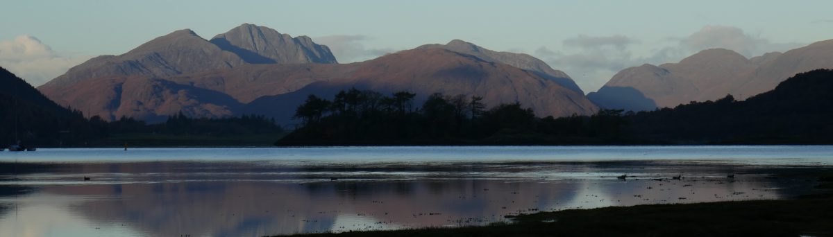

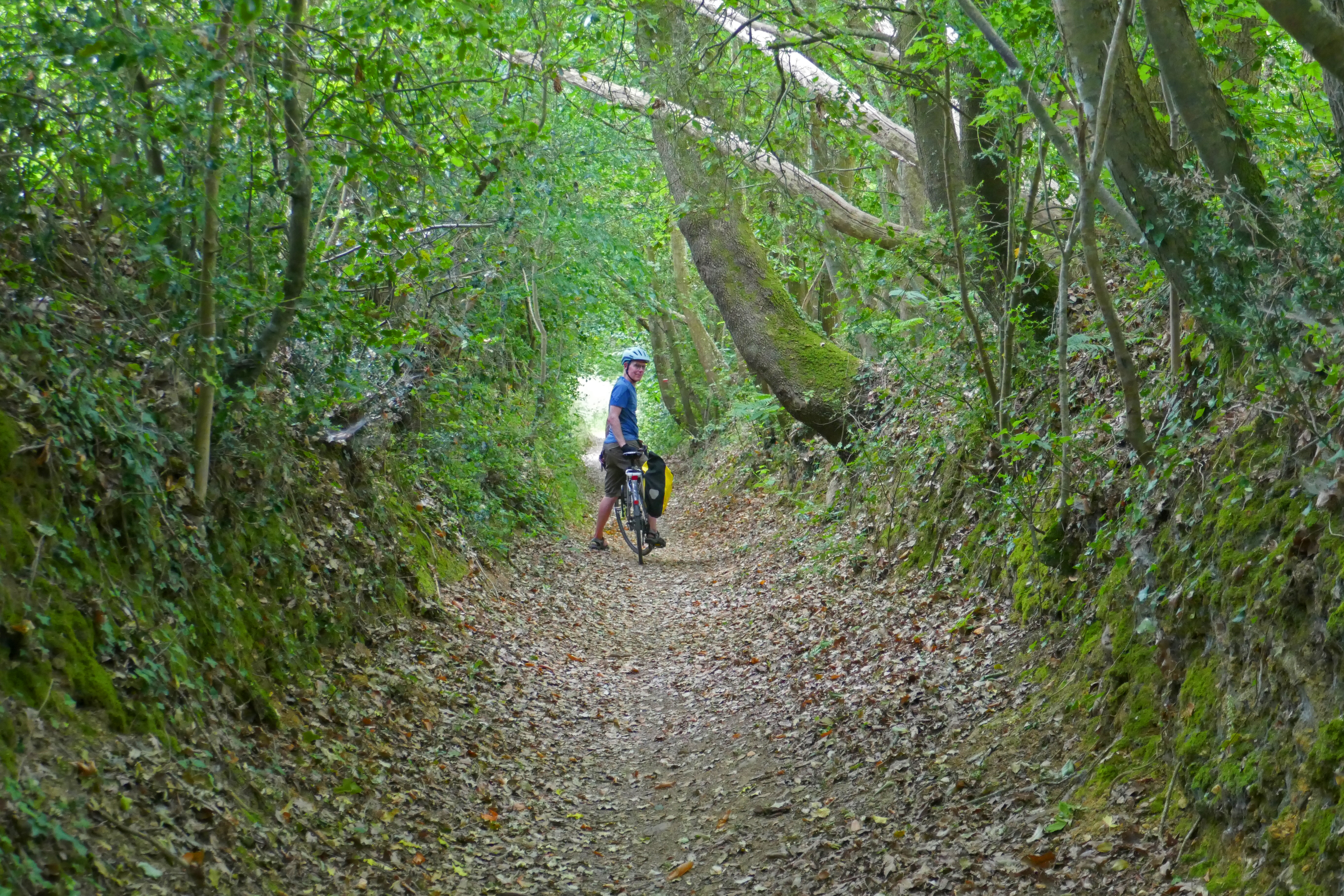
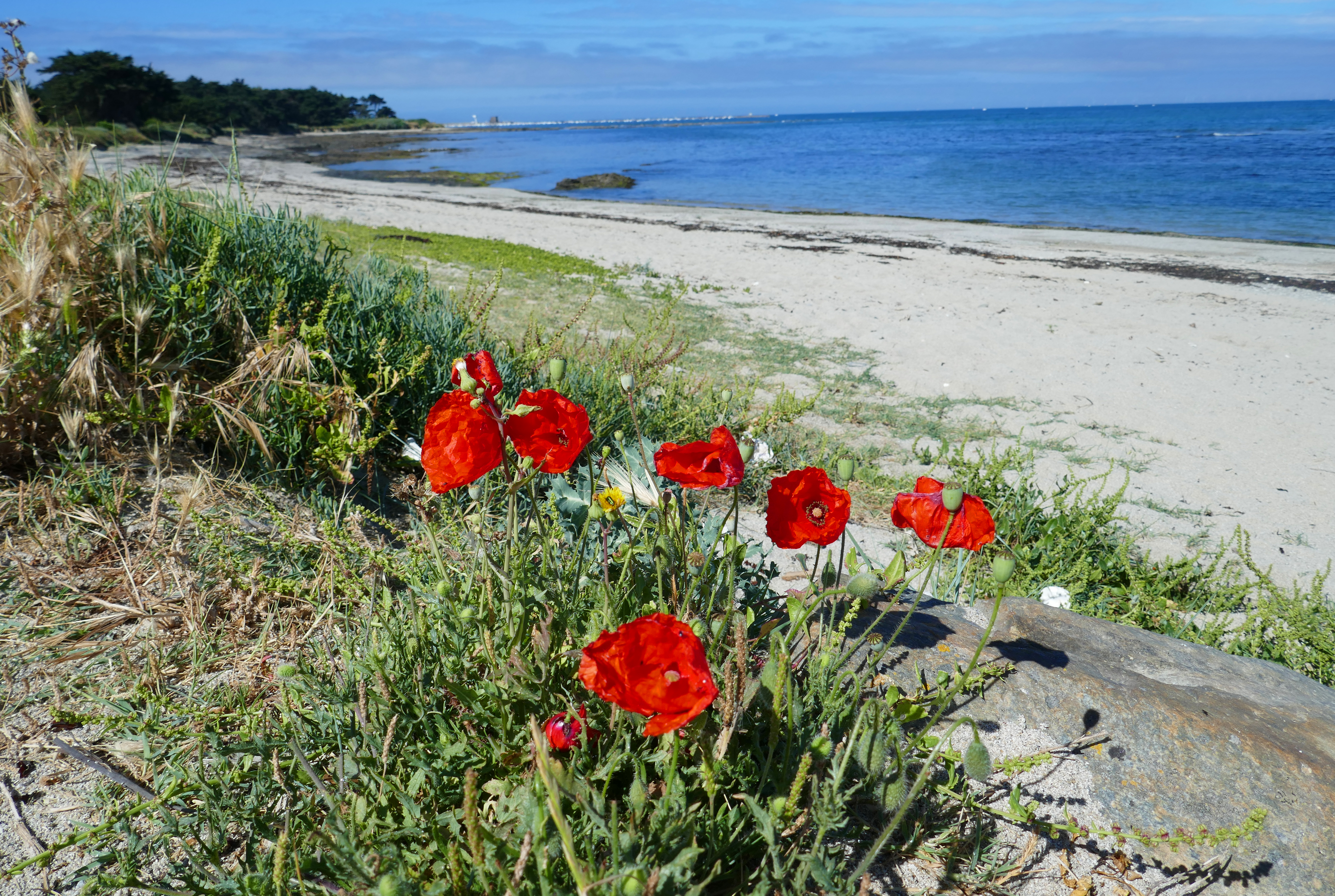
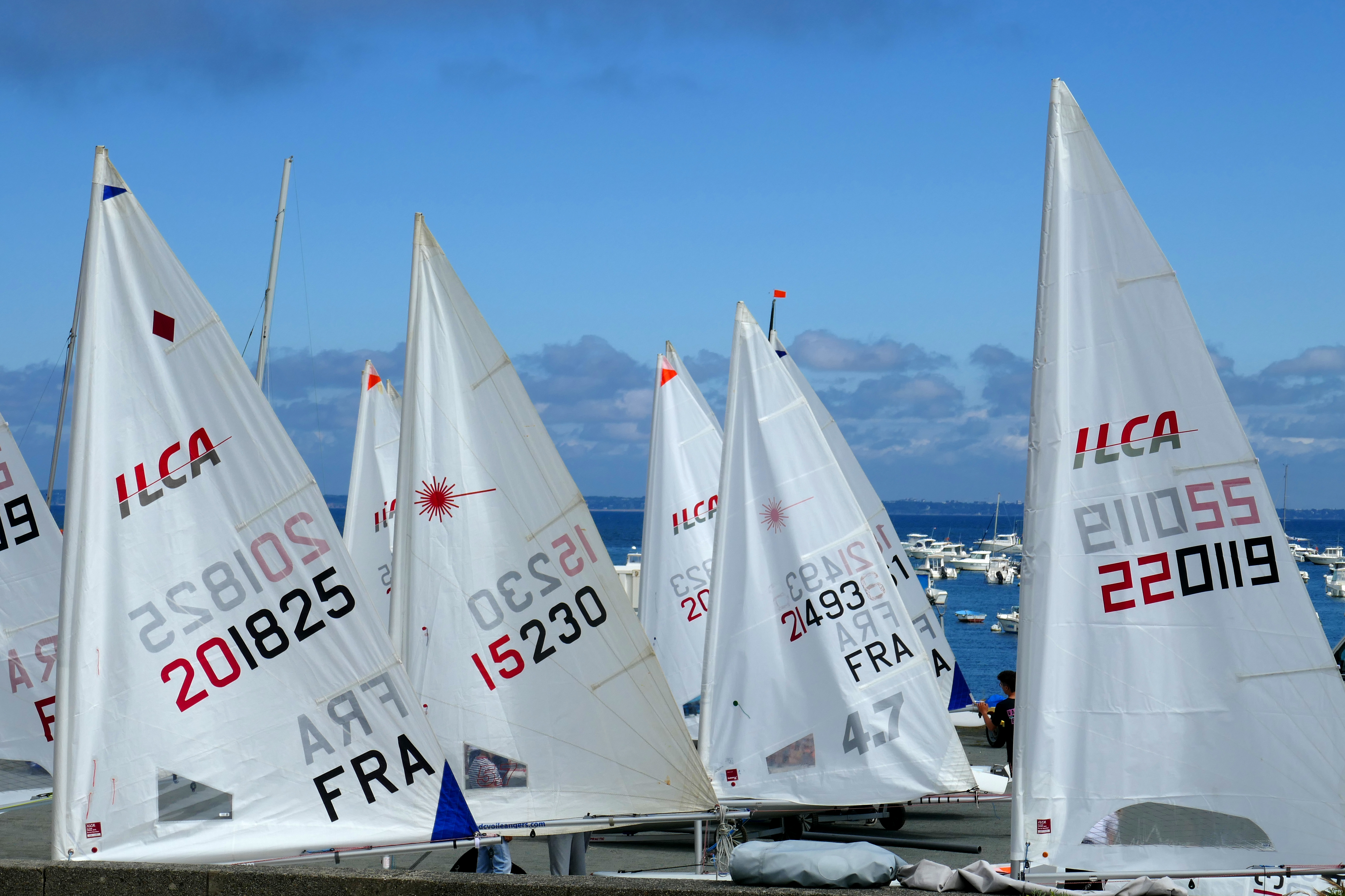


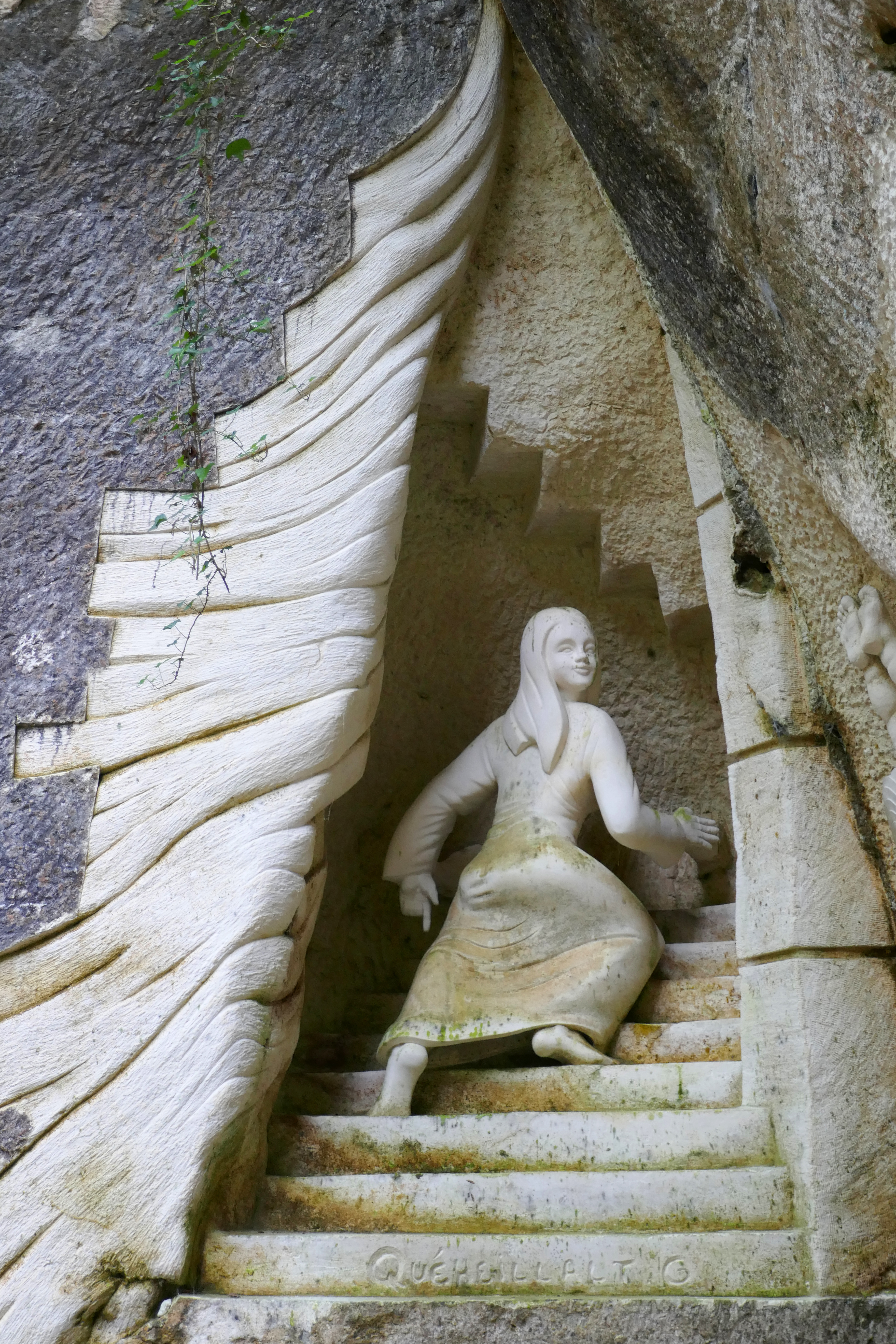


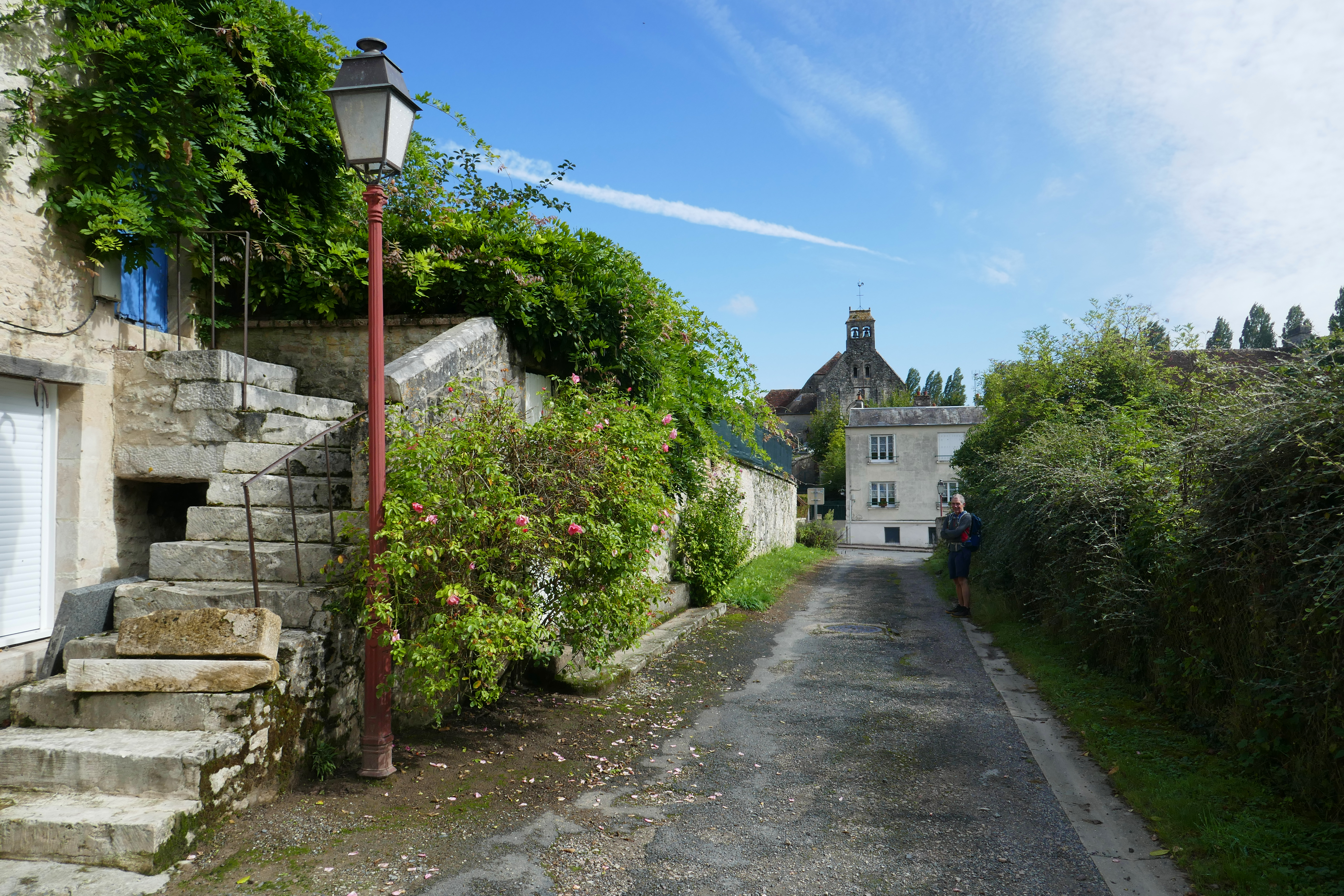
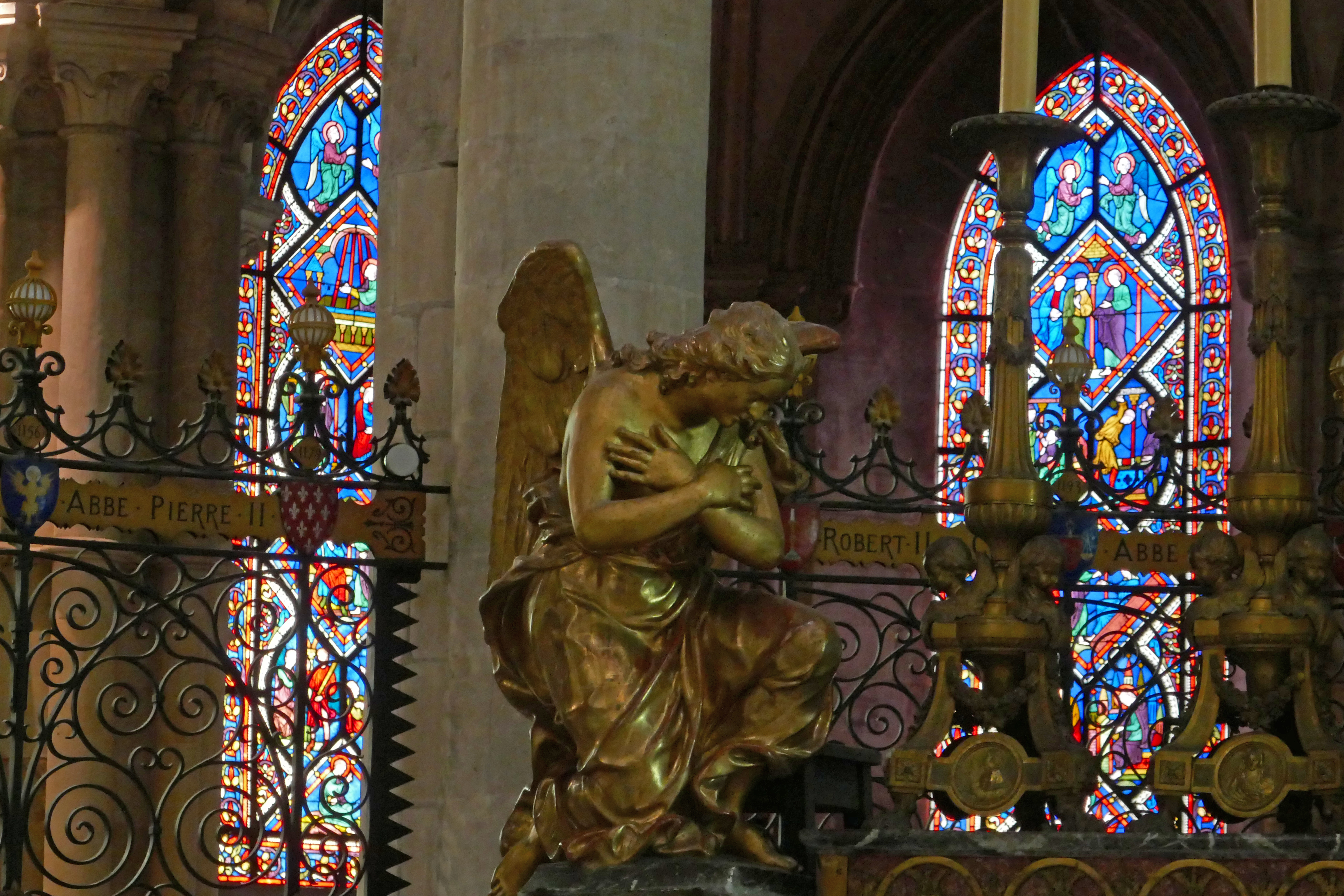


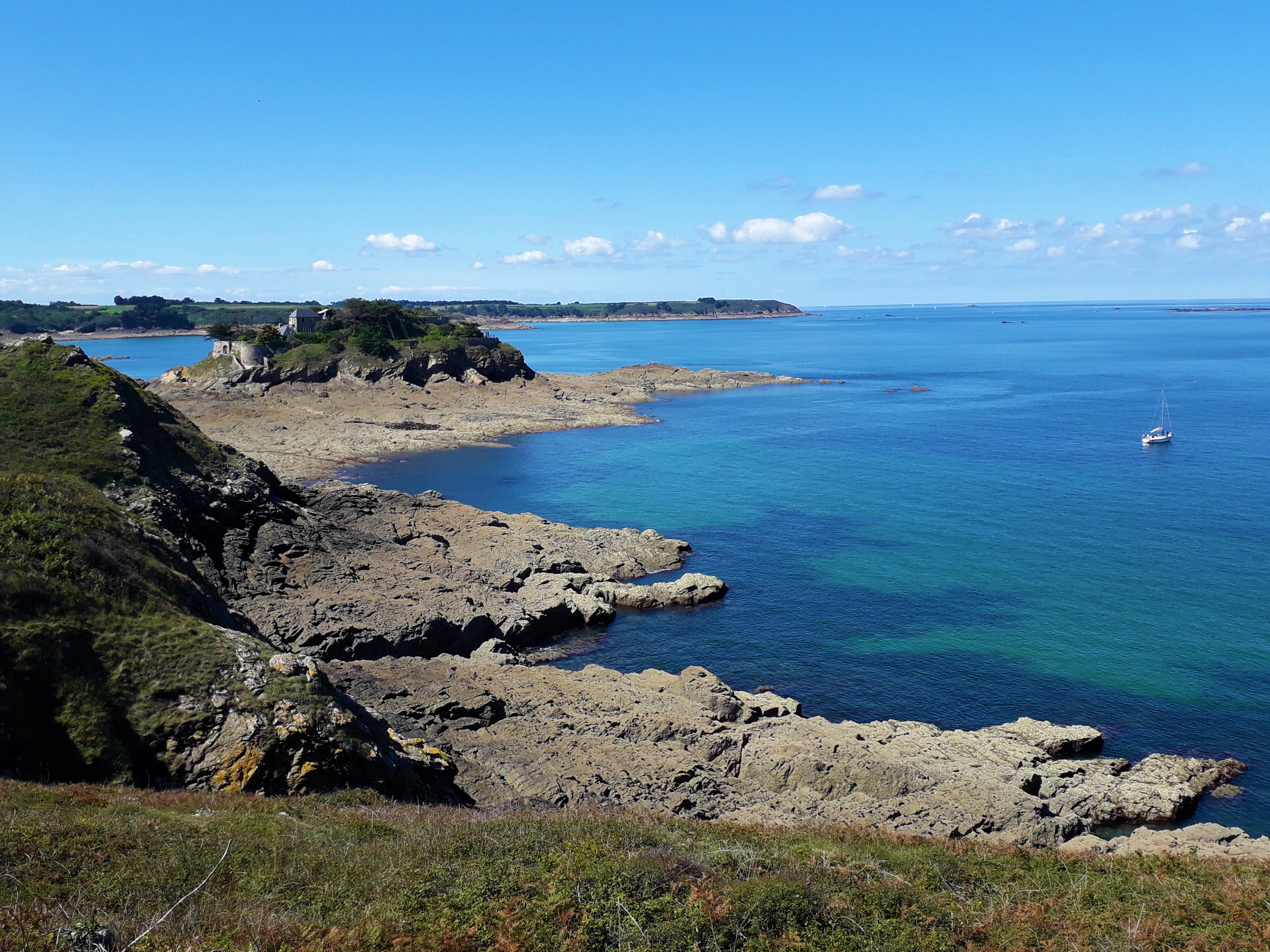
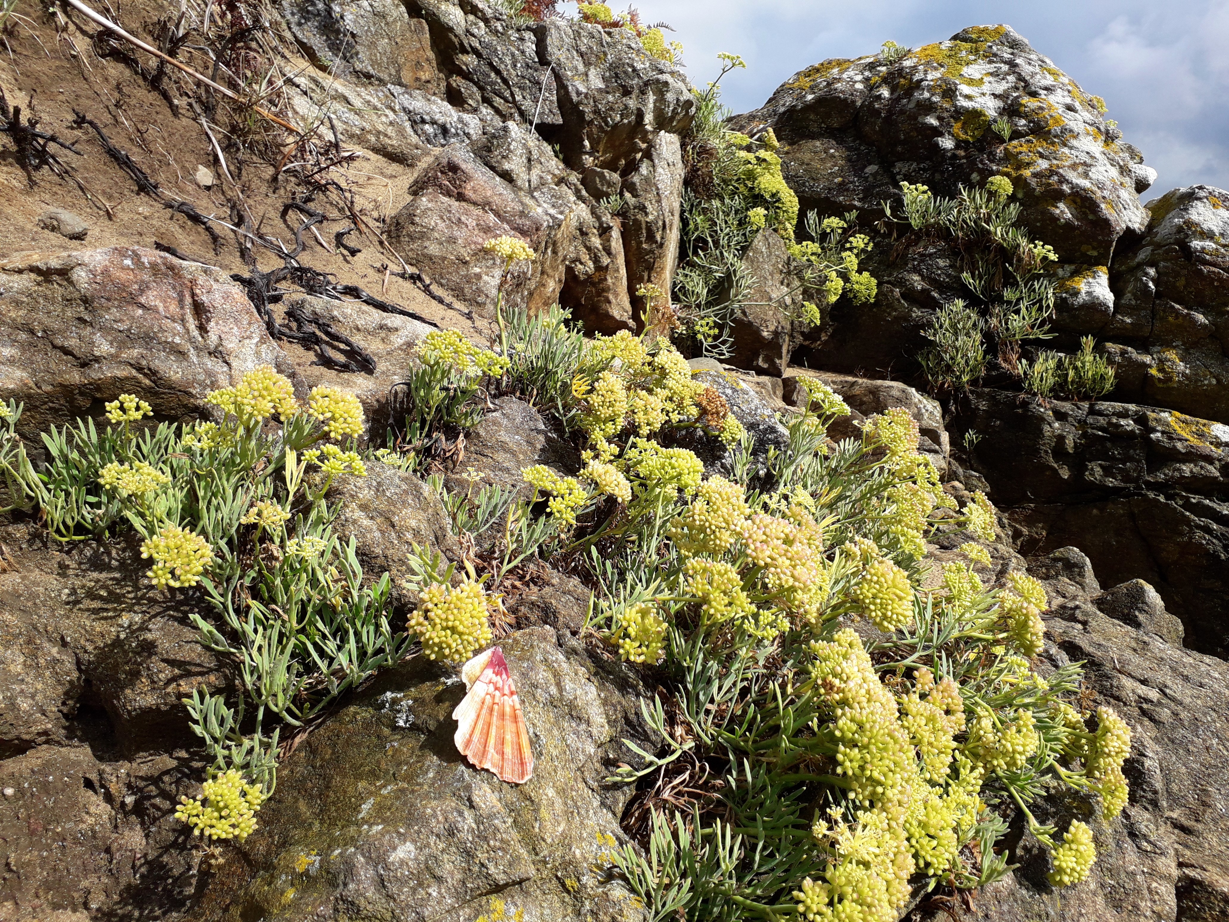

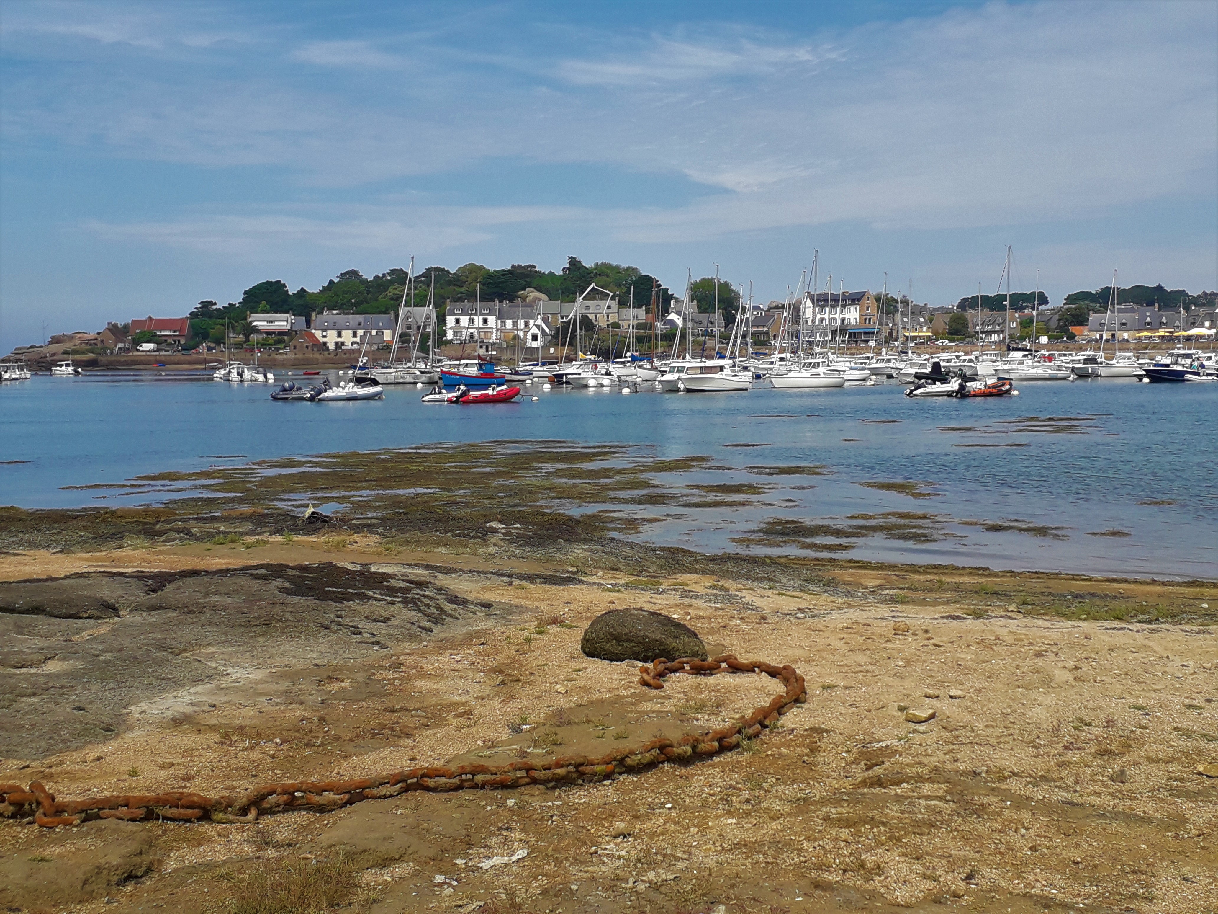
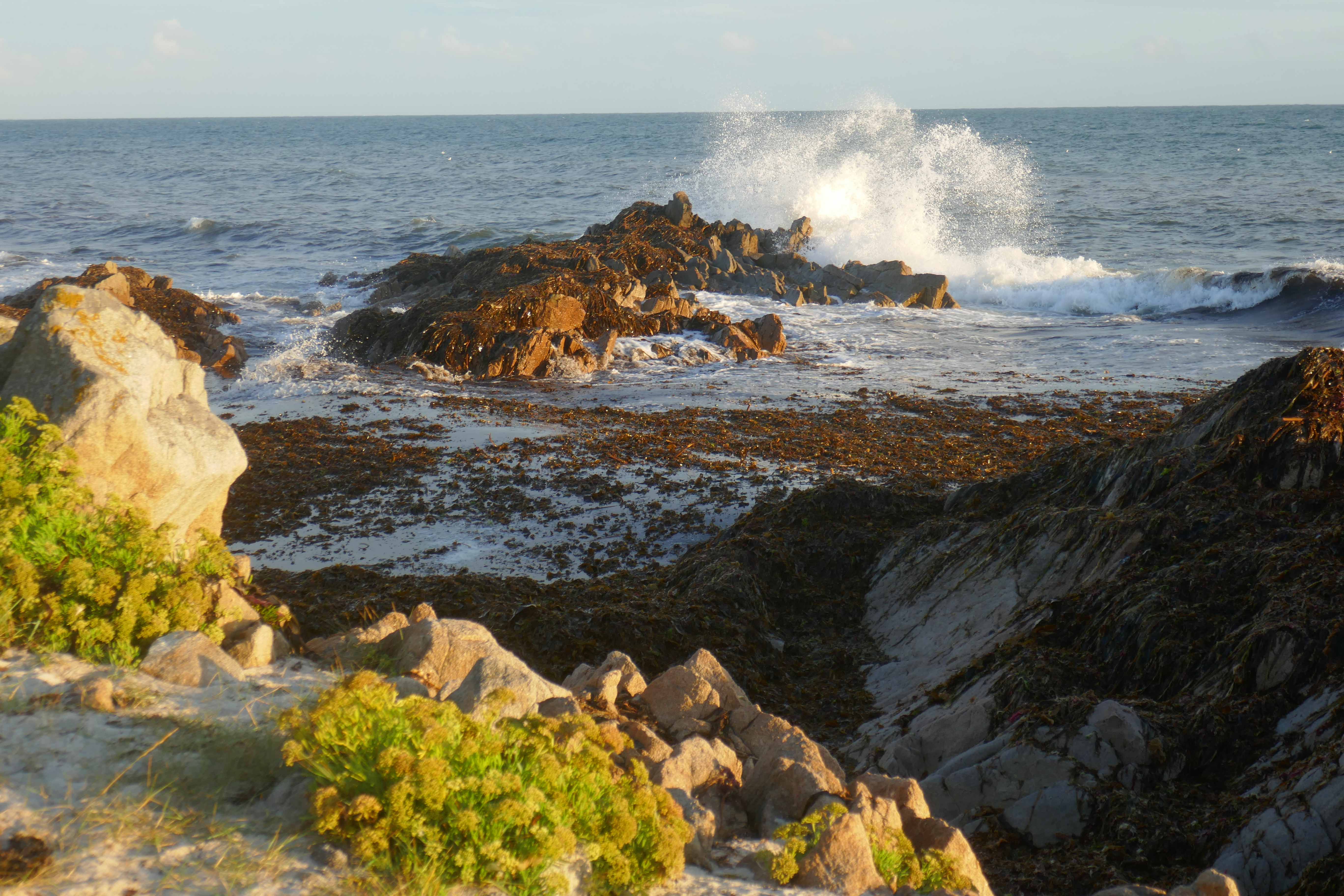

")
")
")
")
")
")
")
")
")
")
")
")
")
")