A hill walker’s paradise, the Écrins Mountains has an abundance of wildflowers, charming mountain villages and traditional houses, beautiful wall-painted sundials and so much more. It is fair to say it is one of my favourite parts of France. The mountains of the Écrins National Park top 4,000 m and, with no roads crossing the central peaks, accessing the unsurpassed mountain walking, the prettiest villages and flower-rich Alpine meadows often involves driving on minor roads that wind steeply up deep-cut valleys.
Below are some of my favourite walks in the Écrins, although I hope to return and discover more soon. The walks follow an anti-clockwise route around the central mountains, starting with the western valleys. The campsites we stayed at are listed at the end of the post.
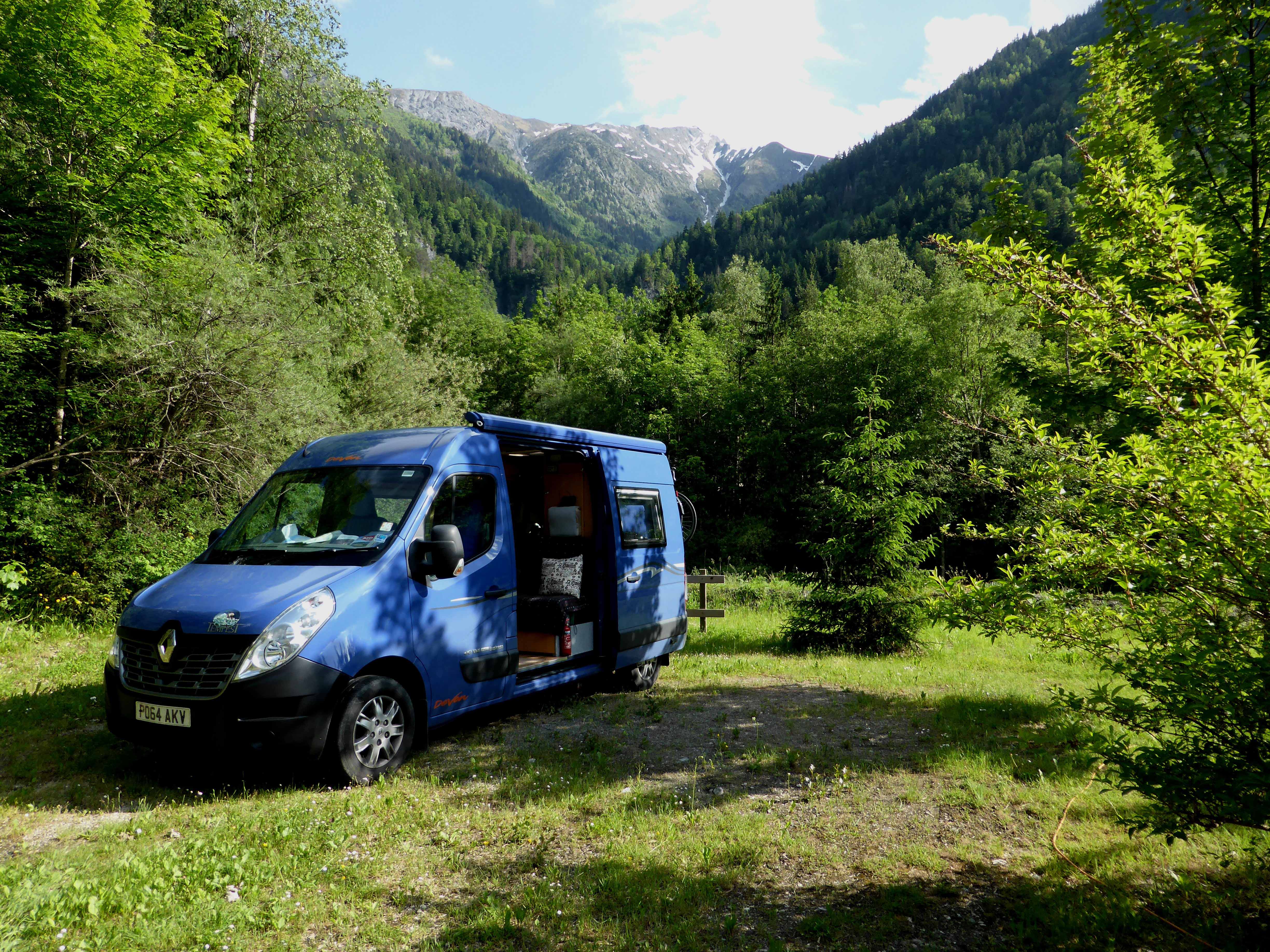
La-Chapellle-en-Valgaudemar
La Chapelle-en-Valgaudemar is a small attractive village that nestles among the mountains and is reached from the N85 north of Gap. We stayed overnight at the campsite and woke to low cloud shrouding the mountains but it was dry as we set off walking from the village up the hillside to Les Portes.
The steep narrow path isn’t long [we were walking for about 45 minutes] but it crams in everything you would expect from a mountain walk into that short space. You will walk through green Alpine meadows, lush woodland and areas of rocky scree, see plenty of colourful wild flowers and have views across the valley and to higher mountains. It was early June when we visited and we identified many varieties of orchids as well as cranesbill, cowslips, globe flowers, tiny pansies and tall erect white asphodels.
At Portes des Oules we stood on the bridge looking down on the gushing waterfall as it rushed down a narrow gorge. The pretty hamlet at Portes des Oules has some houses with thatched roofs, their tall chimneys jutting into the sky, apparently to help prevent fires.
Embrun and The Foret Domaniale de Mont Guillaume
Turning left in Gap we took the road towards Embrun and found a pitch at Camping la Vieille Ferme which is conveniently located for the impressive rock-perched town. As dark descended, scops owls flew through the warm air, the quiet broken by their haunting calls.
We enjoyed a wonderful 14 km walk from here. After walking into the town and enjoying the views, admiring the old town and having coffee in one of the many cafes, we climbed the hillside along a narrow road and track towards Calayère. As we walked swallowtail butterflies followed us from flower to flower and a cuckoo called from the woodland. We climbed higher on the minor road to Le Chateau de Calayère where we rested and watched a couple of donkeys in a field and drank in the mountain panorama.
A delightful green lane surrounded by flower meadows took us into the La forêt domaniale de Mont-Guillaume where we picked up a steep narrow path back down the hill. In the afternoon heat the shady woodland was welcome as we followed the stream back to Embrun.
Mont Dauphin and the Marmots
Between Embrun and Briançon and below Mont Dauphin there is a marmot community and whenever we pass this way we stop to see these charming animals. Although being so accessible they are willing to tolerate humans to some extent, we try and treat them with respect and not cause alarm.
After dawdling along the short trail around the marmot area we drove up to the fortified town of Mont Dauphin which sits above the gorge with craggy escarpments on three sides. We crossed two moats and walked through the immense and complex defensive walls into the walled village. Built by Vauban at the end of the 17th century this is a remarkably well preserved group of buildings. The grid of streets are lined with pretty houses and from the walls the views along the valley are spectacular.
On a previous visit to Mont Dauphin we were camping near Guillestre and enjoyed a memorable walk from there that followed a stunning and airy path below the fortified village but high above the river.
Vallouise
Turn off the main road between Embrun and Briançon at L’Argentière-la-Bessée and follow the valley road for about 10 km to Vallouise. We have fond memories of the campsite at Vallouise when it was a municipal site. Now part of a chain it has lost some of the rustic charm it had but the village of Vallouise, with gorgeous houses, many decorated with ornate sundials and a central square, is still delightful. The village is named in homage to Louis XI, remembering that in the 15th century he briefly stopped the persecution of local people. There are lovely walks from the village but you might want to drive further up the valley for some spectacular mountain walking.
Pre de Madame Carle and the Glacier Noir path
It is a further 22 km or so from Vallouise to the end of the road and the large car park at Pre de Madame Carle but well worth the drive. From here there are a number of fantastic walks including the Glacier Noir. If you are looking for isolation, a bit of excitement and stunning scenery then this is your path.
At first the path zig-zags uphill but eventually you reach the narrow lateral moraine ridge that climbs steadily upwards on the north side of the glacier. We felt privileged to have this fantastic and airy route to ourselves. The path varies in width but is never more than a metre wide and sometimes narrower and the rock and gravel moraine slopes steeply down to the glacier on one side, while the other slope is grassier and less steep; this latter direction is the way to fall!
We walked among a dramatic landscape with dark crags around us and plenty of snow. The tranquility was only broken by the sound of occasional falling rocks. As we climbed higher we could hear the waterfalls at the head of the glacier. These thundered loudly periodically as if a sluice gate was being opened and closed. At first glance this appears to be a bleak and desolate landscape, but look closely and you will see tiny flowers surviving in the rocky moraine. I found a cluster of tiny forget-me-nots, bright pink primula and azaleas bushes which were not yet in flower. Marmots pottered confidently on the path in front of us, flicking their tails and moving quickly and easily on the steep terrain. Chamois crossed our paths and sat watching us from the banks of snow. This was heavenly.
Col du Lauteret
We have driven over the Col du Lauteret [2,057 m] on the splendid road among snow-capped mountains a number of times but only once stopped for a walk. From the col, the well-marked Sentier des Crevasses takes walkers straight into the high mountains as it traverses the valley side. This path is abundant with wild flowers, alpine choughs circle overhead and vultures soar. On the hillsides we heard the piercing alarm call of marmots and stopping to look we eventually spotted them on the hillside. The views from the narrow but easy to follow path across to the immense La Meije are spectacular.
Walking as far as the Belvedere viewpoint is easy. Beyond here the hillside becomes steeper and the rock more unstable.
Les Terraces, Chazelet, the Combe de Martignare and Notre Dame de la Roche chapel
Some of my favourite walks in the Écrins were completed from La Grave. This attractive village, beyond the Col du Lauteret, huddles along the steep-sided valley below La Meije. Its stone buildings and steep narrow streets ooze character. The Romanche river runs along the valley below the village and it is surrounded by stunning Alpine scenery. In the winter this is a popular skiing area.
A 12 km walk took us from La Grave to Les Terraces on a steep uphill path. Les Terraces is a quiet village perched high on the mountainside, where stone houses with balconies have an enviable view. Continuing on towards another sleepy village, Chazelet, we stopped to take in the views at the Oratoire de Chazelet, a stone shrine. The summit of La Meije was peeking out of the cloud, below us was to La Grave and I looked up at the circling griffon vultures knowing I wasn’t brave enough to walk far along the ‘walk of faith’ or Le Perchoir that has been built like a gang-plank from the sheer rock face. Chazelet is another picturesque village whose busiest season is winter. From the village we carried on to Les Plagnes and the Combe de Martignare that was a stunning sea of white with narcissi. Picking up a path back to Chazelet we descended the mountainside to the valley on a steep zig-zag path via the precariously sited Notre Dame de la Roche chapel.
Through mountain villages to L’Aiguillon at 2095m
The mountain villages of the Écrins are beautiful places to explore. Once again from La Grave we set off for Ventelon and on to Les Hieres. Beyond these villages the road became a track and we had excellent views looking up the valley. We reached the stone houses of Hameau de Valfoide where nothing disturbed the tranquility except a hare that lolloped across the lane in front of us.
After passing the Torrent le Maurian we were on a path that was initially steep until it reached grassland full of pheasant’s eyes daffodils and butterflies. It wasn’t far from here to the bench at L’Aiguillon at 2,095 m. We sat enjoying the views to La Meije, high enough to still be in the clouds, and below us in the valley was La Grave. We descended through more flower-rich meadows full of bird song, giving a wide berth to the large dog guarding the sheep [there are lots of signs about how to deal with these dogs]. Joining a road we walked back up hill to Lac du Pontet, a small mountain lake and followed a stream down to Villar d’Arene that is just off the main road. Here we found a cafe and enjoyed beers and ice-cream in a sunny square before crossing the Romanche and walking through lovely fragrant larch forest where the ground was soft underfoot with a carpet of pine needles. The path took us over a shoulder and then onto a track back to the campsite.
Le Bourg d’Arud, Venosc and Lac Lauvitel
Below the skiing resort of Les Deux Alpes and in the north of the Écrins is the village of Venosc. From the nearby campsite we spent a lovely day on another perfect Alpine walk.
It is worth taking time to explore Venosc, a delightful village that has a cable car up to Les Deux Alpes and is packed with shops selling crafts and bijou cafes.
From Venosc, we took a path that followed a clear river through woodland to the hamlet of La Danchère. Here we took the right-hand path up to Lac Lauvitel and into a floral paradise; there were so many wild flowers it was impossible to stop at them all. The stony path was relentlessly steep and at one cascade we had to scramble over a plug of snow. In the hot weather this was tiring work but worth it for the reward when we emerged at the blue lake surrounded by craggy mountains. Around us was an amazing natural rock garden that we wandered through to a meadow and the lakeside.
We descended on what would have been the left-hand path from La Danchère. This was equally steep!
Well done if you have kept reading this far, as I have saved my favourite walk to the last!
La Berarde and Refuge du Chatelleret at 2,232 m
The mountain village of La Berarde is about 20 km further along the narrow road from Venosc and is the end of the road. La Berarde is a small village with a couple of cafes and shops. We parked the Blue Bus here and under a cloudless sky walked 11 km to the Refuge du Chatelleret at 2,232 m and back.
The route starts steeply with zig-zags rising gently up the valley on a sandy path through low shrubs. As we climbed higher the path became stonier and there was less vegetation. We encountered lots of marmots, a few groups of chamois and so many butterflies.
Climbing steadily it took some time to reach the refuge, high in the valley and huddled underneath the massive of La Meije. In early June the refuge wasn’t open but the guardian was busy getting it ready for the summer season. The beauty of this valley is breathtaking. We sat in solitude, surrounded by craggy mountains and with magnificent views down the u-shaped valley to the twin peaks above La Berarde. Sitting in the sunshine we noticed a strange rainbow streak in the sky above one of these peaks. This was a cloud iridescence that lasted for about 30 minutes, moving and changing shape and fragmenting. An amazing phenomena I have never seen before. The descent was the same way and just as lovely the other way round. We stopped to refresh our feet in the cold water of the river on the way. What a fantastic hike and a great end to our time in the Écrins.
Although many walks are well-marked, we took walking maps and the Cicerone guide to Écrins National Park to help with planning and completing our walks.
Campsites in the Écrins
| Les Melezes Municipal Camping, La Chapelle-en-Valgaudemar |
This grassy site has some trees and the ground is fairly hard. The facilities are clean & the water hot. The village is small with some shops but no bakery. Lovely walks from the site. |
| Camping Vieille Ferme, Embrun |
A Dutch-run site near to a lovely town. Some trees for shade but mostly sunny and marked grassy pitches. Clean facilities and warm water. |
| Camping La Meije, La Grave |
A steep walk from the beautiful village & by the river, this is a grassy site with trees, clean facilities and flowers. The site is well maintained & has good views. The showers are roomy with very hot water, the wash up undercover. An all round excellent site. |
| Huttopia Vallouise Campsite |
This large rambling site has great views. It is dotted with permanent erected tents & chalets. The new toilet blocks are good and it has a pleasant reception area. There are bakeries in the village. |
| Le Champ du Moulin Camping, Le Bourg d-Arud near Venosc |
The site has marked pitches, good views, a friendly welcome and a small shop where they sell morning bread. Facilities are in the basement & are clean and warm & the showers are hot & roomy. There is also a drying room. |


")
")
")
")
")
")
")
")
")
")
")
")
")
")


