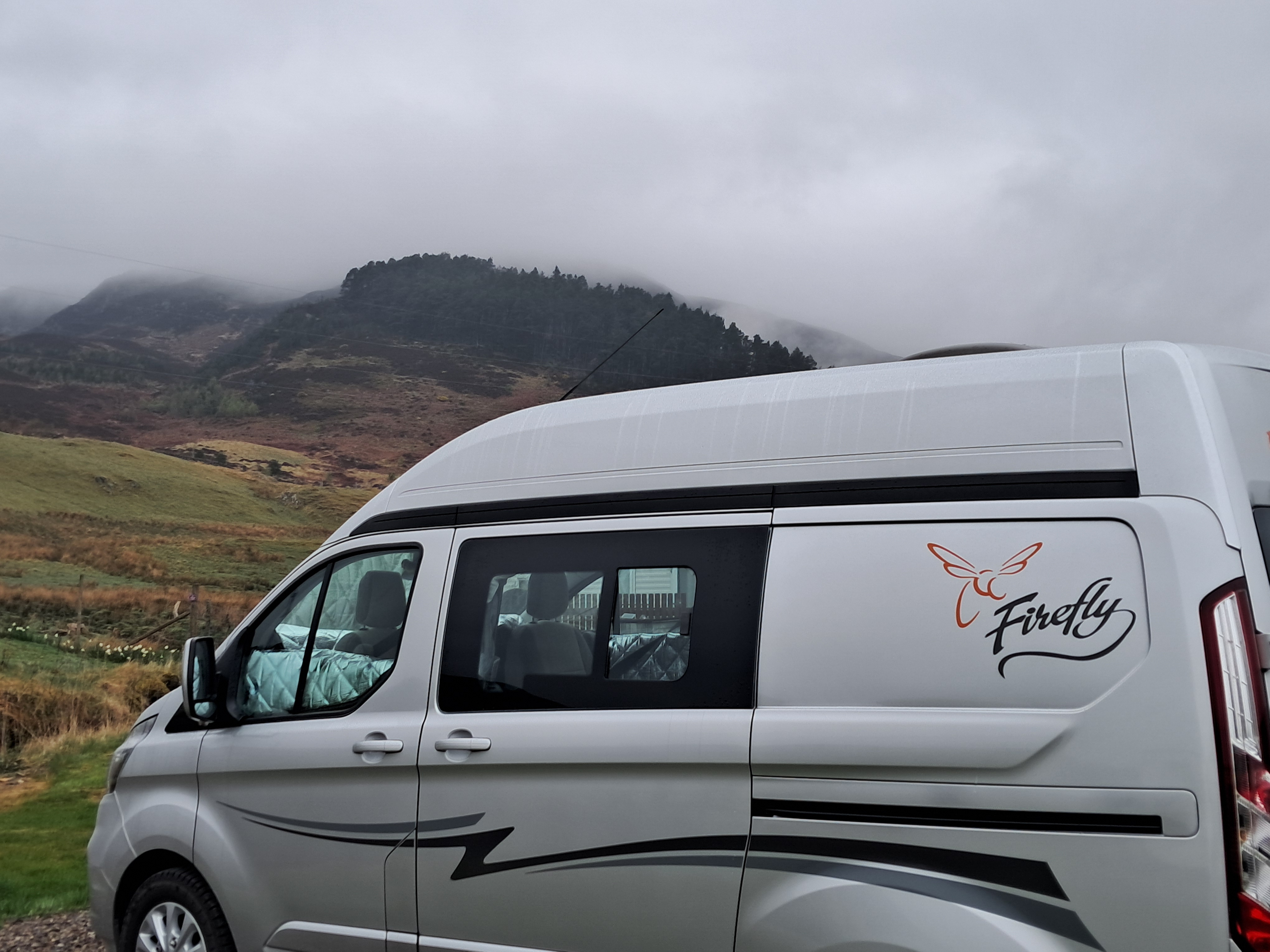
From our pitch I was easily distracted from learning French on Duolingo as a dipper flew along the burn below us and disappeared under the bridge where hardy campers walked to the camping field. Further distractions came with the evening insects, as the acrobatic wheeling of sandmartins around our campervan was so much more interesting than language learning!
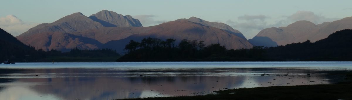
This was Glengoulandie, a glen in the hills between Loch Tay in the south and Loch Tummel in the north and about 15 minutes drive from the small town of Aberfeldy. Here, if all this avian activity becomes boring [never!] you can always move your attention to the herd of farmed deer on the hillside.
At Glengoulandie we were camping in a hope-filled future. Back in 2001 when a local upland farm came on the market, the community saw land that was overgrazed with limited biodiversity and wanted to manage it better. Today this land is owned and managed by a community land trust. The centre of the land is the hill across the burn from our pitch, Dùn Coillich, at 572m high. Planting and natural regeneration on and around this hill over the past two decades has already created attractive native woodland and the wildlife has followed. This positive story is being repeated in many other communities in Scotland and carries the burden of my hopefulness.
On our first evening we made the most of dry weather and took a short walk through the deer park, contouring around the slopes of Dùn Coillich and down to the burn. As we strolled our first cuckoo of the year called from the woodland.
Following the paths from the glen
The next day we had planned a longer walk up the hill but the drizzle and low cloud led to a rethink and we enjoyed being lazy in the shelter of our campervan.
By the afternoon, we were ready to stretch our legs and, togged up in waterproofs, we set off on the marked paths around the community land, first following the red route and then the green and white path after climbing the short link path. This was a total of around five kilometres.
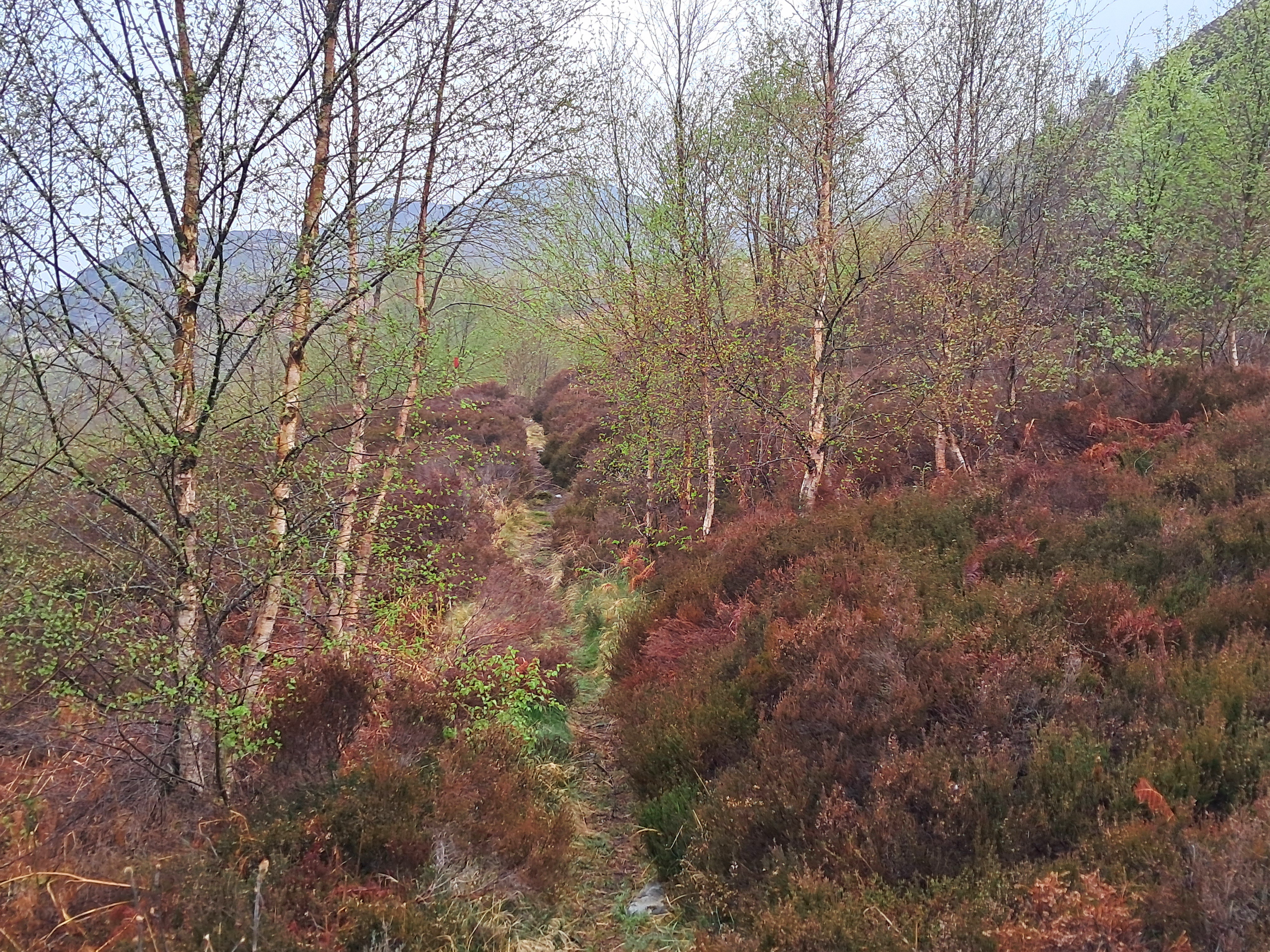
This red route follows an old path above the gorge of the tumbling waters of the Allt Mor, taking us through regenerating woodland of birch and rowan and thickets of sweet-smelling bog myrtle.
Climbing up to the green and white route we were walking through the heart of Dùn Coillich. Even on a damp day the landscape was beautiful and the peace enveloping . The route to the summit branches off from this path but the low cloud put us off climbing higher. Instead, we continued back towards our campervan and reaching the burn we walked on winding paths through delightful lush planted woodland and climbed up to the road to reach the campsite.
Colours on a grey day in Glengoulandie
The regenerating woodland on the community land made Glengoulandie a special place to visit and offers a vision for the future of Scottish landscapes. I am sure we will be back to climb the hill.
The campsite
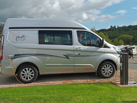
Glengoulandie Camping and Caravanning is a small site, so don’t all rush there at once! If you like quiet campsites with a laid back feel this will suit you. It has just a few campervan pitches, some static caravans, cabins and space for tents, so with or without a campervan you can stay in this special place. You’ll receive a warm welcome and enjoy hot showers, with adjustable temperature settings. The campsite has a cafe and sells a few essentials but there are no pubs or shops within walking distance.
Looking below me and taking in the view in to the steep-sided hollow of The Devil’s Beef Tub I was aware we weren’t far from the source of the River Tweed. The ridge we were following over Annanhead Hill and Great Hill is a dividing line, a watershed. To the south and Moffat I could see the valley of the River Annan as it flows west to the Solway. To the north of the ridge the Tweed flows east to the North Sea. I peered over the trees and grassy lumps and bumps but the young Tweed was still hidden.
The River Tweed runs for 156 kms from the hills above Moffat to Berwick-on-Tweed in England, near the Scottish border. The river flows through the borderlands and some suggest its name comes from an old word for border but this name is also closely associated with a woven woollen fabric. Tweed is often in herringbone or hounds tooth check patterns and has been used for years for coats and jackets.
Moffat
From the high ridge above the unforgettably named Devil’s Beef Tub we descended through restored woodland. Since 2009 The Borders Forest Trust have been bringing back the native woodland, wetlands and heathlands around Corehead, restoring the Ettrick Forest. This already flourishing woodland was delightful walking, with the hillside to ourselves we hiked through varied montane scrub and wildflower meadows, joined by butterflies and bird song. We reached the road at Ericstane from where the walking was long but easy back to Moffat, where we were camping.
When in Moffat we always visit Cafe Ariete, a tradition that began some thirty years ago when we lived in Preston and Moffat was the perfect distance for our first brew stop on any trip north. In all this time the cafe has hardly changed, the coffee is excellent and the breakfasts, lunches and cakes are all tasty and served with a smile. Cafe Ariete is always worth the short detour off the M74!
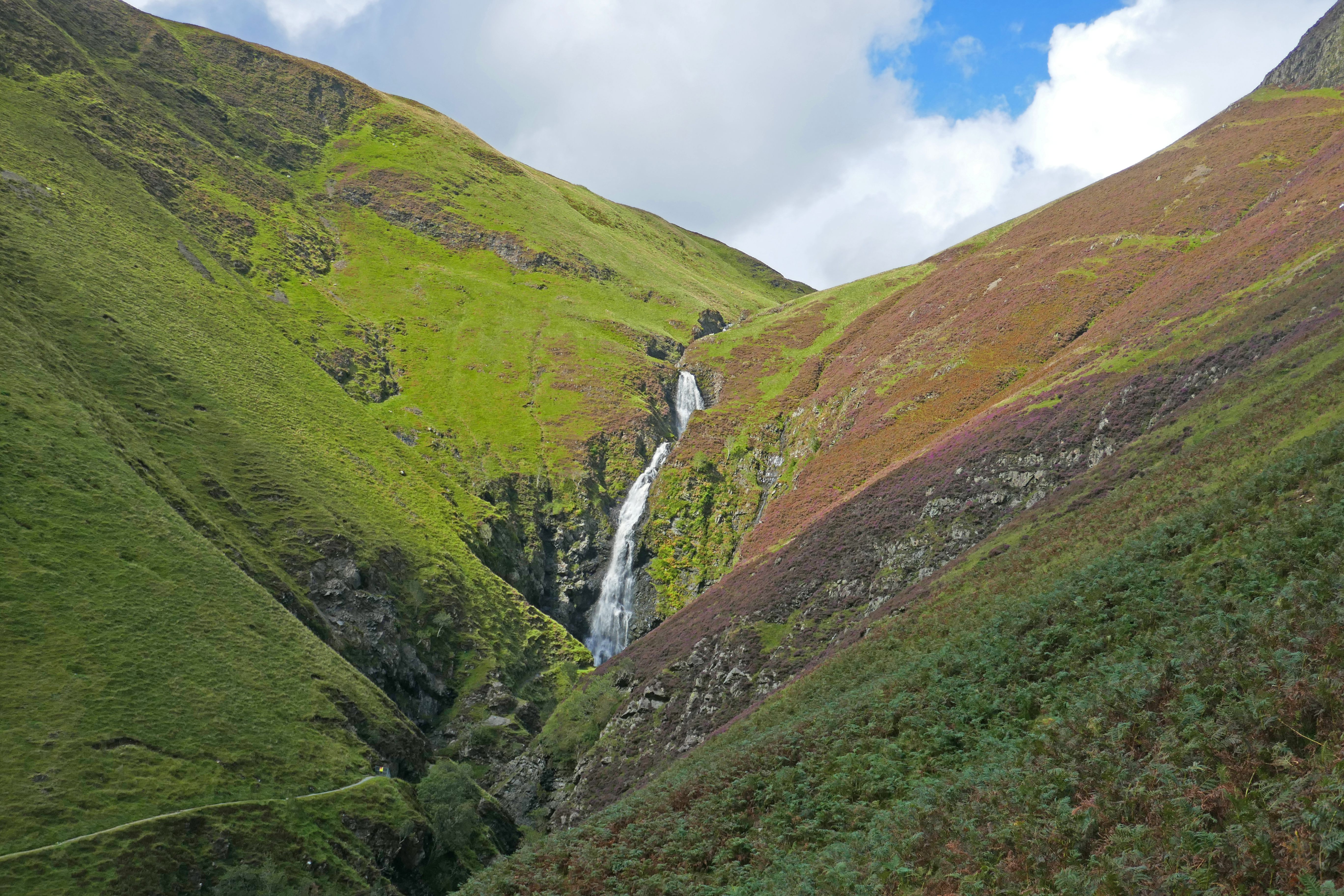
Grey Mares Tail
Grey Mare’s Tail, a waterfall with a 60m drop, is about 20 minutes drive from Moffat. There are two National Trust car parks at the foot of the cascade and from there you can take the short walk to view the falls. We wanted to do more and climbed the steep well-made path above the series of waterfalls. Eventually, the path levels out and meanders through a hummocky landscape to the hidden shore of Loch Skeen, a mountain loch surrounded by crags.
This trip had been planned to follow the River Tweed and we picked it up on the road to Peebles, stopping at Dawyck Botanic Gardens, one of four botanic gardens in Scotland, including Edinburgh. The woodland garden of Dwyck climbs the hillside from the River Tweed floodplain. The landscaping has created a network of sinuous paths among the trees and along the stream, dotted with sculptures and information boards about plant collectors and notable trees. It is a joyful place to visit and worked well on a sunshine and showery day; we could run back to the cafe when dark clouds loomed or shelter under a huge redwood. In September the autumn crocuses were flamboyant and there were early signs of leaves turning.
Peebles & Innerleithen
We had planned this trip after stopping in Peebles briefly last year. It seemed such a lovely small town we wanted to get to know it better. The next morning we parked by the river and walked into the town, filling our bags with goodies, including Selkirk Bannock, from the bakery, browsing the charity shops and enjoying coffee in one of the many cafes.
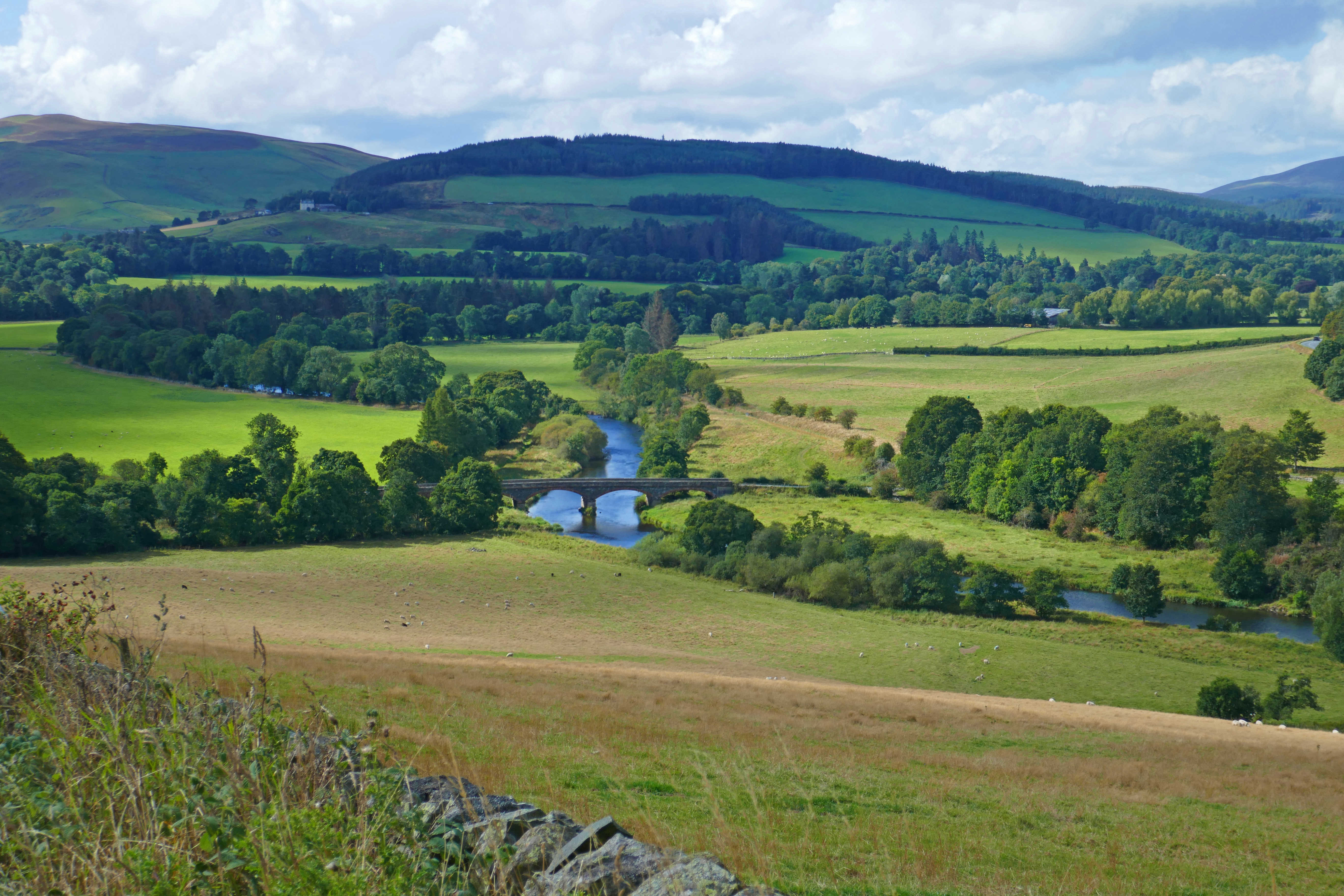
Our circular walk from Peebles along the River Tweed was only six kilometres long but packed in so much, including natters with friendly locals! From the riverside path we spotted a kingfisher and dippers and had views of Neidpath Castle. On the opposite bank we joined centuries of walkers crossing the hump-backed Old Manor Bridge and climbed uphill, stopping to enjoy the views over the Tweed valley. Our descent through the shady lushness of South Park Wood eventually took us to the old railwayline and back to Peebles.
A little further downstream is the small town of Innerleithen, a spa town and former woollen mill centre. We explored the lovely town and its history and were surprised to meet a local with a grumpy dislike of Peebles! Climbing Pirn Hill [apparently known locally as Windy Knowe], we found a set of stone cairns topped with carved tablets on the Iron Age hillfort site. The view over the town and the Tweed valley is well worth the exertion and I can confirm, it is windy!
The garden at St Ronan’s Well
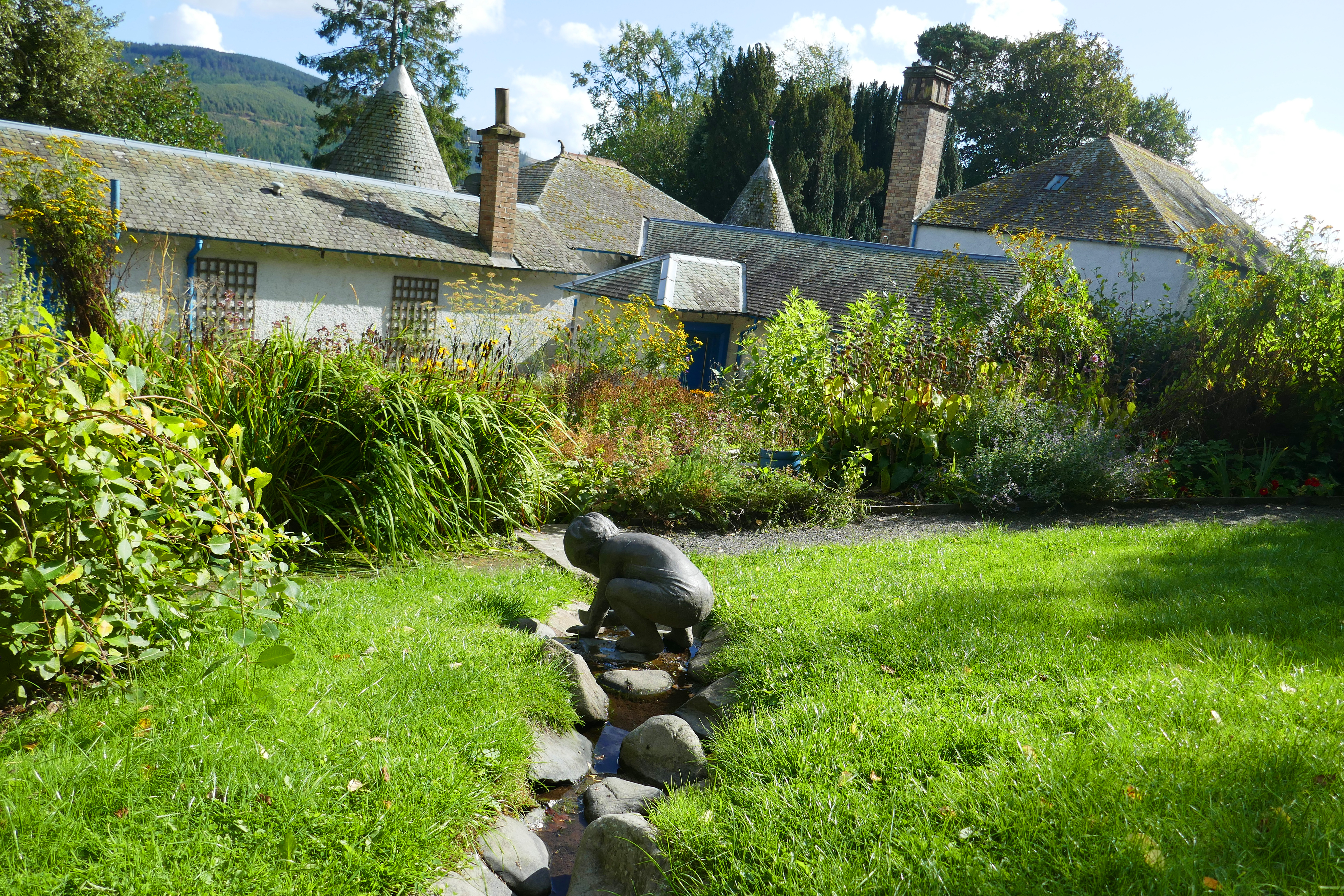
Back in the warmth of the valley, we made our way to Innerleithen’s St Ronan’s Wells. The elegant and colourful 19th century pavillion is unmissable on the hillside. In the past two Scottish writers provided advertising for the health-giving properties of the local springs. Robert Burns wrote about the spa during his 18th century travels and Walter Scott’s novel St Ronan’s Well in 1823 encouraged literary tourism. Behind the pavillion we found an idyllic community garden. Full of flowers and herbs, insects and butterflies, with a trickling spring running through it, the garden has winding paths, seating areas and the love that created it seeps from every leaf.
Selkirk
Selkirk is a hilly town that sits on Ettrick Water, a tributary of the Tweed. It is a thigh busting walk from the campsite at the leisure centre to the town, but worth it for the good and ethically-sourced coffee from Three Hills Coffee on the main street.
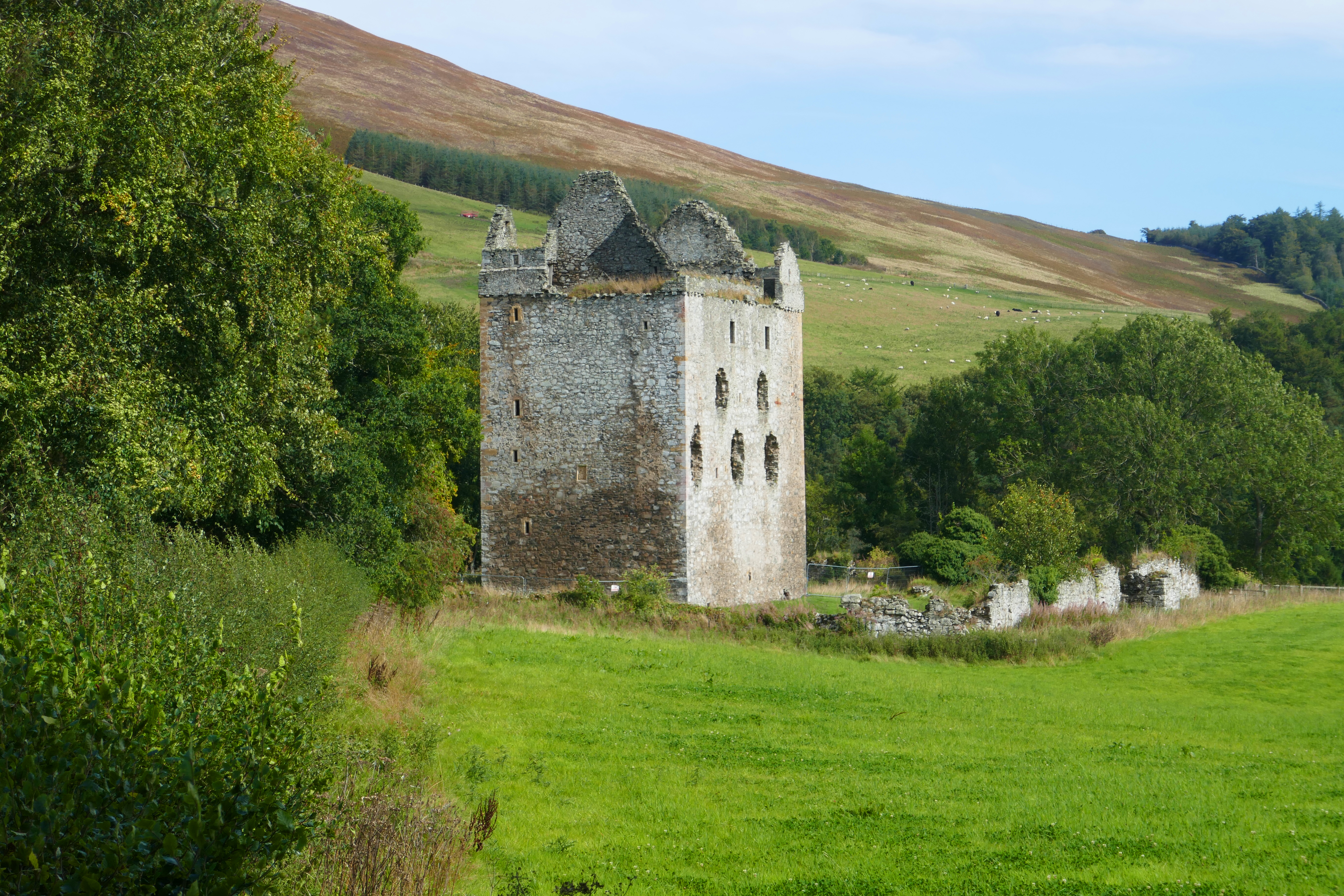
The sun was shining and we planned to complete the Three Bretheren Walk, a classic hike near Selkirk. However, the small car park was packed by the time we arrived. Checking our trusty Walk Highlands app we drove the short distance to Bowhill Estate. The Duchess’s Drive route on the Bowhill Estate was designed for showing off the land to visitors, ascending through woodland to the open moorland. Although on good tracks, the walk was more exhausting than we expected but full of variety and good views across the lumpy Borders countryside. We returned to the car park by the ruins of Newark Tower, whose white stones were bleached by the sun.
Newark Tower at Bowhill
Melrose
We picked up the River Tweed again at Abbotsford, the home of the writer Walter Scott. The large rambling house looks interesting to visit but we concentrated on walking up to Cauldshiels Loch, returning along the bank of the secluded Faldonside Loch before completing our circuit on a woodland path along the River Tweed.
In Melrose we visited the abbey, although due to works being carried out we could only walk around the outside, admiring the red sandstone that blushes when caught by the evening sun. Nearby are two National Trust gardens, Harmony House and Priorwood and, keeping an eye on the weather as showers were heading our way, we sauntered through these two walled gardens. They were both well-stocked and interesting, still full of colour and scents even in mid-September. Priorwood Garden also has an orchard and a stall selling produce from the gardens.
We had planned to spend some time at Berwick-on-Tweed, completing our trip along the River Tweed. However, stuff at home unexpectedly got in the way and Melrose was as far as we got. Until next time!
Faldonside Loch near Abbotsford through the trees
Walking details
Unless otherwise noted, the walks can be found on the Walk Highlands website and app.
The full Devil’s Beef Tub circuit from Moffat is 22.5 km with 521m of ascent. We used a taxi [Moffat Taxis] to get us to the Devil’s Beef Tub viewpoint on the A701 [£10] and walked along the ridge and back to Moffat, reducing the exertion to approximately 15.25 km of walking and only 230m of ascent while retaining lots of interest.
Grey Mare’s Tail and Loch Skeen in the Moffat hills, this 4.5 km walk with 278m of ascent climbs past the series of waterfalls and on to Loch Skeen that is overlooked by craggy hills.
Neidpath Castle and the Tweed walk from Peebles is 6.25 km long with just 89m of ascent. Kingsmeadows car park in Peebles is a large car park and has motorhome spaces.
Pirn Hill Fort Trail in Innerleithen is 2.5 km long with 79m of ascent. Parking is available in a roadside parking area near the entrance to the paths.
The Duchess’s Drive, Bowhill is 11.25 km and 339m of ascent on easy to follow tracks and lanes. There is good parking on the Bowhill Estate for a small charge. The walk is through woodland and across moorland and on lanes by Newark Castle.
Abbotsford has a leaflet of walks you can download, with routes from 2 to 10 km. The Cauldshiels Loch walk is 6.5 km long and takes about two hours from the car park. It was mostly easy to follow, although we did resort to our OS maps as we descended to the River Tweed.
Tweedside Caravan Park at Innerleithen – this site on the edge of Innerleithen has a small touring area, surrounded by static caravans.
Selkirk Victoria Campsite – on the edge of Selkirk, the pitches are marked out on the tarmac car park at the community-run leisure centre. Campers have keycode access to move the height barrier and access to the three shower rooms and a wash-up sink.
Lilliardsedge Holiday Park – in the countryside between St Boswells and Jedburgh, this is a large site with many statics and a tidy touring area of hardstanding pitches. The site has a restaurant and golf course.