

Occasionally we have a holiday without our campervan [honest] [And we always miss the Blue Bus when we leave it behind]. Our latest short break hardly took us out of Lancashire. Here is the story of our mini adventure over a couple of days when we hiked across the Forest of Bowland.
The walk of around 40 kilometres is best done over two days with an overnight in Slaidburn. You have some options on the route and you may vary it depending on the weather, time of year and how much time you have available. The hike features in the Cicerone Walking in Lancashire book as a 45 kilometres (28 miles) walk and if you want a detailed description this would be worth purchasing.
We put the walk on our wish list recently and for the last six weeks I had been keeping a close eye on the weather forecast but July just got wetter and wetter. This wasn’t the weather I wanted for hiking across empty moorland and I had to wait until early August for a break in the rain and a window of sunshine. Excited, I rang the Hark to Bounty Inn in Slaidburn to book our overnight accommodation and we packed the rucksacks with essentials.
We caught the early bus from Lancaster towards Kirkby Lonsdale, getting off in the village of Wray. From here, if you have time you can take the paths up the wooded Roeburn valley but we headed straight up the lane to High Salter, reducing the walk by two kilometres. This lane was quiet and enjoyable with panoramic views over the Lune valley and to Ingleborough, Pen-y-Ghent and Whernside, the Yorkshire Three Peaks. We passed some rustic wooden sculptures and a well-kept memorial bench surrounded by flower beds.
At High Salter we left the last of the farms and reached the gravel track of Salter Fell Road that crosses the moorland to Slaidburn. At first the track climbs steadily up to the watershed, the River Roeburn tumbling below us. From the summit the streams no longer flowed into the River Lune but were heading towards the River Ribble. In this treeless high land the views across the moorland were wide open with the stony track snaking across the landscape. There isn’t much obvious wildlife on these grouse shooting moors but a lizard scuttled away from our feet and a couple of kestrels hovered over the slopes. A herd of belted galloway cows ambled towards us on both verges of the track, forming a moving guard of honour. These calm cows are nevertheless bulky and we walked between them quickly but cautiously.
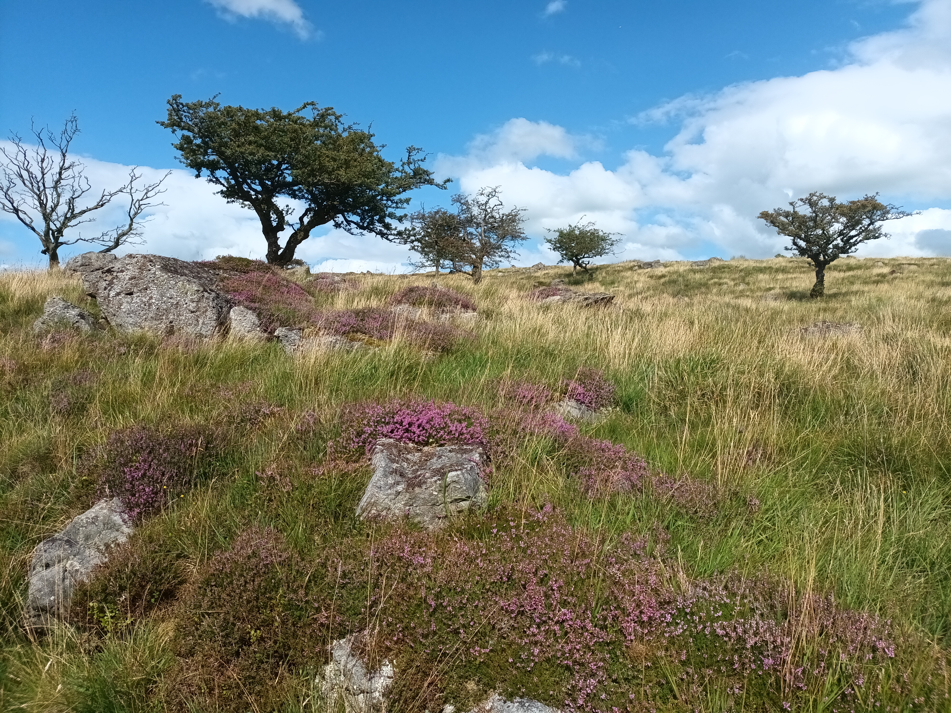
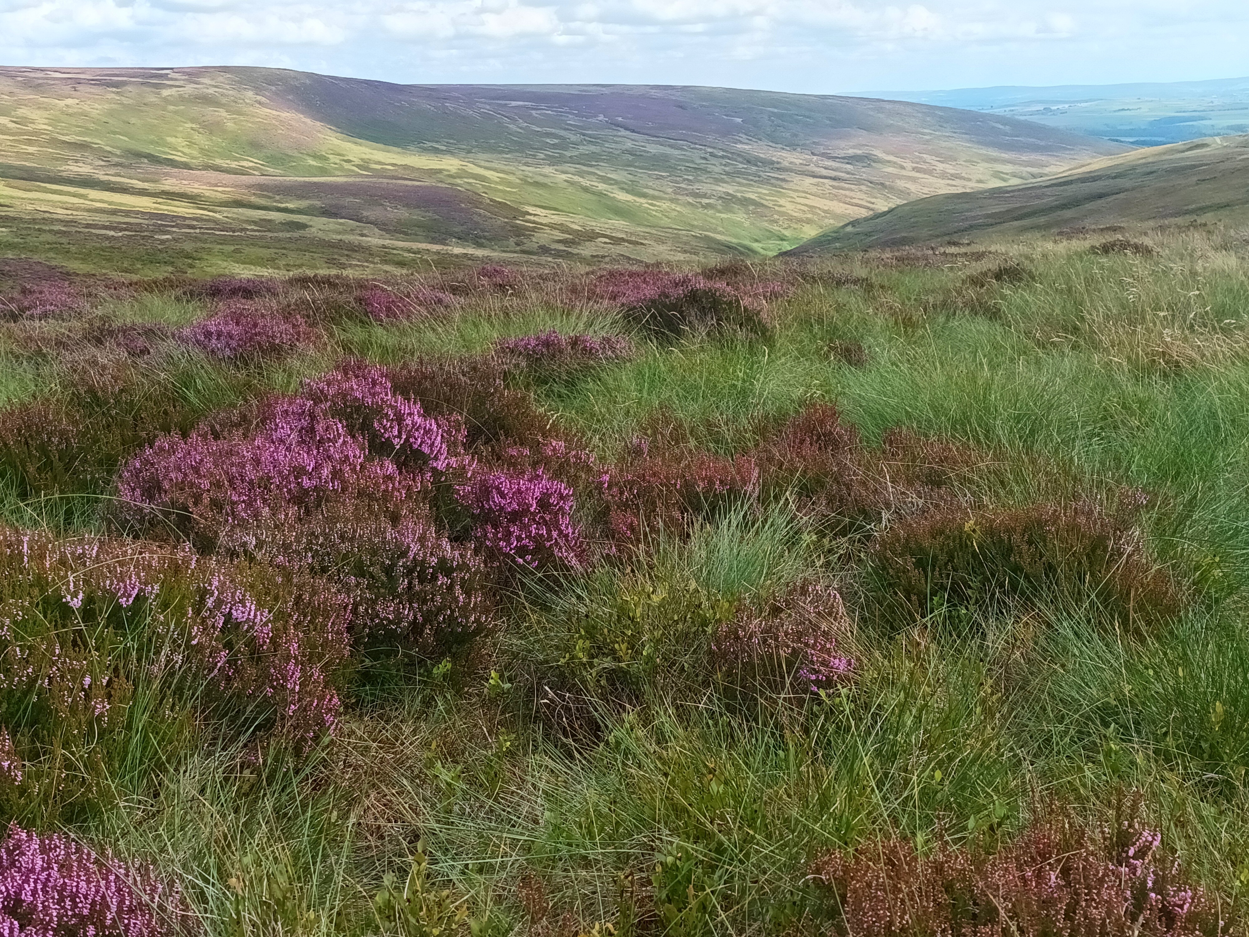
We stopped on a rocky outcrop near the watershed for lunch taking in the view across purple flowering heather. The track is used by off-road bikers and cyclists and a group of scramblers dented the peace and our solitude as they bounced by.
Walking with a heavier than usual rucksack was tiring and we stopped again in the mid-afternoon for cake and I lay back on the heather gazing up at the wispy clouds in the blue sky, waking up a short while later! Up to now route finding had been easy but this changed as we left the Salters Fell Road for Croasdale House on a soggy and overgrown path. Negotiating nettles, farms, stiles, cattle and dogs we eventually reached a lane into Slaidburn. Staying on the track and lanes into Slaidburn would have been easier going and a similar distance although it was harvest time and the narrow country lanes were busy with farm vehicles.
We reached the Hark to Bounty just after they opened at 17.30 and were grateful for a room to rest in with a hot shower and a kettle for tea. The Hark to Bounty is an old inn that is full of character and has a heart of the community feel. The bedrooms are comfortable and individual but not ultra-modern. That evening we ate hearty food in the bar and slept the deep sleep of backpackers. [The Hark to Bounty closed in October 2024, although new tenants are being sought.]
Slaidburn is an unusual village. At first glance it looks timeless and this is in part because it is owned by one family. Sitting in agricultural Lancashire Slaidburn has no modern buildings and is not wall-to-wall holiday lets. The 17th century cottages and farms are rented, the school remains viable and there is still a village shop and pub. Slaidburn also has a handmade chocolate shop, a cafe and a youth hostel available for sole use.
There had been some rain showers overnight but the next morning was fine and after breakfast we once again heaved our rucksacks onto our backs and set off along the River Hodder to Stocks Reservoir and Gisburn Forest. Built in the 1930s, Stocks Reservoir get its name from Stocks-in-Bowland, the village that was flooded.
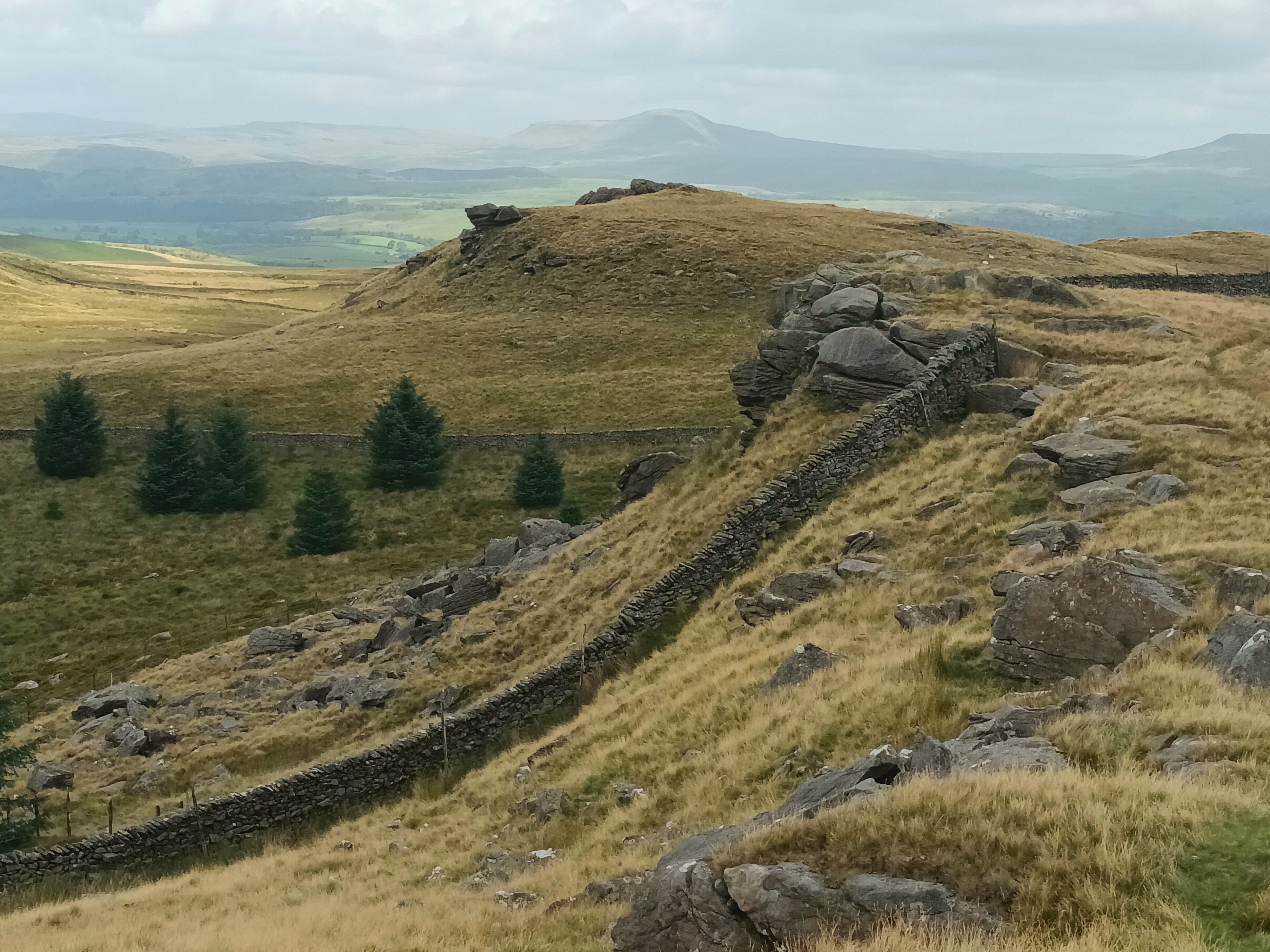
Gisburn Forest is vast, apparently almost 3,000 acres vast, so it was no surprise that it took us most of the morning to cross it. As is often the way when we can’t see the route for the trees, we got lost more than once and without GPS we would probably still be wandering around the forest! All Gisburn’s acres have plenty of variety and from the shores of Stocks Reservoir we walked through magical vivid-green treescapes, alongside sunny verges where peacock butterflies were thriving and, of course, through dark pine forests. Eventually we emerged with some relief at the highest point, Whelp Stone Crag, and stopped for lunch looking across the farmland towards Yorkshire and our walks end.
The relief was short lived as we still had some kilometres to walk and a bus to catch. We tried to choose the best route from the many lanes and footpaths on the map but twice ended up on an overgrown walled lane that no one had tramped along for some time. Both of these were thick with nettles and brambles and, wearing shorts we emerged with legs covered in scratches and stings. I always react badly to nettle stings and my tingling legs were soon attractively covered in swollen red lumps that only antihistamines can deal with. Anthony doesn’t suffer in the same way but did collect a tick.
After more encounters with young bullocks that herded and trotted curiously behind us, way too close for comfort. We tried to stay calm and walk rather than giving way to the urge to run! A hare bounding over a wall delighted us and we climbed gates that were tied shut with string despite being on a right of way and heaved ourselves and our rucksacks over so many stiles we lost count until we reached the A65 and the bus stop by The Craven Arms in Giggleswick. There is a railway station here but we caught the cheaper bus home, changing in Ingleton.
There is something satisfying about completing a linear walk while carrying your kit and we enjoyed our short trip. The warm weather meant we weren’t laden with lots of extra clothing but we did carry plenty of water as well as spare food [apart from Slaidburn there were no shops or cafes on our route] and our emergency first aid kit.